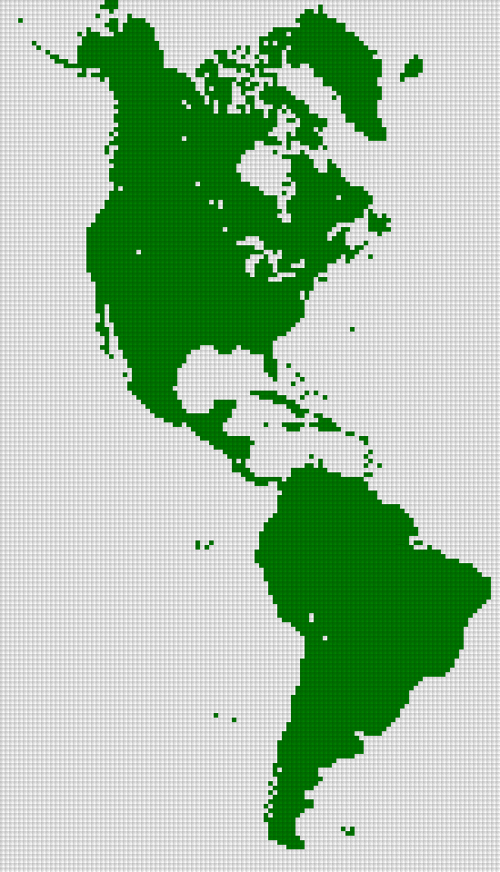
Special RAR map of the Americas

@Marla_Singer:

Thanks for sharing this scenario map. :thumbsup:

It is really nice to see that people enjoy our mod. :)
Told this way, you don't really seem convinced. :(

What is the issue? You called it "scenario" map... so is it because it's too "determined"? I could make a random version of it if you would like that better. You shouldn't hesitate to criticize, I can easily make other versions which could fit better your taste. :)
 
I think "scenario map" refers to the fact that when you start a game you either pick a scenario or play on a random map. I don't read anything bad into that statement.

However personally I would likely prefer a bit of randomness in the map to ensure that it isn't 100% the same each time. However on the other hand playing a real world map isn't for aiming at randomness anyway meaning a fixed map is good too.
 
Told this way, you don't really seem convinced. :(
What is the issue?

There is no issue, it is really great work. :thumbsup:

You called it "scenario" map... so is it because it's too "determined"?

Because it is a "scenario map". :)

Fixed Players, fixed Starting Locations, fixed Bonus Ressources, fixed Good Huts, ... ---> scenario map.
Random Players, random Starting Locations, random Bonus Ressource Placement, random Goody Hut Placemenent, ... ---> random(ized) map

I am simply a modder and thus I often use specific ("technical") terms to clarify what I am talking about.

I could make a random version of it if you would like that better.

There is absolutely nothing wrong about creating a scenario map. :)

I personally however prefer to play random maps or even mapscripts.
(I especially don't like it very much if Bonus Ressources or Goody Huts are always placed the same.)
 
I personally however prefer to play random maps or even mapscripts.
(I especially don't like it very much if Bonus Ressources or Goody Huts are always placed the same.)

Yes, so do I!

What I really would like to see would be a "gigantic" map with an original map of America... ;):D:D I always play only "gigantic" maps....
 
So what do you want to be randomized ?
☐ Goodie Huts
☐ Bonus ressources
☐ European starting locations
☐ American Natives

There could always be a random version of the map. It's easy to add. :)

I've done some testings. My major trouble is with Natives : the script distributes them really sparsely offering tons of free land for colonists to settle. Furthermore I've put marshes in Amazonia specifically because I wanted it to be hostile, but as a result, the script put no Native there. There's no Native in the Caribbeans either because islands are too small to be found.

As for starting locations, they are actually not "random". Don't ask my why, European players always start on the same spots, simply switching their nationalities.


Now, just to defend my case a bit, if I've done the things the way they are in the map, it's because the world is not sparsely and evenly distributed in real life.Things never happen at random, there are geographical spots which are meant to focus attraction on them. That's actually what no Civ or Col game ever achieved to simulate: civilization doesn't develop sparsely and evenly. But maybe that's just what the player want?
 
I've done some testings. My major trouble is with Natives : the script distributes them really sparsely offering tons of free land for colonists to settle. Furthermore I've put marshes in Amazonia specifically because I wanted it to be hostile, but as a result, the script put no Native there. There's no Native in the Caribbeans either because islands are too small to be found.
That makes random natives sound bad. We could make a new script for native placement, but that would likely be overkill for this issue.

As for starting locations, they are actually not "random". Don't ask my why, European players always start on the same spots, simply switching their nationalities.
Odd, but that might actually be interesting too. You don't pick your starting location when you pick your civilization.

However the talk about randomness makes me wonder about one thing. Is it worth trying to make the map random? People aiming for randomness will likely pick a completely random map anyway. Maybe it's ok to make it completely fixed as people aiming for a map they know in advance aren't likely to be people who aims for randomness. Having said that goodie huts should likely be random.
 
So what do you want to be randomized ?

Whatever you want to be randomized (or not). :)

Almost everybod can easily change scenarios maps into random maps.

Now, just to defend my case a bit, ...

Seriously, there is no need to "defend your case".
Your map is great. :goodjob:

And of course it is very kind of you to share it. :thumbsup:
 
Alright guys, I'm happy to announce that I've upload in the initial post a version 1.1 of the map. :)

  • The map has been upgraded to 30 Natives and 8 Europeans. It took many hours but Schmiddie was right, it's funnier this way. :)
  • Map now exists in 3 versions, according to the level of randomness wanted by the player. I've tested them and it's all clean.
  • Mountains have been reshaped to make appear valleys and take better advantage of the movement restriction feature.
  • Amazonia has been slightly rethought to bring more savannah and less marsh.
  • Color tons of few civs have been slightly modified to minimize conflicts.
  • Some mistakes have been corrected: natives now start with units, all their cities can build enough food to sustain at least one citizen, high sea fishes and whales appear further from the coast.
 
The map exists in 3 versions:
  • A version with the 30 Natives, 8 European colonists and ressources, located according to real History.
  • A version with ressources displayed at random.
  • An all random version (both civs and ressources displayed at random).

What about random Goody Huts ?
Are they randomized too in the last 2 versions ?
(RaR has the ability for maps to randomize Goody Huts.)

Otherwise, thanks again for your efforts. :goodjob:
 
Sorry a bug appeared when playing with the Russians with the random ressource version but now it's solved. The new uploaded version is all clean.

What about random Goody Huts ?
Are they randomized too in the last 2 versions ?
(RaR has the ability for maps to randomize Goody Huts.)

Otherwise, thanks again for your efforts. :goodjob:
Yes of course they are. :)
 
Yes, so do I!

What I really would like to see would be a "gigantic" map with an original map of America... ;):D:D I always play only "gigantic" maps....
I've done some testing for a gigantic map but proportions are not good: South America appears too big compared to North America.

Spoiler :

I don't think I'll have enough time to fully build such a map, even with randomized ressources and natives. Would you be interested in a grass/ocean version to finish editing by yourself?
 
Would you be interested in a grass/ocean version to finish editing by yourself ?

It is very unlikely that Schmiddie or myself would ever finish such a raw map.

Schmiddie is busy with graphical work and I am busy with creating logic for small new features or simply improving / bugfixing.
Also, both of us have real lifes ...

But maybe somebody else would finish such a raw map or maybe create other maps from scratch. :dunno:
Of course I'm not regretting it because it allowed me to learn a lot of stuff about geography, economics and history, but just so that you know, it took me over 100 hours simply to create the map of this thread. Of course I'm aware modding takes even more time but still, it's not a 5 minute work.

Generating an adapted coastline model, studying climates, precolumbian forestry, altitudes, rivers (and this country by country), implementing them in keeping focus on gameplay, reshaping details. Studying cultural History to picture accurately native civilizations, studying economical History, yield by yield, to see how should be represented 50 different yields. Testing and correcting the mistakes, enlarging the map northbound to include Alaska, Nunavut, Greenland and Iceland, adding extra civilizations, studying their relationship and testing again. Studying the behaviour of the AI to check if it doesn't ruin anything. Carefully implement relationships between 30 native civs, correcting bugs. I've actually spent more time on notepad++ than on the editor itself. There are so many elements that have to be taken into account in order to create a map that we have no idea of at the beginning.
 
... but just so that you know, it took me over 100 hours simply to create the map of this thread. It's not a 5 minute work.

I am completely aware of the effort for creating such a geographically correct map.
That is why I really appreciate that you did and do share it with community. :)

I simply wanted to tell that we (Schmiddie and myself) would most likely never finish a "grass/ocean version" of any map that you would eventually supply.
We are simply too busy with other things.
 
Alright everyone,

From the existing map, in doubling X and Y plots, I've generated a new version which is 4 times bigger. That means that at the current stage, each plot has been changed into 4 plots.

That makes a map of 136x256 plots = 34,816 plots. That's actually even bigger than gigantic. I don't know if the game can handle that but at least it loads smoothly at discovery stage.

For now, it feels a bit like the Giant world of Super Mario Bros 3. To make it a real map, there's still a lot of work in details: polishing coastlines, mountains, forestry, terrains and rivers so that we would benefit fully of that new "HD" resolution.

But I think it's achievable this way. First tests allowed me even to represent Cape Cod, Long Island and the Delmarva Peninsula on the US East coast. It's far easier to start from that than out of nothing. If you think the game can't handle it because it's too big. Please tell me now so that I wouldn't work for nothing. :)
 
If you think the game can't handle it because it's too big. Please tell me now so that I wouldn't work for nothing. :)
If there is an upper limit, then it would show right away (like the black map). The only upper limit, which will not show right away is running out of memory. The exe is a 32 bit application meaning it can't handle more than 4 GB memory even on 64 bit systems. However 4 GB is huge and I don't think you are anywhere near that. In fact I'm fairly sure it will stay below 2 GB.

The one thing which could be a problem would be if plot index is stored as a signed short, in which case the upper limit for plot count could be 2^15 = 32768. However from what I can tell the code uses int and the limit is 2^31 = more than 2 billion. However if the map is over the limit, then it would likely fail to start the game in the first place. If something breaks later, then it would likely be a bug in the DLL which we would be able to fix. If you can found colonies in the far north and south, then I suspect everything will be fine. Presumably you already tested this with native settlements.

CPU power could also be an issue as the AI will have more units and cities to handle each turn, but the same goes for gigantic maps. It shouldn't be a game breaking issue with a computer, which handles gigantic maps just fine.
 
Thanks for these comforting words Nightingale. :)

Well... I shouldn't show you that now because it's far from finished but I really believe there's a potential in that "bigger than gigantic" version of the map. I'm reaching a level of details I wouldn't have expected. I'm totally redoing heights from scratch as I have now a real ability to edit valleys and mountain ranges accurately. I've done the Rockies but not the Appalachians yet.

Here's a quick glance on the USA... HD version (works are currently in progress it's not finished).

Spoiler :
 
That map looks impressive. I looked around and spotted something interesting. It looks like it is possible to place the trans continental railroad (the 1869 one) on that map without entering peaks at all. The modern railroad is moved due to better tunneling technique and whatever. However the original went from Cheyenne, strait west and ended up at the salt lake. Here it turned north around the lake, went west again until it hit the mountains where it turned south west and exited though the gap in the peaks. Yeah it really looks like there is an opening on your map for this line.

However that is the route I put on based on memory (yes I remember this for some unexplained reason. Don't ask). I decided to look up a map of the railroad line to be sure of this:
Spoiler :

It shows Cheyenne as far south as the salt lake. It also questions the northern most peak just west of the lake. It also shows the river to start not far from the lake as well and not west of Sierra Nevada like on your map.

I admit I haven't looked at any other maps than the one I in this post, but I do wonder if the map is screwed a bit or if the railroad engineers managed to exploit paths though the peaks, which we can't add to this map due to resolution. The natural path they used just west of Cheyenne is just 50 meters wide, which mean we would never be able to fit that into a colo map resolution.

Apart from this minor issue it passed whatever check I came up with. This mean the only thing I can say about this map is :goodjob: or maybe even :bowdown:
Clearly this map appears to end up as a masterpiece and will likely be the best America map ever made for Colonization.

I know it isn't done yet, but I have to say that the features (mainly forests) really stand out as being 2x2. I guess this is a sign that upscaling a map is easier said than done ;)
 
Here's a quick glance on the USA... HD version (works are currently in progress it's not finished).

Nice. :)

@Marla_Singer:

Thanks again for all your efforts. :goodjob:
I really appreciate it.

If you want, your maps could also get part of the next public Release 2.0.
(Of course you would be listed in the credits of the release and the mod.)
 
@Nightinggale:
Thanks those informations have been particularly useful. Despite all the amazing modern map tools we have on the web, it's not so easy to stack the different layers one on the other (relief, climate, river, forestry...). This explains the mistakes at the West of Salt Lake, but this has been corrected.

If you have other observations, don't hesitate, they are really useful.


@raystuttgart:
Thanks a lot! I feel honoured. There's still a lot of work on the gigantic version though. I hope it will be ready soon enough. :)
 
Top Bottom