thescaryworker
Builder
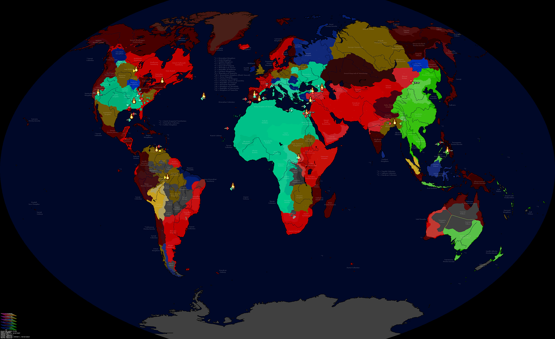
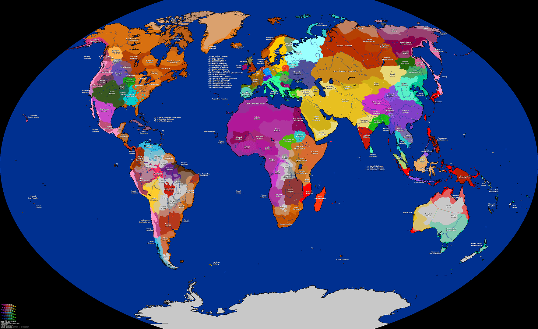
Post and discuss and fantasy maps (be they from Civ, other games, the internet, or your own)
Inspired by the Altered Maps thread.
Here are a few maps of a "world" that I created recently. I call it Tanriac. I've been playing with it for a few months, and am contemplating writing a book that takes place in it.
EDIT: Let's keep this thread for non-earth maps. Altered earth maps already has a thread. (see above link)
Satellite:
Made in Vue 6 Infinite:

Self explanatory.
This is the original picture that I made the other maps from.
Continental:

The continents (white), subcontinents (blue), and large islands (purple)
Mixed:

This picture has a lot in it.
- Cities (colored dots) In order from smallest to largest by population: orange, green, blue, purple.
- Water trade routes (dashed white lines) The thicker the line, the more active the route.
- Country borders (thick pinkish purple brown lines)
- Country names
- Satellite terrain
- Rivers
- Roads (continuous white lines) The thicker the line, the more active it is
- Mountains
- Hills
Political:

Note the differences between this and the Mixed map. Old & New Adon are one country. Anything simply labeled as "K.C.S." on the mixed map is under the rule of the "W" or "E" K.C.S. faction that is closest to it.
The names that go with the abbreviations:
K.C.S. = Kodol City States (W = West; E = East)
R.A.S. = Royal Allied States
C.T.S. = Confederacy of Tribal States
If you want to know anything about the history of this world, just ask.
Inspired by the Altered Maps thread.
Here are a few maps of a "world" that I created recently. I call it Tanriac. I've been playing with it for a few months, and am contemplating writing a book that takes place in it.
EDIT: Let's keep this thread for non-earth maps. Altered earth maps already has a thread. (see above link)
Satellite:
Spoiler :
Made in Vue 6 Infinite:
Self explanatory.
This is the original picture that I made the other maps from.
Continental:
Spoiler :
The continents (white), subcontinents (blue), and large islands (purple)
Mixed:
Spoiler :
This picture has a lot in it.
- Cities (colored dots) In order from smallest to largest by population: orange, green, blue, purple.
- Water trade routes (dashed white lines) The thicker the line, the more active the route.
- Country borders (thick pinkish purple brown lines)
- Country names
- Satellite terrain
- Rivers
- Roads (continuous white lines) The thicker the line, the more active it is
- Mountains
- Hills
Political:
Spoiler :
Note the differences between this and the Mixed map. Old & New Adon are one country. Anything simply labeled as "K.C.S." on the mixed map is under the rule of the "W" or "E" K.C.S. faction that is closest to it.
The names that go with the abbreviations:
Spoiler :
K.C.S. = Kodol City States (W = West; E = East)
R.A.S. = Royal Allied States
C.T.S. = Confederacy of Tribal States
If you want to know anything about the history of this world, just ask.


")