henryMCVII
Warlord
- Joined
- Apr 29, 2008
- Messages
- 237
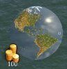
This is just the original Americas Map with some changings.
# existing rivers adjusted
# added some land masses to N-America (especially US east coast) to make it looking more natural
# Great Lakes are lakes now
# Caribian part of the map is completly overhauled
# Its no longer possible to build an Panama canal on nearly each spot on Central America
# some coast corrections made in S-America
Thats all so far. Anyway, some feedback would be nice for making this map better again.
Download