Declare your independence as you unite your colonies in the historic land of America's founding fathers! Other European nations wish to claim the riches of the New World, and land will be claimed quickly. Fight them off, and establish a nation which will stand the test of time!
I am pleased to present...
New England
New England is a small map designed with the growing Religion and Revolution (RaR) mod in mind, albeit there is a non RaR version included for download. Enjoy a path to independence as you assimilate or destroy numerous small native American tribes, or enlist their aide to grab land from your white man neighbors. The whole of New England is up for grabs, as the fate of this historic land is in your hands!
You may now download New England v1.0_TAC and New England v1.0_RaR here.
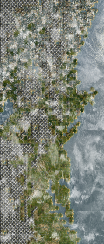
New England is a small map (2100 square tiles, many given to mountains), yet classified technically as a Huge map. This was done to increase the number of native tribes, while reducing their individual strength. If you find the map to be therefore too easy, you can always try playing on the Revolutionary difficulty!
I am pleased to present...
New England
New England is a small map designed with the growing Religion and Revolution (RaR) mod in mind, albeit there is a non RaR version included for download. Enjoy a path to independence as you assimilate or destroy numerous small native American tribes, or enlist their aide to grab land from your white man neighbors. The whole of New England is up for grabs, as the fate of this historic land is in your hands!
You may now download New England v1.0_TAC and New England v1.0_RaR here.
New England is a small map (2100 square tiles, many given to mountains), yet classified technically as a Huge map. This was done to increase the number of native tribes, while reducing their individual strength. If you find the map to be therefore too easy, you can always try playing on the Revolutionary difficulty!

") Thanks.
Thanks.