Guess the Map VII: Bhutan vs. Peru

Status
Not open for further replies.
I'm sorry I don't have an imageshack or photobucket account.

Edit: This was the map:
Norwegianmalforms.png
 
That's unfair. You have to be a Norwegian to take a qualified guess on that one. So I'll try. Has it to do with language?
 
So what is it, red is a Swedish dialect?
 
Prevalence of Bokmål vs. Nynorsk? Or maybe official language per district, respectively.

I have no idea which is which, though.
 
Prevalence of Bokmål vs. Nynorsk? Or maybe official language per district, respectively.

I have no idea which is which, though.

It is indeed official language per municipality. Blue is Nynorsk, red is Bokmål.
 
I have no map at hand at the moment. Maybe Lillefix can post one instead? I never would've guessed it without the hint about languages.
 
How close are the two dialects? My first guess was going to be political parties
They aren't dialects (there are way many more dialects than that), they are written languages with some differences. But of course they reflect the way people speak in the areas where they are official.

They are fairly different. Grammar rules aren't the same (though similar), and several words differ tremendously. One of the most extreme examples is "for example". In Bokmål it's "for eksempel", while it in Nynorsk is "til dømes". But overall they are rather similiar, though it's easier to understand the other than being able to write it.

We had elections for municipalities and counties two of years ago, here's a map if you're interessted:
http://no.wikipedia.org/wiki/Fil:Kommunestyrevalget_2011_-_St%C3%B8rste_parti_etter_kommune.svg
 
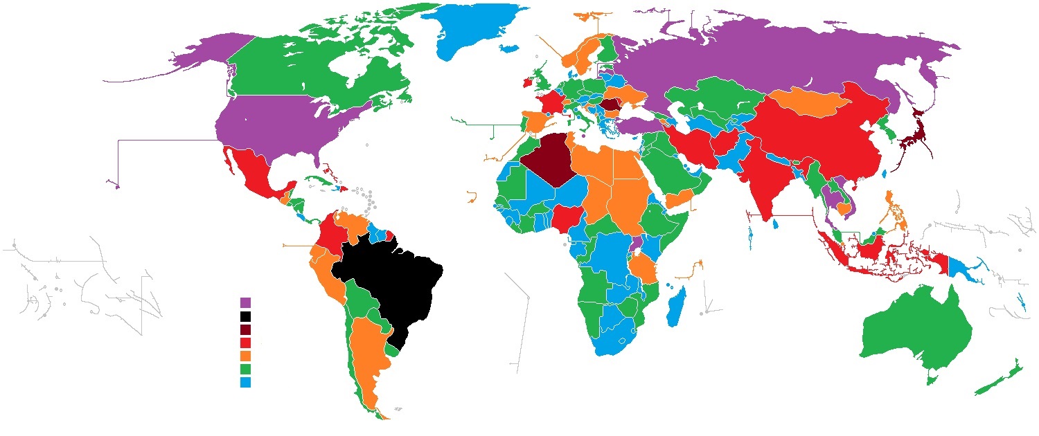
These are amounts of something. Blue is least(including zero and no data, although I'm not saying any of the countries have zero of this) while purple is most. The ranges are quite arbitrary.

And since the amounts can be ambiguous I used the amounts listed on a Wikipedia table. I haven't taken the grey ones, just because I'm lazy. There may be errors, but I'll correct them if I see any.

kart2.jpeg
 
Is it number of first/highest level of administrative divisions (like provinces and states)?
 
Is it number of first/highest level of administrative divisions (like provinces and states)?

Belgium's got more than one.
Amount of soldiers serving in the army?
 
No he's right. Blue is zero to ten divisions.

Well that was quick. Next map please. You or anyone else who wants to.
 
This should be considerably easier than my last one.

Edit: This was the map:
Census-2000-Data-Top-US-Ancestries-by-County.svg
 
Status
Not open for further replies.
Back
Top Bottom