Map Request: Western Hemisphere

Dom Pedro II

Modder For Life
Joined
Apr 3, 2002
Messages
6,811
Location
Exit 16, New Jersey
I need a map of the Western Hemisphere. I'm aware that there are several such maps out there, but mine has important criteria.

I don't need ALL of the Western Hemisphere. Below is a box representing the area I need to be featured.

It will probably have to be very big.

For this map, I need the following:

1) Long Island must be represented, and preferably more than 2 tiles.
2) There must be enough space that Baltimore and Washington can both be placed on the map.
3) Sea squares in the Mississippi spaced so that ships can squeeze through... AT LEAST as far as St. Louis.

I would like to include Western Europe in this, but I think that might ultimately be a bit much. The Atlantic wouldn't have to be proportionally accurate and Europe not placed exactly where it ought to be but only that it is roughly correct to simulate cross-Atlantic relations.

Again though, if including that makes it too unruly, then it's best if Europe is left out. But at least give some space in the Atlantic then for a few squares to be placed so the Europeans can be represented.

Also, I don't need somebody to go nuts with the terrain detail. I can do that myself. What is most important is that the shorelines are well-done. If somebody could help me out, that'd be great! Thanks!
 

Attachments

  • americas.jpg
    americas.jpg
    46.6 KB · Views: 137
I'm relatively new to mapmaking, but I could give it a shot, if you don't mind me doing it. It would take a while, considering the size you are asking for. I do have a couple of questions though:

1) do you have any particular dimensions for the map (#of tiles x #of tiles)?

2) What do you need this for exactly (That is if you want to share that info)?
 
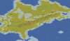
Surely... I'm not really certain of the dimensions.

But the point of this map is for a scenario I'd like to make about my alternate history of the Civil War, which as I explained, I have been working on a novel about and is the reason I went to Virginia recently.

Backstory: The scenario starts in October, 1862. After destroying McClellan's army during the Six Days Battle at the end of June, Lee sent a new army spearheaded by Stonewall Jackson north to Gordonsville. After a brief engagement with the advance forces of General John Pope, Union commander of the Army of Virginia, at Cedar Mountain, Jackson waited for the rest of the army and they surrounded and destroyed Pope's army of 35,000 men. Marching North, the Army of Northern Virginia picked up another 11,000 prisoners at Harpers Ferry bringing the total number of Union captured in the East to almost 90,000. With another 70,000 men left in the Eastern theater, Lincoln had enough men to hold the capital but not to engage the Confederates in the field.

In early September, it became clear that Britain and France would recognize the Confederacy. Buell in Kentucky already sluggish ground to a halt in the face of serious logistical complications due to severed rail links with the East and Bragg marches towards Louisville all but unopposed. Lee's Army of Northern Virginia marched in Pennsylvania in early September and began destroying the anthracite coal mines in the state. Without a supply of coal from Pennsylvania, and with rail lines from the Allegheny coal fields cut, the Union war machine would grind to a halt. Worse yet, the bottleneck in fuel would cause rioting in the Union cities come winter.

After the debacle on the Peninsula, McClellan was imprisoned on charges of dereliction of duty, but he continued to have support claiming that Lincoln's lack of support rather than his incompetence explained the disaster. The situation continues to spiral out of control, and after Pope humiliates himself and his Republican backers, the largely Democratic military decides its time to take action. The McClellan clique first tries to make demands of the Lincoln government, and when they are rebuffed, they set into motion a coup d'etat. On September 23rd, not waiting to be deposed, Lincoln fled the city with his supporters to set up a new capital elsewhere and continue the fight. The following day, claiming that Lincoln had abandoned the city to its fate, the generals force a general assembly of Congress and insist that a new President much be appointed. They do. McClellan is chosen.

Many people believe the Army's claims, but many realize the severity of the situation. With Lincoln still claiming his legitimacy, there is a schism. The northern states are torn in their loyalties. New York, New Jersey, Missouri, and Maryland opt to back McClellan. The rest of the state governors, especially New England, Illinois and Indiana back Lincoln. But the people Indiana and Illinois are hardly loyal to Lincoln. Intense fighting breaks out throughout the Midwest. From the Alleghenies to the Missouri River, violence takes total control.

Given the total disintegration of order, four separatist movements flare into full effect. By December news reaches the West, and Utah and southern California resolve to declare their independence. In the Midwest, copperheads who back neither McClellan nor Lincoln are seizing the oppurtunity to try and break a new Confederacy out of the Northwest. But given the divided loyalties of the region, they do not have enough support to simply call state conventions and thus remain largely roaming guerilla forces.

The last area of dissent is perhaps the most unlikely one: New York City. In 1859, mayor Fernando Wood, a popular mayor who had a large following from the lower classes, proposed NYC's secession from New York and forming a new state. In 1861, emboldened by the Confederacy's action, he proposed the creation of an entirely separate country. The idea was largely rejected especially since the South's tarriff policy would make it extremely difficult for New York to compete in the global economy. But that only meant that the Confederacy had to lose. If Confederate victory seemed inevitable, then New York could not remain in the Union if it was to survive. There would be no way to compete, so the only choice would be full commitment to at least partial autonomy. And with chaos reigning throughout the continent, a military dictatorship in place in Washington, and Lincolnist counter-revolutionaries under Lafayette Baker terrorizing the population, nothing seemed particularly inspiring. But New York's hand is about to be forced...

On October 7, 1862, the USS Sonoma under the command of Thomas Holdup Stevens, fires upon and sinks the HMS Desperate which is believed to be escorting a Confederate blockade-runner. In England, news of the coup d'etat makes everyone certain that a peace treaty will be soon to follow and so recognition is given to the CSA. Then a few days after that, the news of the attack on the Desperate arrives. The result puts Britain at full alert and this is the beginning of a naval war that will escalate into a full conflict. British ships steam into New York harbor and begin a brutal bombardment of the Brooklyn Naval Yards in early December and then the area as a whole. Cut off from New Jersey, and running low on essentials like coal and food, Wood's supporters take to the streets, oust Republican Mayor Opdyke, and declare Manhattan, Staten Island, and Long Island a new republic: The Republic of New York. They immediately sign a separate peace with Britain, and the British begin sending food and supplies into the city.

Meanwhile, in the American West, the Native American tribes have been watching more and more Federal forts being abandoned as men are being called East and word of the disasters reach Chief Red Cloud of the Sioux. The Natives are willing now, realizing the oppurtunity ahead of them, to unite in a way that they never before have, but what to do? They can make war against the white man and take advantage of his weakness, but they do not have the strength to conquer him, and once stability returns, he may push them out of their lands altogether. Or they can align themselves with Lincoln and in his desperation for more fighting men, he will be forced to give in to the demands of the Sioux rather than risk war with them. It is an oppurtunity either way for the natives to ensure their survival and they are not going to be left out of this conflict.

Elsewhere in the Americas, the war is spreading. In Mexico, Santiago Vidaurri is seeking to join the Confederacy with the five north Mexican states he controls. Benito Juarez's Republican government is struggling for existence and not only must he combat the French and Imperialist Mexican forces, but now he must also suppress Vidaurri's bid for independence.

French-backed dictatorships in Costa Rica, Ecuador, and Paraguay are making their own bids to become Monarchies, and soon the rest of South America will be drawn into the conflict. Chile and Peru, already in conflict with Spain, will bring themselves into alliance with the United States. Even Prussia and Russia might possibly be forced into the conflict.
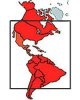
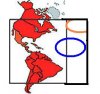
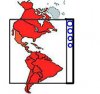
Civilizations:

Lincoln government
McClellan government
Confederate States
New York City
Nation of the Deseret
Pacific Republic
Sioux
Juarista Mexico
Vidaurri government
Britain
France
Spain
Prussia
Russia
Brazil
Paraguay
Argentina
Chile
Peru

Spain, Britain, the CSA, France, New York City, the Nation of the Deseret, and the Pacific Republic and the Vidaurri government are in a locked alliance against the other alliance of the Lincoln government, Chile, Peru, and Juarista Mexico.

Brazil and Argentina are in a locked alliance against Paraguay.

Russia and Prussia are wild cards as are the Sioux.

The McClellan and Lincoln governments are in a locked alliance against each other, and the Lincoln government is in a locked war with the CSA, but the McClellan government is not necessarily although their objective for victory includes recapturing the Confederate states.

Basically, the goal for the separatist movements is basically to survive to the end of the game as is the goal of the Confederacy. The goal of either US governments is to overtake the other and bring order back to the continent and that includes the separatist regions. Britain has to try to hold onto Canada and France to hold on to Mexico. The Juarista government has to beat Vidaurri and the French. Brazil and Argentina have to beat the pants of Paraguay and Paraguay has to do the reverse. Peru and Chile have to push the Spanish out of their territory.
 
This is very interesting. To me it seems necessary you include Europe, but how? This will take some brainstorming...
 
Alright, I've been thinking about it and I have come up with a few ideas concerning Europe, and the map size, which I will put in my next couple of posts. I've also attached some images to help explain these ideas. For Europe, option 1 would be to extend the map to the right and fit europe somewhere in the upper right quarter. This could mean putting it up in the top right-hand corner (orange circle), a pro to this is that it is a more accurate placement, but a con is that you can not show as much of Europe, or in as much detail. So, instead, Europe can be pushed down to the middle, between North and South America (blue circle), but this also has pro's and con's. More of Europe can be included, and it can be larger, but how far down is too far? It would be an odd place to put Europe. Either way, this would allow for a war in Europe, which can be a good thing, or a bad thing if europe is made too small (nations quickly defeated). Another bad thing is that it still would be difficult to get nations like Prussia or Russia on to the map.
 

Attachments

  • option1.JPG
    option1.JPG
    13.2 KB · Views: 124
Option 2 concerning europe would be this: the map is extended slightly to the right and each European nation is given a small island and one to a few cities, with most of the resources they need. These islands would be lined down the right side. Once again, pro's and con's. All european nations can be included, and they would take up a limited amount of space. However, this would not allow a war in Europe, which I know is not the focus of your scenario, but it would be more accurate.
 

Attachments

  • option2.JPG
    option2.JPG
    11.7 KB · Views: 119
And finally, the sizes. I have been drafting, and I have figured out I could make the height of the map one of three dimensions (in tiles, of course). I have not figured out the width yet of course, because of the Europe question. I'm not sure if these dimensions mean anything to you, as I am not really comparing them with anything, but here they are:

The smaller option (height 212 tiles, which is still not exactly small) would make it harder to show detail, although it can still be done, but may be at the cost of accuracy (thinking of long island and such)

The middle option (height 264 tiles) would probably/hopefully allow sufficient detail and accuracy.

The Larger option (a whopping height of 352 tiles) about as big as you can make a map, lots of detail, definately accurate.

Of course, which option is best ultimately comes down to: exactly how big do you want this, and how big is too big?

I'm probably making this a bit too complicated, but I would like your opinion, Dom Pedro II
 
352 tiles is definitely too big.

264 is probably the best.

And about the idea for small islands with the Europeans on them, I also considered this as well. If you weren't able to fit Europe into the map, I was going to add these myself. I remember that the American Civil War scenario for Civ 2 had this, and it basically worked pretty well.

The width of the map was not of any real concern to me, my box was merely to show that I had no use for the extreme north or south of the Americas.

It might be best to go with the islands simply because any war in Europe at this time is not going to be a war of conquest. At this point in history, the goals for wars are much more limited. While there might be some fighting in Europe, the real theater of war is going to be the Americas and other areas of Imperial possession like Central Asia if Russia gets involved (that really doesn't need to be represented, so breathe a sigh of relief). As such, if Europe IS represented and war breaks out, it could flare wildly out of control and the Europeans might end up expending most of their resources on wars of conquest in their own backyard, which doesn't really fit for this scenario.
 
Well, I have started on the map. I tried a 264x216 version, but it turned out to be much bigger than it looked on paper, and was much larger than necessary. So, I tried a 212x172 version, which is still quite large, but any smaller would lose needed detail. I have completed a very rough outline of the map: just the coast, and a few lakes and islands. Attached is an image of eastern Canada and the US, along with the minimap, as a sample of what the map looks like so far. Fortunately, there is plenty of room for all the details requested. However, if you would prefer the map to be larger, I can always go back to the 264x216 version.
 

Attachments

  • americas1.JPG
    americas1.JPG
    110.1 KB · Views: 109
You're very good for someone who is "relatively new" to mapmaking. :)

I like it. Of course, I would like it to be HUGE! But the bigger the map, the more work for the computer... so I'd rather keep it as small as possible. This works fine.
 
Excellent Idea for a scenario. I would have volunteered for making the map, but Red Alert looks to be doing a better job then I would have anyways.

Red Alert: Excellent map so far. I have only two things with it: Lake Erie should be wider (the southernmost and second from the right great lake), and In Lake Superior you should have it just a bit wider at the very top and out of Upper Michigan have a peninsula out of the west, slanting east (two squares, that's all). But then, I'm very nit picky, especially about my home state. :)
 
Don't worry North King, the great lakes will be looking like the real things by the time I'm done with them. As I said before, It's just a very rough outline so far - what I have now is just marking where everything goes. Thanks for the pointers, criticism is most welcome. You see, accuracy of the great lakes is important to me too... I live on Lake Ontario :D
 
Tell me what you think..... :D
 

Attachments

  • americas2.JPG
    americas2.JPG
    66.6 KB · Views: 100
If it's not a problem, as well as making the Mississippi seafaring, I'm going to make other major rivers (St. Lawrence, Amazon, Paraguay) seafaring as well, to match.

btw, I'll be lurking around that development thread.
 
Here's an update & preview of the map progress. I have now edited all coastlines to make them look real and added the seafaring rivers. As you can see in the pic below, I've made the most progress on eastern Canada & USA. Soon, the entire map will be filled similarly to this part. There are a few things to note here: 1) Seafaring Rivers - I wasn't sure how you wanted it - the rivers to have strategic crossing points where cities are placed, or if they were to be accessable to boats the whole length of the river without going through cities (no crossing points). I have done the crossing point version, and labeled the points in the pic. 2) Victory Point Locations - as you can see, I have set VPLs on the map. These are only temporary, they merely mark the crossing points on the seafaring rivers. 3) Too much grassland - I only covered the displayed area in grassland as a base terrain that I will diversify later. Also, it allows me to place all the rivers on the map.

Anyway, I best get back to work.
 

Attachments

  • americas3.JPG
    americas3.JPG
    119.8 KB · Views: 84
Back
Top Bottom