Very small map-->Europe and Africa

Yoda Power

✫✫✫✫✫✫✫
Joined
Sep 24, 2002
Messages
13,869
I just addded africa to my 16-16 europe map
 

Attachments

  • 16-48.zip
    23.9 KB · Views: 367
...
 

Attachments

  • 0425747.jpg
    0425747.jpg
    28.9 KB · Views: 1,148
Madagascar is..well..ah..not sure, well i forgot it sorry:(
 
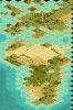
Could you make a larger vesion of this excellent map?:D
 
I'm not very good with maps, but how about what ever you think would be medium size?
 
Originally posted by Azale
I'm not very good with maps, but how about what ever you think would be medium size?

i think LouLong will make such a map soon.
 
Thank you:D
 
But you did tell me Loulong was making one.:goodjob:

How does Loulong make those maps so rapidly? India,Egypt, and South Africa in the span of about two weeks?
 
Originally posted by Yoda Power


i think LouLong will make such a map soon.


Eerr, the idea is very good but I need to finish 5 maps before so don't expect it too soon.
Yoda, I think Arabia should be included too. No ?
 
Originally posted by LouLong


Eerr, the idea is very good but I need to finish 5 maps before so don't expect it too soon.
Yoda, I think Arabia should be included too. No ?

yeah i would prefer that too.
 
Originally posted by Azale
But you did tell me Loulong was making one.:goodjob:

How does Loulong make those maps so rapidly? India,Egypt, and South Africa in the span of about two weeks?

How ? Well, I am French ! That's how and why. :D :D

More seriously. I use a map utility (at Apolyton) that I use to convert maps I take from the national geographic map generator. Just use the tool to make the main coastline. Then I do the rivers (I am really careful with rivers since they are good references) and different terrain types.
As for the resources, it is a mixture of atlas (geographical and historical), National Geographic map generator (natural resources options) and knowledge. I have actually pbs with fish and salpeter but the rest is usually fairly accurate.

pb with the map utility, it converts only a few sizes (and always squared ones).
 
so you also use the map utility by John Avram, i think im one of the last that still uses "the old way". BTW map making is a pretty fast doing thing, i made a Africa map in two hours. It has not been posted on the internet, because its for something "secret".
 
Actually I just use it to draw coastal lines from pictures, full stop.
I just make costs/desert to make the costs. Everything else (including lakes/islands) is done by hand. Since I don't have Civ2 PC I don't import Civ 2 maps either.
Well, the coast is usually the big trouble, especially considering the stretching in Civ3, so that helps me a lot but not too much.
I mean it would take me more than two hours to get a complete African map (depends on the size though ;) ).
 
here is a pic of my africa map, i dont remember the exact size, but you get the idea.
 

Attachments

  • africa.jpg
    africa.jpg
    7.2 KB · Views: 841
I'm not going to rush you LouLong:D
 
Its not a bad map, but u should realise that Europe is about 1/4 the size of Africa, not 1/2 its size.
 
Originally posted by Aonghus
Its not a bad map, but u should realise that Europe is about 1/4 the size of Africa, not 1/2 its size.

yes i do, but it would be nearly impossible to make europe detailed if it was the correct size.
 
Top Bottom