Puppeteer
Emperor
Oh, by the way, I changed the license on GitHub to the MIT license for code and made attributions for a couple of included libraries I'm using.
I started this project with a fear of spoiler info, but lately I've been thinking I'm pretty sure it's possible to see the known map for each civ, and there might be use cases for that. Is the multiplayer game tracker something that exists, or is it something you want but don't have? What type of map info would be most useful: whole map, known-map-by-civ or aggregate known world?

Ok, please try these. I made a slight change in the tag structure to more closely mirror the tiger.
Mac zoom test, svg as img
Mac zoom test, svg in DOM
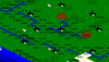
When making this test I realized it's not just the big map that behaves differently depending on how I include the SVG. IE is faster than anything when I include the SVG in an img tag. Chrome seems to do better with the SVG in the DOM while IE pretty much chokes on it. I'll be doing more experimentation to see what the root cause is, but I'm more focused on other things so I'll just offer two viewers for now. Please also try two-finger-scrolling the Game of Thrones links above. They are mostly the same, but I removed a couple of constraints and wonder if it makes a difference.


 Oh, that was a good one!
")
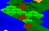
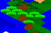
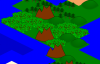
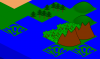
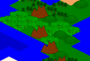
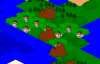
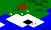
A quick jungle tweak. Which is better? ("None of the above" is assumed; which is the least harmful of these two?) The only difference is whether or not the trunks are obscured by the "leaves".

 --to the map, but I don't feel like finding or making the graphics for it all right now. Maybe I'll get text labels for non-strategic (because spoiler) resources on there before I burn out completely; we'll see.
Assumptions:
	Barbs are first civ, then human player(s) then AI player(s)

Guesses:
	WRLD section data does not change from turn to turn
	Barbs are first civ so they can always ensure they're at war with everyone? And/or otherwise programatically differentiate themselves from other civs?

Thoughts:
	Are continents represented in WRLD? Guessing not since the sizes seem consistent
	Is there only one barb camp per civ? In my huge 2-player map I have reason to believe there are only two current barb camps on a huge continent.

WRLD
	2 bytes
	bit flags?
	No correlation to map size or player # found
	Not turn or date
	LSb is one for all 3 of my test saves
		gamesaves/unc-got-map.sav
		0000  4b 00                                             K.
		(75,)
		 1001011
		gamesaves/unc-test.sav
		0000  11 00                                             ..
		(17,)
		   10001
		gamesaves/unc-lk151-650ad.sav
		0000  6b 00                                             k.
		(107,)
		 1101011
WRLD (2nd instance)
	164 bytes
	looks like 41 integers
	has map width and height
	0x00 int? - Continent ID of the ocean (may be a short or even byte, but the high bytes have been 0 so far)
	0x04 int? - Map height / y rows
		4 ints? - No clue. Why the separation between rows and columns? These are small enough to be two x,y coordinates, but they aren't. Only lsB seems to be used..hmmm, bit flags?
		map data like arid/etc? Kinda doubt it.
		don't think they are continent IDs
		Hmm, last int at 0x14 always 0?
	0x18 int? - Map width / x columns
	0x1c - 0x9b - 32 * int - Index of home tile for each civ! -1/ffff for nonexistent civ or barbs
		guessing this is the start location and not necessarily the current home
		0x1c int - Barb start location: -1 / ffff because n/a
		0x20 int - Human player 1 start location (tile index, not x,y)
		... next human players and then AI players
	0x9c - int - World Seed
	0xa0 - int? - no clue - 5 seems to be a common value so far

WRLD (3rd instance)
	52 bytes
	looks like 13 integers
	1 is a common value, also 2. Occasionally 0 or -1/ffff . Nothing else seen so far

TILE (1st instance, aka "A"? aka Tile36)
	36 bytes
	think mostly ints but some shorts or bytes mixed in
	0x00 - no clue. Seems 0 for first byte, 0 or 1 for second byte
	0x02 - no clue. Both bytes used
	0x04 int - Resources! -1/ffffffff if no resource, so I can tell this is a 4-byte int
		0x00 - Horse
		0x01 - Iron
		0x02 - (unknown strat) (coal?)
		0x03 - (unknown strat) (aluminum?)
		0x02 - Saltpeter
		0x04 - (unknown strat) (oil?)
		0x05 - (unknown strat)
		0x06 - (unknown strat)
		0x08 - Wines
		0x09 - Furs
		0x0c - Spices
		0x0d - Ivory
		0x0a - Dyes
		0x0b - Incense
		0x0e - Silks
		0x0f - Gems
		0x10 - Whales
		0x11 - Deer
		0x12 - Fish
		0x13 - Cow
		0x14 - Wheat
		0x15 - Gold
		0x16 - Sugar
		0x17 - Tropical Fruit
		0x18 - Oasis
		0x19 - Tobacco
	0x08 int - definitely associated with units. Wild guess: visible/top unit ID?
	0x0c int - varied numbers, can't quite spot a pattern
	0x10 byte? or low nybble of 0x11
	0x11 byte? - Pre-Conquests terrain? All 0's in most samples, but LK's world map seems to have terrain info here
	0x12 short? - Pre-conquests flag of some sort? All 0's in most games, but some variation in LK's WM
	0x14 short? - Barb info. Do barbs have tribe IDs? They must I guess, but would that be here? LK's WM has repeated number; my maps are limited but seem to have unique IDs
		0x003e - Barb camp and/or barb warrior on my test map
		0x004b - ? - very common on LK's WM, incl one in water
		on isolated map, values of 0x0001, 0x0029 and 0x0011
	0x16 short? - City ID
	0x18 short? - Colony for me is 0x0000 ... Colony ID?
	0x1a short or byte - Continent ID
	0x1c short? - no clue, varies, big numbers
	0x1e short? - all -1/ffff
	0x20 short? - all zeroes
	0x22 short? - all zeroes

TILE (2nd instance aka Tile12)
	12 bytes
	0x00 byte? (int I think) - Improvements
		00000001 - Road
		00000010 - Rail?
		00000100 - Mine
		00001000 - Irrigation
		00010000 - Fortress?
		00100000 - Goody hut?
		01000000 - Pollution?
		10000000 - Barb camp
	0x01 - all zeroes. High byte of short? No, I think Improvements is one byte. Guessing byte padding
	0x02 - all zeroes - Guessing byte padding
	0x03 - all zeroes - Guessing byte padding, or maybe these 4 "0"-bytes are an unaligned integer?
	0x04 - part of Terrain? Not sure why lsB would be 0, but what else is this?
	0x05 byte - Terrain. Low-nybble base terrain, high-nybble overlay terrain
	beyond -- looks bit-flag-ish, but doesn't seem to be visibility
		By-civ culture visibility? Masking with 0x02 looks like it could be my civ's ...something. Culture vis isn't right.
	0x0a short? -
		values 0x000a or 0x002a associated with starting positions ... 00001000 bit
		Think the high "2" bit 00000010 00000000 may be associated with human players because 0x002a is human starting position. But there are plenty of other values, and I don't know what this means.

TILE (3rd instance aka Tile4)
	4 bytes
	0x00 int - All zeroes?

TILE (4th instance aka "B"? aka Tile128)
	128 bytes
	0x00 int - bit mask of is visible to civ (fog of war). lsb is barbs, next is human player 1, etc..
	0x04 int - bit mask of is visible NOW for units only, does not seem to include city/culture visibility
	0x08 int - bit mask of visible to colonies?
	0x0b int - bit mask of city/culture visibility
	0x10 byte - tile transition values? Only values are at top row and bottom two rows of map
	0x11 byte - tile transition values? Seems mostly to left of land transitions, but not absolutely. Also at top and bottom of map
	0x12 byte - tile transition values? Seems to apply to most land transitions, but standalone and left-most hills and mountains seem to be -1/ff . Presume this controls how the overlays/transitions work to e.g. show continuous hills
	0x13 byte - 0 or 1. Flag of some sort; can't figure out what it means. Or maybe high byte of previous value?
	0x14 short - City ID of the city working this tile (includes city tile)
	0x16 - Guess: 32-short-int list of trade network IDs known to that civ? But not necessarily tradeable I think. Perhaps this is what trade routes are seen/known to that civ because of recency of tile improvement knowledge? Maybe both civs have to be able to see the same trade network ID to trade via that tile?
		0x16 short? - all 0xffff
		0x18 short? - Appears to be ID of road/land trade networks. Each isolated road network has its own ID
		0x20 short? - Also seems to be land trade network ID, but is 0xffff everywhere on my pre-conquest-win test save (no opponents left). Maybe this is used to determine which civs might trade with each other?
		0x22 short? - At a quick glance looks identical to 0x20
		...
	0x56 - Guess: 32-byte per-civ-knowledge improvements flag
	0x76 short? - can't determine what is is, but 1a1a values look familiar; maybe this is related to Tile36 0x06? Maybe this helps determine which graphic tile to use?
	0x78 short? - All zeroes. Maybe high-bytes of int?
	0x7a short? - All zeroes.
	0x7c short? - All zeroes.
0x7e short? - All zeroes. Or maybe this has been byte paddingI think I'm about to burn out on this for a while. I have the info I need to add a bunch of stuff--except rivers
NiceNo, I am not kidding this time. This particular cow may stick.
")
Maybe tomorrow I'll make a custom map that's almost all grassland with a little bit of river and see where the variations are.