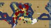
Is the elevation used in the script? On this screen you can see 10 plots of the main mountain range ( + some dispersed mountains) and there is 1 hill. Where is the country where 90% of the moutains sides are not hills but flat plains?
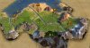
Continued a littel and found the Mount Cervin, giving me an advantage when Moving on the hills…
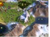
Continued a littel and found the Mount Cervin, giving me an advantage when Moving on the hills…
Attachments
Last edited: