Biggest Map Size

Darkstorm_99

Chieftain
Joined
Sep 27, 2006
Messages
1
what is the biggest possible map size on civ2 becuase there is the rule in customize opitions tab and i want to play on a big long game
 
The X and Y axis multiplied together cannot exceed 10,000 hexes. I usually use 100 x 100, but you can try any combination as long as you don't exceed 10,000. The current GOTM game, #68, is 250 x 40 hexes.
 
What version of Civ2 do you have? Does it have multiplayer options?

The maximum map surface you can have in Civ2 is 10,000.

Civ2 can handle bigger maps though. Older Civ2 versions can have maps up to 10,922 squares. Newer versions (those supporting multiplayer) can have maps up to 32,767 squares.

I recommend you try this little program:
http://www.cix.co.uk/~spot/civmapgen/CivMapGen.htm

It's a totally awesome Civ2 random map generator that has many options and can create nicer maps than Civ2 can. It can also create maps bigger than 10,000 squares for you.


If you have Multiplayer Gold Edition or Test of Time, you could also try the so-called "No Limits" patch. You can find them here:
http://www.civfanatics.com/civ2/downloads/utilities/

If you install that patch you can create random maps up to 32,767 squares. The patch also lifts other limitations though. It also allows you to get more than 30,000 gold and a population larger than 320,000,000.
 
Ace said:
The X and Y axis multiplied together cannot exceed 10,000 hexes. I usually use 100 x 100, but you can try any combination as long as you don't exceed 10,000. The current GOTM game, #68, is 250 x 40 hexes.
What is a hex?
 
A hex is actually what we old board wargamers call the squares on the civ map. The board wargames used a six sided map unit, the hexagon, hence the term hex. And since old habits die hard, we still call them hexes.
 
Practically it is rectangular, though it looks a little different - take a chess board and tilt it half way away from you and you'll get the same perspective as the civ "tiles" (/"hexes").
 
What is a hex?
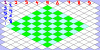
In Civ 2, synonymous with "square" or "tile" ... The tilting gives a pseudo-3d look to the game, without incurring the attendent overhad programming and CPU usage. Taking the converse of ElephantU's note, "tilt" the Civ 2 map "down" (so you look straight down on it from directly overhead), and it becomes the same checkerboard map as in Civ 1, for example.
 
On Civ 2 for the playstation, I'm sure we all know this glitch.

If you are doing well at the game your name goes 'nil' from loading it so many times. And when you can see the whole map, sometimes you can't see any of it and have to go into 'find city' and look for your capital. And you can see the map again. Just in case not everyone knew.

Coincidentally, in order to count how far away your next city is you can pretend your city is a chess knight and look in that many directions.
 
ElephantU said:
Practically it is rectangular, though it looks a little different - take a chess board and tilt it half way away from you and you'll get the same perspective as the civ "tiles" (/"hexes").
I'm not understanding this analogy.
 
by ElephantU:
take a chess board and tilt it half way away from you and you'll get the same perspective as the civ "tiles" (/"hexes").
by Perfection:
I'm not understanding this analogy.
Add: ... looking across the chessboard from one corner (e.g., diagonally), at an eye-height of several inches (or cm) ....

When you take this perspective, the squares will look more and more diamond-shaped as you lower your eye-level (the look square from directly overhead the chessboard). :)
 
Perfection said:
But the Civ2 board isn't like that it's edges are all weird.

Yeah, it looks like this thread confuses a couple of different questions...

So look here... In green you see the chessboard we're looking at from an angle as starlifter mentioned.

The red numbers indicate how a map's width is determined, the blue numbers indicate the height (counting the number of rows). Notice how the right edge of the map always has to fit in with the left edge, like a jigsaw, so to speak, because round maps need to be able to fit those two together. The bottom edge doesn't have to match the top edge, because maps don't wrap around that way.
 

Attachments

  • civ2map.gif
    civ2map.gif
    10.1 KB · Views: 225
Nice graphic, Mercator. The isometric view is not in common (daily) experience of most people, which is why its such an effective 3-D "look" but in fact is not 3-D at all. All the 3-D CPU overhead is not needed, and this keeps Civ 2 running well, even on ancient machines. :)
 
Back
Top Bottom