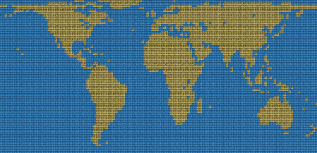
I am currently working on a
cylindrical equal area projection Earth map. In my view, it is even better than the equirectangular projection.
As the name suggests, it is a projection that preserves area. So Africa really is three times as big as Europe, Australia is three quarters the size of Europe, Greenland doesn't appear any bigger than it really is, and so forth. The downside is that there are some distortions in distances and continental shapes, but I think they are far less important than accurate area in Civilization.
Also, one big disadvantage of the equirectangular projection is that it makes a lot of uninhabitable terrain in the north of the globe larger than it really is. You could simply cut that terrain out, but then, the Northwest Passage would not be working anymore, so it is not an option for me.
I've done a comparison, putting a square grid for what would be a giant-sized map over an equirectangular (ER) projection and an equal area (EA) projection. The ER map would be 240 x 96 = 23040 squares and the EA map would be 220 x 104 = 22880 squares, almost the same size:
Alaska: ER 130 sqares, EA 75 squares
Greenland: ER 265 squares, EA 114 squares
Kamchatka Peninsula: ER 20 squares, EA 15 squares
On the other hand, because it preserves correct area, the EA projection has a lot more useful terrain in the tropical and subtropical regions than the ER map:
India: ER 130 squares, EA 150 squres
Madagascar: ER 22 squares, EA 30 squares
Borneo: ER 27 squares, EA 35 squares
What about Europe and Japan? This is supposed to be the advantage of the equirectangular projection, because it enlarges areas in these latitudes, right? Here is what I found:
Iberian Peninsula: ER 29 squares, EA 29 squares
British Isles: ER 20 squares, EA 18 squares
Japanese Islands: ER 21 squares, EA 20 squares
In summary: Europe and Japan are just as big or only marginally smaller on the equal area map, while there is a lot less inhospitable terrain in the far north and more hospitable terrain in the tropics and subtropics.
I am currently working on a 132 x 64 map, comparable in size to the official Civilization IV world map. I am using the so-called Hobo-Dyer projection: