Lunar - Map of the Moon

Sxythots

Chieftain
Joined
Jan 6, 2001
Messages
29
Location
Vancouver, BC, Canada
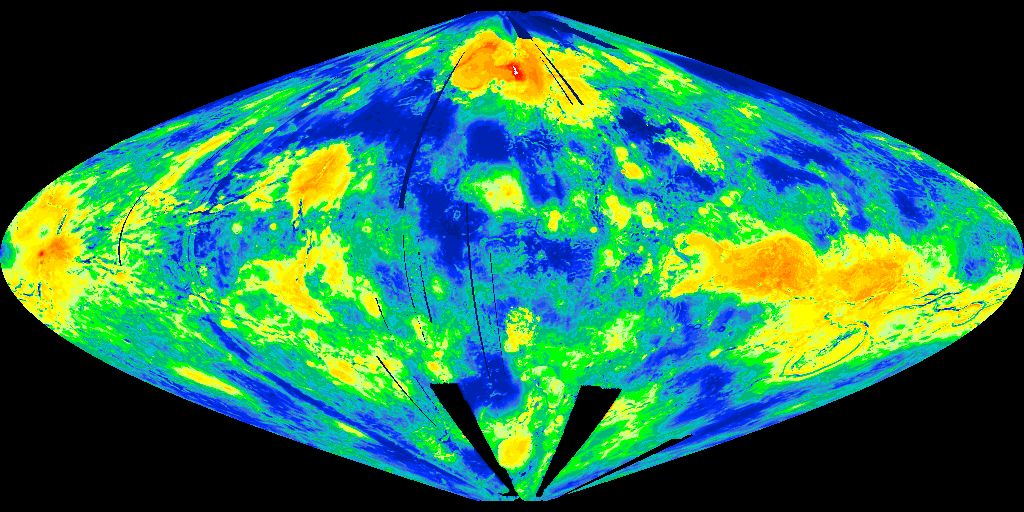
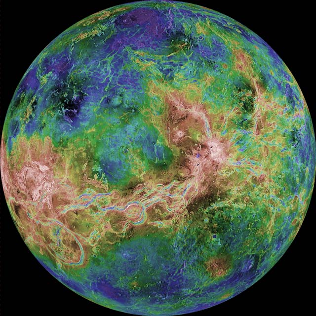
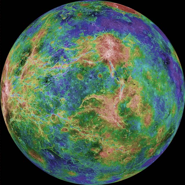
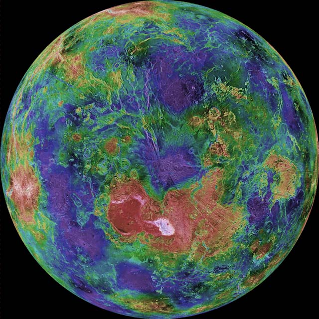
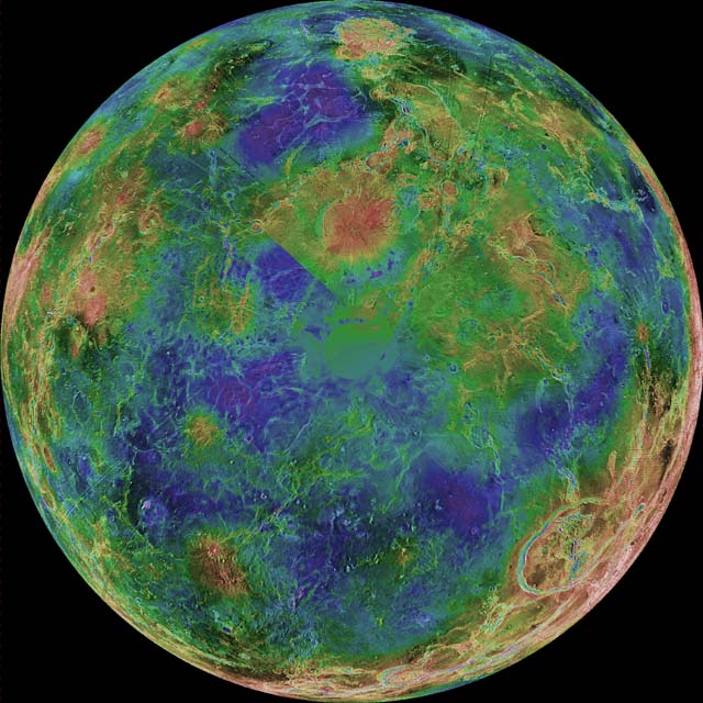
"Lunar" is the surface of the moon as it might appear with an atmosphere, oceans, & life. This map was created from Nasa's lunar surface telemetry and depicts both the near & far sides. Due to this map's small size & Civ's limited palette, only the most prominent of craters are apparent. All others are either under water (lakes/seas/oceans) or part of the terrain makeup. Unfortunately NASA cut off the north & south poles on their telemetry maps so I had to use some creative license there to prevent this map from have a straight cut along the top & bottom.

I fretted for a long time trying to decide exactly how I would place terrain on this map. Mountains, hills, flatlands, seas & oceans were pretty easy as the real characteristics of the moon dictated where they would be. However, deserts, plains, grasslands, marshes, forests, jungles, tundra & volcanos were a different matter all together as there wasn't anything to base them on.

After quite a bit of thought, I decided to generate this terrain using NASA's telemetry maps and a "what makes sense" approach based on where the water would be. One would expect that wetlands & green terrain would be nearer coastal areas & lakes while drier terrains would be more distant from them. Using this methodology the remaining terrain came together quite nicely to produce the map I have here.

Rivers and resources are all individually placed by hand. As usual, I have been fairly chintzy with the tradeable variety of resources and have placed them in a manner as to increase the likelihood that there will be have & have-not nations thus lots of reasons for tension & conflict. Goody huts & bonus grasslands were auto-generated.

Lots of time, work & effort went into this map so I hope you find it enjoyable. I always appreciate constructive critiques of my maps so let me know if you have any suggestions that would improve them.

Len Zigante :borg:
Despicable (aka Sxythots)


PS... on a side note, I created a picture map of an erotic nature a while back that earned me a ban & was subsequently deleted from this board. I have no intention of creating another map like it as the amount of work & controversy it created just arent worth my time & effort. However, if anyone is interested in checking it out, it can be found in the forum at the following site:
http://www.the-battlefield.com/civ3/forum/
 

Attachments

  • Lunar.zip
    67.9 KB · Views: 661
  • Lunar.jpg
    Lunar.jpg
    50 KB · Views: 2,234
Dang... it was 5am when I finished this lunar map & I was so tired I forgot to ask this question.

I obtained a number of NASA's telemetry maps for other planetoids around the solar system... mars, mercury, titan, venus, etc. I don't know if these "what if" maps would have much of a following so I would like some feedback on whether or not I should bother creating them (gas giants are out... they don't have stable characteristics and are mostly "bands" of color).

Give me your thoughts on whether my effort in this direction would be appreciated. If not, I would rather spend my time making more picture maps. If so, any planetoids in particular? Thanks.
 
a mars, a venus and a map of europa (... the jupiter moon ... ) (this one i made myself) are already somewhere in this forum, perhaps you should take a look. but why not? perhaps a map of mercury! ... :crazyeye:
 
Venus, please!

There was a great National Geographic map of Venus that I saw years and years ago, where they used blues to colour in lower elevations and yellows and reds to colour in higher elevations, and it looked like the coolest world map ever. I wonder if I can find it on the net somewhere...?

Edit: Not from National Geographic, but anyway:


Mercator projection, from the "Pioneer Venus" mission. Hi-res TIFF file available here.


Sinusoidal projection, from the "Magellan" mission.


Mercator projection, from the "Magellan" mission.

(--From links at this site.)


Mercator projection, -66.5º to 66.5º latitude, starts at 240º longitude, (c) Calvin J. Hamilton


Mercator projection, -66.5º to 66.5º latitude, starts at 240º longitude, courtesy of A.Tayfun Oner

(--From following up links at this site.)
 

Hemispheric view centred at 0º East longitude


Hemispheric view centred at 90º East longitude


Hemispheric view centred at 180º East longitude


Hemispheric view centred at 90º West longitude


Hemispheric view centred at North Pole


Hemispheric view centred at South Pole

If someone knows how or can make a moving gif from an mpeg, this video would be handy (and look pretty cool) if looped.

(--Again, from following up links at this site.)

Simply beautiful, makes me want to sing. (Or, would, if Venus really was as verdant as these images make it look! ;))
 
Wow... thanx for all the supporting info Mithadan. Seeing you are so gungho on this I decided to go ahead & do it.

At first it seemed the best place to start was with the colorized topography map you provided. Since they cut off the poles again, I decided to look around and found a more recent, flattened photo-compiled map of venus showing everything. After working a bit with this map, I saw that both NASA's & National Geographic maps were wrong... they totally mucked up how Venus's topography actually looks. This is also apparent if you compare those round global maps to their flattened ones.

The tip offs for me were their altitude scales. If light areas represent higher ground then all the volcanos are dark & therefore submerge into the ground with their craters protruding above the cone. Also, all those surface lines look more like valleys to me than they do hills. So with a bit of photoshop work I created some JPGs of what Venus's topography really looks like. I made one very high contrast so the land masses would be more apparent. (see attached images as I dont know how to embed them here - speaking of which...what DO you guys do to embed images into your text?).

Anyways, now comes the artistic license part... at what elevation do I make sea level as that will determine the shape of the land masses. Also... how do I apply the terrain that is not altitude dependent (grassland, forests, etc).

I've decided to create 2 versions of this map, one with a shallow ocean & more land, another with a deeper ocean & less land. Of course, this means that between the 2 maps, some hills will now look like mountains if measured from lower down on the slope (shallow map) so accordingly, some terrain will be more elevated between the 2 maps to reflect this. There are also a small number of tiles that are idiosyncracies due to how photoshop converted the colors (meaning that land exists in a place on the deep ocean map but not on the shallow ocean map. If anything it should be the other way around but these are relatively few so I am not going to bother finding & fixing them).

As for the rest of the terrain, I decided to take the easy way out & let an altitude level represent a type of terrain. The maps differ because on the shallow ocean map, a greater range of altitude represents a terrain type. I also decided to switch some deserts with plains for a bit more variety.

Also just to clarify incase someone wants to point it out, Venus is a pretty flat planet so I exaggerated the differences in altitude to produce mountains hills, oceans & seas.

If you are interested, I've attached a screen capture of a portion of both maps. No resources have been applied yet & I may tweak some of the terrain for better appeal. Any comments while I'm working on these?
 

Attachments

  • venusmap laid flat.jpg
    venusmap laid flat.jpg
    64.8 KB · Views: 373
  • venus invert w bmpmap.jpg
    venus invert w bmpmap.jpg
    75.2 KB · Views: 282
  • Venus Hi Contrast.jpg
    Venus Hi Contrast.jpg
    60.1 KB · Views: 274
  • Venus Deep.jpg
    Venus Deep.jpg
    332.2 KB · Views: 344
  • Venus Shallow.jpg
    Venus Shallow.jpg
    393.4 KB · Views: 339
Right on!

I like the shallower one better than the deep one, although I think in either case there will have to be less coastal terrain, to avoid (so much as is possible) a complete exploration of the map by curraghs or galleys! As to where to place forests, plains, deserts etc., that's entirely up to you. I wouldn't care if you just made all the "green" parts of the map into forests/jungle!

Out of curiosity, what size of a map is this going to be?

PS: to embed images into your posts, you have to use the ["img] ["/img] set of brackets (minus the " marks of course). You can either remote link to other images on the web (as I did with all those Venus pictures), or upload your own images to the civfanatics folder (the button for this is at the very bottom of the page).
 
Sxythots said:
Give me your thoughts on whether my effort in this direction would be appreciated. If not, I would rather spend my time making more picture maps. If so, any planetoids in particular? Thanks.

I have 160x160 Venus and Mars .bix maps on the official Civ3 site, here and here (although Venus is misattributed).

I'm currently working on a map of Ganymede, using data from here.

Richard
 
Oh! I'd best go and check them out. In any case, I guess the more the merrier..?
 
Mithadan said:
Oh! I'd best go and check them out.

The Venus one has clutches of resources in a way that Earth maps generally don't (so you may see 3 horses next to each other, that sort of thing). The Mars map uses more standard distributions.

In any case, I guess the more the merrier..?

Of course - it's not like I have a copyright on Mars and Venus!

Richard

PS: See http://bulk.vttoth.com/BULK/MOLA/mola.html for a utility that raises and lowers the sea levels of Mars and Venus so you can check what your planet will look like at various degrees of coverage.
 
Richard Bartle said:
PS: See http://bulk.vttoth.com/BULK/MOLA/mola.html for a utility that raises and lowers the sea levels of Mars and Venus so you can check what your planet will look like at various degrees of coverage.
Very cool site! I think I like the sea-level set at 650m the best, although even so it would seem that the entire world would be connected by coastal tiles. Oh well.
 
It would be nice if these were projected on a torroid some functional way.
Also, Pluto, Titan, Luna, the Gallileans, and Mercury should be tiny; Mars should be small, and Venus should be Standard. If Earth is the standard, right?
 
Tholish>Pluto, Titan, Luna, the Gallileans, and Mercury should be tiny; Mars should be small, and Venus should be Standard. If Earth is the standard, right?

If you're interested in replicating planets to a single relative scale, yes. If you're interested in playing an interesting game of Civ3, well, not necessarily. I personally prefer playing on huge maps, so I'll be making huge maps whatever.

Besides, if everything were written to a single, standard scale then a map of, say, Ireland would only be about 2x2 squares. This IS only a game, not an astronomy simulation.

Richard
 
Since most planets are all land, they are equivalent to a much larger map with oceans, at least one size larger.

http://www.civfanatics.net/uploads8/LunarTerrain.zip

This is a terrain set I made for Luna.

The biq included doesn't play at this time, but in the editor you can see where I'm going. All terrain is greyish. Forest is city terrain. Newly cratered looking terrain will replace jungle, and only appear on the map as a pollution effect. Hills made to look more cratery and replace all kinds of terrain. Ag domes are irrigation, dirt tracks are road, subway stations are railroad, parabolic solar mirror furnaces (courtesy Nasa) are mines.
Polar terrain will have a smaller movement cost, equatorial terrain will have a higher one. Units will have a higher movement rate to compensate. The effect will be to compensate for global curvature. The equator and more polar temperate zones will be averaged out so one map width will equal two equatorial diameters, while the pole to pole distance will represent half of pi times an equatorial diameter. On luna each tile is 50 miles, so the dimensions are 80 by 60, though the last few bands tiles at top and bottom are reduced movement cost polar regions. That map is not included and I repeat the biq will not play, because I put in tech names and no pediaicons.

I will use the dropship as the animation for Army and it will be cranked out by a Building and have both a bombard and like a 13 movement, all terrain as roads, so it can basically go anywhere.

The subsidize immigration building will produce 13 ATAR colonistars and have a huge maintenance cost. The mass drivers will be financial buildings.

Civs will be corporations on the moon.

Now, I'm going to download the lunar map and convert it painstakingly by hand to my specifications.

And gas giants are not necessarily out. Uranus, for example, is not a gas giant but a liquid giant. It consists of methane, ammonia, and water under increasing temperature and pressure as you descend. The upper atmosphere is very cold, but at about 9 atmospheres the temperature is a relatively balmy 30 below. At about that temperature and pressure ammonia, methane and water will all become solid together before turning liquid again, so its touch and go whether there is a solid crust of volatile rich ice. If there is no crust, a simple worker job like salting should be adequate to clear things up. If so, Uranus has 64 times the area of earth (a 360 by 360), all of it swept by hurricane force winds of pure, burnable hydrogen that can be harnessed at low tech with windmills made of locally produced ice polymer. Neptune is very similar, except it is truly featureless: Uranus will have probably have a large liquid area where one pole tilts to the sun, and an ice crust pangea on the other side. And thus be random map fodder, like Titan.
 
Top Bottom