Follow along with the video below to see how to install our site as a web app on your home screen.
Note: This feature may not be available in some browsers.
Our friends from AlphaCentauri2.info are in need of technical assistance. If you have experience with the LAMP stack and some hours to spare, please help them out and post here.
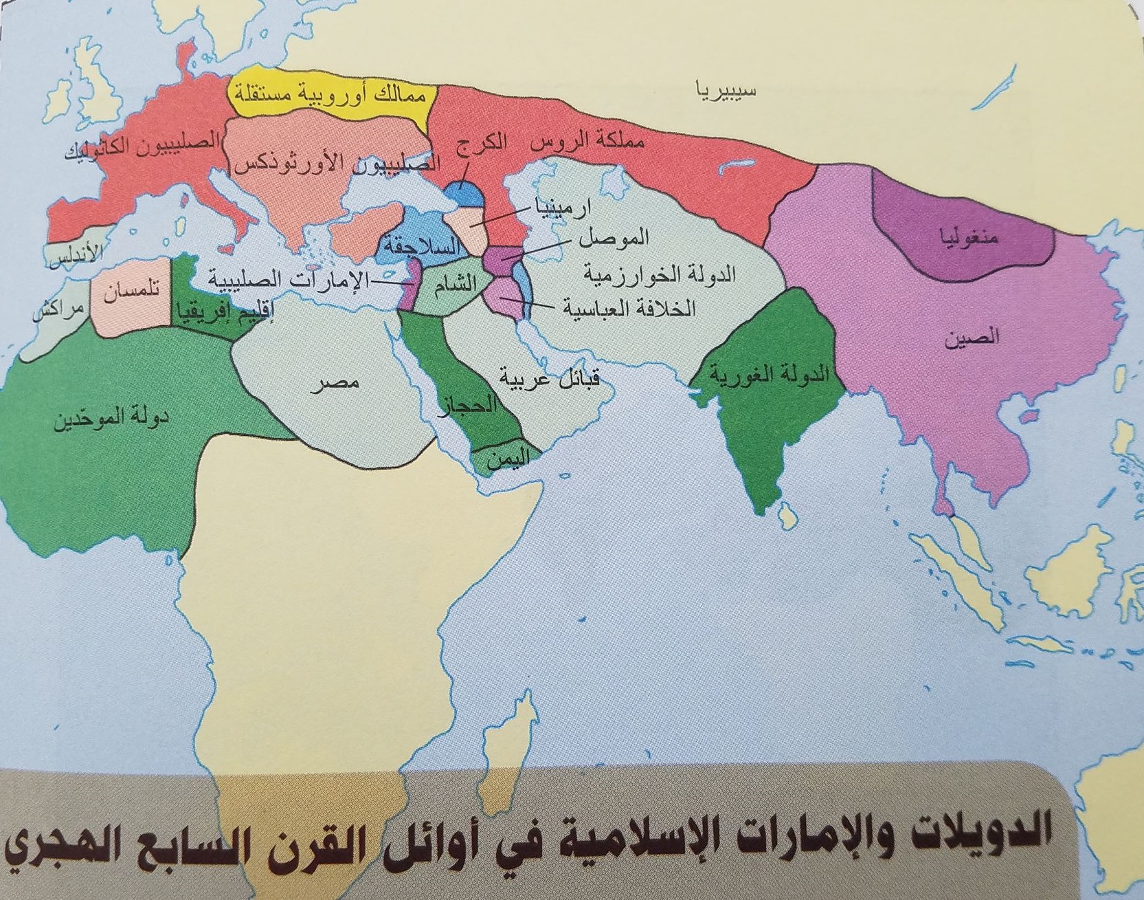
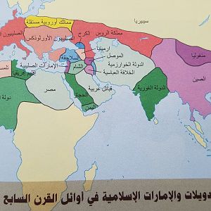
This isn't really a horrible map, it's just someone who CLEARLY doesn't understand how to draw borders. Also, does anyone know what time period this map could refer to?
The green empire in India is the Ghurid Sultanate, but the Ghurids were based in Afghanistan, and only controlled northern India, not the entire subcontinent.
The green empire in West Africa is apparently the Almohads, who only controlled North Africa and southern Iberia at their greatest extent, but never West Africa.
The red empire in Central Asia/Russia is the 'Kingdom of Russia', but the Russians/Slavs at this period did not control this territory, it was under various Turkic city-states and tribes.
The time-period seems to be just before the invasions of Genghis Khan, judging by the existence of the Khwarezmian empire.
This site uses cookies to help personalise content, tailor your experience and to keep you logged in if you register.
By continuing to use this site, you are consenting to our use of cookies.