Propaganda
Warlord
- Joined
- Apr 3, 2002
- Messages
- 120
Thanks, in advance.

Originally posted by Erocco
Didn't the map of the world used to be the same 63 years ago?
At least last time i checked it was. Maybe Europe moved away from South America 10-15 centimeters.


")
") Details, details, details.
Details, details, details.
Originally posted by Richard III
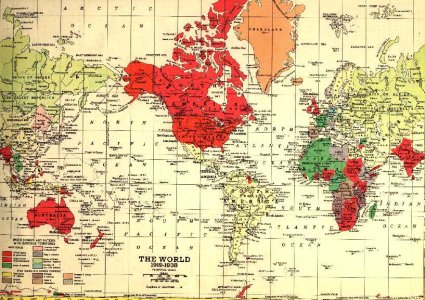
I have a huge German atlas dated at about 1937 with swastikas, autobahns and the whole bit. Pity I can't exactly mail it to you...
But that gives me an idea. Since I plan to begin work on transferring my WWI atlas shortly, we could develop a "historically accurate maps for scenarios" group to trade best practices and save modders some work. The trouble is, I'd need to improve my abilities with all the other crap - e.g. picking the right civs, modding them, leaders etc. first before I could do much in that regard.
R.III