Can An Atlas lie?

On your world map what is the relationship between Greenland and Africa?

  • Greenland is bigger than Africa

    Votes: 3 6.4%
  • They are the same size

    Votes: 2 4.3%
  • Africa is bigger than Greenland

    Votes: 34 72.3%
  • I don't have a world map but still want to vote

    Votes: 8 17.0%
  • Don't Understand, Don't Know or Other

    Votes: 0 0.0%

  • Total voters
    47

MrPresident

Anglo-Saxon Liberal
Joined
Nov 8, 2001
Messages
8,511
Location
The Prosperous Part of the EU
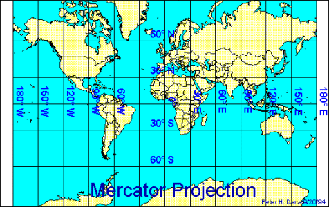
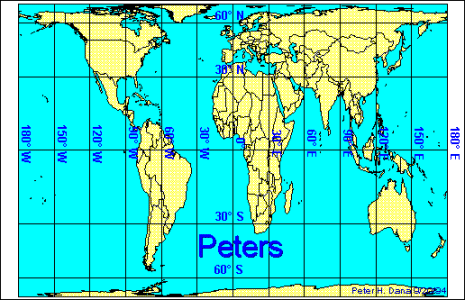
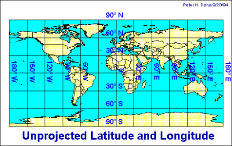
I was looking at a world map recently and something seemed different. I went and got my trustie Atlas and sure enough the two world maps were different. I was wondering which is the most common map and where in the world is one more common than the other. So if you would like to be part of my experiment then please answer the question above.
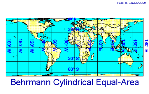
 
The proportions on world maps are (usually) not correct. That's because of the projection. Imagine projecting a sphere to a plane piece of paper. You have to focus on one point (or a line) that can be projected correctly, the rest is distorted (word?). A very common projection of the whole world is the Mercator projection where the equator is projected correct and the further you get to the poles the bigger it looks (you have to imagine that geometrically ;) 
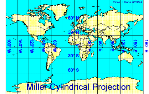
). If you want more correct proportions you have to look at a globe. :D
 
On most projection maps, Greenland ends up looking much larger than it really is. I'm looking at a map right now and it looks like Greenland is much larger than South America, but in reality South America is nine times bigger than Greenland. Greenland in fact, wouldn't even cover the Amazon Valley.

So does it lie? No, not really. You just have to understand that the world is really round, and poorly represented on a two dimensional surface.
 
I believe it's called a "Mercator projection", a way to map curvature in two dimentions, but this distortion is even seen in civ-2 maps!
 
My understanding is that most world maps are 'Mercator projections' (named after a Flemish Geographer) which means that the world is projected flat as if on to a cylinder so that all the parallels of latitude are the same length as the equator instead of converging as they do in the real world.

The effect of this is to massively increase the appearance of east west size of the northern land masses North America, Eurasia and Greenland.

Greenland is substantially smaller than Australia.
 
Yeah, that is the distortion of the Mercators projection. Some geographers, "Geographers for Social Justice" no less, have undertaken a lobby/project to push for more realistic projection maps, which do not reinforce implicit stereotypes and value judgements by making one part of the world unnaturally bigger (read "more important" and "better").

Their map is different, but some have criticized them for overcompensating:D "These geographers are crazy, Asterix!"
 
Mr. President, they do have such maps. They are accurate. They just look ugly and are impossible for a layman to use, that's all.

But if the projection makes Greenland look bigger, that's okay. Because Canada is right beside it on the projection... :D
 
Yep, the mercator projector, widelyspreaded in the US, is from 16th century.
Mercator is more accurate on the shapes of continent's,
but skrews the real sizes of them.
Therefore, Greenland is bigger than Africa on there (and Scandinavia bigger than India :king: )

In 20th century discovered Peter's projection is more accurate on the real sizes of
Continents. Therefore I use it.
 

Attachments

  • behcylea.gif
    behcylea.gif
    12.8 KB · Views: 151
And one last one. Many more to be found at the link I gave.
 

Attachments

  • unproj.gif
    unproj.gif
    13.9 KB · Views: 154
Then you have the maps where they base the size of each continent/country by their population or their GDP etc. Very weird looking at how some continents will be very huge whilst others will be tiny.
 
Originally posted by Dell19
Then you have the maps where they base the size of each continent/country by their population or their GDP etc. Very weird looking at how some continents will be very huge whilst others will be tiny.

Yeah, I saw one on National Geographic Magaz. Holy wrap India was BIG.
 
If you own a pre-1980s Soviet or Eastern European map, especially a city street map, then yer bein' lied to...
 
It has always amazed me how damn small Europe really is. It is really wild to think that that small area once controlled most of the world.

Well, like is true in so many cases: "You can't make this stuff up."
 
Back
Top Bottom