History of Your city

Lord_Sidious

No Fun At All
Joined
Oct 18, 2003
Messages
731
Location
Lisboa, Portugal
How is your city (or village), it is beautiful or not, it is big? Well I will tell you how mine is-

City name-Lisbon
Original name-Lisboa
Population-around 1,000,000 in the city and counting with suburbs around 2,000,000
Foundation year-around the 8th or 9th century BC

Lisbon is a city in the end of river Tagus the biggest river in Iberian Peninsula.
Some people say that Lisbon was originally a Phoenician colony or a Greek colony, but it first name was Ulissipo (city of Ulysses). When the Romans conquered Iberia, Lisbon (that time Olissipo) wasn't very important, but there was a roman who said "Who is king of Olissipo is the king of the world". In the times of Barbarian invasions it stood in power of the Visigoths and when the moors conquered it they gave more importance to it. Around the year 900-100 the name was first Olixipona, and then Lixipona and finally Lixbona. Lisbon flourished as one of the most important cities in Iberia. In 1147 Lisbon was conquered by the Portuguese king Afonso Henriques Lisbon now was the Portuguese capital.
Many years later in 1415 Portugal started the Age of Exploration, even years before Spain. Lisbon in that time flourished as one of the most important, if not the most, city and trade centre of Europe. Then it continued to be but along with Seville. In that time were constructed the Belém Tower, the Jerónimos Monastery and a lot of monuments. With the Iberian Union (1580-1640) Lisbon diclined as so the Portuguese Empire in the Indian Ocean. It was the stage of the 1640 revolution. But in 1755 a terrible thing happens!
The Lisbon Earthquake! :eek: It was and continues to be the largest earthquake ever in Europe with a magnitude of 8.6! Thousands of people died and half of Lisbon was destroyed by the fire. But a Prime-Minister of the king, Marquês de Pombal reconstructed Lisbon and he was one of the first people to build a primitive kind of anti-seismic buildings. Lisbon was invaded by French in 1810 and they encountered a great fortifications- Linhas de Torres Vedras. In the zone where I live! Lisbon was stage of the assassination of the king and the prince in 1908 and the republican revolution of 1910. Lisbon was growing day after day and in 1940 there was the exposition of the Portuguese World that talked about our passed glories to commemorate the 300 years of the Restoration and the 800 from the independence. Lisbon was also the stage of the 1974 revolution. During the 80s and the 90s Lisbon grew a lot and in 1998 it hosted the Expo '98 to comemorate the 500 years of the voyage of Vasco da Gama. And then a host city of Euro 2004.
And yours?
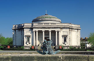
Here are some monuments and marks in Lisbon-Torre de Belém, Mosteiro dos Jerónimos,Torre Vasco da Gama and Vasco da Gama bridge, the biggest in Europe (18 km)
 
Excellent idea for a thread, I created a number on other forums about local history :)

I don't live in a city but on a penninsula (though it has in excess of 200,000 people and is bigger than a lot of cities in the UK) called the Wirral. I can provide information on that when I get home :)
 
"Brief History Of Albany

While looking for a trade route to the far east in 1609, Henry Hudson sailed up the great river that now bears his name. The settlement of Fort Orange, named for the royal family of the Netherlands, was established in 1624 and 1652, Pieter Stuyvesant, governor of New Netherland, proclaimed that Fort Orange should become the village of Beverwyck.

In 1664, when the Dutch surrendered to the British without a battle, King Charles II granted a large tract of land including Fort Orange to his brother James, the Duke of York and Albany. Thus, Beverwyck became Albany and New Amsterdam became New York. Albany remained under British rule until the American Revolution.

On July 22, 1686, Governor Thomas Dongan granted a charter recognizing Albany as a City and appointed Pieter Schuyler as the first Mayor. Since that time, 74 men have served as Mayor of which 34 were of Dutch descent.

In 1754, Benjamin Franklin and other colonial leaders met in Albany to draft the Albany Plan of Union as a common defense against the French. The document was never adopted by Parliament, but is seen as an important precursor to the U.S. Constitution.

Albany supported the First Continental Congress in Philadelphia and served as a focal point for military planning and as a supply center for the Revolutionary War effort. Albany native Philip Livingston was one of the signers of the Declaration of Independence.

In 1797, Albany officially became the Capital of New York and in the 19th century, the City became a center of transportation with the advent of the steamboat and the Erie Canal in 1825. Travel by rail began in 1831 between Schenectady and Albany.

The City has long been a center for education, finance and politics. The presidential names of Martin Van Buren, Grover Cleveland, Theodore and Franklin Roosevelt and Chester A. Arthur are all associated with Albany. In 1921, Democrat William S. Hakett defeated Republican William Van Rensselaer in the mayoral race. This marked the rise of the famous Albany Democratic "machine" headed by Dan O' Connell; the city has remained a Democratic stronghold to this day.

In the year 2000, the city is undergoing a dramatic revitalization and remains a center of government and culture in upstate New York."

http://www.albanyny.org/government/history/index.asp
 
My Birthplace- Bath.

Supposedly founded circa 800 BC by the legendary king Bladud. A temple was founded at the site of the hot springs (Britain's only hot spa) after it was discovered the waters cured certain skin complaints and eased the pain of arthritis. Bladud later fell to his death after ingesting a heroic dose of psychoactive mushrooms and attempting to fly.

The Roman city of Aquae Sulis (named after the British river deity Sulis, though some believe it's actually a corruption of "Solis"- meaning "Sun") was founded on the site, and the Roman baths are the city's biggest attraction. Bath remained a major city throughout the Dark Ages- the battle of Dyrham was fought just north of the city in 570AD when Ceawlin finally established Saxon domination over the South-West. King Edgar was crown in the Abbey in 970AD.

Remained a significant city, but went into decline in medieval times. In the early 18th century, it became the height of fashion due to the spectacular balls thrown by "Beau" Nash. Over the next 150 years, architects flocked to produce hundreds of showcase buildings as the city became a focal point for arts and leisure.

Nowadays you might as well stick a glass dome over the city because it's just heaving with tourists.
 
My city Århus. Started out as a Viking town, but never became one of the important cities in that time. When christianity arrived it became seat of the bishop, but grew only slowly up untill the industrial revolution. However it became an important harbour in the 19th century. Today it is the 2. biggest city in Denmark with about 250K inhabitants.
 
Namur was a gaul village and became a city when the Romans came : Namurcum It's located when rivers Meuse and sambre meets, with a high hill. So, it's a strategic place for both military and trade.

In the early middle age, Namur was the most important city of the Comitatus Lommensis, which was renamed Namurcum Comitatus when de count choosed it as their capital.

namvrcvm-preview.jpg


All the area belonged to the holy germanic empire but actually was independant andsplit into several little feudal states. Located between four powerfull neighbours ( Principalty of Liège, Duchy of Brabant, Duchy of Luxembourg and County of Hainaut ), Namur was often attacked and had to fight to preserve its independance.


The city I live in, Gembloux, was the border between Brabant and Namur. It was build around a abbey in the Xe century. The chief of the city was the Abbot-Count.

braun_hogenberg_II_20_m.jpg


In 1535, the Dukes of Burgondy buy the county and get the whole area by marriage or legacy. Only Liège remains independant. From Burgondy, we go to Spain and then Austria.

In 1692, Louis XIV takes the city by have to give it back. It's the last great battle for Namur before WWI. The old city still has the look of a XVIIe city.

In 1789, it's the revolution. France kicks the Austrians out at we become french. But Napoleon looses in Waterloo in 1815 and Wallonia goes to the Netherlands. In 1830, it's a new revolution and Belgium is created.
 
In a time long ago, Basel was a small Raurican (a celtic tribe) city. When the Romans conquered 'Switzerland', they founded Augusta Raurica. This city is near of Basle on the Rhine. It was the city of the region until the Allamans ('Barbarians') came. Augusta Raurica was burnt down and in the following centuries, the city was abandoned and the people fled to the 'Castra' Basilia. The settlement was more safe there because the heart of the city is on the Münsterhügel ('cathedral hill') which thrones over the Rhine.
Since then on, Basel flourished. It was an important city throughout the Middle Ages. In the swiss view, it was the city with the first bishop, the city with the first university (460). Internationally viewed, there certainly is to mention the Concil of Basel which gave us the best sweets - the Basler Läggerli. For disasters, there was the big earthquake in 1356 - the biggest of Middle Europe. As a tolerant city, many famous persons lived here for some time: Erasmus (of Rotterdam), Paracelsus, Holbein, Böcklin and an Oscar winner - Arthur Cohn :).

For history reasons: Basel was part of the Holy Roman Empire of German Nation, but it quickly became independent. From then on, it was a Bishop-Principality (Fürstbistum) meaning that the bishop was the ruler of the city and its region. But reformation came, and the bishop was driven out, but the principality existed on - but just without the city of Basel.
The city joined the Swiss League in 1501 and formed a state. With the time of the revolutions, with Napoleon, there was also a revolution in Basel. The country revolutioned against the city, and one swiss state became two half-states. And that's the problem we have today. As a city, Basel has to provide many services for the region. But however this costs money, and the money the city gets is only from the city itself, the country has to pay no taxes to the city,but to the states of Baselland, Solothurn and Aargau, and to the Alsace (France) and Baden-Würtemberg (Germany).

Today, Basel is famous for it's chemical industry with the by this time only two companies: Roche and Novartis. These two developped from companies such as Ciba, Geigy, Sandoz, etc. And perhaps some of you remember the 'Schweizerhalle chemical disaster. Also, but a sidenote, there are thousands of museums in Basel.

And @all Germans: the people of Basel are the Basler NOT the Baseler!

mfG mitsho
 
My City: New York

New York was originally founded as a trading post by the Dutch, and called New Amsterdam, in 1624. In 1664, it was captured by the British bloodlessly. Apparently, the mayor, Peter Stuyvesant, was extremely unpopular. It was then renamed New York.

The city gradually expanded in the years since, becoming a major trading hub due to its massive harbor. During the American revolution, it actually sided with the British, and was occupied until the treaty of Paris, in 1783. It was then, briefly, the capitol.

New York's economic upturn really shot up with the building of the Erie canal in 1825. This allowed goods to be traded with the great lakes basin at a time when railroads were few and far between.

The city survived the infamous draft riots of the civil war, in 1863, which the army had to be called in to quell.

During the Industrial Revolution, large numbers of European immigrants were processed at the immigration center at Ellis Island (now a museum).

The modern city limits were established in 1898, with the other 4 boroughs (Brooklyn, Bronx, Staten Island, and Queens). It is often humorously called "The Great Mistake."

In 1993 and 2001, New York was struck by terrorist attacks that ultimately destroyed the World Trade Center.
 
Livermore, California
Population (2000 census): 73,345

Livermore and the surrounding valley were originally under the domain of the Ohlone indians. In the 18th century the area was used for grazing by the Spaniards from Mission San Jose. California was secularized in the 1830's and large land grants were given out. One of the valley's largest grant went to the rancher Robert Livermore.

With the discovery of gold came thousands of '49ers, Livermore became a popular stopping point because of its location, 1 day's travel from San Jose. William Mendenhall, a friend of Livermore, established the town in 1869 (Livermore had died in 1858).

My highschool, the first in all of California, was founded in 1891.

The Livermore Rodeo was founded in 1918 and can be heard from my house :mad: early in the morning in June. I can see the rodeo grounds from my computer.

In 1952 the Lawrence Livermore National Laboratory was founded. The lab is the sister of the (in)famous Los Alamos National Laboratory.

.. A rather brief and boring history of my city..
 
Nanocyborgasm said:
My City: New York

New York was originally founded as a trading post by the Dutch, and called New Amsterdam, in 1624. In 1664, it was captured by the British bloodlessly. Apparently, the mayor, Peter Stuyvesant, was extremely unpopular. It was then renamed New York.

The city gradually expanded in the years since, becoming a major trading hub due to its massive harbor. During the American revolution, it actually sided with the British, and was occupied until the treaty of Paris, in 1783. It was then, briefly, the capitol.

New York's economic upturn really shot up with the building of the Erie canal in 1825. This allowed goods to be traded with the great lakes basin at a time when railroads were few and far between.

The city survived the infamous draft riots of the civil war, in 1863, which the army had to be called in to quell.

During the Industrial Revolution, large numbers of European immigrants were processed at the immigration center at Ellis Island (now a museum).

The modern city limits were established in 1898, with the other 4 boroughs (Brooklyn, Bronx, Staten Island, and Queens). It is often humorously called "The Great Mistake."

In 1993 and 2001, New York was struck by terrorist attacks that ultimately destroyed the World Trade Center.


I would contset some of this. Stuyvesant was the governor of all of New Holland, which became New York. The Dutch couldn't battle the British for the colony and just ceded it. New York was also the scene of a battle between revolutionaries and British, before it was overrun and captured.

On another note, it was also the site of the turtle attack(first submarine).
 
My City: Waterford (Port Larige), Ireland.

The name Waterford is derived from an old Norse word 'Vedrarfjiordr' that can be traced back to the late 9th century.

'Vedrarfjiordr' is believed to be derived from either ‘Fjord of the Rams’, probably a reference to the export of sheep from the area, or more prosaically, from ‘windy fjord’.

This latter meaning probably refers to Waterford as being a safe haven for Viking ships sheltering from a windy Irish Sea.

The Vikings, realising the strategic and trading importance of the three rivers which empty into Waterford Harbour, built a longphort or dock at the confluence of the St. John's River and the River Suir.

Waterford City was founded in 914 AD and developed into a significant urban area during the 10th century. Waterford is arguably the oldest area of continuos urban settlement in Ireland. Reginald’s Tower marks the site of the first defensive structure built by the Viking settlers. The Tower is mentioned in the Irish Annals as early as 1088 thus making it the oldest civic building structure on this island. In the 1080s, a Viking fleet at Waterford had become a major force in the tangled web of Irish and Welsh political intrigue when Diarmuid O’Brien, King of Munster, negotiated that the fleet go to Wales to assist Gruffydd ap Cynan to recover the Kingdom of Gwynedd in Wales.

A hundred years later it was the turn of a dispossessed Irish king to seek help from beyond the sea in order to regain his lost kingdom. Thus it was, that in 1169 a group of Anglo-Norman mercenaries landed in Wexford at the invitation of Dermot McMurrough and by 1170 they were at the walls of Waterford. After a bloody battle the city fell to Strongbow and his armour clad Anglo-Norman supporters. Strongbow was made heir to the McMurrough lands in Leinster and as previously agreed married Dermot’s daughter Aoife.

This marriage which took place in Waterford's Reginald's Tower, symbolises the long and sometimes tortuous birth of a new Ireland. In 1171 the King of England, Henry II, arrived in Waterford and anxious to exercise his control over a process of conquest that was taking place almost despite him, he began to demand the submissions of the Anglo-Norman knights.

The submission of Strongbow and his followers was received by Henry at Waterford. Henry II recognised Strongbow as McMurrough’s heir to Leinster but the strategically important port cities of Dublin and Waterford, which Strongbow had captured, were retained by the King. Henry II elevated Waterford to the status of a royal city - a status that was to change the course of the city’s history dramatically.

Consequently in the years after the invasion, many English and French merchants settled in Waterford. This new merchant class with it's trading contacts in England and on the continent was to make Waterford medieval Ireland’s chief port for the import of wine and a major exporter of wool and hides. The city flourished during the 13th century and many new monasteries, friaries and churches were built. New stone-built defences protected it's citizens and a sophisticated form of local government developed whereby the citizens elected a mayor on an annual basis to rule over the city. In many ways it was a golden age for the city.

The 14th century saw the beginning of the breakdown of Anglo-Norman power in Ireland. However Waterford’s close connections with cities such as Bristol and Chester ensured that it remained very much part of the English political scene. This century also saw the plague known as the ‘Black Death’ wipe out a third of the city’s population. This decline in population, which was experienced all over Europe, had an adverse effect on trade. The subsequent decline in demand caused the City Fathers to become even more tenacious in protecting the city’s monopoly on shipping entering Waterford Harbour.

Traditionally, all ships entering the harbour, with the exception of those originating in Leinster, were obliged to unload at Waterford. In 1372 Waterford City Council commissioned the decoration of the Great Charter Roll, an illuminated manuscript measuring 14 feet in length, in an attempt to strengthen their legal case against the burgesses of New Ross who were working to nullify Waterford’s monopoly. The manuscript thus produced has fortunately been preserved in Waterford and is regarded as the most important Irish illuminated manuscript from the late medieval period.

During the 14th and 15th centuries, Waterford was surrounded by hostile neighbours – the O’Driscolls (sea pirates from Co. Cork) were the scourge of the city’s shipping, while their allies the Powers, an Anglo-Norman family who controlled Co. Waterford, were often known to attack the city and plunder the nearby countryside in search of booty.

Yet despite the problems Waterford was by the end of the 15th century a strong and well-fortified city with an international reputation for good quality woollen shawls which were known on the continent as ‘Waterford Rugs’.

In 1495 an attack on the city by Perkin Warbeck, a pretender to the throne of Henry VII was repulsed. Canon mounted on the ringworks in front of Reginald’s Tower saved the city and gave Waterford the distinction of being the first Irish city to use artillery in its defence.

In recognition of the city’s loyalty, the King gave the city it's own motto:

‘Urbs Intacta Manet’ – Waterford the Loyal City.


The 16th century saw Waterford gripped by a religious and political dilemma. The English monarchy, for whom the citizens always displayed a great loyalty, had severed it's links with the Papacy in Rome.

For over a century Waterford walked a tightrope between treason and loyalty. During this period the city’s loyalty to Rome was never in doubt. Many scholars of international repute were born in the city, so much so that during the late 16th and early 17th century it was known as ‘Parva Roma’ - Little Rome. The city’s attempts to keep on the right side of both the monarchy and the papacy ended when Cromwell entered the scene. Cromwell unsuccessfully besieged the city in 1649 - the only city ever to hold out against him. However in August of 1650 his son-in-law took Waterford.

The Cromwellian army expelled many of the rich Catholic merchants whose families had resided in the city since the time of the Anglo-Norman Invasion. Luckily, the trading links they had established over the centuries stood them in good stead. Many of the Catholic merchants who were forced to flee to both France and Spain were later to establish themselves in the wine business.

The restoration of the Monarchy in 1660 brought only temporary respite to the Catholics of Waterford.

In 1690 William of Orange defeated the Catholic James II at the Battle of the Boyne and the Protestants were once again in the ascendance beginning a new phase in the city’s history. As the new Protestant merchant class grew rich from trade, especially that with the New World, the city took on a new mantle.

The defensive walls were removed from along the quays and many of the old gates to the city were demolished to allow for the greater movement of men and merchandise.

The 18th century was to see Waterford transformed. Great new public buildings were being erected, many of them under the watchful eye of the Waterford born architect, John Roberts. Roberts designed City Hall and both the city’s cathedrals. The fact that the Catholics of Waterford were allowed to build the cathedral testifies to a large measure of religious tolerance existing in the city. In fact when Christ Church was being demolished in 1773 to make way for the new Church of Ireland Cathedral, vestments dating from the reign of Henry VII (1485 – 1509) were discovered.

As a gesture of good will the Protestant Dean presented them to the Catholic Dean. The vestments are the only pre-Reformation vestments to have survived in Ireland and are now in the National Museum. Roberts’ architectural genius was to make Waterford prominent among the Irish cities in terms of its classical architecture. The sophisticated elegance of the city was not reflected solely in its great public buildings for in 1783 the now world famous Glass Factory was established by the Penrose Brothers.

During the nineteenth century Waterford Glass achieved a world-wide reputation with exports going to the four corners of the earth. Many of the ships carrying this glass to foreign ports were in fact built here in Waterford. The ship building trade that has been practised in the port for over a thousand years has entered a new phase.

By the mid-nineteenth century Waterford had four ship building yards and was second only to Belfast in terms of tonnage produced. The first iron steam ship ever to sail into a Russian port was built in Waterford and appropriately it carried with it a gift of Waterford Glass presented to the Tsar when the ship sailed into St. Petersburg. Today Waterford is still one of the premier ports in the country. Much of the city’s architectural heritage has survived and is being restored for future generations to enjoy. The centuries old glass making tradition is still practised in the city. Waterford’s past is therefore more than just history - it is a living tradition, for this is a city where people continue to live in the shadow of ancient city walls and practise trades that have been perfected by their forefathers for centuries.

(taken from waterfordcity.ie)
 
The Wirral

I chose to write about the smal peninsula that I live on in England called the Wirral. Lying between Liverpool and North Wales, and flanked by the Mersey and Dee Estuaries, the area has been vital for trade and transport since the time of the romans. A map of it's location follows:

northWest.jpg


A closer map of the Wirral itself is following :)


tshipsmap5.gif


History:

The wirral has always been important to the North West of England, and in the past far more so than neighbouring Liverpool. The romans had a large base neaby at chester (which they called Deva) and possibly used the wirral for trading with Ireland. The area has a mixed past after the romans left, for a time the Saxons occupied land in the area alongside the western side, flanked by the Dee estury and later the Vikings arrived and settled areas throughout the peninsula. During much of the history, the peninsula remained mostly farmland and fishing industries except around what is now Port Sunlight and Thornton Hough which was marshland. The peninsula also gets numerous mentions in the doomsday book, Wiliam the conqueror's census.

The Wirral has always been important to travel as it lies right between Wales, Ireland and England, and in the 1300's, a charter to operate ferries was granted to run between Liverpool and Birkenhead. Liverpool though was at this stage little more than a small hamlet, whilst the Wirral was a thriving farmland area. Things continued in this line until the start of the industrial era around 1800 which changed the area for good. For one, Liverpool saw rapid change, founded on the principle of the slave trade and then the merchant trade. Wirral though became the first stop for raw goods coming into the area before being transported eastwards in the direction of Manchester and so on, often via canal boat.

Originally, the Dee estuary was used as the route for shipping, but gradually this route became silted up badly and the shipping switched to the Mersey side of the peninsula. The rise in importance of the area saw many new industrialists take interest in the peninsula, two of them would make a considerable contribution to the Wirral.

John Laird:

A ship-builder by trade, he came to the area in 1824 and bought large areas of what is now known as Birkenhead and built an ironworks on the land. Laird expanded his business dramatically on the site and Birkenhead and Wallasey expanded with it. Laird merged his company eventually with another called Cammell to produce a massive ship building site in the Tranmere and Rock Ferry areas. During it's time, the yards produced pretty much the most famous British carrier of WWII, the Ark Royal and one of our famous battleships, the Prince of Wales. Pictures of these are below. The yard also built many nuclear powered submarines for recent service. Now, unfortunately it has been closed.

g190724.jpg


19sb2j1.jpg


William Hesketh Lever:

Lever was the founder of the Lever Brothers empire, now known AFAIK as Lever Faberge, a worldwide company making detergents and soaps. Lever was the first in the country to perfect the mass production of soap from sources that didn't make the soap smell awful and made a fortune on it from a factory and shop in Bolton. Sometime in the latter part of the 19th century he realised the benefit of opening a factory nearer to where his imported goods reached the country in the Wirral and looked for land there to buy. Seeing the marshland around Port Sunlight, Lever bought most of the land there.

Lever then built an entire village named after one of his then principle products, (sunlight soap) Port Sunlight. He constructed the village for all his workers as a working man's paridise, with a school (which BTW I attended), pub, sports hall, church and so on. The entire village was built in an old style based on similar buildings in chester and other areas. By and large the village has remained almost exactly the same ever since. Lever also built an extensive art gallery which he dedicated to his wife within the village. A picture of this is below.

ladylever.jpg


And some of those houses:

Port%20Sunlight%2011.jpg


The prosperity of the area in the 19th century continued until well into the 20th, the Wirral being an important part of the port traffic coming into Liverpool. In the mid 19th century, the Birkenhead docks were built to support this and the expansion of Birkenhead as a town. As the Mersey became more and more important, increasing numbers of people moved to the east coast of the Wirral. This increase swamped the available ferries in demand and by 1886 the very first underwater railway in the world was built between the Wirral and Liverpool connecting both Wallasey and Birkenhead to the larger city nearby.

During the war, the Wirral was frequently bombed by the Germans due to it's docks and connection to shipbuilding causing a major refit to the roads in the areas of Birkenhead and Wallasey. Eastham also contans a major fuel storage area now which was also a target then. The decline in merchant shipping and Britain's economy after the war though hit the Wirral hard, yards like Cammell Lairds slowed production and eventually closed, Lever's were forced to close much of their other work in the area and so on. Though still an important area (almost equal in population to Liverpool), the Wirral's economy has struggled in certain areas such as seacombe and others since the war. Other areas, mostly those on the western side have prospered. Wirral remains quite a nice area, most of the western half is farmland and golf courses (the British open is here in a few years) with the eastern half industrialised.

Famous/Strange things:

The first hovercraft tests in the world were carried out from the beach at New Brighton
The Beatles frequently played on this side of the Mersey before their stint in Hamburg
The main park in Birkenhead, Central Park is a small scale version of the more famous one in New York, the Birkenhead one is older and apparently, the New York one is modelled on it!
The symbol of the Wirral is a hunting horn, this is to signify our link to the past as since the romans, the area was covered in Forest and used by nobles for hunting in.
During the American Civil War, Laird built for the confederates 3 surface raiders (1 only was delivered) which were frequent visitors to these shores. He was due to build 5 but the British government found out and stopped him. The CSS Alabama had a notorious reputation sinking 36 ships before being sunk. The US government promptly took the UK government to court for building and helping the ship and others and won!
There have recently been installed a number of historic warships in the Birkenhead docks. The collection comprises HMS Plymouth, a type 42 Destroyer and HMS Onyx, a submarine, LCT7074, possibly the only surviving Landing Craft Tank from D-Day, and U534, this is the only wartime U-boat raised and put on display. Onyx and Plymouth are Falklands era ships. U534 was one of the last U-boats sunk in the war just off Denmark by the British, though it's said that no-one died on board her.

Sports wise, we have 1 professional football club on the Wirral called Tranmere Rovers. Here is a pic of their ground. They play in a relatively minor league, but aren't too bad :)

TheStadiumImage.jpg


I live in Rock Ferry, a small village on the eastern coast of the Wirral, about half way up. I work in Wallasey, Liscard to be precise and went to school in Bebington and Port Sunlight. My family are mostly either from Liverpool, Wales or Wallasey. I myself was born in New Ferry, just a little down from where I live now.

Some Wirral links:

http://members.tripod.com/wirral_rf/

http://www.wirralview.co.uk/
 
Very good idea for a thread, you suddenly got me interested in my city.

Aberdeen then:

The original settlement was probably known as Aberdon, due to it being situated near the River Don. I can't seem to find when it was historically founded - the sites I'm looking at claim either since Roman times or somewhere in the dark ages. Regardless, this area is now known as 'Old Aberdeen'. 'New Aberdeen' was created in 1136AD by David I, on the banks of the river Dee. Both sites grew and ultimately joined together as one - though were legally seperate until (i think) 1469.

From then on Aberdeen grew quickly, despite plague and war. The castle of Aberdeen was (according to tradition) sacked by Robert the Bruce in 1306 when he attacked the English defenders. The password to enter the castle on that night was Bon Accord (Good-Will) - now Aberdeen's motto.

The 14th Century also contained such Aberdonian delights like more plague, a burning of the city by the English and another disease known as 'the pest.' Good times.

Aberdeen survived though, largely thanks to it's port, extensive fishing industry and being used as an important trading town for the baltic, northern Europe and the rest of Britain. It founded two colleges - Kings College (which became the University of Aberdeen) in 1495, and the Marischal College in 1593.

Despite some minor setbacks (a few marauding armies here and there - five in 1639!) Aberdeen continued to grow into a city. Not much more to tell, except the mention of the growth (and decline) of granite mining. The extensive use of granite to construct buildings give Aberdeen it's nickname 'The Granite City'. The industry peaked in the early 20th century but declined shortly after. Aberdeen economy is now mostly dependant on the fishing industry, as well as oil gathering in the North Sea.

Finally, I'll mention the "New Streets Act" in the late 18th Century, which saw the construction of King's Street - which leads to the River Don - after 1804, and Union Street. Union Street was a mile-long piece of engineering, involving the levelling of hills and creation of bridges to create what is now considered the main street of Aberdeen. The construction of both Union Street and Union Bridge (named for the act of Union between Britain and Ireland) bankrupted Aberdeen Council in 1817, but was considered "one of the finest streets in the Empire."

So there you go. Very basic stuff, though it got me interested for an hour or so. I got all of my information from these three websites, the first was especially helpful.

http://www.undiscoveredscotland.co.uk/aberdeen/aberdeen/
http://www.localhistories.org/aberdeen.html
http://www.british-publishing.com/Pages/AberdeenOG/history.html
 
This is the city I was born in and where I live. Most of the info was extracted from Wikipedia (with some personal touches)

Surface: 202km2 (78.3 sq mi)
approx 3.000.000 inhabitants (above 10.000.000 if you include the metropolitan area)
Mean annual temperature: 18°C (64.4°F)

Buenos Aires is the financial, industrial, commercial, and social hub of Argentina. The people of Buenos Aires are known as porteños (people of the port), recognizing the huge historical importance of the port in the development of the nation.

To the west of Buenos Aires is the Pampa, the most productive agricultural region of Argentina. As a result meat, dairy, grain, tobacco, wool and hide products are processed or manufactured in the Buenos Aires area. Other leading industries are automobile manufacturing, oil refining, metalworking, machine building, and the production of textiles, chemicals, paper, clothing, and beverages.

History
Spaniard seaman Juan Díaz de Solís discovered the La Plata River in 1516 but his expedition was cut short by an indigenous people's attack in which he was killed.

The city was first founded as Santa María del Buen Ayre on February 2, 1536 by a Spanish gold-seeking expedition under Pedro de Mendoza. The name was chosen by Mendoza's chaplain, who was a devout follower of the Virgen de Bonaria (Our Lady of the Fair Winds) of Cagliari, Sardinia. More attacks by the indigenous peoples forced the settlers away and in 1541 the site was abandoned. A second (and permanent) settlement was established in 1580 by Juan de Garay, after he sailed down the Paraná river from Asunción.

From its earliest days the success of Buenos Aires depended on trade. The Spanish administration of the 17th and 18th centuries insisted that all trade to Europe initially pass through Lima, Peru so that taxes could be collected. This extravagant deviation frustrated the traders of Buenos Aires and a thriving contraband industry developed. Unsurprisingly, this also instilled a deep resentment in porteños towards Spanish authorities.

I remember reading in college that Buenos Aires was founded to stop the silver contraband from Potosí (the Mountain of Silver), which headed to Europe through the Parana River thus avoiding paying taxes in Lima. The result was that contraband was still pouring out through Paraná River but at a higher cost (having to bribe local deputies in Buenos Aires).

Sensing this instability, Charles III of Spain progressively eased the trade restrictions and finally declared Buenos Aires an open port in the late 1700s. These placating actions did not have the desired effect, and the porteños became even more desirous of independence from Spain. Ultimately, on May 25, 1810, while the metropoli endured the Peninsular War and after a week of mostly pacific deliberations, the creole citizens of Buenos Aires successfully ousted the Spanish Viceroy and established a provincial government (this date is now celebrated as a national holiday). On July 9, 1816 a congress gathered in Tucumán declared the independence from Spain, which did not officially recognize it until 1862.

Railroad construction during the 19th century only increased the economic power of Buenos Aires as raw materials flowed into its factories. By the 1920s Buenos Aires was a favoured destination for immigrants from Europe, and large shantytowns started growing around the city's industrial areas, leading to extensive social problems. At the same time, Buenos Aires was a multicultural city that ranked itself with the European capitals.

The city's spectacular economic development attracted immigrants from all over the world through the 1920s, mostly from Italy and Spain. The Italian community's adoption of Spanish was gradual. The pidgin of Italian and Spanish was called cocoliche; it fell out of use with time, and today survives in a few sentences, usually uttered for comic relief. The lunfardo argot originated within the jail population, and spread to all porteños with time. Lunfardo uses words from several dialects of Italian, mainly Sicilian, and tricks such as inverting syllabes within a word (vesre). Lunfardo is used by porteños mostly in informal settings.

In the mid 20's Buenos Aires had 875 km of railways, with 3.000 cars and 99 different lines of tramways. It also had in 1913 the first subway line of the southern hemisphere. The problem is that few lines have developed since then, so nowadays Buenos Aires is behind in mass traffic development. As a matter of fact between 1930 and 1990 only a copule of km were digged, and it was only 5-10 years ago when a new line was started, which is expected to be finished by 2007. One remarkable spot is that in the "A" subway line, the cars are the same since 1921... wooden cars maintained by the line's employees, in almost their original state. Also in 1961 tramways were eliminated, so now you only have subways, trains and mainly buses.
On March 17, 1992 a bomb exploded in the Israeli embassy in Buenos Aires killing 29 and injuring 242. Another explosion, on July 18, 1994 destroyed a building housing several Jewish organizations killing 96 and injuring many more.

Buenos Aires is now widely regarded as a very cosmopolitan city, we have had immigrations from various countries during the 20th century, spanish, italian, polish, syrian-libanese, chinese, corean, israeli, etc etc.

Sorry if it sounds like a promotional leaflet but mostly it seems to be, I could not take the time to reedit everything, and I wanted my city to be posted here. If anyone ever decides to visit it, enjoy it!
 
Well, although actually I dont reside in Cadiz I was born there and my family is from Cadiz. And I believe that this pastiche about the history of Cadiz would be more interesting.


T060515A.jpg


Cadiz: Agadir, Gadir, Gadira or Gaddir ( stronghold ) for the Carthaginians, the Greek Gadeira, and the Latin Gades. Named after Neptune´s son According to Platon, built between Hercules´ pillars. One of the oldest city in Europe, sits on a small, narrow, peninsula of only 10.58 Km long. Today Cadiz has a population of 160,000 inhabitants. Until the construction of the Carranza Bridge in 1969, there only existed the small strip of sand connecting Cadiz to San Fernando, its closest neighbor, making this the only land connection to the rest of Europe.

The almost island positioning of Cadiz, his very extensive bay, and its location between the Mediterranean Sea and the Atlantic Ocean has always kept the city as a major focal point along the ages.

History and mythology are more closely linked in Cadiz than in any other city in Spain. Its mitologycal origins date back 3500 years. Cadiz plays an important role in Greek mythology. Legends speak of the fatal encounter between Hercules and Giant King Gerion, situating it in Cadiz (called Gadeira and Erytheia): Hercules killed the three-bodied winged giant shooting an arrow at the joint of the three bodies. Cadiz itself is one of the 'Twelve Labours of Hercules', that is, the separation of Europe from Africa. Hercules presence survives to this day in the city´s coat of arms where he stands between the pillars that announced the end of the world.

It is said too in some greeks texts that the first Inhabitants of the island of Cadiz were the "sea people", who came after the Troye war. Historically the actual city was founded by Phoenician sailors as base to commerce with the ancient native civilization of Tartessus (the biblical Tarshish). Its foundation is ascribed to Phoenician merchants from Tyre, as early as 1100 B.c. In the 7th century b.C it had already become the great mart of the west for amber and tin from the Cassiterides.

In this epoch was built in the city suroundings, a temple, consagrated to Melkart, a phoenician god later Identified with Herakleion or Hercules by the Greek who thought that Hercules´ashes were kept there. A very important holy place in the ancient times and an enormous building apparently with shape of zigurat/lighthouse that lasted to the 12th century a.C.

About 501 B.C. Cadiz was occupied by the Carthaginians, who made it their base for the conquest of southern Iberia, and in the 3rd century for the equipment of the armaments with which Hannibal, who vowed eternal hatred to Rome at Hercules's temple, undertook to destroy the power of Rome. But the loyalty of Gades, already weakened by trade rivalry with Carthage, gave way after the second Punic War.Its citizens welcomed the victorious romans commanded for Scipion the Africanus (206 b.C) and assisted them in turn to fit out an expedition against Carthage.

Thenceforward, its rapidly-growing trade in. dried fish and meat, and in all the produce of the fertile Baetis (Guadalquivir) valley, attracted many Greek settlers; while men of learning, such as Pytheas in the 4th century B.C., Polybius and Artemidorus of Ephesus in the 2nd, and Posidonius in the 1st, came to study the ebb and flow of its tides, unparalleled in the Mediterranean. C. Juius Caesar lived in Cadiz for some time too. It was here in 69 BC at the age of 31, while serving on the circuit court of the governor in the city of Gades, that supposedly he saw a statue of Alexander the Great of Macedonia in the temple of Hercules. He either sighed very sadly or cried a little. When asked why he says:
"Do you think I have not just cause to weep, when I consider that Alexander at my age had conquered so many nations, and I have all this time done nothing that is memorable."

Twenty years later, Julius Caesar, conferred the civitas of Rome on all its citizens in 49 B.C.; and, not long after L. Cornelius Balbus Minor built what was called the New City, constructed the harbour which is now known as Puerto Real, and spanned the strait of Santi Petri with the bridge which unites the Isla de Leon (San Fernando) with the mainland, and is now known as the Puente de Zuazo, after Juan Sanchez de Zuazo, who restored it in the 15th century. Under Augustus, when it was the residence of no fewer than 500 equites, a total only surpassed in Rome and Padua, Gades was made a municipium with the name of Augusta Urbs Gaditana, and his citizens ranked next to those of Rome. In the 1st century A.D. it was the birthplace or home of several famous authors, including Lucius Columella, poet and writer on husbandry; but it was more renowned for gaiety and luxury than for learning. Juvenal and Martial write of Jocosae Gades, Cadiz the Joyous, as naturally as the modern Andalusian speaks of Cadiz la Joyosa; and throughout the Roman world its cookery and its dancing-girls were famous.

In the 5th century, however, the overthrow of Roman dominion in Spain by the Visigoths involved Cadiz in destruction. Moorish rule over the port, which was renamed Jeziral-Kadis, lasted from 711 until 1262. About 1145 Ben Maimun, an Almoravid admiral seized Cadiz and demolished the Ancient Temple of Hercules to look for legendary treassures supposedly hidden in his entrails. The legend said that who would dare to destroy Hercules's temple would die violently. Curiously, Ben Maimun died at Christians's hands some months later.

After Christians reconquered Cadiz, the city was rebuilt and repeopled by Alphonso X of Castile ending many centuries of total decadence. Since 1262 to the fall of Granada kingdom, Cadiz was near to the frontier beetwen Christian and muslim Spain, being a source of war material and merceneries for christian kings.

Its renewed prosperity dates from the discovery of America in 1492. As the headquarters of the Spanish treasure fleets, it soon recovered its position as one of the wealthiest port of western Europe,and consequently it was a favorite point of attack for the enemies of Spain.

During the 16th century it repelled a series of raids by the Barbary corsairs; in 1587 all the shipping in its harbour was burned by the English squadron under Sir Francis Drake; in 1596 the fleet of the earl of Essex and Lord Charles Howard sacked the city, and destroyed forty merchant vessels and thirteen warships. After this the city was fortified. Some years later the wealth recovered in previous assaults tempted the duke of Buckingham to promote the fruitless expedition to Cadiz of 1626; thirty years later Admiral Blake blockaded the harbour in an unsuccessful attempt to intercept the treasure fleet; and in 1702 another attempt was made by the British under Sir George Rooke and the duke of Ormonde.

During the 18th century the wealth of Cadiz became greater than ever; from 1720 to 1765, when it enjoyed a monopoly of the trade with Spanish America, the city annually imported gold and silver in huge amomounts. With the closing years of the century, however, it entered upon a period of misfortune. From February 1797 to April 1798 it was blockaded by the British fleet, after the battle of Cape St Vincent; and in 1800 it was bombarded by Nelson. Although this new decadence was indeed due to Seville taking his place as center of commerce with american colonies,

In 1808 during napoleonic wars the citizens captured a French squadron which was imprisoned by the British fleet in the inner bay. From February 1810 until the duke of Wellington raised the siege in August 1812, Cadiz resisted the French forces sent to capture it; and during these two years it served as the capital of all Spain. In fact Cadiz and San Fernando were the only enclaves not conquered by Napoleon. Here, too, the Cortes met and promulgated the famous Liberal constitution of March 1812. To secure a renewal of this constitution, the citizens revolted in 1820; the revolution spread throughout Spain; the king, Ferdinand VII., was imprisoned at Cadiz, which again became the seat of the Cortes; and foreign intervention alone checked the movement towards reform. A French army under the duc d´Angoulme, allied with the spanish crown, seized Cadiz in 1823, secured the release of Ferdinand who suppressed bloodily the rooted liberalism of Cadiz and Andalucia. However, there were new revolutions in Cadiz in 1843 and 1868, when the city was again the centre of the revolution which effected the dethronement of Queen Isabella. Cadiz even declared his independence from Spain during the 1873 republic.

Since mid 19th century Cadiz was losing importance. Finally The disasters of the Spanish-American war of 1898, was almost catastrophic for local commerce with Cuba and Puerto Rico.

Although his liberal tradition. Cadiz was the place of birth of Jose Antonio Primo de Rivera, who phounded the Spanish Phalanx and at the start of the Spanish civil war of 1936, the cities of Cadiz, along with Saragossa, Seville and Burgos declared their support for the Nationalists (Fascist). This saved Cadiz of any destruction.

Today Cadiz no longer ranks among the first marine cities of the world. Although several great shipping lines call here; big shipbuilding yards and various factories exist on the mainland; and it is the center of a considerable sea trade.

Ancient map of the Bay of Cadiz: (map correction: Where it says "I de Cadis" it is indeed "Isla de Leon" so, San Fernando)

roux_1764_pl_1_m.jpg
 
Nope!
 
Back
Top Bottom