Ultramarine
Chieftain
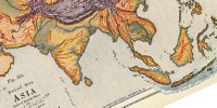
 Is there a tool or utility program out there that can convert this image into a civ map biq?
I looked through the utility programs section real quick and didn't see anything.
 Is there a tool or utility program out there that can convert this image into a civ map biq?
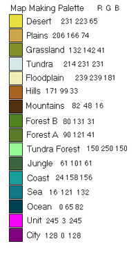
That's the one, although the image has to be square & reduced to a size where one pixel = 1 tile.* Also it has to use a special 16 color palette which is described in the thread. After the conversion a fair bit of cleanup will need to be done in the editor.BMP to BIC is available, though I've never used it either. From the bic it can be imported in the editor to a biq.
http://forums.civfanatics.com/showthread.php?t=96884
"Tips & advice" unfortunately turns into one of my long, long posts. But since it was a request:If anyone who has experience with using the bmp2bic program could give me some tips and advice for converting the above image it would be greatly appreciated.
The steps I have used are used are -That's the one, although the image has to be square & reduced to a size where one pixel = 1 tile.* Also it has to use a special 16 color palette which is described in the thread. After the conversion a fair bit of cleanup will need to be done in the editor.
* It is possible to make a map larger than BMPtoBIC can handle by cutting it into pieces & then using Map Tweaker to reassemble it.

This Map Making thread has a good discussion of how to do a decent freehand map & works very well if the map is already a digital image, as you have. Be sure to read all two pages because several variations are discussed and the best ones (IMHO) come last. The biggest advantage is that you can do all kinds of shapes & sizes of maps. & The method doesn't depend on your level of artistic skill - just starting with a decent map & patient application of effort.It' still looks like it's going to be a "be-hatch" to do with my limited skills but, I don't think I can pull it off freehand and have it come out good.
 Thank you so much for that in depth post Blue Monkey!


That's why I mentioned the "1 tile = 1 pixel" concept. Getting that idea straight helps with map design. Larger map = more detail = coastlines, etc., look more "realistic". Smaller map = less detail = chunkier look with coastlines & mountain ranges looking zig-zaggy. When I referred to "clean up in the editor" mostly it's making those kinds of aesthetic corrections. But there's no way to avoid loss of detail at the map scales C3C can handle. One tile may represent 100+ km of territory - think about the amount of terrain change that happens in RL in an equivalent span.Ultramarine you are going to lose the majority of that detail when you convert the image.


 dammit where's my...
