Maccabee's World Map

Maccabee's World Map 1.1 220 x 220 2016-10-05

Gosh, I hate it when the forum logs me out while I'm typing a post. Guess I better start typing in Notepad. Okay, now that I'm typing this for the second time....
Gorn, thanks for your compliment about the layout.
As for the resources, I know it seems I was biased in favor of Europe, but that's not the case. I tediously counted the resources placements in both atlases, and wherever possible, placed them where they actually occur. For example, according to the atlases I used, England has six major coal deposits and four major iron ore deposits, while all of China has only 14 major coal deposits and 29 iron deposits. Europe as a whole continent has 31 iron deposits (34 if you count the Ural Mtns.) and 19 coal deposits.
Its not fair to all the civs, true, that's just where Nature or Nature's God put them. (Yes, England seems pretty crowded. I suppose I could kill off most of the game. Poor Bambi.) I aimed for realism, because I reasoned it would be easier for others to thin out what is already there than it would for them to research and painstakingly place what is missing. I feel the map is rather enlightening, when you see how poor some countries are in strategic resources, like coal and iron, but how rich in luxuries like gems, ivory, spices, or others. And then some regions are just bleak.
I'm glad you noticed Sicily and the two islands at Japan's extremities, Kyushu and Hokkaido (did I spell those right?). I agonized over the placement of those. When forced to choose between reflecting the fact they are seperate islands or placing them as close as possible to their actual geographic locations, I opted for geographic placement. Again, I was shooting for realism, or as much as is allowed by a map this small. If they didn't hit the 512 city limit, I would play on a 256 or 362 map.
Thanks for writing, Gorn. You made my day, and made me feel my effort was worthwhile. BTW, since you know Japan very well, how does it look, besides the joining of the two islands? Did I miss any important resources there? How does the terrain look for Japan? I spent more than an hour trying to figure out how to place Mt. Fujii in a way that would seem accurate, and wasn't entirely satisfied with any of the options the limited number of grid squares allowed me.
 
Here's an attempt at a thumbnail of the minimap ..Don't know how this works.


Minimap.zip
 
You don't have to zip common graphics files like jpeg & gif. Just upload the files like you have been doing with the zips, and then refer to their address in the upload folder by using the
 
I may be inexperienced, but I'm persistent.
 

Attachments

  • Minimap2.JPG
    Minimap2.JPG
    7.9 KB · Views: 325
Europe.JPG

Here's (I hope) a screenshot of Europe and the Mediterranean Sea, with parts of North Africa.
 
Any previous visitors to my thread might be pleased to see that I *finally* :blush: 
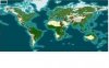
got the hang of thumbnails and attaching screenshots. I edited most of the posts on the first page to include a thumbnail of the minimap and big screenshots attachments of each continent. Soooooo, please tell me what you think. Go ahead. I have a thick skin. Really. :p
 
Wow, that's quite the map!

I like the preponderance of volcanos, for one. It's really nice to have actual mountains in the Sahara instead of hills, because thataway you don't get cities in the middle of the Sahara built on hills...

The lines between different bioregions are quite severe, though. Like how, for instance, European Russia suddently turns into a big swath tundra forest. If forests aren't settle-able, but hills are (?), then one will get cities up and down the Urals but nowhere else past Moscow, I'd wager.

It is quite striking, but I'm unsure about the effect on playability. How are the Incas supposed to have an empire when the entire (well, almost) west coast of South America is desert & mountain?

I still like it, though. I usually use MapTweaker to chop these world maps up into smaller, regional chunks that I can play on without my game slowing down to a crawl (I have a horsehockey computer).
 
Mithadan,
Thanks for noticing the volcanoes. Since C3C gave us the ability for volcanoes, I tried to place one wherever the Hammonds atlas indicated an active one.
As for all the hills in the Urals, I changed the rules to restrict city building to plains and grassland. This should prevent an unlikely string of cities running north to south through the Eurasia divide. If you like, just change the Urals to all mountains and reenable cities for hill terrain.
I did consider the impact of the western coastal desert on Incan development, but since their empire didn't begin until ca. 1200 A.D., they will have to clear much jungle and build their empire slowly. This might indicate at least one reason the Mayan flourished long before in the more easily cleared (?) Yucatan peninsula. Again, I was striving for the realism as reflected in the two atlases. The deserts are the Sechura and the larger Atacama.
Like you, I prefer to finish my games sometime within my lifetime. The elimination of wide swaths of plains between the tundra and forests of Russia was to prevent the civs closest to that area from sprinting to empire while others labored away earning their land, and also to delay or prevent that 512 city limit.
BTW, is MapTweaker available at CivFan? Where did you dl it?
Again, your comments are appreciated. Thanks for writing.:cool:
 
No problem, am happy to provide some feedback.

If I recall correctly, I think I got the link to MapTweaker somewhere in the Utilities sub-forum. I rarely go there, but there should be a thread on it somewhere nearby...
 
Varwnos,
I admit my bias in favor of the Brits must have misled me to get too happy trying to get its coastline just right.
I remeasured my source map, and you are correct. The British Isles were a little long northwards and a little wide westwards. I made changes accordingly, and hope you will be pleased with the results. (I even shrunk Ireland, may the saints forgive me.) I may need to make further changes to the Isles terrain now to accurately reflect hill ranges and placement, etc. Thank you for the constructive criticism.
Below you can download the result.

http://civfanatics/uploads11/Maccabees_Undeveloped_World_1.2_220_x_220.zip
 
Here are before and after shots.

Before Varwnos:

Before Vwarnos v1.1.JPG


And after Varwnos:

After Vwarnos.JPG version 1.2

:eek:


Oops, sorry I misspelled your name in the Subject title. I can't edit it. (blush)
 
I don't mind extra large european territories for gameplay's sake, but from the look of your latest previews, I like the look of the British Isles much better!
 
Umm, as I stated earlier in the thread, yes, it is heavily forested, as one would expect the earth to be more heavily forested prior to 6,000 years of land clearing and cultivation. Or do we imagine that the earth looked the same then as it does now? If I could schedule terrain events as we could in Civ2, I would program a receding Ice Age glaciation.
Also, as I stated earlier in the thread, the minimalization of terrain squares ready for city building is intended to slow down the race to the 512 city limit that happens with any large map. I chose this map size (220 x 220) to allow more detail than a 180 x 180, but hopefully to avoid the 512 limit crash that I experienced with 256 x 204 and above.
 
The thing about clearing forests for cities is that I think the AI will not clear any forest that is outside of it's city radius. That shouldn't be too much of a problem as long as there are enough plains & grasslands squares to build one's cities...and then the AI will go crazy chopping down forests (rapacious AI!). But if you're banking on the AI clearing a forest in order for a new city location, then I think there'll be dissapointment.

Correct me if I'm wrong!
 
Mitadan,
If you are correct, then that would have many interesting possibilities for scenario building. If it's true, then I could place all the AI cities, and then just fill in all the unused grassland and plains squares with forest (assuming all other terrain types have been set as unbuildable), and the AI would not build any new cities. This would allow me to use even a 362 squared map for a scenario without reaching the 512 city limit, so long as I modify all the terrain to prevent city building. Still, in most scenarios I make, I want the AI to expand some, to progress and compete. Hmm.
Does anyone else know if this is indeed part of the software code? Will the AI clear forest or jungle outside their city radii to build more cities?:confused:
 
Top Bottom