MapView - Pls take the time to read and moan about map-making

Gr3yHound

Mr.MapView
Joined
Mar 30, 2004
Messages
396
Hi fellows,

i know, this sub-forum is basicly for ready-to-download utilities and not for chats n´stuff but i hope to get in contact to you people that actually need what i might provide, a utility that makes your life easier. I just didn´t have the time yet. But things change. I´m currently working on an improved version.

If that all sounds weird i might give some little explaination.

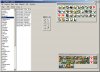
I´ve already made map/semi scenario editor called MapView that seems to work out for some ppl, i already had request by bigger modding groups to implement the one or another feature etc. So the basic tool seems to have it´s right to exist.

So now,
as i got most parts of the rewrite done i´d like to recall the needs.

But you need to know something to really understand why i keep on asking for assistance:
I´m not even playing Civ4 that much, i don´t really create maps and scenarios so i can´t really know what´s actually going on when somebody tries to create a scenario. BUT i like to have my fun learning and creating easy ways to accomplish things.

So i ask you to describe the hard parts of your work, what is really annoying you bcause the task is too complicated, too weird, too stupid, too time consuming.
What kind of modifications do you wan´t to accomplish that are hard do do, but base on little things?

To make things clear, it´s just the part of actually creating scenarios, designing maps and those kinds of things.

The new version already features xml dependency, which means that you can basicly place everything inside your scenario that is already known by civ itself.
I explained a lot of my plans, and the already done features in the thread that can be accessed by checking out the link in my signature.

But there must be more.

Thanks for reading and be sure i´ll take care of your suggestions.

Greetings,
GreyHound
 
Wow, I can't bel;ieve no know else has responded to this request i nthe last month.

Anwya, I just got back into playing CIV4 Warlords.

What I really miss about Scenario making is the ease of map creation that CIV3 Edit (the map maker and such that came with the game) had. I want ot be able ot easily map a map (random or manually) and randomly and/or manually assigng starting locations, change terrain, resources etc.... as well as place units and cities and what have you. The way Worldbuilder does ithis is just to damn cumbersome. First you have to "start" a game then open the worldbuilder, and it "centers" on which ever Civ you were "playing" when you entered Worldbuilder. I want to be able to do all of this without "starting" a game, and be able to switch Civs and move to where they are "located" on the map so that I can move them somewhere else is needed or tweak the terrai naround them and what not if I so choose.

For instance I want to make a map for me and my brother to play on agisnt either some freinds and the AI or just the AI or just some freinds. I want to make sure that Team 1 (or his civ and my civ) etc... start near each other if we want that. You just can't do this easily in Worldbuilder.

If you have any questions feel free to email me or send me a PM.
 
i must admit the overwhelming response here didn´t actually encourage me to sacrifice time into MapView as i originally planned to. :(

I code arround every other day but it won´t come as soon as i hoped to get it done.


About your ideas, i think i got all that functionality covered already. Something i haven´t thought about is some advanced control about civilizations spawn points. I´ll write that down.
 
Wow, I can't bel;ieve no know else has responded to this request i nthe last month.

It's because for placing this thread is wrong - putting this thread in C&C would give more answares.

It would be coold to have in the back layer .bmp or any graphics putted behind.
And semi-invisible layer to put plains, bonuses etc. - so i can see behind layer with graphic - and draw fast from satellite maps.
Or even converting BMPtoWBs
For me BMPtoWBS doesn't work and this future would be very useful.
I like your map editor and i used it when creating maps.
 
greyhound,

you really need to get this program made!!! it is soooo needed in the community :) your old version will do till then, as it is the easiest river creator!!
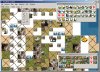
 
Thanks you guys, i already thought the thread is best suited directly in the "creation and modifications" forum but it was moved inside this abandoned (haha, well atleast less visited sub-forum).

I was a bit pissed that noone responded since i really do this for your pleasure, i mean i don´t play nor mod civ. Just today i read a nice agreeing response in the main thread and immediately spend 5 hours on coding.

So, to shorten this, i´m working on MapView as i post and will hopefully deliver something quite useful.

The mayor changes are basicly that you have the option to totally scan your civ install for identifier tags.
like:
\\Assets\\XML\\Text\\CIV4GameTextInfos_Objects.xml

whatever mapview will find will be supported for placement. This means it should be pretty much support any well done mod and official mods (didn´t check yet)

MapView will now don´t have hardcoded references. It will just recognize that there´s BONUS_WHATEVER used in the *.wbs to be displayed and then look for BONUS_WHATEVER.tga to render the bonus onto your map. I might add a check if BONUS_WHATEVER is also recognized by Civ (my checking the xmls), but give you the choice to ignore occuring problems.

Another big change is the support of Cities and Units, as well a Civ placement and Tech/Building spreading. Also the possibility of "revealing" certain parts of the map to a specific team will be a feature. This comes with the feature that will allow you to "look throught the eyes" of a certain player/team. (keyword: war of fog, undiscovered areas) so you can comfortably create scenarios.

And there´s still a lot to be done.
I think i might be quite useful to really create mid-gameplay maps, especially when trying to create ncie scenarios.
On that case i´ve several things in mind. Adjustable unit promotion, adjustable startvalues for city culture and the other team specific values like gold etc.

And in a long term way i hope the Civ5 developers will look at MapView and say "Hey, that´s been pretty nice, let´s see if we can´t do something similar instead of providing such a slow and unuseful shot as the current ingame editor" :)

@asioasioasio. I currently have one semi-transparent layer that can be used as a rotoscope. Already thought about different layers for bonuses etc. but ive no idea how it will come out. Basicly it´s not so hard to get in, lets see ;D

And my BMP/JPG->WBS already works pretty nice, atleast when it comes to detect shapes and basic terrain recognition.

@GarretSidzaka:

Yay, nice to hear that. I´ve not yet recoded the river part but it will be my next step to get done.


And of course you can add any idea you´d like to see, that´s what this thread is for.

so long

grey

I´ve 2 screenshots attached that somehow show the current state. You can´t see much atm but mayb someone is interessted.
The white part´s of the map are because that fields contain features/routes that have no visual representation file yet. (flood plains, fallout and railroad). That´s quite a good example how client based MapView is going to be. As soon as i created those files they´d be shown.
 

Attachments

  • stateofthecode1.jpg
    stateofthecode1.jpg
    332.8 KB · Views: 213
  • stateofthecode2.jpg
    stateofthecode2.jpg
    291 KB · Views: 170
Looks absolutly great! I can't wait to play with this. Shocking you dont even play civ though!:eek:
Well whatever your motivation is the community will be eternally in your dept if you get that new programm to work!:goodjob:

One more idea:

If BMP->WBS conversion works. Could it also work the other way round(including defining the colors which represent terraintypes, hight, ressources etc.? The WB itself is still the best tool to actually model a landscape if the look of i.e. mountainranges itself is important to you but making corrections of the whole map afterwards is of course a pain so creating a bmp out of an existing wbs would round up the whole procedure to an utmost flexibilty.(that's just something for the far future maybe).

In general I recommend against trying to completly finish your program before you release. It's better to release small bits get feedback on it and update. Small updates keep poeple excited about the program and will give you the needed feedback to polish your project based on userneeds. Few poeple will constantly support a project that might or might not get released someday in the future. It's sad but that's the way it is. At least that's my experience with my modproject. I didn't have the time nor the energy for many improvements a long time and publicity went to quite good to hardly noticed. Only mods/projects that constantly update maintain constant input by the community...
 
Hi :)

btw, i play some Civ4 every now and then but that´s not more often then once a month.

Yeah i know about the issue you explained, i already experienced that similar.

I just want to reach a state where the program actually turns useful, that´s the time i´ll release the new version.
 
It looks great - your mapview was always great alternative for worldbuilder (i always preferaed to make maps in your program) - and now it will be much more great - new features for scenarios makes it much more flexible and useful. :)
 
No they´re fine, just as you see. That´s basicly the kewl thing About MapView and it´s initial purpose. You have a map and you are able to see how it will look ingame. When you place (mouse click, move ) the river the algorythm starts doing things, basicly just altering the River object of Field[x][y]. Alignment and floatingdirection.
The immediate backfeed that actually shows the new river field on the map is already relying on the final data as it will also be saved. What you see is what you get ;)

Like in the current version of MapView you still sannot mess with rivers. Meaning you can only create River floating N<->S and W<->E, that&#180;s what "working" Rivers do.
You cannot create a N<->S river and make it&#180;s floating direction to be W or E.
I don&#180;t think you need to do that anyway,
I assumed you wanted to place actual rivers and no ******-rivers. ;)
 
This project has enourmous potential, please don't lose interest in it.

I don't know if this is even possible but....
What I need most is an easy way to add/remove civs from an existing map without having to manually remove all reference to barbarians first (still sometimes doesn't work).
e.g. to turn a 24civ map into an 18civ map with a few clicks would be awesome, currently it involves removing all barbarians (and cities and animals)..then the civs..then replacing the barbarians, and is a daunting prospect on a large map.

The ability to work on a map without running the game is already very useful.
 
Hi Carter, sorry for the delay, i´ve been on a short vacation.

I'd need to investigate on the subject. Afaik there´s some Civ restriction about the number of civs but idk yet, it´s something i´ll look into once the usual map editing works good enought.
 
same with the testing.

Here are my loud groans (and hopefully you'll consider them for future updates =D)

in order most wanted to wanted but imo less important

1) Background Tracing Tool, just like the one in civ4editor. Shouldn't be hard and is SUCH a blessing
2) copy/paste tool
3) Scroll Lock! Eek, it is very frustrating when you are drawing, and suddenly it jerks to the side causing you to scribble accros the page =] that or the dreadful miss-fill. This should be an option when in edit mode to keep your workplace steady
4) Undo. Don't you hate it when you work on the map for an hour and you accidentally fill in the ocean with land?
5) scaling tool for entire map (please don't waste time on this if its not feasible, I imagine it would be hard to whip up)

and yes i realize the first 2 are already in civ4editor, however that program is both unstable, incompatible with maps edited in mapview (well my custom maps at least), and too slow to run on my computer comfortably (can barely edit a giant map, and can barely, if even, load a large one)

Really its like these two programs are two halves to an incomplete apple

Hopefully you can implement some of these, let me know!
 
1) Background Tracing Tool, just like the one in civ4editor. Shouldn't be hard and is SUCH a blessing
What exactly would a Background Tracing Tool be? Like a rotoscoped image? That´s in the works, and already works quite good.
2) copy/paste tool

That´s already in my mind, quite on Top of the things do do next.
Especially since yesterday i created support to have several Maps opened at the same time. Copy Paste between maps will somehow be a feature sooner or later.
3) Scroll Lock! Eek, it is very frustrating when you are drawing, and suddenly it jerks to the side causing you to scribble accros the page =] that or the dreadful miss-fill. This should be an option when in edit mode to keep your workplace steady

Yep, signed. Sucks!
Nowadays moving arround is a seperate tool. When drawing stuff you will be able to zoom with the mouse but not able to move sideways. (Also no autoscroll as in the current version of MapView.) I´ll prolly add the feature to move arround with the arrow keys later.
4) Undo. Don't you hate it when you work on the map for an hour and you accidentally fill in the ocean with land?

Undo isn´t very easy to realize, I would probably need to create internal backups of the whole map on each occured change. I planned to create Undo functionality but the time will show if i can get it working well. (Might be quite memory consuming, need to benchmark that) Nothing to expect too soon.
5) scaling tool for entire map (please don't waste time on this if its not feasible, I imagine it would be hard to whip up)
I already wrote FlipX and FlipY. Also got Cropping and Shifting Semi done.
Resizing isn´t that easy. How would you make a 40x40 map to be 60x60? Where to know what those extra 20 lines and rows would be? 80x80 would be easy again.
and yes i realize the first 2 are already in civ4editor, however that program is both unstable, incompatible with maps edited in mapview (well my custom maps at least), and too slow to run on my computer comfortably (can barely edit a giant map, and can barely, if even, load a large one)

Really its like these two programs are two halves to an incomplete apple

Hopefully you can implement some of these, let me know!

I´m quite positive the new version will be very very compartible to ANY kind of *.wbs files. The current MapView version is just too static, i learned a lot of it and think i made extreme progress with the new one.
 
@Background Tracing~ I don't know, its where you have a translucent image as a background (stretched to fit your map i guess) so you can trace

@scroll lock~ sounds great

@undo~ don't worry about it too much, it sounds like it would lower performance (and I like to work with really large maps)

@scaling~ yea thats quite a problem, maybe a multiplier that multiplies by whole numbers, though if you come up with something for decimals (ie 1.5x) go for it

and i must congratulate you, you have maintained great interest and priority on this project despite relatively low input. You seem to have all bases covered when it comes to features. Looking forward to your next release!
 
Back
Top Bottom