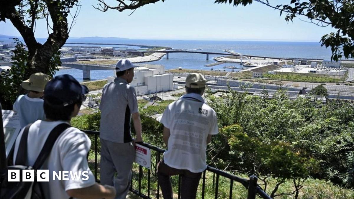
• 📚 Admin Project Update: I've added a major feature to PictureBooks.io called Avatar Studio! You can now upload photos to instantly turn your kids (and pets! 🐶) into illustrated characters that star in their own stories. Give it a try and let me know what you think!

Natural Disasters: Oh, does my native land love to kill...

Hawaii got hit with the tsunami waves, but while they for 2-4 ft tall, there were no major damages or mass casualty.

1753862264205.png
 
This goes in at number 6 at almost the exact same spot as number 5.

1753862645227.png
 
California :


"However, the maximum height is much, much lower than in Hawaii," she said. "The largest for the region is in Santa Barbara, where it's predicted to be between one and two feet. For all the rest of Southern California it's less than one foot."
 
I got the tsunami alert this morning (12+ hours ago) and didn’t think it would make it into the American news.
 
Hurricane Melissa has rapidly intensified into a major hurricane and is expected to bring several feet of rain, hurricane force winds, and a direct strike to Jamaica over the next few days and has already dumped a ton of rain over southern Haiti already.

260251_5day_cone_no_line_and_wind.png
260251_key_messages_sm.png
Screenshot 2025-10-25 222413.png
 
Hurricane Melissa strengthens to category 5 as communities in Jamaica warned of ‘potentially unimaginable impact’

Having now intensified to Category 5, slow-moving Hurricane Melissa has all the ingredients to be a catastrophic storm, with devastating storm-surge, extreme winds and unusually high rainfall accumulations.

Communities in Jamaica will need to prepare for potentially unimaginable impacts, and with climate change fuelling stronger storms with higher rainfall totals, this is a stark example for other countries as to what may be in store for them

1761581095343.png
 
Melissa's power is just incredible, it may become the strongest storm on record in the Atlantic before hitting Jamaica. It is still strengthening largely due to this:
crw_sst_13L.png
 
1200UTC, still RI'ing it up.

1410UTC, the eyewall has shrunk further to <10nm.

This storm is quite literally a hair's breadth away from the absolute mathematical limit for how strong a storm can be.
I do not mean 'record breaking.' It already did that.
I mean it was below 908mb at 1200Z and was already so bad the Hurricane Hunters had to abort

To give you some idea of just how insane this truly is?

This is pushing at least 185MPH sustained winds. And with the illegal NOAA cuts, even attempting more Hunter flights is unlikely. It takes a LOT to get them to abort. So getting good data has been made utterly impossible.
And every GOES pass shows that it is continuing to intensify.
 
Melissa's power is just incredible, it may become the strongest storm on record in the Atlantic before hitting Jamaica. It is still strengthening largely due to this:
View attachment 745996

:eek:

Maria, which ravaged Puerto Rico in 2017 (which still has damage from it today), was only a Category 4 when it hit.

We should have a pretty good idea on just how bad it will get in about 12 more hours.

The strongest hit from a hurricane in the last 170 years was a Category 3 for Jamaica.

**Edit**
I hope this map is wrong and the hurricane veers left or right even. No, veer left please!
Ugh, there is no where down there to put a super hurricane that won't hurt a big island of people.

 
Last edited:
:eek:

Maria, which ravaged Puerto Rico in 2017 (which still has damage from it today), was only a Category 4 when it hit.

We should have a pretty good idea on just how bad it will get in about 12 more hours.

The strongest hit from a hurricane in the last 170 years was a Category 3 for Jamaica.

**Edit**
I hope this map is wrong and the hurricane veers left or right even. No, veer left please!
Ugh, there is no where down there to put a super hurricane that won't hurt a big island of people.


Important context is that "landfall" is defined as the eye of the storm hitting land, and because that means that a significant % of the storm's area will typically be over land for hours before landfall, major storms almost always weaken and make landfall at lower than their peak intensity.

That being said, Melissa is now strong enough that it will probably make landfall as a category 5, albeit weaker than it is now (and bear in mind, indications are that it is still strengthening so we likely have not reached peak intensity yet).

About an hour or two ago the hurricane hunter flight was forced to abort mission due to extreme turbulence inside the storm. I believe they are trying again although I don't have up-to-the-minute info about the hurricane hunters.
 
Edit: adding in the 2 am EDT advisory.

Screenshot_20251028-010424_Firefox.jpg


A couple of satellite images I snagged from Reddit:

Really beautiful storm. Would be more beautiful if it was just a fish storm.


QLQIkGc.jpeg
melissa-13l-northern-atlantic-caribbean-sea-v0-j42kioih5sxf1.webp
 
Last edited:
Some regions of this planet are not suitable for humans to settle permanently.
 
4 am advisory:
BULLETIN
Hurricane Melissa Advisory Number 28
NWS National Hurricane Center Miami FL AL132025
500 AM EDT Tue Oct 28 2025

...CONDITIONS DETERIORATING ON JAMAICA AS EXTREMELY DANGEROUS
CATEGORY 5 MELISSA SLOWLY APPROACHES...
...CATASTROPHIC WINDS, FLASH FLOODING, AND STORM SURGE EXPECTED ON
THE ISLAND TODAY...


SUMMARY OF 500 AM EDT...0900 UTC...INFORMATION
----------------------------------------------
LOCATION...17.2N 78.3W
ABOUT 115 MI...180 KM WSW OF KINGSTON JAMAICA
ABOUT 290 MI...465 KM SW OF GUANTANAMO CUBA
MAXIMUM SUSTAINED WINDS...175 MPH...280 KM/H
PRESENT MOVEMENT...NNE OR 25 DEGREES AT 5 MPH...7 KM/H
MINIMUM CENTRAL PRESSURE...901 MB...26.61 INCHES

NEXT ADVISORY
-------------
Next intermediate advisory at 800 AM EDT.
Next complete advisory at 1100 AM EDT.

INIT 28/0900Z 17.2N 78.3W 150 KT 175 MPH
12H 28/1800Z 18.2N 77.7W 145 KT 165 MPH...INLAND
24H 29/0600Z 19.9N 76.5W 120 KT 140 MPH...NEAR THE COAST
36H 29/1800Z 21.9N 75.1W 95 KT 110 MPH
48H 30/0600Z 24.6N 73.1W 90 KT 105 MPH
60H 30/1800Z 28.1N 70.0W 85 KT 100 MPH
72H 31/0600Z 32.4N 65.4W 80 KT 90 MPH
96H 01/0600Z 43.0N 52.0W 65 KT 75 MPH...POST-TROP/EXTRATROP
120H 02/0600Z 51.0N 35.0W 50 KT 60 MPH...POST-TROP/EXTRATROP

280855_5day_cone_no_line_and_wind.png
 
8am advisory has the central pressure at 896 mb, 180mph winds. A monster of a storm, and bound to become more common as the ocean keeps getting warmer.
 
11 am advisory

BULLETIN
Hurricane Melissa Advisory Number 29...Corrected
NWS National Hurricane Center Miami FL AL132025
1100 AM EDT Tue Oct 28 2025

Corrected Tropical Storm Warning section to add Turks and Caicos

...EXTREMELY DANGEROUS CATEGORY 5 MELISSA ABOUT TO MAKE LANDFALL IN
JAMAICA...
...CATASTROPHIC WINDS, FLASH FLOODING, AND STORM SURGE OCCURRING ON
THE ISLAND...


SUMMARY OF 1100 AM EDT...1500 UTC...INFORMATION
-----------------------------------------------
LOCATION...17.9N 77.9W
ABOUT 40 MI...60 KM SE OF NEGRIL JAMAICA
ABOUT 235 MI...380 KM SW OF GUANTANAMO CUBA
MAXIMUM SUSTAINED WINDS...185 MPH...295 KM/H
PRESENT MOVEMENT...NNE OR 25 DEGREES AT 9 MPH...15 KM/H
MINIMUM CENTRAL PRESSURE...892 MB...26.34 INCHES


WATCHES AND WARNINGS
--------------------
CHANGES WITH THIS ADVISORY:

The Government of Cuba has issued a Hurricane Warning for the
province of Las Tunas and a Tropical Storm Warning for the province
of Camaguey.

The Meteorological Service of the Bahamas has discontinued the
Hurricane Watch for the Turks and Caicos islands.

SUMMARY OF WATCHES AND WARNINGS IN EFFECT:

A Hurricane Warning is in effect for...
* Jamaica
* Cuban provinces of Granma, Santiago de Cuba, Guantanamo,
Holguin, and Las Tunas
* Southeastern and Central Bahamas

A Tropical Storm Warning is in effect for...
* Haiti
* Cuban province of Camaguey
* Turks and Caicos Islands

FORECAST POSITIONS AND MAX WINDS

INIT 28/1500Z 17.9N 77.9W 160 KT 185 MPH
12H 29/0000Z 19.0N 77.1W 130 KT 150 MPH
24H 29/1200Z 21.0N 75.7W 100 KT 115 MPH...INLAND
36H 30/0000Z 23.4N 74.1W 95 KT 110 MPH...OVER WATER
48H 30/1200Z 26.6N 71.5W 90 KT 105 MPH
60H 31/0000Z 30.8N 67.5W 85 KT 100 MPH
72H 31/1200Z 35.9N 61.5W 75 KT 85 MPH
96H 01/1200Z 45.9N 47.1W 60 KT 70 MPH...POST-TROP/EXTRATROP
120H 02/1200Z 52.8N 30.3W 45 KT 50 MPH...POST-TROP/EXTRATROP


281458_5day_cone_no_line_and_wind.png
 
892 is crazy, if it maintains it will be tied with Dorian for strongest Atlantic landfall in recorded history
 
Back
Top Bottom