Need Huge (32,000+) European Map. Know of any? ;)

yoshi

Emperor
Joined
Oct 2, 2002
Messages
1,179
I'm looking for an extremely accurate map of Europe of maximum possible size (obvioulsy because the larger it is, the more accurate it will be).

Have been looking around but most of the maps I have found are not accurate enough and the few that are accurate, are too small (enlarging will distort the map's details).

MAP ACCURACY:

Should be able to compare it with a real-world map (taking proportions into account of course).


MAP SIZE:

Since maps have their width doubled in the game (i.e. double the width you set in the editor), doesn't that mean that you can potentially play on a map of 65,522 squares?

Example (maintaining a square map):

Maximum size square map: 181x181 (32,761)
Maximum size square map (compensating): 128x255 (32,640)
Resulting in-game map: 256x255 (65,280)


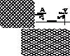
I've attached a map that is 131x250 (32,750) squares in the editor but 262x250 (65,500) squares in the game as an example.
(I've added the terrain from a 68x145 (9,860 square) European map that I DL'd of the net and shifted it into the bottom right-hand corner of the map so that you can clearly see the difference in size.)

QUESTIONS FOR THOSE WHO KNOW:

How are the squares added in the game to double the width (i.e. one between each 'original' square')?

Are there side-effects to using this system?


If the answers are YES and NO respecitivly, please post links to any maps that take the above into account. Thanks.
 

Attachments

What, did everyone suddenly die in the this forum? Last post was like, two days ago! ...Even the prolific Lozzy Ozzy has gone silent! :)

Okay, I'll simplify the question:

Does using the in-game double map width effect to make the map bigger (as opposed to just making the 'slimming' the original map width down by half to compensate) have any side-effects?

Since most of the good European maps that I've seen are below 32,000 squares, I'm assuming that map-designers are not taking advantage of the double-width thing, so I'll stop asking. But feel free to recommend (link, temporarily upload) any really good European maps that you know of or have.

While I'm at this monologue, I'll ask for your opinion on something (assuming any of you are still breathing ;) ):

The European map is intended for a WW2:Europe scen that I've been scratching away at for God knows how long. I'm tired of testing on simple island maps and think I've gotten to the point where I think I should be testing this stuff out in the actual scen--before this becomes one of those endless projects that never end up getting done.

I'll add relevant features so that you can see what I'm going for and can recommend the best approach:

Version: Civ2:MGE (the ToT version is a whole other ball game so I won't get into it).

Map:

- Europe and Atlantic (N. American East coast to Russian Urals). Tilted 30 degrees to take in less of the MIddle East and more of the North Atlantic.

In-game map features:

- All tiles have fortresses.

Unit features:

- All combat ships (attack value higher than 0) have 'submarine advantages/disadvantages' ability (so that they can't attack cities mostly).

- No transports (hence, no problem with putting fortresses on Ocean tiles). Land units are spawned via events based on the completion of certain objectives (e.g. the destruction of blocking coastal defences or the capure of key ports).


I'm going for a really historically accurate game (as much as humanly possible while maintaning 'fun' gameplay) so I need the map to be as large as possible.

What I was thinking was to simply get rid of the Atlantic altogether (about half the map and dedicate the enitire map to just Europe (i.e. from Iceland to Urals). This would allow me to double the size of the European land area thus allowing for a MUCH higher level of detail. I can certainly take advantage of the extra space as I have the names of all European cities, locations of industrial zones, military installations and relevant strategic/tactial level plans at the outbreak of war.

At the same time, I developed a whole system of convoy warfare that, were I to limit the game area to just Europe, would be limited to just a part of the Eastern North Atlantic.

What is the best course to take (i.e. as a player, what would you appreciate more: realism or scope)?

[I tend to go for the latter because, IMO, if it's not realistic, it loses historical relevance (i.e. if you're going to play WW2, play as close to WW2 as possible--within the parameters of Civ2--otherwise, what's the point?). But, as I said, I haven't tested it on any European map yet so I don't really know what would work best.]


P.S. This is not an issue in the ToT version because I can just put the Atlantic on a seperate map a la 'Europe in Flames' scen (actually, I may even have a seperate map for each front so the main European map will literally be ALL Europe but I'm still testing the transport function and an appropriate way to divide up the maps so that playability is not degraded by the division).
 
@yoshi-What, did everyone suddenly die in the this forum? Last post was like, two days ago! ...Even the prolific Lozzy Ozzy has gone silent!

what do you mean by that? I might come on everyday (whilst doing homework) but i don't randomly post rubbish-oh dear i'm doing that right now...
 
yoshi said:
MAP SIZE:

Since maps have their width doubled in the game (i.e. double the width you set in the editor), doesn't that mean that you can potentially play on a map of 65,522 squares?

Example (maintaining a square map):

Maximum size square map: 181x181 (32,761)
Maximum size square map (compensating): 128x255 (32,640)
Resulting in-game map: 256x255 (65,280)

No. The map editor and Civ2 coordinate systems are not the same. The maximum surface is 32,767. Try counting the width and height of the map in Civ2 by hand and you'll notice.

The coordinates in the map editor are the logical ones, in Civ2 the coordinates are screwed. There are only (odd,odd) and (even,even) squares.
For instance, the top-left square is (0,0) and the one next to it is (2,0) rather than what it really should be: (1,0).
I think I know why the coordinate system is the way it is, though. It's easier to draw the map (for the programmers), because the coordinates (x32) exactly match the placement of the graphics on the screen.
 
Take it easy Loz, it was meant to be a complimentary comment witha bit of cheek that's all. ;)

@Mercator: The maximum surface is 32,767.

Not if you make width and hieght equal. Then the closest you can get to 32,767 is 32,761 (i.e. 181x181).
But that's a mute point because why the hell does the map have to be square?! [yoshi = :crazyeye: ]

The coordinates in the map editor are the logical ones, in Civ2 the coordinates are screwed. There are only (odd,odd) and (even,even) squares.

For instance, the top-left square is (0,0) and the one next to it is (2,0) rather than what it really should be: (1,0).


Isn't 0,1 SW of 2,0 in-game?

Anyway, all the squares are there regardless of configuration.

I actually answered my own question regarding expoiting the double-width thing: found a gigamap (32,700+ square) here that seems to do exactly what I wanted. Only it cuts off before Iceland so there is no Atlantic at all.

Oh well, can't have it all.

@kobayashi: Have you made or come across any maps of the northern hemisphere looking down from the north pole.

I remember having designed one for a Cold War scen that I was working on once but the problem was that all the countries in the Southern hemisphere looked squashed (making them full size would have left HUGE areas of water (e.g. south Atlantic 3 times the width of north). I 'll see if I can find it.
 
yoshi said:
I remember having designed one for a Cold War scen that I was working on once but the problem was that all the countries in the Southern hemisphere looked squashed (making them full size would have left HUGE areas of water (e.g. south Atlantic 3 times the width of north). I 'll see if I can find it.

The map is actually round..and should cut off with the top third of Latin America, half of Africa and Indonesia in Asia.
 
kobayashi said:
Hey Mercator, you be the map guru right?

Have you made or come across any maps of the northern hemisphere looking down from the north pole. I saw some (on paper) which would be real cool to have for modern global scenarios.

I suppose I am. ;)

There's definitely at least one, maybe 2 or 3. I don't have any access to anything Civ2 right now, but here are a few maps:
http://www.civgaming.net/mercator/legacy/database/maps/arctic.htm

IIRC, Dirk Weber's map is as you described.

Edit: Or, um... At least they're maps centered on the north pole. I'm not entirely sure if those maps cover all of the NH, or just the more northern parts of it.

yoshi said:
Not if you make width and hieght equal. Then the closest you can get to 32,767 is 32,761 (i.e. 181x181).
But that's a mute point because why the hell does the map have to be square?! [yoshi = :crazyeye: ]

Well, it's the theoretical maximum. I believe you're right in that it can't actually be achieved... Wait, actually it can: 151x217.

Isn't 0,1 SW of 2,0 in-game?

Nope, that's (1,1).
 
Sorry I missed this thread this late, yoshi. I have a very good giga map of Europe laying in my civ folder, can't even recall who made it. But here you go, hop it's what you're looking for. :)
 

Attachments

Thanks for uploading that map E. I'll DL it when I get home and give you my opinion.

No matter how good it is, it'll be a tough choice because the RealEurope map I DL'd is not only as accurate as you can get but is even designed for a WW2 scen and is massive at 32,750 (131x250) squares. BTW, the link I posted to that map has been changed so it's useless. You can find that map (and a whole assortment of others) here at Poly:

http://apolyton.net/civ2/civ2maps.shtml


@kobayashi: The map is actually round..and should cut off with the top third of Latin America, half of Africa and Indonesia in Asia.

Didn't you say you wanted maps of the northern hemisphere looking down from the north pole? That would be the North Pole is at the center of the map and the continents around it.

If it's round, then it sounds like what you want is just a regular world map only it includes more of the North Pole (i.e. more Glacier area) and cuts off much of the Southern hemisphere. If that's so, then I don't know of any maps like that.


@Mercator: Wait, actually it can: 151x217.

Six extra squares! Happy day! ;) ...Well, I shouldn't talk as I'm so obsessive that I'd be capable of completely changing the dimensions of a map just to be able to maximize the map size. :rolleyes:

Nope, that's (1,1).

Damn. So what does this mean, the in-game map is actually 'thinner'? (If the answer is obvious, note that my math skills could easily be outdone by a grade 6 student.)
 
Eivind, I had a look at your map and yes, it's quite good.

Here's the choice I must now make:

New Europe.mp:

- 132x246 (32,472) squares.
- Includes Iceland but North Africa is a bit skimpy.
- Isn't designed taking double width into account so you get 'fatter' in-game European map.
- Little distinction between actual Plains and Grassland regions but still very accurate.

Realeuro.mp:

- 131x250 (32,750) squares.
- Does not include Iceland but there is more of North Africa.
- Northern Norway/Sweden/Finland cut off.
- Geographical features highly accurate.
- Takes double width into account so map looks 'thinner' in Editor but proportional in-game.

Basically, I have to decide if that bit of the Northeastern Atlantic in New Europe.mp is worth giving up the 278 extra squares, larger total landmass and high geographic accuracy of Realeuro.mp. In other words, more European landmass vs. more Atlantic water mass (i.e. completely Europe-based or some Atlantic combat). Tough choice.

I'll attach the Realeuro map so that you can compare and give your opinion.

Again, keep in mind that I'm going for detail (i.e. many historical cities and flexibiliy of unit movement so that tactic also play a role--not that getting the AI to do this won't be anything short of a miracle ;) ) but also interesting play (i.e. diverse land/sea/air strategy with emphasis on interception of war materiel in transit).
 

Attachments

Something i did for a recent scenario works quite well-if you don't need desert or any other terrain you can make a "border" terrain and "no mans land", this helps making saw 1916 Germany and it also is effective at stopping crazyAI tactics. The borders need high movement penalty and no resources they also need high defence where no man's land has low defence.
 
Nice work Loz.

Borders:

I usually use immobile units as borders (I call them something like, Frontier Post so that it makes more sense when they are attacked) so that the border is removed when the enemy breaks through.

Using terrain with a high movement cost is good, although it won't affect units with 1 MP. Using Hills, Mountians or Forest terrain as border terrain would allow you to have a coninuous line effect.

If using ToT, you could have two terrain types: National Border and Regional Border. Use the optional terrain mask in the ChangeTerrain action to extend your own National Border as you take cities by changing NB to RB and vicerversa.

No Man's land:

Nice. Serves to keep units on Roads instead of rolling through the countryside.

You've seen the AI 'tracks' idea that I proposed for use with ToT right?
 
:hmm: I somehow lost track of this thread...

yoshi said:
Damn. So what does this mean, the in-game map is actually 'thinner'? (If the answer is obvious, note that my math skills could easily be outdone by a grade 6 student.)

Um, no... The map looks exactly the same in the civ2 map editor as in-game in Civ2. It's just the coordinates that are assigned differently.


yoshi said:
- Isn't designed taking double width into account so you get 'fatter' in-game European map.

(...)

- Takes double width into account so map looks 'thinner' in Editor but proportional in-game.

I take it you're referring to the "radar" world map vs. main map view, not editor vs. in-game (unless by editor you mean MapEdit, for instance).

... And there really is no such thing as "double width". That's just the ****ed up Civ2 coordinate system messing with your head.


Making maps look "proportional in-game" really isn't a good idea at all. The reason why maps look "fatter" is because you're looking at the map from a perspective. That is, you see it from a bird's eye view. In contrast, the radar map displays the map correctly, as if you're looking straight down on it.

In the main map window, you should really be treating the map's "squashed" diamonds as if they're proper diamonds (i.e. squares tilted by 45 degrees). They're squashed because you look at the map at an angle.

Now, this is just theory, and you can brush it aside if you want to. But there's one thing you have to keep in mind. In a map that's proportional in the main map window, moving north-south will take twice as much time as moving the same distance east-west.
 
Okay, let me clear up what I meant first:

In MapEdit/Map Editor map looks as its meant to (because the coordinates are not messed up). You view the map in-game and it does really look like it's been stretched width-wise (yes, the mini-map presents it lik it is in the editor).

Let me see if I got this right:

- squares (diamonds) in the editor are not 'squashed' (thus no 'fattening'/angled effect)
- in-game coordinates are an unrelated screw up
- by making maps 'thinner' in the editor so that they look normal in-game is actually just warping the map and not doing any good otherwise

This is correct?

"In a map that's proportional in the main map window, moving north-south will take twice as much time as moving the same distance east-west."

That seems to be so. but, as you said (or at least I think you said) this is just a mathematical illusion created by the in-game coordinates and an accompanying visual illusion in the 'fattening' effect.

The question is, does this apply to the Editor map as well? According to what was said above, this should not be possible (assuming the editor's coordinates are not "****ed up").


---------------------------------

To anyone who gives a $hit:

I've decided that I'll be using the map Eivind IV uploaded for the MGE version (may tweak it to add more of Atlantic) and the other map for the ToT version (ToT version will use multi-maps to divide Atlantic and Europe a la 'Europe in Flames'--possible further addition of Siberia/Middle-East map).

I compared the land mass of each country and distances between land masses and found that the other map is not that much bigger viewed that way, so I'd rather give up size for more variety of play (I just wish more women thought that way ;) ).
 
Mercator said:
Making maps look "proportional in-game" really isn't a good idea at all.
I mostly agree with this. I remember when I made my second (32 725-tile) gigamap of Middle-earth I originally used a 1:1 width-to-height tile ratio (proportional in the minimap). Unfortunately, some areas on the game map became extremely distorted due to the horizontal stretching effect of the tiles. Eventually I made a compromise between proportional and aesthetic, and reduced the ratio to about 3:4. Real horizontal distances (in number of tiles) have therefore effectively been reduced by 25%, but I can live with that. There's a screenshot of the map, together with explanatory notes on my website; you may have seen it.

:hmm: I suppose while I'm here I can attempt to answer some of these questions…

yoshi said:
In MapEdit/Map Editor map looks as its meant to (because the coordinates are not messed up). You view the map in-game and it does really look like it's been stretched width-wise (yes, the mini-map presents it lik it is in the editor).
What editor are you talking about? The MapEdit map looks like the game's minimap, ie, no tile stretching. The Civ2 Map Editor looks like the game map, ie, tile stretching (each tile is 64 x 32 pixels).

yoshi said:
- squares (diamonds) in the editor are not 'squashed' (thus no 'fattening'/angled effect)
- in-game coordinates are an unrelated screw up
- by making maps 'thinner' in the editor so that they look normal in-game is actually just warping the map and not doing any good otherwise
This is correct?
Anything using the diamond-shaped tiles is "squashed". That means both the game map and the Civ2 Map Editor are "squashed". Yes to the second. Mostly yes to the third (see above).

yoshi said:
That seems to be so. but, as you said (or at least I think you said) this is just a mathematical illusion created by the in-game coordinates and an accompanying visual illusion in the 'fattening' effect.
It ain't an illusion. If your game map is visually proportional (to compensate for the tile stretching) then you have essentially halved your horizontal distances or doubled your vertical ones – whichever way you want to put it.

yoshi said:
The question is, does this apply to the Editor map as well? According to what was said above, this should not be possible (assuming the editor's coordinates are not "****ed up").
Forget about the coordinates. What applies to the Civ2 Map Editor also applies to the game map.
 
I'll second everything Wobbegong said...

Wobbegong said:
I mostly agree with this. I remember when I made my second (32 725-tile) gigamap of Middle-earth I originally used a 1:1 width-to-height tile ratio (proportional in the minimap). Unfortunately, some areas on the game map became extremely distorted due to the horizontal stretching effect of the tiles. Eventually I made a compromise between proportional and aesthetic, and reduced the ratio to about 3:4. Real horizontal distances (in number of tiles) have therefore effectively been reduced by 25%, but I can live with that. There's a screenshot of the map, together with explanatory notes on my website; you may have seen it.

Well, you're right. As with most other things in Civ2 creation, it's a compromise. But people should at least know why they're doing something. Once they know how it works, they can feel free to find a compromise, or ignore it altogether. As long as they know what the consequences are.


Here's an image to help you visualize...

On the top-left you see what your map theoretically really looks like. That's what the map looks like if you were to view it from straight up. This is also how the minimap (and the MapEdit preview) shows your map, looking straight down on it.

On the bottom-right you see what the map actually looks like in Civ2. The squares have become diamond-shaped, creating an illusion of depth. That's what you get if you look at the map from a 30° angle bird's eye view.

The difference in the Civ2 and Civ2 map editor coordinate systems is completely unrelated to this. Both of them show the map in this isometric view.
 

Attachments

  • mapview.gif
    mapview.gif
    10.5 KB · Views: 243
Nice diagram M. That makes the effect quite clear.

W, by reducing width real width by a quarter the map becomes distorted. Personally I want realsim. If Europe looks warped, then so be it but the distances must be accurate (i.e. unit ranges are realistic so map distances must also be so). I only bother with asthetic appeal where nothing else is compromised. The reason why I was asking about the possibility of exploiting the double map width in-game to be able to play on a bigger map is because I thought the coordinates and stretching were related--but they aren't so...I guess that's that.
 
yoshi said:
W, by reducing width real width by a quarter the map becomes distorted. Personally I want realsim. If Europe looks warped, then so be it but the distances must be accurate (i.e. unit ranges are realistic so map distances must also be so). I only bother with asthetic appeal where nothing else is compromised.
It's a case by case situation. If you'd seen my 1:1 map (which was very accurate BTW) then you'd definitely want to change it. I tried various widths in the range of 75-100%, but settled on 75% (approximately). As Mercator said, it's fine as long as you're aware of what you're doing and what the consequences are. To be truthful you will never really get accurate distances in Civ2 movement-wise, because the game tiles are squares instead of hexagons. If that wasn't the case then maybe I'd be a little more obsessive about this sort of thing. My theory: get the width as close to 100% as possible, but if the map looks ****ed, don't be afraid to squeeze it a little. ;)
 
I see what you're saying.

Okay, by maintaining accuracy I meant...em...I'm too bloody lazy to alter the whole map.
 
Back
Top Bottom