Question on hills and mountains pattern

wolf_66

Lone Civer
Joined
Jan 19, 2004
Messages
307
Location
Armageddon
Hi guys
I'm quite sure this has been already covered somewhere but can't find it
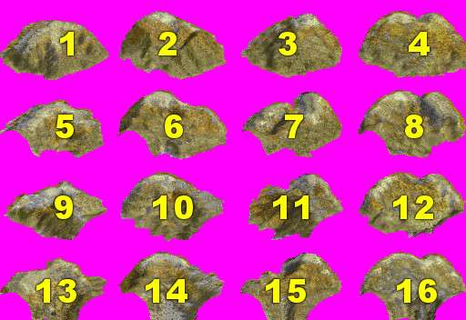
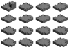
Can anyone explain how xhills.pcx and mountains.pcx tiles are disposed on maps ?
The only thing I understood is that tile nr 1, e.g. the one in upper left corner is always used when hill or mountain is isolated, e.g. not in contact with other similar overlays

thanks
 
There is a thread or post buried somewhere.

Probably the most useful thing to do is to make a version of the pcx with big fat brightly colored numbers in the middle of each tile. Then try various combinations. IIRC, it's just like the base terrains - it's not just the combinations that matter. Where you place them on the map changes which ones are selected.
 
For complex answers, I'd refer to Blue Monkey's linked discussion. For just the simple pattern, it should look something like this (with the arrows showing where an additional hill/mountain could be added.) For thick ranges, the pattern could be more varied.
hillmountpattern.png
 
Thanks to both
@ Blue Monkey. I already made what you suggested and got a bit puzzled. I was hoping for some sort of recurring pattern but is seems tiles layout changes too much with position
@ wujah. Your picture can be helpful for my purpose.I was actually trying to understand how hills/mountain tiles can link together
 
In wuhjah's diagram the green arcs match the curvy chopped off part of the hill/mountain. Fundamentally, that part is going to be behind whatever hill/mountain is in front of it. I know from experimentation that you don't have to cut off your graphic there - whatever is beyond that just isn't seen. The top row are all "front ends" or stand-alone hill/mountains. Maybe that will help?
 
^What Blue Monkey said is right. Maybe this pic can help more if you're creating any new mountains. This set-up works because mountains in the front get laid over mountains in the rear (if that makes sense to you.)
 

Attachments

  • mountains png.png
    mountains png.png
    33.3 KB · Views: 135
^For the official record on that wall, Row two #2 and #4 are out of order. I'm sure I fixed it on my final work, which was then lost, but it wasn't fixed on that png file. I noticed it when I posted it, but hoped to ignore it :o. Since @nick0515 and others mentioned the wall, I felt the need to clarify.
 
I can't find a complete set of annotated terrain files. Probably lost in a hard drive crash last year from which i could not recover all files.


Make a set of terrain pcx to use for testing with big bold annotations (like the illustration). It doesn't need to look like whatever your finished set will be. The game doesn't care what the graphics look like only what the file is named and where in the pcx to look for things. What connects to what will be same regardless of pictures.

Once you've got the annotated pcx set-up you can play around in the editor to see if placement on the map, what terrain is nearby, and so on, affect what is used.
 
Top Bottom