I'm re-purposing this thread as a general-purpose "coded-maps" thread.
So, I'm working on a general-purpose tool to aid in creation and display of RFCEurope "areas". The idea is that we need something like the
RFC Atlas so that people can check out spawn areas and victory condition areas. While pretty, that atlas is hard to produce with a simple program, slightly slow and online, so potentially difficult to check, etc.
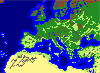
I'm writing a simple program which will produce a schematic representation of the map with areas overlain. This program is also useful to me for easily making non-rectangular spawn shapes. Key features are:
1) Reads the map from the WBS, so when you run this program it's always up-to-date.
2) Reads and writes areas completely compatible with Consts.py
It also produces relatively small graphics files which we might be able to insert into the Civilopedia, for instance (I'm unsure how hard this is currently). At the very least, we can include up-to-date images with each version.
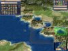
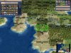
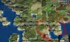
Here's a sample image. The Austrian spawn area used to be just a rectangle, but I extended it arbitrarily into a non-rectangular shape. Oh-ah. Alright, it doesn't look that impressive, but trust me, it was a bit of work. The idea would be to have one image with all the spawn areas, one with all the "normal" areas, and one for
each territory-based UHV.
Comments? Suggestions? Do you think I should get back to work on fixing annoying crashes in the mod instead of wasting my time on this?