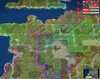
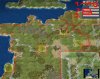
City name maps. I saw you already mentioned the problem on the last page. When switching between civs, the plots which have city name signs on both maps will disappear. So, when the game shows a full french map, and you swith to burgundy, the WB will show the burgundian map as a full blank one.
This is a display thing though, so there is no real bug. It won't overwrite any of the files.
But this means it's much harder to fine-tune the maps, so a good chunk of the comfort with using this tool is gone
I'm not totally sure, but probably you can solve this this way: I would add a full blank map (as dummy map) into the python file. And whenever you swith to another civ's city name map, you do it in two steps. First to the dummy map, and then automatically to the real map. Would be a little slower of course, but syncronizing the maps would be so much easier
")


")