Terrain Templates... to make new terrain the easy way

No Tom, believe me, I had paid attention to deactivate all visible layers. I really don't understand what happened. I did it many times with the same results. The problem is only in my 'Grid Beach' layer but don't know what is it

By performing various tests, I found the following things:
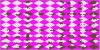
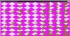
- My layer Grid Beach included bizarre anomalies (look attachment)
- You should specificed in the tutorial that it's necessary that the Plains layer completely covers the entire grid and not only the numbered part in XDGP-PlainsCreator.psd

EDIT: The Plains Creator action copies from within the Grid Numbers portion only. If it is not doing this for you, that means it could be a problem with 'Move' commands it uses to move a selection to another specified part of the image. When using the PlainsCreator action, you have only the Plainscreator and Plainscreator2 templates open, correct?

So from the original location of a selection, the Move tells it precisely where to move to. Example: Move Selection To: -384 pixels, 320 pixels (for W, H). So 384 pixels to the left, and 320 pixels down). I have no way to know if CS2 is different though ?

Unfortunately for me this has not solved all problems: it must remain a problem pallet or something that leaves in magenta boxes (under CS2)
The procedure TerrainCreator works perfectly but it remains a problem in PlainsCreator i think (at the end I got the message: delete command not available). The Grid Beach seems correct now but still doesn't work in XDGP-TEMPLATE.psd

I have to do it manually and i manage to make a first terrain kit but i have more than 20 other projects!
Do you plan to make something for hills too because in 'ace age or winter terrains' hills are much to green!

Thank you for your help and for this great tool in some hours i did what would cost me weeks!

Perhaps CS2 names different again than CS. The action makes a copy of Magenta Grid. CS names this 'Magenta Grid copy'. This copy is deleted after everything else is done since that layer is pasted into the new image that is created. In the layers, pick a layer and right click, and select duplicate layer. Let me know what it names it to. Either that, or it could be the dumb way Photoshop switches back and forth between images, it uses some arcane way of doing so, instead of going by the image name.

The palette does have 1 extra Magenta box in there, I will find where that comes from and get rid of it.

I know someone who has CS4 version, but I do not see them very often. It is tough to specifically see what is going on without being able to view the whole thing myself... since there is no way to test it, or know what CS2 does differently than CS. If Adobe did not make CS2 backward compatible in this aspect with the most basic functons of copy, paste, and layer selections, then that is horrible.

The only thing that could be done with hills is to recolour them, not sure a template would help much at all. It's a matter of selecting what portions to recolour and doing so (Image->Adjustments->Hue/Saturation,Brightness/Contrast,etc). The only thing it could possibly do is provide pre-made selection areas ??

I will see if I can get ahold of my buddy with CS4, and test it over there to get a better idea of what the specific problem may be.

Tom
 
you have only the Plainscreator and Plainscreator2 templates open, correct?
yes

I have no way to know if CS2 is different though ?
sorry but I do not control the software enough to answer this question :sad:
When i use the default Grid Beach layer it works and when i use mine it doesn't but they look absolutely identical apart of course the terrain!

only thing it could possibly do is provide pre-made selection areas ??
oh yes this would be an excellent addition to your tool :goodjob:
 
Spoiler :
attachment.php


attachment.php


I have spotted 4+ differences in between your new plains tile and mine. 1 is missing completely on the bottom row. Another goes off too far into the Magenta portion, and some others are just different.

I should be able to figure out why this is happening.

Tom
 

Attachments

  • GridBeach.jpg
    GridBeach.jpg
    95.8 KB · Views: 294
  • GridBeach2.jpg
    GridBeach2.jpg
    101.5 KB · Views: 245
You're right, i even didn't see these differences
I hope you can find one explanation
 
Hate to bump such an old thread:

But okay, I've never really been satisfied with these templates, for a few reasons;
1) very difficult to make changes to, the scripts are hundreds of recorded actions
2) problems with different versions of PS
3) making them usable by different paint programs would be even tougher
4) not user friendly
5) kinda confusing
6) near impossible to easily change coasts without massive work

but I guess they are something... but anyways;

This might not be super user friendly either, and may not be able to be used by everyone at first (until I can port over to GIMP once done), but:

I have still been working on understanding the terrain, and came to an idea of being able to make terrain in a much easier way. I figured out a way to be able to more easily make brand new terrain using a 3d program that has very excellent results. I am still very early in the process, but have very high hopes that it should be pretty simple for others to use. In the end it will be mostly a matter of changing textures for the different terrain types, and the sea, coast, shores, and ocean; and then rendering (which would create an entire PCX file). The only afterwork needed is copying a provided magenta overlay that will be included and applying the palette.

I'm going to actually be molding terrain (to an extent). This will really only be required for coastlines. Texture can handle the rest. I have mapped out the 'points of contact' for coastlines, so I'm going to try to make it so coasts can become 'unique' on each tile by simple changing a randomizing type modifier; and the 3d program will do the rest.

But, still tons of work to do on it, so I'll give updates as I go; and any suggestions will gladly be taken into account. And I'll try to give screenshots as I get something to show.

With this, it should be extremely easy to alter whole coastlines, change water colors, change the color of shores, along with everything else. Various 3d techniques can be used to make great blends between terrain types, and other things, like waves and transparent water with sun reflections and seeing the beach under the water near the coastline will always be able to turn out in whatever quality one likes. So should be exciting to see what happens!
 
That is great news Tom, i wish best of luck in auto all the features you are announcing here, especially the part of water rendering.

Meanwhile i want to ask for your help, how would you easily blend coast-water-ocean like this?

Spoiler :
 
No way to easily do it. Get out the selection tool and start drawing a selection around all the spots that need to be blended. This is what I had to do to blend the terrain together in the script. If you do you I would save it so you can use it later! Then you can blend using w/e tools / plugins you can get. I used a PS plugin that was free (melt and fur) that was okay; but those might not work the best for water. Water looks great by the way!
 
...
I figured out a way to be able to more easily make brand new terrain using a 3d program that has very excellent results.
...
This is an exciting concept. I've struggled with taking land terrains & converting them to cso files for the hollow earth scenario. Textures is a brilliant solution. Even without that the whole idea of variable opacity (beach / shore blend) is a great coastal solution.

Which 3D program do you plan to work with?

Meanwhile i want to ask for your help, how would you easily blend coast-water-ocean like this?
What tom2050 suggests is a very good way. Make sure to work on a duplicate layer so you've got the original in case you don't like the results. I've also tried creating a transparent layer. Then using a brush with a bright color to draw the area to blend. The opacity can be adjusted to see if the proper area is getting covered. When the squiggles look right select them by color so you get all. Change layers, and blend the selected areas.

If you want to stick with the already indexed pcx rather than convert back to rgb in GIMP you may also want to try filter > noise > pick or filter > noise > blend. Example results:
Spoiler :
pickblend.gif
 
This is an exciting concept. I've struggled with taking land terrains & converting them to cso files for the hollow earth scenario. Textures is a brilliant solution. Even without that the whole idea of variable opacity (beach / shore blend) is a great coastal solution.

Which 3D program do you plan to work with?

Im going to try to make it for 3ds and Blender. IIRC Kyriakos posted recently that he found Blender was a bit easier to work with for the new version. So I will try to convert it over since it is free. Hopefully it works well enough; theres no way to get a perfect render to match exactly with the way the PCX are. So it will require a small bit of afterwork, but it should be very minimal.


If you want to stick with the already indexed pcx rather than convert back to rgb in GIMP you may also want to try filter > noise > pick or filter > noise > blend. Example results:
Spoiler :
pickblend.gif

That is good idea! Let us know what works Rick.
 
Re Maya (as an example) vs. Blender - Maya - like many of the high end expensive programs - has a fairly intuitive interface that enables people to get results with minimal training and allows people who work in the same pipeline to easily share projects. Blender was designed to allow extensive personalization of interface & with many single key shortcuts. There are often several ways to execute the same sequence of commands/actions. It's built for speed, not comfort. Steeper learning curve but finished projects are through the pipeline very quickly once you work out your own way of doing things. My first professional project went from being handed a rough pencil sketch to delivered model in less than a week. Half of that time was spent working out the rhythm & learning shortcuts. If I did the same type of thing again it could be finished in two days or less. There's a strong online blender community, online tutorials & several good books available to help someone who already knows a bit about modelling & animation get over that initial hump.
 
Just as an update on 3d terrain creation setup...

I have adjusted the render portion (size and view) so one can render an exact 1152x576 image of the terrain and be done right there after a simple few post-render steps.

Eventually, for coastlines, my hope is that I can 'pin coastline points' to where they need to be on the edges (so they blend together correctly with other terrain squares, but to have the 'in between coast' to change using some kind of variable. So this way much variation can be gotten.

May need a seperate file for each terrain pxc though. I know some 3d programs use a type of 'layering' but they all differ so I probably won't attempt to setup anything like that.

Still determining how to setup the texturing of the squares so it is very easy to apply but the texture will automatically vary. There are different ways to do it. I will test once I get things a bit more complete.

Here is very early sample (grass only, no variation) of 3d render and post-render process (apply magenta overlay, apply palette):

eh4rt.jpg


Good news is it works as hoped so far.
 
Back
Top Bottom