Domestic T3 D1- New Province Boundries

greekguy

Missed the Boat
Joined
Jun 15, 2004
Messages
4,386
Location
New Jersey, USA
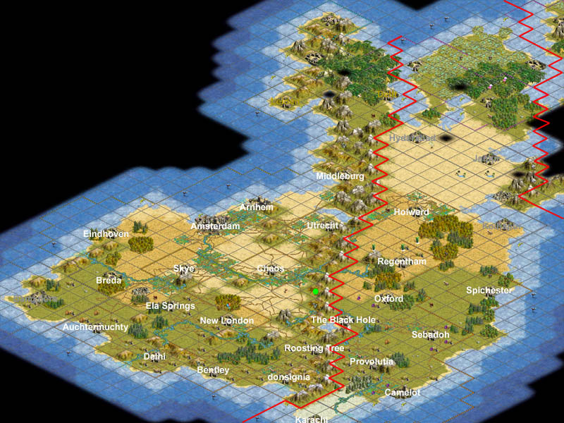
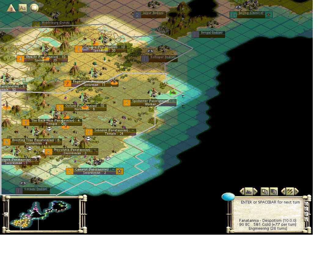
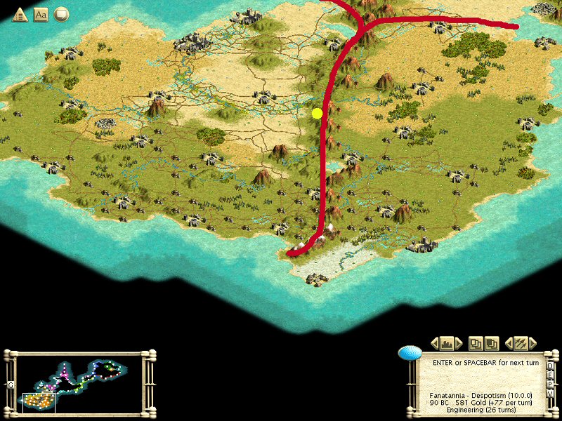
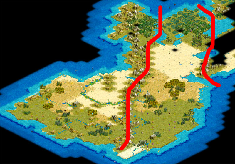
With our land every expanding, we now need to create more provinces in our empire. Fanashire is too big, and we have lots of land to work with. Since a recent constitution amendment gave me this power, i will lead this discussion. :D Please post how you think we should divide our land into new provinces. What i think is, we should keep all the land from the former Indian west border across to our eastern sea border as Fanashire, as well as Oxford, Spichester, and the two Dutch cities below them. Our second province should be the captured Indian core land and eventually Bangalore and the few Dutch cities north of the former Indian core. I think our third province should be all the land North of the other two provinces, basically the Dutch core.

P.S. will post a screenshot later
 
I think we need to consider where and when we will move our Palace.

We should consider two different methods for dividing the provinces:
1. A Small "Capital" provice of productive cities and larger corrupt outlying provinces.
2. Divide the map into pie shaped wedges that will allow each province to have productive and corrupt cities.

Assuming that we move the Capitol to the Rotterdam area I personaly prefer option 2 as it allows each governor a few good cities to balance the corrupt ones. We would start with basically a line drawn through the middle of the continent and everything North West would be Province two and everything South East would be Fanashire. The next time we split the provinces we divide these up more.
 
alright, here's the pictures for my suggested province borders(sorry about the white stuff):

fantanniaeast,_90_BC.jpg


fantanniawest,_90_BC.JPG


There are 3 colors there: black, dark gray, and light gray. Some provinces i couldn't fit entirely into one screenshot, so some lines carry over. If you can't tell the difference between the two grays, the dark gray is on top and light gray on bottom.
 
Here is my idea for province division. It follows a natural feature of the land and if the palace moves to a central location will give equal numbers of productive cities to each.

DG6-provinces.jpg


I would like the new provinces decided quickly so that Noldodan can take on his role as quickly as possible.
 
I Like Mad-Bax's split for the first 2 (or 3) provinces. The 2nd Province even gets a few productive cities (Donsignia and Roosting Tree) before the Palace move.
 
It could be split NW to SE through the yellow dot sometime later of course.

How many governors can we support?
 
Once we get to ICS and tons of needed rush management we will need plenty of provinces to keep things manageable. We could end up with a half dozen or more provinces and governors before this is over.
 
That map looks good for the forseeable future, but once we do ICS we'll need to probably split it in half.
 
Using the natural features is better because it's easier to see at a glance where the provinces are. Although I agree that once we go to ICS we'll need to subdivide provinces, and this advantage will be lost; but that's still a bit in the future.
 
First of all, here's a blank map of the area so we can encourage some brainstorming.

Second, I like mad-bax's proposal because it follows the mountain range as a geographical barrier; however, I don't feel it does a good job of properly balancing the area of the two provinces, nor does it take into account the areas up north, which for a long time will be too unproductive due to terrain to warrant a new province.

Here's my current idea, which attempts to balance the large landmass of which we currently have knowledge into two, approximately equal in area, into two 'superprovinces.'

DG6_BC90_OctProvProp1.jpg
 
I have no problems with your proposal OctavianX. Later the provinces should be split through the middle along the NW-SE Axis through the new Capital.

Please will the person responsible put this to the vote ASAP? We have a second governor elected who isn't part of the Game ATM.
 
I like this too. Greek Guy is in charge of this decision. I would suggest a 48 hour poll on this so that the 2nd Governor can setup shop after tommorow's turn chat.

The one thing not specifically mentioned is which side is Fanashire and which is Province #2? I'd say Camelot should be in Fanashire and the green dot (Future Capitol) would be in Province #2.

Its also not real clear while the border runs in relation to the Tiles as the grid is not on. I would say that the Mountains should generally be in Province #2 as Roosting Tree and Green Dot are both directly adjacent and most of the ones that are adjacent to The Black Hole are some that are also adjacent to Roosting Tree and Green Dot
 
Poll is up. Sorry it took so long. ;) Poll Here
 
The line is better on the Camelot side of the mountains (the way it is on the map above), since that line would be kind of strange on the other side around the Middleburg area.

I'd also agree that Fanashire should be the one that contains Camelot, mainly for continuity's sake. The first province would logically contain the first city.
 
Since we know we're going to ICS this area later on, we should take that into account now and not be splitting provinces in two when that infill begins. These provinces are too big long-term, I'd prefer to see 2 or 3 provinces on each side of the main dividing line.
 
We can split the provinces into 4 by running a line from NW to SE through the proposed future capital site. The only problem I have with doing that now is that we don't have 4 governors elected.

Maybe we can split it into 4 and take two provinces each for the remainder of this term?
 
Back
Top Bottom