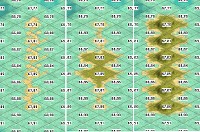
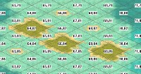
A Full Earth Map, With Areas "Resized" To Maximize Game Play

...
Briefly recapping:
  • Change the ratios of and areas to reflect (global power) global history, without letting 90% go unused.
  • My solution: to resize land areas accordingly: changing land area sizes, enlarging the "important" and (literally) shrinking the others. As mentioned above (and using el mencey's 362 x 326 map as a rough referent) Europe (N-S from the northern tip of Scandinavia to all of the North African coast; and W-E from Ireland to Moscow) my approach increased Europe's size 225%, from 60 x 60 tiles to 90 x 90.
  • Major shrinking would occur, e.g., westernmost North America & all but the Caribbean coast of South America; Saharan and Sub-Saharan Africa
...
So, cutting and pasting at every, every step, I realized that I could accomplish my goals by rotating all of East Asia 90 degrees, counterclockwise, using SE Asia as a hinge.
...


... :help: ...
QFT (emphasis added)
I can make a map for you with those changes and convert it to a test biq. It's takes a while but is just a simple process.
@Ozymandias - If you would like a roughed out biq ... with the adjusted regional sizes I can do that for you ...

  1. I think the first step would be for me to match your cut & paste process with a simple outline map. It would take a couple of passes - showing you what the rough cut (in the movie sense) looks like, and using your notes about what needs further adjustments to make the next draft.
  2. Then once it looks about right the second step would be using the final version of the outline map as a guide to transform the satellite map once - blending the edges of the puzzle pieces as I go.
  3. Third step: convert the map image to a biq with Quintillus' Editor.
Can't tell if :help: is a plea for further comments and discussion or to actually make an initial version of a map / biq. I can start the work if/when you give the word.
 
I think the first step would be for me to match your cut & paste process with a simple outline map. It would take a couple of passes - showing you what the rough cut (in the movie sense) looks like, and using your notes about what needs further adjustments to make the next draft.
  1. Then once it looks about right the second step would be using the final version of the outline map as a guide to transform the satellite map once - blending the edges of the puzzle pieces as I go.
  2. Third step: convert the map image to a biq with Quintillus' Editor.
Can't tell if :help: is a plea for further comments and discussion or to actually make an initial version of a map / biq. I can start the work if/when you give the word.

:eek: ... :think: ... :dance: .. :woohoo:.... :hug:


:bowdown: ,

-:Dz
 
So, if i have the sense of it, in broad strokes -
  • Europe larger
  • Major shrinkage of Africa & South America
  • Central Asia reduced
  • Australia shrunk
  • Western North America reduced (everything west of the Mississippi?)
 
Last edited:
With all world mapping (in general, not just in Civ) there are fundamentally two opposing possibilities: either preserve areas (relative size of regions & continents) or preserve distances between points. Most map projections find some compromise between those incompatible ideals.

For present purposes we're sacrificing the accuracy of both area & distance for the sake of playability. Which actually gives us a great deal of freedom.

Since we're going to have a visually distorted map anyway it's worth taking a moment to consider using something other than the standard "North at the top, South at the bottom" style we've been indoctrinated to think of as "the world" from elementary school on.

In one of he other threads we spent a while discussing the authagraph projection.

authagraph-approximation.hypo.jpg


I think it would actually be easier (in terms of fewer pieces & edges to match up) to do the shrinking of various areas and enlarge Europe from a projection like this.

The choice is yours - I can work with any type of projection.
 
I think that any "traditional" map projection (meaning recognizable N/S E/W) would do.

Plainly, my (very) crude cut-n-paste simply (once again!) enthrones me as The Once And Future V.G.I. ( :king: ; :crazyeye: )

My basic notion:
  • ~ 362 x 326 map.
  • Overall, you can consider there basically being size increases & decreases of about 2 :1 : 0.5 (or less) - Approximations are definitely OK.
  • Truncate the southern part enough so that just (perhaps) 2 Tiles lay between the tip of South America and the southern edge of the map.
  • Truncate everything in the North from the Arctic Circle, leaving just a few exceptions (all I've really thought to accommodate is a 2 Tile or so passageway atop Scandinavia.)
  • Enlarge Europe, India, East Asia, the whole Caribbean, and as much of North America (east of the Mississippi? Appalachians) ~200 - 250% (I promised @Civinator Europe = ~90 x~90 Tiles.)
    • As long as the Caribbean is well scaled as compared to Europe, the most significant part of North America is he Eastern Seaboard, up to the entry of the St. Lawrence.
  • I rotated (maybe "tried to" is a better phrasing :) ) ALL of historically important East Asia as far, counter-clockwise, as feasible, using the the point where the eastern edge of the Himalayans meets the SE Asian jungle.
    • No warfare or much of anything else of significance has ever transpired from India to China or vice-versa.
    • The greater the rotation, the more of (game play useless) Central Eurasia is eliminated.
    • A "corridor" will thereby till exists from Europe to the Khyber Pass and on to the Pacific.
    • A significantly reduced in size SE Asia now protrudes at an angle equidistantly proportional to China/India.
  • Seriously shrink:
    • SE Asia
    • Australia
    • The Arabian Peninsula, and as much "useless" space between there and India as possible.)
    • South America from as far south from the Caribbean as is feasible.
    • Greenland
    • Alaska (just to reserve the Aleutians as a "mini-conduit" across the Bering Sea.
    • All of Africa from the Mediterranean Coast southward:
      • Perhaps "elongate" the eastern coast of Africa.
To compensate for any distortions which might otherwise effect game play, I had planned to use much "blocking terrain" -
  • Impassable Mountains (Himalayas; Andes; Rockies; etc., with single Hill Tile to Hill Tile passageways for e.g. (again) the Khyber Pass.
  • Two types of Desert, with the second using "repurposed" Marsh Tiles:
    • One type is passable (the North Coast of Africa); the other is not.
  • Impassable Jungles.
  • As there is no such biome as a Civ 3 "Plain," utilize those in any logically passable, remaining areas, with a high MF (4?), no Cities, etc.
  • Use Quint's editor to make the entirety of the Western European coast, down and just around the tip of Africa Ocean Tiles.
    • Ditto all of South America south of the Caribe.
    • Likewise perhaps around SE Asia.
  • Coast Tiles should remain:
    • Throughout the Med and Caribe.
    • The East Coast of North America.
    • English Channel.
    • A "Great Semi-Circle" from somewhere around Madagascar and continuing around the Indian coastline ...
... And then, on the 7th Day, we rest :)

- Oh, and -

:thanx: :worship: :dance:


:D
 
Keep in mind that impassable flag does not prevent pollution from spreading onto that tile. Flintlock did add this to his exe fixes to-do list, but until then the only options are to either remove all things that cause pollution (nukes, volcanoes, "causes pollution" building flags), or to make it virtually impassible. I did the latter in my mod by making it impassible to wheeled, nothing can be built on it, and it is barren of any foods, shields, and commerce bonuses so the AI doesn't try to build on it.

Also India and China have at times gone to war. Four since its independence. There is currently conflict in the Himalayas with shelling and skirmishes. There was a melee battle where around 20 Indians were killed and unconfirmed reports of 40 Chinese. This is part of the current powder keg between India, China, and Pakistan. All three nations are fighting each other in undeclared wars over various regions on their borders.
 
Last edited:
This is the outline map i'll be starting from. The next step will be to mark in red the borders between the "chunks" ( I like that better than "puzzle pieces"). Optimal workflow - for me - will be to:
  1. resize and move around the various chunks individually without worrying about connecting them up.
  2. Once sizes and positions look good I will use the revised outline map to create a geophysical or satellite imagery version of each chunk individually. (much easier to scale and transform each chunk
  3. Smooth out connections between the resulting terrain. For example, smoothing out where the Himalayas & the mountainous regions of southern China and northern Mainland Southeast Asia intersect.
  4. Fill in the connections where the chunks don't already connect. A lot of this will be coastlines.
  5. convert that to the bmp needed for processing by Q-Editor. (this is the stage where the proportions get adjusted to match how many tiles you want the biq to be)

I'll be posting a lot of map images as we go, so that we can discuss adjustments to make throughout each phase of the process. Sort of like working through several rough drafts of a text document.

Z3tuEl.png
 
Last edited:
Keep in mind that impassable flag does not prevent pollution from spreading onto that tile. Flintlock did add this to his exe fixes to-do list, but until then the only options are to either remove all things that cause pollution (nukes, volcanoes, "causes pollution" building flags), or to make it virtually impassible. I did the latter in my mod by making it impassible to wheeled, nothing can be built on it, and it is barren of any foods, shields, and commerce bonuses so the AI doesn't try to build on it.

Also India and China have at times gone to war. Four since its independence. There is currently conflict in the Himalayas with shelling and skirmishes. There was a melee battle where around 20 Indians were killed and unconfirmed reports of 40 Chinese. This is part of the current powder keg between India, China, and Pakistan. All three nations are fighting each other in undeclared wars over various regions on their borders.

Thank you very much for the info about pollution :hatsoff:which I'd entirely forgotten about.

As for the wars - The Sino-Vietnamese all-out war in 1979 was a quick and thorough disaster for the Chinese, and, at most Civ scales and maps, would most likely be best represented by a single, accordingly disastrous attack by the Chinese into a single Jungle tile. (To this day, I remain astonished at the Chinese - arrogance? - at not taking into account how battle hardened the once-NVA army remained. As an aside - and in consideration with many other factors - it's one reason why I believe that the Chinese military is, today, a paper tiger. Encroachment on reefs is one thing; taking on the USN and USAF is a different matter altogether.)

Re: India: both the 1963 war and the various border skirmishes have all taken place, without either battlefield or strategic airstrikes, in the Himalayas. Again given typical Civ maps, the first might take place in 2 or at most 3 Mountain tiles, without any real effect.

Cheerio!
-:)z
 
This is the outline map i'll be starting from. The next step will be to mark in red the borders between the "chunks" ( I like that better than "puzzle pieces"). Optimal workflow - for me - will be to:
  1. resize and move around the various chunks individually without worrying about connecting them up.
  2. Once sizes and positions look good I will use the revised outline map to create a geophysical or satellite imagery version of each chunk individually. (much easier to scale and transform each chunk
  3. Smooth out connections between the resulting terrain. For example, smoothing out where the Himalayas & the mountainous regions of southern China and northern Mainland Southeast Asia intersect.
  4. Fill in the connections where the chunks don't already connect. A lot of this will be coastlines.
  5. convert that to the bmp needed for processing by Q-Editor. (this is the stage where the proportions get adjusted to match how many tiles you want the biq to be)

I'll be posting a lot of map images as we go, so that we can discuss adjustments to make throughout each phase of the process. Sort of like working through several rough drafts of a text document.

I know I'm repeating myself (for 15 years or so :D) but you are, as ever, a Gentleman & a Scholar.

I simply cannot thank you enough!
 
you're very welcome Ozy. As you know, I love map making.

Without getting into too much technical jargon, the map I posted & will be using here is just for very approximate relative sizes. When it comes to making the real map I'll be using a different type of map. It's one that's a bit more esoteric for the uninitiated (odd orientation, etc. etc.). It's advantage is that it will allow me to adapt each chunk of the world based on something closer to it's actual size on the globe. That way when I do things like resize Africa i'm not distorting a distortion of a distortion. Will give the result of the resizing, bending & blending a bit more verisimilitude.

By the time it's all boiled down to a biq all of that stuff will be behind the curtain. I'm simply explaining it ahead of time so that it won't be a surprise if regional shapes suddenly look different when we get to later stages. The fundamentals - relative size, adjusted proportions etc, will be the same. Just some changes in detail that will - hopefully - make it more Saville Row than Monkey Wards.
 
My two cents on India v. China v. Indochina v. Himalayan kingdoms:

All of that has been going on since at least as far back as Alexander of Macedonia. Mauryan & other South Asian dynasties extending territory both East & West, various Chinese dynasties at war with the Indianized states of SE Asia, Tibetan Empire ( Medieval era timeframe iirc) extending out into what centuries later became Western China as we knew it in the 19th & early 20th centuries. Etc. etc. Not to mention the Great Game proxy wars ...

Long story short - it may only be a tile or two over the last 50 years or so, but taking the long view it's something more comparable to how the frontiers between France & Germany have shifted over all the centuries since Charlemagne. Or maybe we should go back to Gauls & others of their ilk during the Roman Empire, or ...

None the less, when we're talking about a scenario for a game limited to 31 civs at most, on a map scale where a single tile may be equivalent to hundreds of miles, and tune for playability, it's going to be impossible to accurately reproduce the scale & scope every ongoing clash everywhere across the globe.

I can't wait to see how much nit-picking happens when areas on the biq have odd sizes and shapes. Preventing naval movement via counterfactual ocean straits trumps accurate geography. As does providing playable islands.

Another one of my long winded explanations ...
Spoiler :

This is exactly the problem I mentioned above. A tile is like a single pixel: I can control the color/terrain but not the size or shape. Imagine that you want to draw a map with a pixel 120 miles across, and 60 miles top to bottom. Luzon, as islands go, is a fairly simple shape: It's basically a rectangle: at its widest is one pixel wide and 6 pixels top to bottom. But our pixels aren't in a stacked one on top of the next grid like a piece of graph paper. This is what 1 pixel east-west by 6 north-south looks like where Luzon falls on our map:

See how different plains, grassland, and hills look if all I do is click six times. I can't control how wide or narrow Civ stamps a particular terrain, and it stamps different grid coordinates differently: here are various examples of single tile island, all grassland:

I can plump up Luzon by making it 2 pixel/tiles wide in places, by changing the orientation of the island or its geographic location by over a hundred miles, by distorting the kind of terrain present, etc. Noone can spread terrain across half a tile on either side of a line, anymore than that can be done with a color across half of two adjacent pixels. Now take a look at a map of the Philippines and compare the shape of Mindanao to Luzon.

You raise a valid point, but the question moves from one of mapping to one of scenario design and game play: how do I distort the location, shape, surface area, and terrain to balance realistic mapping versus playability. The game doesn't care what Japan looks like to us. On our map right now Japan has 37 land tiles. When I change the Philippines (29 tiles at the moment) I change its strength relative to Japan as a tribal base for production and growth. Now add in differences in terrain and resources. It gets a lot more complex than "Luzon and Mindanao in the Philippines seem a bit anemic".
 
KDLsbB.png


A few questions to help me decide where the whole gets sliced into chunks. Only looking for in-the-ballpark answers at this point. NB: the red lines are not at all where the actual chunks will be separated - they're simply an aid to discussion about these questions.

1. A. Roughly where do you want the eastern frontier of enlarged Europe to be? My guess is it could be anywhere between a frontier that's roughly Finland-Black Sea as the lesser end of possible landmass to using the Urals as the frontier at the larger end of potential landmass.
1. B. For present purposes is Anatolia part of Europe?

2. Do you want a sea passage all the way across the northern coast of Asia? If not it makes it much easier to fiddle around with Central Asia. It will let me do a fair amount of North-South compression in addition to the expected East-West.

3. Where is the frontier between ...

Pause for a jargon question. It gets sort of cumbersome talking about yaddayadda-Asia vs yadda-yadda Asia. I'd like to suggest some alternate vocabulary. Strictly for purposes of dealing with the chunks while designing the map, nothing at all to do with any aspect of the Civ scenario itself. Some of this we've already been doing - for example referring to the South Asian subcontinent as India. Some of my proposed list is based on how areas are referred to in geology/physical geography, some are simply terms of convenience.

Proposed Names for Whole Chunks
strictly for map-making, not for the actual scenario
  • Europe
  • Africa (including the Arabian Peninsula)
  • India (probably includes everything from the Iranian Range on the West to Nagaland & the ranges it shares with Burma as the frontier on the east. Incorporates Himalayas to the North)
  • Steppes ( the vast Central Asian area to be greatly scaled down, including portions of the Pacific coast of Asia)
  • China (understood to include Korea, Japan & the rest of the East Asian chunk)
  • Sunda ( Sundaland is a geological/geographical term for more or less Indochina & the Malay Peninsula through all the island chains until what's considered Australia)
  • Australia (including New Zealand)
  • Alaska (including part of Canada)
  • Greenland (and perhaps some adjacent coasts of Canada)
  • N America (excluding Alaska & Greenland)
  • Caribbean (including regions along the coasts of the Gulf of Mexico, the Tehuantepec Isthmus & Yucatan Penninsula through to the Pacific Ocean)
  • S America
If those appellations are acceptable it will save a whole lot of typing. i'll use them for the rest of this post so you can get a feel for how well they work (or not).

Meanwhile, back to the geographic questions ...

3. Where is the frontier between China & Steppes? I'd assume that China includes at least the southern part of Manchuria. It would also make sense to divide them just north of Hokkaido so that Sakhalin is part of Steppes.

4. In addition to reducing Sunda overall, would you like me to shrink Borneo & New Guinea even more ?

5. A. The Big Island will probably need to be grossly out of scale. Wouldn't make sense to put Pearl Harbor directly on top of a volcano. ;)
5. B. Which raises the question of what other islands across the world will be important enough to the scenario to include. Galapagos? Rapa Nui? Canaries? Diego Garcia? Midway? Maldives? Caribbean other than Cuba, Jamaica & Hispaniola? Samoa? Tahiti? those are just the ones that come immediately to mind to ask about.

6. Geologically & ecologically Alaska might be considered to extend down through British Columbia and as far East as the Canadian Rockies. Where to bound it is related to question 7 ...

7. Should the northern reaches of N America be shrunk along with Alaska & Greenland? And - as with Steppes - should there be a seaway along the north?

8. Should the whole peninsula of Florida be slightly reduced compared to the eastern seaboard of N America? I'm wondering how many tiles of everglades & swamp the scenario really needs.
 
Last edited:
My apologies if any of those were covered in previous posts. The way my brain works thinking about the chunks is almost completely different from thinking about real world geographic boundaries.

I'll have a few specific questions once answers to those broad ones are worked out.
 
First off, I "go away" for a few days, and see what @Blue Monkey has been up to :thumbsup:

Given how (genuinely) painful it was, for me to attempt even the simplest of gfx, I return to my own provenance: Words.

First off, I'm wondering if I should amend the first post, with something along the lines of:

Purpose:

To provide a Global Civ 3 map, emphasizing where civilizations either did, or might plausibly have grown to, a global reach. Given the limits of Civ 3's ability to replicate history (“The Aztecs are going to Alpha Centauri!”) I'm defining these are areas in 500 BCE (which, I believe is when the game should start, anyway) where a Civ can/grow to a minimum of 300 tiles, on a 362 x 326 map. (300 tiles would have been Babylon, at its largest extent, on a map that size.)

Specifically, the goals are to make Europe, the Indian subcontinent, East Asia, and the Caribbean, each up to about 200% larger; also with all of North America east of the Mississippi being enlarged as is feasible. To accomplish this, we'll use a “standard” type of map, an example of which Blue Monkey has provided. Plainly, making some parts of the world proportionally larger means making others smaller. Quite a few “visual distortions” will need to be made (see my list, below) with each and every change made with the intention of improving game play.

I'm going to posit a, "Nomenclature Addenda" (geez, now I feel like a desperate nitwit with a PhD :crazyeye: ) My suggested changes here are bold -
  • Europe
  • Africa (excluding the Arabian Peninsula - which is largely desert, and should probably be as "minimized" as much as possible.)
  • India (probably includes everything from the Iranian Range on the West to Nagaland & the ranges it shares with Burma as the frontier on the east. Incorporates Himalayas to the North)
  • Steppes (the vast Central Asian area to be greatly scaled down, including portions of the Pacific coast of Asia)
  • China (understood to include Korea, Japan & the rest of the East Asian chunk)
  • Sunda (Sundaland is a geological/geographical term for more or less Indochina & the Malay Peninsula through all the island chains until what's considered Australia)
  • Australia (including New Zealand)
  • Alaska (including part of Canada) - (see below)
  • Greenland (and perhaps some adjacent coasts of Canada) - (see below)
  • N America (excluding Alaska & Greenland)
  • Caribbean (including regions along the coasts of the Gulf of Mexico, the Tehuantepec Isthmus & Yucatan Peninsula through to the Pacific Ocean)
  • S America (South of the Caribe)

Now, about those distortions:

A quick spin of a Globe readily reveals that half of a “truly proportional” map would be taken up by the Pacific. Another quick glance will reveal that the middle half or so of the middle of the Eurasian super-continent is, essentially, wasteland. Ditto the Sahara, Australian Outback, and Gobi deserts, etc. Likewise the Himalayas and Andes. Then the all but impenetrable jungles of South America, Africa, and much of SE Asia and Indonesia. And then there is all the tundra and ice in the Arctic; so (to begin with) all land mass north of the Arctic Circle is eliminated, with a, “cartographic manipulation” made to allow navigation across the northern tip of the Scandinavian peninsula.

Next up are the “realistically” playable parts of the Earth, which will be "resized" as equally proportional as possible, areas:
• Europe and the Mediterranean, defined as:
• East - West = Ireland - Moscow
• North - South = Scandinavian Peninsula to the entirety of historically built upon, or battled upon, North African coast.
• The entirety of the Caribbean.
• The Indian sub-continent.
• All of historically significant East Asia is “tilted” (“realigned,”) counter-clockwise approximately 45 degrees, with its “hinge” being roughly where the eastern Himalayas meet the tropical rain forest (“Jungle”) of SE Asia.
• North America, from the Mississippi to the Atlantic, and from Florida (which, itself, will certainly be “minimized”) north to about Boston (I’m certain that my Master Cartographer partner will have much improved ideas.)

Changes will be made to both accommodate differences in both scale and area size. Changes will also be made via Tile attributes, hopefully benefitting both play and historicity (no Greek galley ever passed the Strait Of Gibraltar - and neither did any other Euro-Mediterranean Civ until the 15th Century.)

Drastic “miniaturizing” will be used where (1) no Civ either passed, or reasonably passed the, “Babylon Test,” and, (2) has never been part of a major campaign, in any war, although - admittedly - Blue Monkey might have a magic wand or to apply here. This can be applied to:
• Anywhere north of the Great Lakes in North America.
• All of South America, south of the Caribbean coastline.
• All of sub-Saharan Africa.
• Much of the Indonesian Archipelago.
• Australia.

To address scale and historical accuracy, changes will be made to Coast, Sea, an Ocean tiles:
• Suggested changes for MFs in water would be [Coast = 1] [Sea = 2] and [Ocean = 4] Also keep in mind that Check Boxes can readily be used to change, “Sinks in,” etc.
• Using Quintillus’ editor, Ocean tiles will be placed directly adjacent to land tiles:
• Along the entirety of the West African Coast.
• Along the entirety of the western coast of North America.
• Along the entirety of the both coasts of South America, south of the Caribbean.​

On land, we will have:
• A new type of Dessert Tile - “Deep Dessert” - which will be Impassable, thereby allowing all of the warfare which did and/or could have taken place on Africa’s Mediterranean coast - and not into the greater Sahara, itself
• Along with “regular” Jungle tiles, there will also be a second type of Jungle tile, “Impassable Jungle” (real name TBD) will also become, “blocking terrain.”
• “Regular Jungle” tiles will allow access to Resources perhaps two tiles inland (which, I believe, will allow a more realistic approach to European style 18th/19th Century style Colonialism.)
• Mountains will be Impassable.
• As there is no biome called a, “Plains,” there will now be two types:
• Impassable “Wasteland,” mostly for “filling in” otherwise undesired most of the remaining tiles of northern, central Eurasia.
• “Plains” with a high MF, in this case, forming a three or four tile wide “corridor,” linking Europe and East Asia, thereby allowing (for example) a Silk Road; a Trans-Siberian RR, and the Khyber Pass.

... And, now, I think I’ll hand this back over to Blue Monkey, once again.

P.S. Having just had another look, I realized I'd missed the Pacific! I would suggest that any island which could hold a major sea/air/land force at a WW2 tech level - Hawaii; Okinawa - should be included.
 
Last edited:
Using Quintillus’ editor, Ocean tiles will be placed directly adjacent to land tiles

As far as I remember, the 'Deepwater harbor function' in the Quintillus editor allows the placement of sea tiles (not ocean tiles) next to land tiles.

On land, we will have:
• A new type of Dessert Tile - “Deep Dessert” - which will be Impassable, thereby allowing all of the warfare which did and/or could have taken place on Africa’s Mediterranean coast - and not into the greater Sahara, itself
• Along with “regular” Jungle tiles, there will also be a second type of Jungle tile, “Impassable Jungle” (real name TBD) will also become, “blocking terrain.”

This is somewhat funny, as such a setting is working very well for about ten years in the SOE map. In SOE it is called 'border terrain' mainly for blocking Germany and Russia before June 1941, using former jungle terrain with its green base terrain (and marked with watching towers) and floodplain terrain as 'special desert terrain' for separating forces in the desert (also marked with watching towers). In SOE, both terrains are only impassable for units with the wheeled flag.

Borderterrain.jpg


Special desert.jpg


“Regular Jungle” tiles will allow access to Resources perhaps two tiles inland (which, I believe, will allow a more realistic approach to European style 18th/19th Century style Colonialism.)

May be here a setting as it was done in the Giant Earth Map with the tropical forest can be helpful.

Mountains will be Impassable. “Plains” with a high MF, in this case, forming a three or four tile wide “corridor,” linking Europe and East Asia, thereby allowing (for example) a Silk Road; a Trans-Siberian RR, and the Khyber Pass.

Many years ago I made a post using volcano terrain for these passes in the mountains with transformed graphics from volcano eruptions to devastating thunderstorms in the mountains.
 
Last edited:
As far as I remember, the 'Deepwater harbor function' in the Quintillus editor allows the placement of sea tiles (not ocean tiles) next to land tiles.

On the one hand: *SIGH*. On the other, having a more significant differentiation between Ocean and Sea might prove helpful :think:

This is somewhat funny, as such a setting is working very well for about ten years in the SOE map. In SOE it is called 'border terrain' mainly for blocking Germany and Russia before June 1941, using former jungle terrain with its green base terrain (and marked with watching towers) and floodplain terrain as 'special desert terrain' for separating forces in the desert (also marked with watching towers). In SOE, both terrains are only impassable for units with the wheeled flag.

Oddly, I seem to recall mentioning something about SOE - perhaps regarding Europe's size - earlier on ... :D

Many years ago I made a post using volcano terrain for these passes in the mountains with transformed graphics from volcano eruptions to devastating thunderstorms in the mountains.

:thumbsup:
 
On land, we will have:
• A new type of Dessert Tile - “Deep Dessert” - which will be Impassable, thereby allowing all of the warfare which did and/or could have taken place on Africa’s Mediterranean coast - and not into the greater Sahara, itself
• Along with “regular” Jungle tiles, there will also be a second type of Jungle tile, “Impassable Jungle” (real name TBD) will also become, “blocking terrain.”
• “Regular Jungle” tiles will allow access to Resources perhaps two tiles inland (which, I believe, will allow a more realistic approach to European style 18th/19th Century style Colonialism.)
• Mountains will be Impassable.
• As there is no biome called a, “Plains,” there will now be two types:
• Impassable “Wasteland,” mostly for “filling in” otherwise undesired most of the remaining tiles of northern, central Eurasia.
• “Plains” with a high MF, in this case, forming a three or four tile wide “corridor,” linking Europe and East Asia, thereby allowing (for example) a Silk Road; a Trans-Siberian RR, and the Khyber Pass.
In SOE it is called 'border terrain' mainly for blocking Germany and Russia before June 1941, using former jungle terrain with its green base terrain (and marked with watching towers) and floodplain terrain as 'special desert terrain' for separating forces in the desert (also marked with watching towers). In SOE, both terrains are only impassable for units with the wheeled flag

I'm glad to see both these posts here. The general topic of terrain utilization came up during a long phone conversation between Ozy & myself, including reference to Civinator's work.

Many years ago I made a post using volcano terrain for these passes in the mountains with transformed graphics from volcano eruptions to devastating thunderstorms in the mountains.
:thumbsup: Having mountain storms is a creative alternative to volcanic eruptions.

Combining Civinator's "blizzard-spawning" impassable mountains with my concept of using LM Hills for passes would create a way to further inhibit movement through high ranges. The volcano terrain could be impassable (like the regular mountains) yet adjacent to passes with nearly identical graphics. There would even an opportunity to add in elements of the "nature civ" discussed in many places across the C & C forum. Brainstorming here - blizzards (paratroops) landing on passes units are attempting to navigate. Or stationary avalanche / storm units that are pre-placed & hidden (analogous to the guerrillas in some scenarios) until encountered.

Having to deal with severe inclement weather and other natural events has been an important factor in many military campaigns - "General Mud & General Winter" is the Russian phrase iirc.

P.S. Having just had another look, I realized I'd missed the Pacific! I would suggest that any island which could hold a major sea/air/land force at a WW2 tech level - Hawaii; Okinawa - should be included.
Those can be added in later - after the basic map is established. The question cropped up when thinking about resizing. It's worth posting now so that all of us can be thinking about specific locations worth adding.
 
Back
Top Bottom