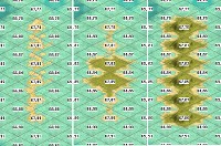
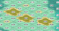
First off, I "go away" for a few days, and see what
@Blue Monkey has been up to

Given how (genuinely) painful it was, for me to attempt even the simplest of gfx, I return to my own provenance: Words.
First off, I'm wondering if I should amend the first post, with something along the lines of:
Purpose:
To provide a Global Civ 3 map, emphasizing where civilizations either did, or might plausibly have grown to, a global reach. Given the limits of Civ 3's ability to replicate history (“The Aztecs are going to Alpha Centauri!”) I'm defining these are areas in 500 BCE (which, I believe is when the game should start, anyway) where a Civ can/grow to a minimum of 300 tiles, on a 362 x 326 map. (300 tiles would have been Babylon, at its largest extent, on a map that size.)
Specifically, the goals are to make Europe, the Indian subcontinent, East Asia, and the Caribbean, each up to about 200% larger; also with all of North America east of the Mississippi being enlarged as is feasible. To accomplish this, we'll use a “standard” type of map, an example of which Blue Monkey has provided. Plainly, making some parts of the world proportionally larger means making others smaller. Quite a few “visual distortions” will need to be made (see my list, below) with each and every change made with the intention of improving game play.
I'm going to posit a, "Nomenclature Addenda" (geez, now I feel like a desperate nitwit with a PhD

) My suggested changes here are
bold -
- Europe
- Africa (excluding the Arabian Peninsula - which is largely desert, and should probably be as "minimized" as much as possible.)
- India (probably includes everything from the Iranian Range on the West to Nagaland & the ranges it shares with Burma as the frontier on the east. Incorporates Himalayas to the North)
- Steppes (the vast Central Asian area to be greatly scaled down, including portions of the Pacific coast of Asia)
- China (understood to include Korea, Japan & the rest of the East Asian chunk)
- Sunda (Sundaland is a geological/geographical term for more or less Indochina & the Malay Peninsula through all the island chains until what's considered Australia)
- Australia (including New Zealand)
- Alaska (including part of Canada) - (see below)
- Greenland (and perhaps some adjacent coasts of Canada) - (see below)
- N America (excluding Alaska & Greenland)
- Caribbean (including regions along the coasts of the Gulf of Mexico, the Tehuantepec Isthmus & Yucatan Peninsula through to the Pacific Ocean)
- S America (South of the Caribe)
Now, about those distortions:
A quick spin of a Globe readily reveals that half of a “truly proportional” map would be taken up by the Pacific. Another quick glance will reveal that the middle half or so of the middle of the Eurasian super-continent is, essentially, wasteland. Ditto the Sahara, Australian Outback, and Gobi deserts, etc. Likewise the Himalayas and Andes. Then the all but impenetrable jungles of South America, Africa, and much of SE Asia and Indonesia. And then there is all the tundra and ice in the Arctic; so (to begin with) all land mass north of the Arctic Circle is eliminated, with a, “cartographic manipulation” made to allow navigation across the northern tip of the Scandinavian peninsula.
Next up are the “realistically” playable parts of the Earth, which will be "resized" as equally proportional as possible, areas:
• Europe and the Mediterranean, defined as:
• East - West = Ireland - Moscow
• North - South = Scandinavian Peninsula to the entirety of historically built upon, or battled upon, North African coast.
• The entirety of the Caribbean.
• The Indian sub-continent.
• All of historically significant East Asia is “tilted” (“realigned,”) counter-clockwise approximately 45 degrees, with its “hinge” being roughly where the eastern Himalayas meet the tropical rain forest (“Jungle”) of SE Asia.
• North America, from the Mississippi to the Atlantic, and from Florida (which, itself, will certainly be “minimized”) north to about Boston (I’m certain that my Master Cartographer partner will have much improved ideas.)
Changes will be made to both accommodate differences in both scale and area size. Changes will also be made via Tile attributes, hopefully benefitting both play and historicity (no Greek galley ever passed the Strait Of Gibraltar - and neither did any other Euro-Mediterranean Civ until the 15th Century.)
Drastic “miniaturizing” will be used where (1) no Civ either passed, or reasonably passed the, “Babylon Test,” and, (2) has never been part of a major campaign, in any war, although - admittedly - Blue Monkey might have a magic wand or to apply here. This can be applied to:
• Anywhere north of the Great Lakes in North America.
• All of South America, south of the Caribbean coastline.
• All of sub-Saharan Africa.
• Much of the Indonesian Archipelago.
• Australia.
To address scale and historical accuracy, changes will be made to Coast, Sea, an Ocean tiles:
• Suggested changes for MFs in water would be [Coast = 1] [Sea = 2] and [Ocean = 4] Also keep in mind that Check Boxes can readily be used to change, “Sinks in,” etc.
• Using Quintillus’ editor, Ocean tiles will be placed directly adjacent to land tiles:
• Along the entirety of the West African Coast.
• Along the entirety of the western coast of North America.
• Along the entirety of the both coasts of South America, south of the Caribbean.
On land, we will have:
• A new type of Dessert Tile - “Deep Dessert” - which will be Impassable, thereby allowing all of the warfare which did and/or could have taken place on Africa’s Mediterranean coast - and not into the greater Sahara, itself
• Along with “regular” Jungle tiles, there will also be a second type of Jungle tile, “Impassable Jungle” (real name TBD) will also become, “blocking terrain.”
• “Regular Jungle” tiles will allow access to Resources perhaps two tiles inland (which, I believe, will allow a more realistic approach to European style 18th/19th Century style Colonialism.)
• Mountains will be Impassable.
• As there is no biome called a, “Plains,” there will now be two types:
• Impassable “Wasteland,” mostly for “filling in” otherwise undesired most of the remaining tiles of northern, central Eurasia.
• “Plains” with a high MF, in this case, forming a three or four tile wide “corridor,” linking Europe and East Asia, thereby allowing (for example) a Silk Road; a Trans-Siberian RR, and the Khyber Pass.
... And, now, I think I’ll hand this back over to Blue Monkey, once again.
P.S. Having just had another look, I realized I'd missed the Pacific! I would suggest that any island which could hold a major sea/air/land force at a WW2 tech level - Hawaii; Okinawa - should be included.
...
 is a plea for further comments and discussion or to actually make an initial version of a map / biq. I can start the work if/when you give the word.
 ...
...  ...
...  ....
.... 
 ,
, z
z

 )
) ) ALL of historically important East Asia as far, counter-clockwise, as feasible, using the the point where the eastern edge of the Himalayans meets the SE Asian jungle.


 which I'd entirely forgotten about.


