( the compliment/acknowledgement is to timerover51)
On playability - my thanks to Yoda Power (amongst others) for explaining & demonstrating the necessity of sacrificing accuracy (a little) for playability. It is worth looking for places where you can add variety to any large swathes of similar terrain such as forests. Even just single tile meadows, hills, or whatever can make for more enjoyable play as well as increase aesthetic value.
In another thread we discussed some of Chris Wayan's work.
He has made relief globes as well maps of several alternate Earths. Then extrapolated changes down to the level of alternate lines of evolution & cultural developments based on those geographies. While most of his work posits changes in axial tilt rather than differences in Ice Ages, his imaginative speculation based in science still has a lot to offer about how changes in sea level affect geography, local climates, & ecologies. Here's a brief ample from his detailed explanation of
Seapole's geography:
Yes, look at that map. The Atlantic Ocean is truncated at about 30 Degree North Latitude. Then kindly take a look at the current ocean currents patterns in the Atlantic. Now, kindly explain how you are going to get any significant warm water Gulf Stream flowing to what would be the western coast of the rotated South America. Answer, you are not. What you are going to get is a circular current flow from east to west somewhere around 30 Degree north, hitting the eastern coast of the rotated Africa, which in that portion is going to be an elevated plateau region, then swinging north with limited warm to the North Atlantic Ocean. The northern areas of rotated South America are going to be pretty cold, while the northern areas of the rotated Africa, which would include the Ethiopian Highlands, are going to be also pretty cold.
Description of South Africa from the CIA World Factbook:
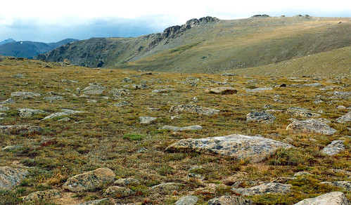
vast interior plateau rimmed by rugged hills and narrow coastal plain
Temperature drops 1 Degree Celsius or 1.8 Degree Fahrenheit for every 1,000 feet in altitude. The same thing applies to the rotated Andes Mountain Chain, most of which is at or above 30 Degree North. Some of those mountains on or near the Equator have glaciers on them, now. Put them at 30 Degrees North or higher, and you are going to have a lot more glaciers.
Now, a lot of the moisture that hits the Midwest originates in the Gulf of Mexico. With the rotation of Africa and Europe, you have no Gulf of Mexico or Caribbean Sea. Given the elevation of Africa and no good source of moisture, a lot of the eastern portion of the Rotated Africa is going to be semi-arid to arid. The nice cold current flowing down the eastern coast of rotated South America is going to have about the same effect as the cold California Current has on southern California and the Baja Peninsula, while the Andes Range is going to screen it off from any moisture coming from the limited easterly winds at about 30 Degree North.
Then there are the Coastal Range, the Sierra Nevada, and the Rockies in rotated North America blocking the easterly wind pattern south of the Equator. Real good rain shadow effects there, and all of Asia sitting out to the west with limited sources of moisture.
Have you even bothered to look at current ocean current patterns and also wind patterns? Did the author of this bother to do so?
I will not even get into the problems posed by his rotation with respect to plate tectonics, and the location of volcanic chains and deep ocean rifts. It is safe to say that there would be massive changes.
")
 ... So you name the bug then I explain?
  - But, of course, happily.
") z
z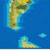

 ) The notion is to have a limited "mixture" of types of Stele/Obelisk per Civ; there will be an Era I Tech called, "Monumental Architecture" and will require the "Sea People's Obelisk" present to build the Great Lighthouse, etc.
 z
z


 ,
,