abilard
Chieftain
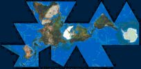
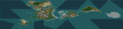
Attached is a 204 x 100 Fuller Projection map of the world.
"Many" would say that the Fuller projection gives the best proportioned representation of earth's land mass compared to any other map. This map is based on the image attached.
As you can see, there are some issues in putting a Fuller projection map into Civ3...
1) What to do with those "void spaces" (dark areas that are off map). My solution: All ocean spaces on the map were designated
as sea spaces and these void areas are made as ocean spaces with a move value of 0. So, a ship sailing from West Africa to the NW coast of S. America would sail across the adjacent sea spaces, then "warp" across the ocean spaces to the desired sea spaces point off the coast of S. America. Potential problem is, of course, that a player's ship can warp from say Morocco to Guyanna just as easily as from Morrocco to Argentina. Any suggestions around this problem are welcome!
2) To prevent improper "warping" only x-wrapping is activated. Activating y-wrapping would enable a ship to quickly sail from S. Africa to Japan while bypassing the Western hemisphere. With only x-wrapping on, the ship would have to sail around the straits of Megellan and then across the Pacific. A little closer to reality.
I have also placed all 24 civs in their approximate historic locations (note- I placed the Ottomans in Central Asia).
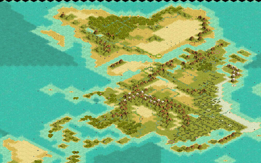
I believe my coastlines are very accurate, but my terrain features may be a bit off (especially for Antarctica since I know that it's mountainous, but I've left it as all tundra for now). Also, my resources are probably misplaced. Suggestions (or modifications) are very welcome.
If this map proves fun and playable, perhaps a larger (408 x 200) map is in the works?
http://www.civfanatics.net/uploads5/Fuller_Projection.zip
"Many" would say that the Fuller projection gives the best proportioned representation of earth's land mass compared to any other map. This map is based on the image attached.
As you can see, there are some issues in putting a Fuller projection map into Civ3...
1) What to do with those "void spaces" (dark areas that are off map). My solution: All ocean spaces on the map were designated
as sea spaces and these void areas are made as ocean spaces with a move value of 0. So, a ship sailing from West Africa to the NW coast of S. America would sail across the adjacent sea spaces, then "warp" across the ocean spaces to the desired sea spaces point off the coast of S. America. Potential problem is, of course, that a player's ship can warp from say Morocco to Guyanna just as easily as from Morrocco to Argentina. Any suggestions around this problem are welcome!
2) To prevent improper "warping" only x-wrapping is activated. Activating y-wrapping would enable a ship to quickly sail from S. Africa to Japan while bypassing the Western hemisphere. With only x-wrapping on, the ship would have to sail around the straits of Megellan and then across the Pacific. A little closer to reality.
I have also placed all 24 civs in their approximate historic locations (note- I placed the Ottomans in Central Asia).
I believe my coastlines are very accurate, but my terrain features may be a bit off (especially for Antarctica since I know that it's mountainous, but I've left it as all tundra for now). Also, my resources are probably misplaced. Suggestions (or modifications) are very welcome.
If this map proves fun and playable, perhaps a larger (408 x 200) map is in the works?
http://www.civfanatics.net/uploads5/Fuller_Projection.zip
 I'll take a look soon as possible.
 I spent some time last night fixing the download problem in taltho's globe world, check it out let me know. Thank's man!
")
