Fuller Projection

abilard

Chieftain
Joined
Jun 19, 2003
Messages
69
Location
Lost in America
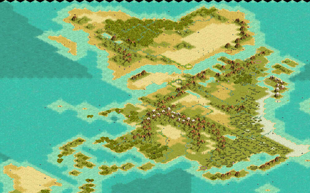
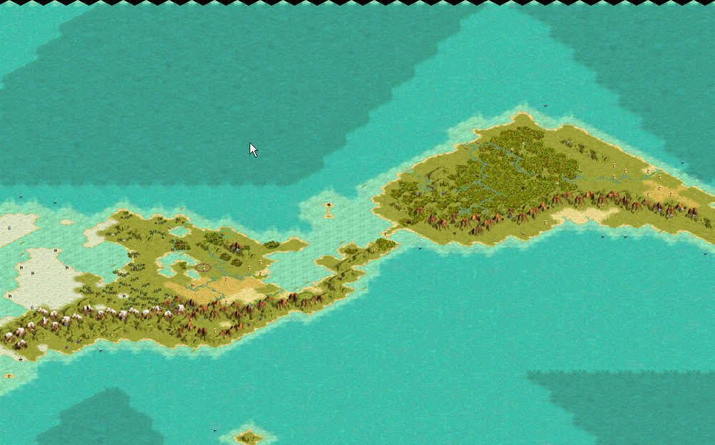
Attached is a 204 x 100 Fuller Projection map of the world.

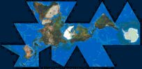
"Many" would say that the Fuller projection gives the best proportioned representation of earth's land mass compared to any other map. This map is based on the image attached.

As you can see, there are some issues in putting a Fuller projection map into Civ3...

1) What to do with those "void spaces" (dark areas that are off map). My solution: All ocean spaces on the map were designated
as sea spaces and these void areas are made as ocean spaces with a move value of 0. So, a ship sailing from West Africa to the NW coast of S. America would sail across the adjacent sea spaces, then "warp" across the ocean spaces to the desired sea spaces point off the coast of S. America. Potential problem is, of course, that a player's ship can warp from say Morocco to Guyanna just as easily as from Morrocco to Argentina. Any suggestions around this problem are welcome!

2) To prevent improper "warping" only x-wrapping is activated. Activating y-wrapping would enable a ship to quickly sail from S. Africa to Japan while bypassing the Western hemisphere. With only x-wrapping on, the ship would have to sail around the straits of Megellan and then across the Pacific. A little closer to reality.

I have also placed all 24 civs in their approximate historic locations (note- I placed the Ottomans in Central Asia).

I believe my coastlines are very accurate, but my terrain features may be a bit off (especially for Antarctica since I know that it's mountainous, but I've left it as all tundra for now). Also, my resources are probably misplaced. Suggestions (or modifications) are very welcome.

If this map proves fun and playable, perhaps a larger (408 x 200) map is in the works?


http://www.civfanatics.net/uploads5/Fuller_Projection.zip
FP2.jpg
 
I think you need an impassable terain type abiliard!
 
Great comment... 2 questions.

1) Where? I'm assuming you're talking about the top and bottom edge of the map. The spaces along the fold definitely need to be passable to some degree. Even more so, they need to be "ultra passable"- 0 move value. Otherwise you could never sail across the Atlantic or Pacific... you could only hug the coasts.

2) How? Looking at the editor, it appears that you can only change existing terrain types and not add any new types. Do you know how to add new types of terrain? If so that would really help!

Oh, and one comment... isn't it 3AM in Alsaka right now?
 
Right now it's 11:15, last night it, or earlyr this morning it was 2:30 am, and I had just got off work.

well I was thinking this morning when I woke, another possability is that you could make the ocean, as narow path's, say going from south amarica to africa, use it like a belt route useing only connecting paths, in x and y wrapping you could probibly keep most of the paths from crossing by looping around.

So I see y'a did like the idea of squashing the map hu.
 
Not sure I understand what you mean by paths and the x/y wrapping. Guess my brain's groggy. Perhaps you could demonstrate it? Modify the map? Maybe I'll "see the light" then.

Working nights? It looks like we actually work about the same hours then. (since it appears that I'm 10 hours ahead of you.)
 
I'll see what I can come up with to help make this more realistic. :mutant:

just downloaded it now. :scan: I'll take a look soon as possible.

taltho's globe World should download properly now, check it out.
 
Ok I'v had a small chance to look over this map abiliard.
what I noticed first is in the north American continent the baha california is not there.:(
Also I think you could faten the continent's up, ie make them wider, use room from top and bottom more land coverage makes for a better game with the option of more civs ext.

:D I spent some time last night fixing the download problem in taltho's globe world, check it out let me know. Thank's man! :cool:
 
Glad you noticed that... I always forget Baha. I'll fix and repost soon.

About fattening up the continents, you are absolutely right that it would give more room for more civs (and more mayhem, hee hee!); HOWEVER, that would ruin the accuracy (my map isn't perfect, but the shape and proportions of the continents are very very very very very very accurate) of the map.

I was planning to make a bigger Fuller Projection map (2x bigger) is this one goes over well. That's probably the best way to make more room for more civs.
:)
 
oops i posted my idea for how to make the map truly real, creating zero move cost pathways that connect the triangles to their correct partner, to have the most room for this i think that the map needs to be made at a diagonal across the map screen. this will provide plenty of path room to connect everything up, and sew that pesky taurus into a globe.

If there is plenty of room to create these magic pathways, the map could actually have all wrapping turned off, but that wouldn't be as much fun.

Wouldn't it be cool if the newest version had inverted y wrapping, crating a true globe, where you move past the north pole, and come down on the opposite side of the globe?

Try visualizing inverted X and Y wrapping, where nothing takes you to the oposite side, but instead a corrolating point on that same side. I'm having a hard time wrapping my brain around that one.

chizzy
 
"Funky wrapping" connecting points along the same edge... that's EXACTLY what's needed. That would open up a whole world (knuk knuk) of possibilities in terms of reprenting a true globe.
 
Hay I had some things done for this map....but my blasted computer killed it :die: without thought or consideration.
I think my prossecor is bad.:mad: :mad: :mad: triple mad.
but it looks like y'a got it figurd out. I was going to play this map but now I have to wate.
 
:( Sorry about your machine. Sometimes computers just completely suck (but civ really wouldn't be the same without them now, would it?)

In terms of having it all figured out, I only have it figured out in theory. Anyone out there know how to make a unit wrap from one point along a map edge to another point on the same edge?
 
I just had a great question in another thread that I'd like to adress here...

Steph: "How Colombus can go frm Cap Verde Islands to America on your map?

I maintain that using a real distance world mai is not possibleb with civ II engine. Only regional map (Europe only for instnce) could be "distance correct""

Great point. To get "around" this I've assigned all ocean squares as sea squares with a normal move value and made all of the "blank space" on a Fuller map ocean tiles with a 0 move value.

So, on this map, for Columbus to sail from N. Africa to the Carribean, he would sail from N. Africa (let's say tile 86,14) to the nearest ocean squares (let's say tile 96,24). Next he would go across the ocean tiles which have no move value (since these really aren't ocean, but off the map tiles) to any other bordering sea tile in the Carribean (e.g.- 129,37). The one big problem with this work around is that Columbus could just as quickly emerge off the coast of Greenland as he could off the coast of Venezuela.

Please feel free to toy with this map if you have any ideas on how to "make it work".
 
Well, it's rather easy (I hope). You need to make the map bigger, to leave "empty squares" on the border.

Then, you will use your 0 move Ocean squares (nice trick by the way) to create "ocean lane" between some parts (like western African coast and eastern South America), but then you will separate these lanes with impassable terrain.
 
Great idea about sea lanes. I guess I could "map out" all possible sea lanes and separate with impassable terrain as you suggest.

A larger Fuller map would also be nicer I agree. So much fun to have and so little time:)
 
The problem with sea lanes, something I tried to work out with one of your fuller maps is that you still have land based bombers that can't reach targets they should be able to reach. the most ineresting implementation of this true round earth idea has been a map actually twisted to create a polar projection. It works in it's own unique way, partly because all wrapping is then turned off. If you created open free movement spaces around the edges to elliminate the the filled in gaps from tearing the earth apart, you could still do it as a total wrap. All the corners are the south pole, while the center of the map is the north pole. I think this method holds the most promise for producing not only an accurate but true to form map.

Chizzy
 
Great idea, but wouldn't you also have the same bomber issue with the gap / zero move spaces in a polar projection (by the way, I hadn't thought of the bomber problem... good thinking)?

Have you (or has anyone) made a polr projection map yet? Would be great to see.
 
Back
Top Bottom