YossarianLives
Deity
Current Map Overview (Turn 54)
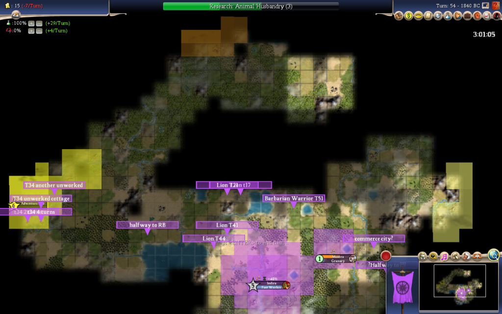
Its probably a good idea to keep all our thoughts on the map in one thread for easier reference. Im going to put a lot of links and quotes in this thread about our map and map speculation in general.
So heres the most important quote; Plakos stated Map Settings.
Here are some maps Plako has done in the past:
This is what we had said before about our assumed layout:
I'm not sure that's correct anymore, but I don't really have any better ideas right now. One thing we need to strongly consider is that we are on a continent and there are not necessarily land connections through all the wraps, but maybe we can sail south from a city in the tundra to get to the top row of cities.
...
And to finish off, Im going to quote some long posts about possible map layouts from RBs PB 4 game. Lord Parkin and Irgy did some pretty intensive map speculation in that thread, starting with Post #48:
Through Post #63:
With some pretty pictures in between:
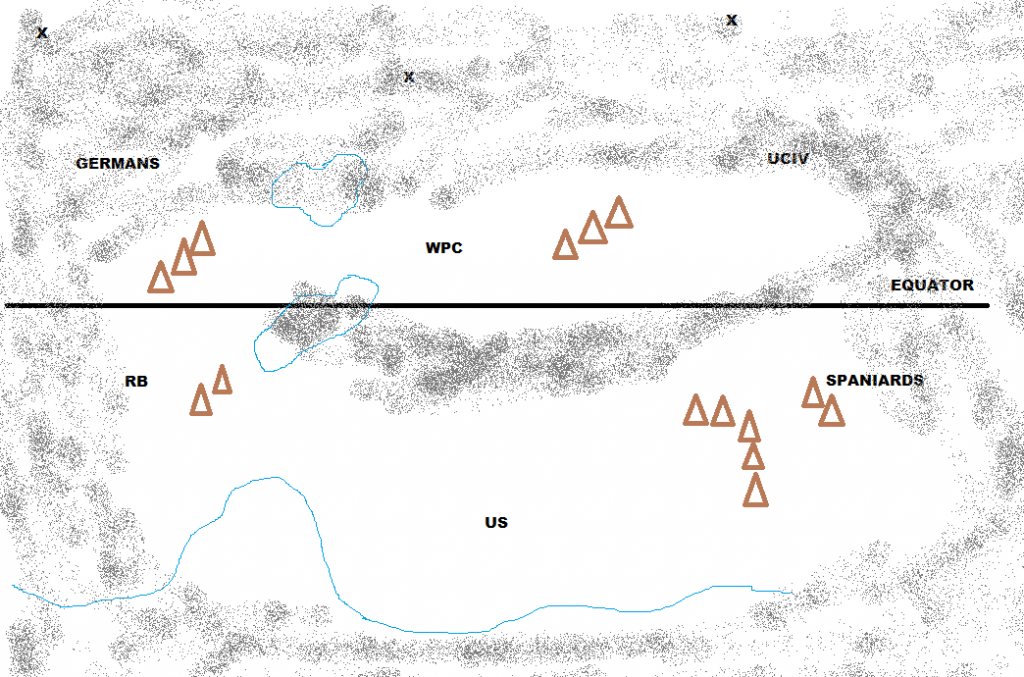
And this is what that map actually looked like (warning: BIG picture):

Note: You can find the starts by looking for the Deer / Deer / Cow combinations
Spoiler :

Its probably a good idea to keep all our thoughts on the map in one thread for easier reference. Im going to put a lot of links and quotes in this thread about our map and map speculation in general.
So heres the most important quote; Plakos stated Map Settings.
The most significant thing in here that adds to our discussion is that the Size is Huge (game setting) In reality something between 80-100 x 40-60. That means the entire map has a total of between 3,200 6,000 tiles, probably somewhere in the middle. We know from the score mouseover that there are 2,868 land tiles in the map, meaning that there are between 332-3132 water tiles.It seems that things are converging so here are the final settings that somehow could affect to the map:
Map - MAPMAKER'S CHOICE, something random/special, decent amount of land, not archipelago
Wrap - TOROIDAL
Mirrored starts - NO (capital locations are very similar though)
Fair/balanced starts - YES
Corporations - ON
Barbs - ON
Speed - NORMAL
Huts - OFF
Allow all teams pre-optics contact - YES
Size - Huge (game setting) - In reality something between 80-100 x 40-60
Difficulty - Emperor
I won't say anything else about the map until the pick up process is finalized.
Here are some maps Plako has done in the past:
Spoiler :
This is what we had said before about our assumed layout:
Spoiler :
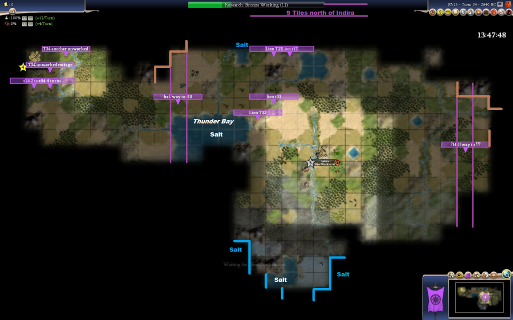
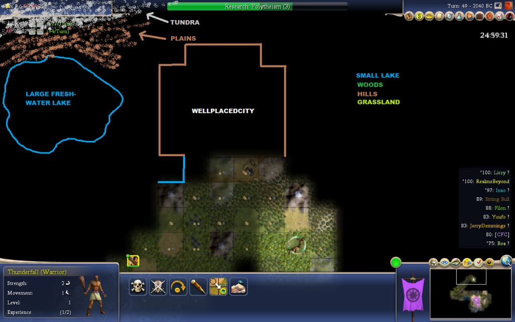
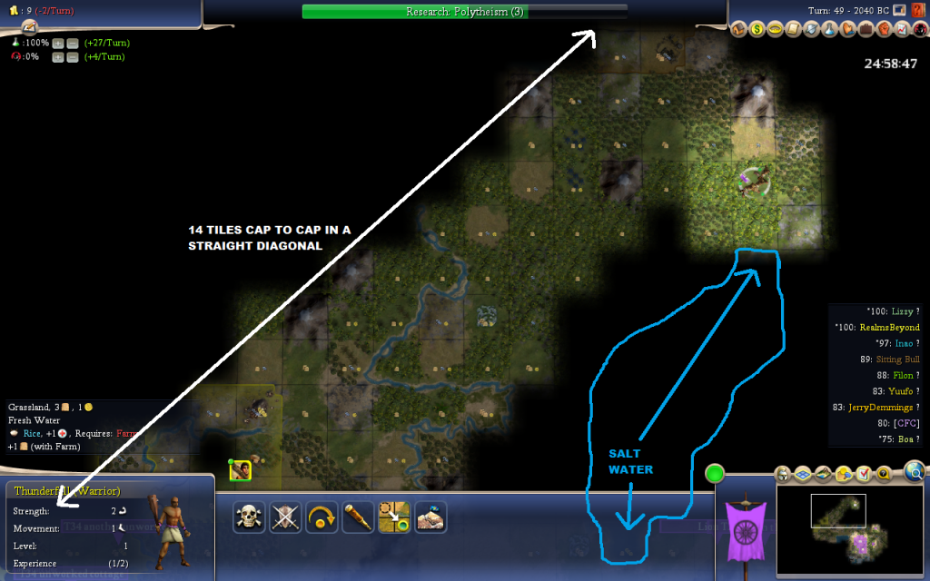
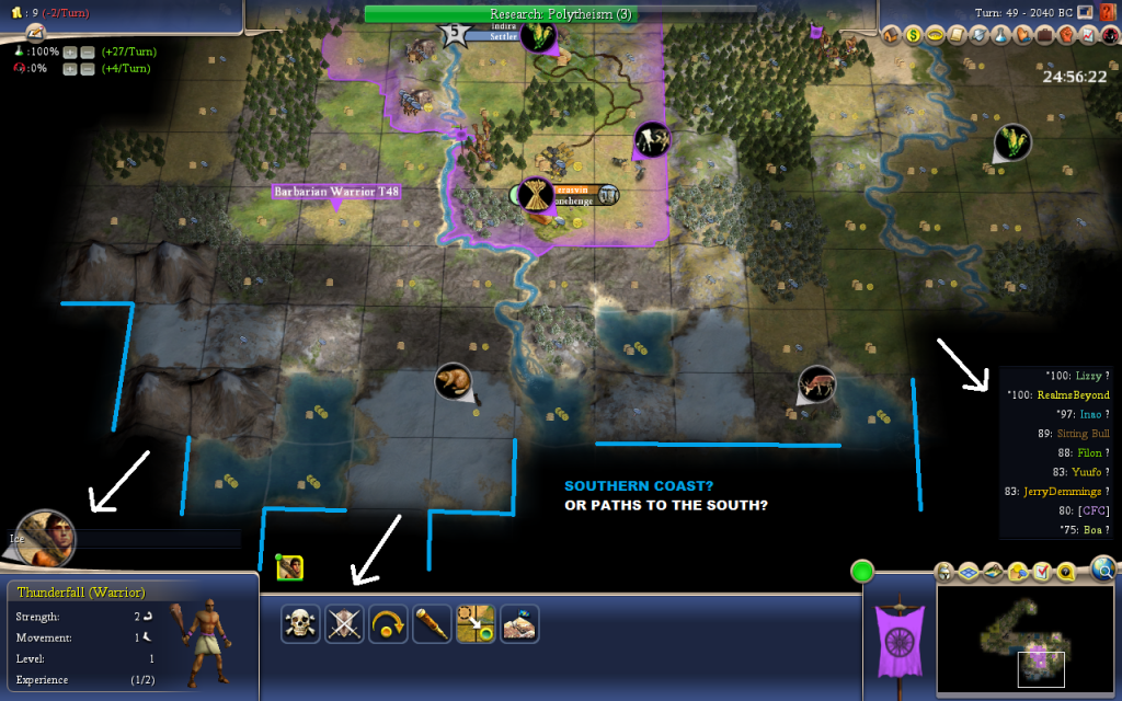
Basically, we're now thinking that the teams are spread in a 3 x 3 grid on this map, with teams approximately 18 tiles from us to our West (RB), East, North, and possibly South beyond all that tundra. That would look something like this:
.x....x....x.
.x....x....x.
RB..Us...x.
If our map guess is correct (and I have no idea how accurate it might be), then RB's Western neighbor is our Eastern neighbor, making it very important that we find them quickly and start establishing good relations with them. It would be devestating if RB and our Eastern neighbor partner up, leaving us out in the cold (or similarly, if our Southern and Northern neighbors partner up).
I'm not sure that's correct anymore, but I don't really have any better ideas right now. One thing we need to strongly consider is that we are on a continent and there are not necessarily land connections through all the wraps, but maybe we can sail south from a city in the tundra to get to the top row of cities.
...
And to finish off, Im going to quote some long posts about possible map layouts from RBs PB 4 game. Lord Parkin and Irgy did some pretty intensive map speculation in that thread, starting with Post #48:
Spoiler :
Lord Parkin Post #48 RB PB 4 said:Just having a think about the possible logical ways to arrange ten starting points "fairly" on a map (assuming the X axis is longer than the Y axis, as is standard).
The options that I've come up with so far are:
* * * * * * * * * * (needs to be cylindrical or toroidal to be fair)* * * * *
* * * * * (cylindrical/toroidal for fairness)* * * * *
.* * * * * (cylindrical/toroidal for fairness)....*
..*...*
*.......*
*.......*
..*...* (flat/toroidal for fairness, could be donut or any 3+ sided layout
....* - possible but already done before by Krill)*...........*
...*.....*
*....*....*
...*....* (probably cylindrical with sea around the main landmass for fairness
......* - similar variants of 5x2 or 10x1 with other "wiggles" possible too)* * * *
*.......* (only really close to fair on a flat script, and even then dubious
* * * * - probably necessary to be an inland sea map type).* * *
* * * * (possible, but dubious whether it could be made fair for the middle two
.* * * - would have to be archipelago, lakes, or mountain ranges)
Any other possibilities anyone can think of for arranging 10 starts semi-fairly? Any more than 4 players along a line in the Y axis would be too cramped, I think (assuming X>Y dimensions), so rotations of the 5x2 and 10x1 layouts probably wouldn't work.......*
*.........*
......*
*.........*
......*
*.........*
......* (similar issues to above, and probably too cramped in the Y axis)
What does this tell us? Personally, I think the 1st, 2nd, 3rd and 4th layouts are the easiest to balance. Krill's already made a map like the 4th option for a previous Pitboss here, so I think that's less likely to pop up than the other map arrangements. That leaves us with three possibilities, all of which suggesting that we should almost certainly have neighbours in the East and West directions (not necessarily reachable by land though). If the map is flat or cylindrical and we find a top or bottom edge, that'll probably scratch out either the NW/N/NE or SW/S/SE directions for meeting people. Assuming one of those is knocked out, XW/X/XE (X being N or S) seem about equally likely to host nearby civs depending on the map layout, but less likely than the almost-certain W and E directions.
So basically, continuing to head W should be good. If we can head that way for long enough, we should be almost certain to either hit a barrier (sea/lake/mountain), or meet someone. Either of which is good, because it tells us (a) who we have as a neighbour and where they're located, or (b) that we're safe from attack in that direction at least for the early game. (That is unless the map's been designed to be hugely confusing to walk around.) Heading W is as good as E according to this analysis, but our Warrior's already going W at the moment so he may as well continue (a future Warrior exploring E would probably be a good idea though).
Thoughts?
Spoiler :
Irgy Post #63 RB PB 4 said:With apologies for derailing again...
I played with the stripe idea. It generated a lot of repeats. It also generated basically all of the original suggestions along the way (except of course the ones that weren't actually symmetric ). It came up with only one genuinely new arrangement, which might not look all that symmetric but is thanks to toroidal world wrap. There was another that looked new, but it was really only two stripes, but on an angle. It was noticably more symmetric on that angle though mind you.
I've also attached an arrangement for 5 that it came up with, because it's one I had no idea existed. You can take two copies of any arrangement for 5, and shift them by any amount you like relative to each other, and you'll get a new symmetric arrangement for 10. So there's infinitely many answers in that sense
I've realised though my crazy petersen graph is never going to work. The two lakes across the boundaries have 6 and 9 civs on them not 5, so even though the underlying graph is symmetric the arrangement is absolutely not. I don't think it can be fixed. A shame really.

Spoiler :
*....*
.*....*
..*....*
...*....*
....*....* (or mirror image - either way really needs to be toroidal to be fair)..*......*.*
*...*..*....*
.*.*......* (cylindrical or more likely toroidal would be necessary here)
And this is what that map actually looked like (warning: BIG picture):
Spoiler :

Note: You can find the starts by looking for the Deer / Deer / Cow combinations


 ) then to me our enemy is clear. We have to establish a protected zone, that is a block of cities that is covered on both sides by another block of our own cities. This means going after the neighbor to the immediate East or West, and then going after the Northern and Southern neighbors of that civ. That creates a situation where we have at least one block that is protected on all sides.
