2metraninja
Defender of Nabaxica
The map is great (reminds me of something - a movie or a game) and you are right that only actual screenshots cant be exchanged, while drawings can, yet I am not convinced we must give it to RB.

I'm now thinking more like this:
o1oooooo2oooooo
oooo3oooooo4ooo
5oooooo6oooooo7
ooo8oooooo9oooo
1 - Germans
2 - UCiv
3 - WPC
4 - Apolyton
5 - RB
6 - Spaniards
7 - CP or CivFr
8 - CFC
9 - CivFr or CP
Now, if we have coast below us and we're all on a landmass surrounded by water, instead of being able to walk across the E-W and N-S wraps, then that would make this all a little less balanced, but that's what it's looking like right now. This would be good for us, though, as it would mean we've met every one of our neighbors.
Edit: Sorry, there must be an E-W land wrap or else the Germans could not have met Poly to their West. It still looks like coasts are blocking the N-S wrap, but I could be wrong.

ooo1oooooooo2oooooooo
oooooo3oooooooo4ooooo
oo5ooooooo6oooooooo7o
oooooo8oooooooo9ooooo
")
...
Map
Map - MAPMAKER'S CHOICE, something random/special, decent amount of land, not archipelago
Size - HUGE (game setting) - In reality something between 80-100 x 40-60
Wrap - TOROIDAL
Mirrored starts - NO (capital locations are very similar though)
Fair/balanced starts - YES
Allow all teams pre-optics contact - YES
 from our subforum, Plako. I am enjoying the map so far, thanks very much for creating it!


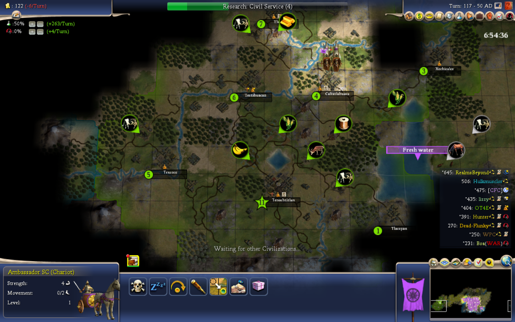
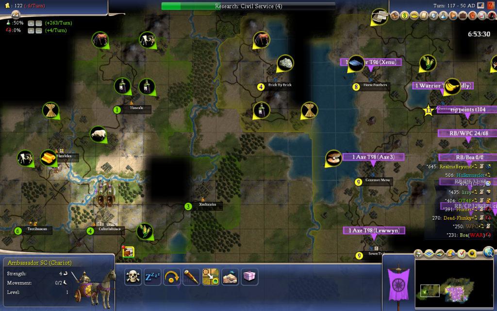
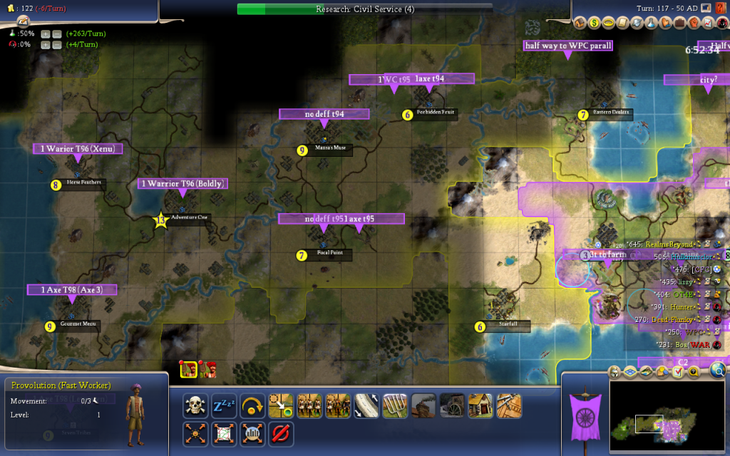
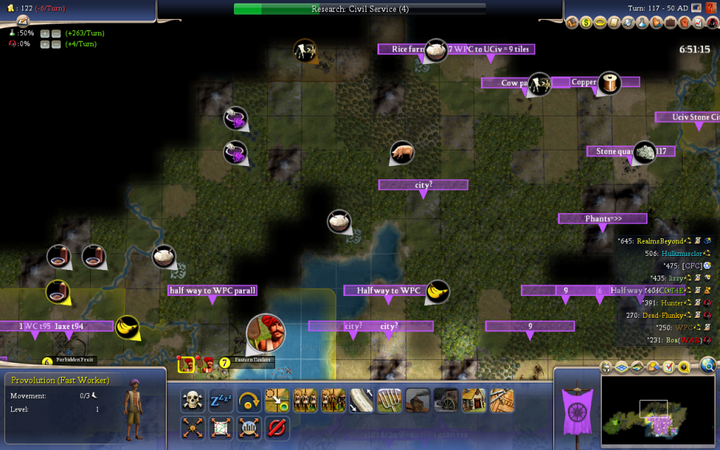
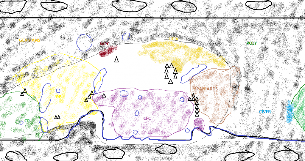


Just wanted to dig this thread up again now that we have a pretty solid picture of the entire world:
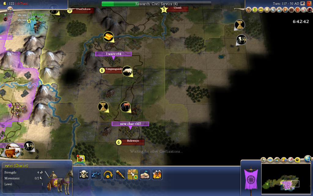
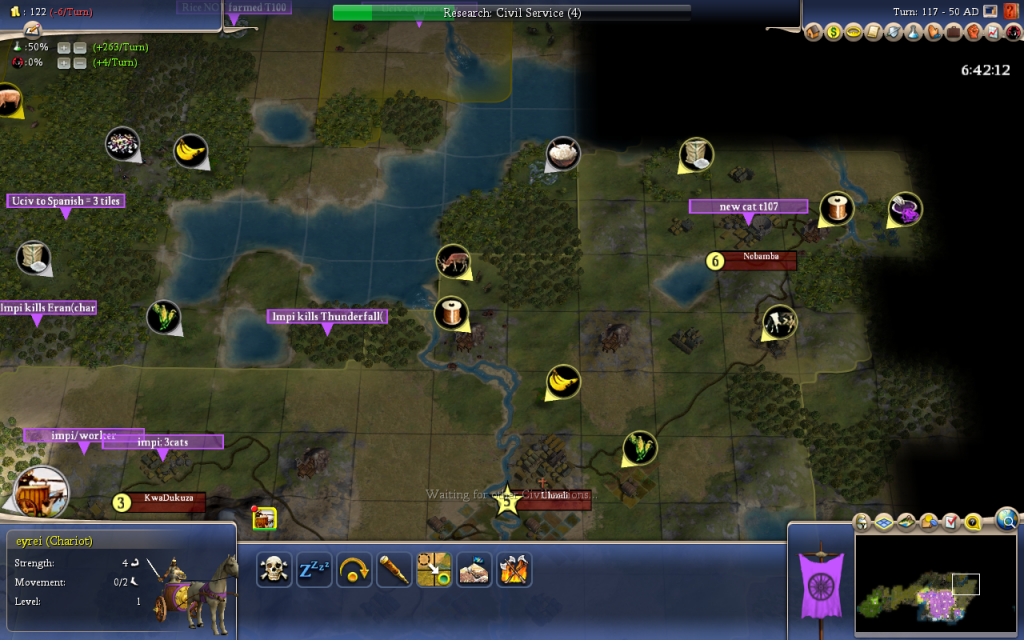
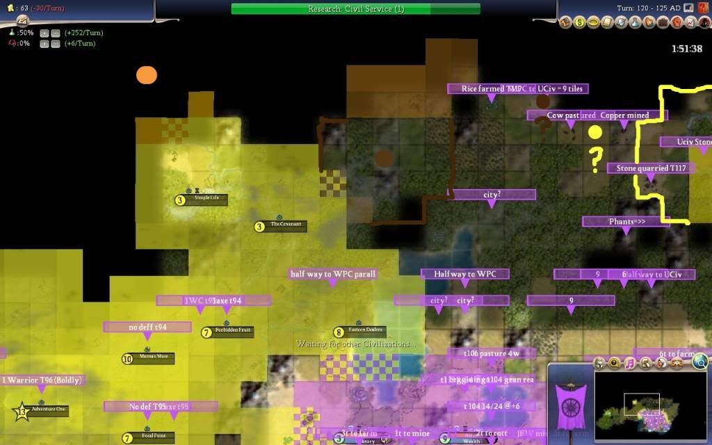
And here are some shots of the starting locations and what all the different teams did with them:
Spoiler :CivPlayers are lacking the nice rivers a lot of us got
WPC failed to do too much of anything but chop their forest deer
We went mostly with cottages, but we're getting some good production out of it, too
RB also has a nice mix between cottages and hammers
UCiv
CivFr
Poly actually moved their cap to that city to the left in this picture
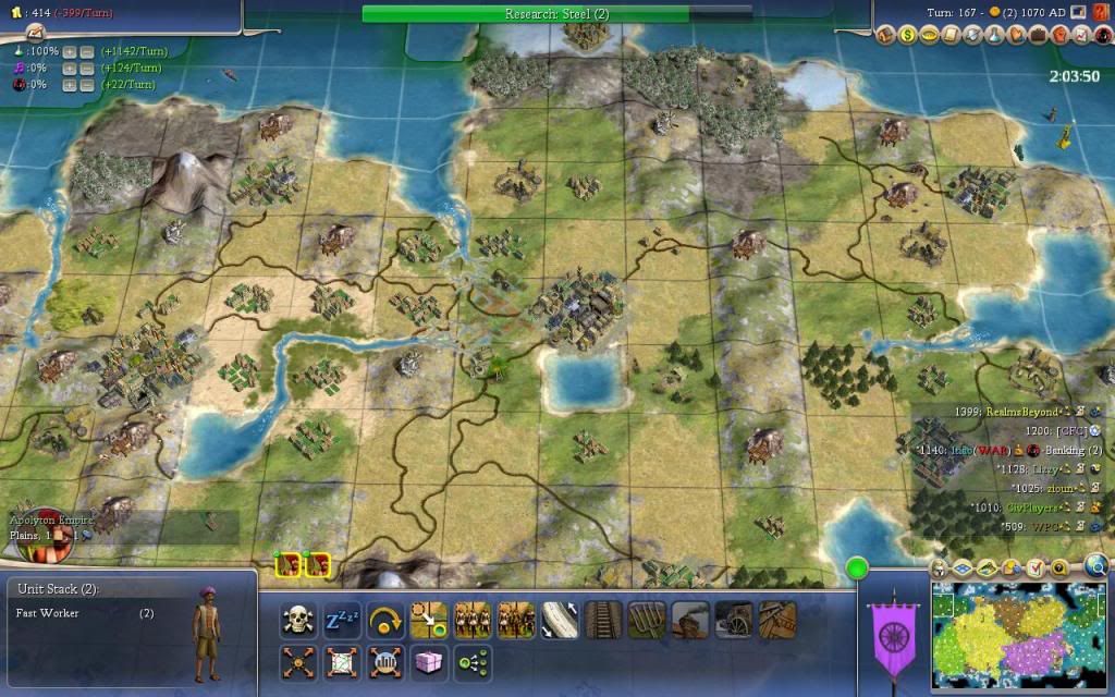
. When did that happen
 Last time I checked we were in fourth.