Solution: The Globe in Civ V, a really spherical map with only hexagonal tiles!

Status
Not open for further replies.
Couldn't it be something like a pentagonal hexecontahedron?

Your link is broken.

And I guess I should have been even more specific and said that it needs to use regular polygons for faces. With tiles like that, I would imagine that the two long edges would be more vulnerable than the remaining 3. Besides, that looks a lot like a hexagonal sphere with 12 pentagons, with the pentagons split into 5 triangles and joined to the hexagons. I don't think you can make a bigger sphere with those tiles unless you used hexagons.
 
Orthoceros, what you propose is most cool thing I can imagine in Civ games! I wish I can code my own game from scratch, but I never coded anything with 3D graphics so it would be painful. Especially I cannot imagine how to code such map you propose, but I am good in game designing. I once coded map editor, but with big (640x512) flat 2D Earth map imported from graphics file (upside view) - I had idea about exteding it to whole game but I abandoned project because it was started on Amiga, and I bough finally PC in 1998 year. I have this code on emulator anyway, but as I said it was 2d and in basic extended then to some assembler improvements (Motorola rulez - no memory segmentation limit). Anyway it would be painful to redo this code and it is useless today.

I dream about making game with realistic spherical planet maps, and not only one planet in the game but whole galaxy. Yeah, like connecting best from Civs, Emperor of Fading Suns, Masters of Orion, Frontier (had huge Milky Way Galaxy map and game fitted on one diskette!), Alpha Centauri (though about making planet map not flat, but have plots to get different elevation like in AC?).

Also I though about making cube wrote on sphere map types like this one:
origimage_2_2457664.png


It does not looks perfect, as such "sphere" would have the same distance in plots on top as in on equator. Also there 8 vertex/poles which have one diagonal neighbor less than other plots. Anyway it would be easier to code, and I could use 2d map representation in such case at start while trying to learn how to make 3d map.

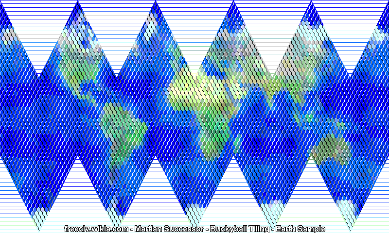
Looking for other projects I also found this:
http://freeciv.wikia.com/wiki/Talk:Sphere

It is not perfect anyway too, but easier to 2d representation too:

Bucky-earth-20.gif
 
I like this a lot. I think the shortest path thing is kind of cool actually, if humans are likely to get it wrong then the AI has error bars to make its pathfinding algorithm look better.

I guess you need 8 types of city maps (no distortion, on distortion and each direction from it at distance 1, although 6 of these can be done by rotation so really its 3) to handle the change in tiles, and the 2d-representations there. Fortunately distance 1 is correct so if the tile is at distance 2 from a city you can treat it as normal, otherwise this would be a bigger deal.
 
@Ramesses:
  • I appreciate your answers to other members; especially since I am often too busy and don't have much time left for this hobby to answer myself.
    Note@all: This is also the reason, why I can post in this thread every few months only...
@Robo-Star, Ramesses and gazius | hexagonal base tiles are the pragmatic choice:
  • Additional to the things mentioned by Ramesses about the pentagonal hexecontahedron (http://en.wikipedia.org/wiki/Pentagonal_hexecontahedron) I think we should focus on hexagons for a very pragmatic reason: Considering that square tiles lived for 19 years in the Civ series I think the following assumption is realistic: Either we see the globe based on the currently implemented tile system in the next years or we will have to wait alot longer until the tile concept is entirely replaced by smooth positions, unit moving radii and area concepts...
@Fanatic Noob:
  • Besides Civ, I also played Alpha Centauri and liked Master of Orion when I was young and the game you envision would surely be great. However, as youself note: it IS a "dream": If you don't have 10 years of time and a bunch of money and a project team comprised of a lot of people with a broad spectrum of skills, it will not be realizeable!
  • The upper image in your post shows the tesselation of a sphere using the cube as base geometry. I agree that "it would be easier to code", but it also has more distortions and will not be easily convertible into non-square tiles later on ...
  • Your lower image is the 2D map of the 12 pentagon-solution (1 for the North Pole, 5 for the upper row of triangles, 5 for the lower row and 1 for the South Pole).
  • A note about the 2D projection with respect to a minimap in Civ: Of yourse you could define such a 2D map for the suggested 3D tesselation in this thread, too, but I think the well-known Robinson-Projection (http://en.wikipedia.org/wiki/Robinson_projection) would look nicer as a mini map (and could be calculated from the 3D map with ease).
@LordTC:
  • Thank you. Your first point is dependent on the type of player: a real strategist would probably disagree with calling it cool when an AI unit outruns him because of a counter-intuitive UI. If this distortion has to persist, the UI for moving units to distant tiles must always offer and visualize the tile-shortest path to the player.
  • There are different approaches allowing you to reuse all 2D graphics (terrain types) and 3D models (units, buildings) without special versions for the pole tiles. One approach works as follows: The four overlapping hexagons at each pole can be shrunk a bit until they do not overlap any more. This leaves a square-formed hole in the map at the center of the pole. Now, every unit or building on a polar tile would be rendered within the corresponding shrunk and non-operlapping hexagon. The terrain on the other hand would be rendered into the overlapping version without hole utilizing blending. This way you should get a graphically acceptable visualization without having to vreate special art just for the polar tiles (or their neighbouring tiles).
Has anyone had any success using my Matlab source code released above (in post #91)?
 
If I can spark some more discussion here:

Let's say that we've chosen our tiling system out of all the ones presented in this thread. Three things are certain: it is made mostly of hexagonal tiles, it has artifacting in the form of non-hexagonal tiles at several "poles", and there are more than two "poles".

If we could relegate the artifacting to two poles opposite each other, we could cover them in impassible ice and call it a day. Sadly this is not the case, so we have to start collaborating ideas on how to deal with this problem.

We should start by identifying our approach. Are we going to modify the pole tiles with bonuses to make up for the loss in strategic usefulness? Are we going to hide them under impassible terrain as well? Are we going employ some sort of super-special programming trickery, like making each unit move on a grid that is not the world grid or something? Or will we take a different approach entirely?
 
and the game you envision would surely be great. However, as youself note: it IS a "dream"

Well, It is a dream but I never gave it up ;) I have few ideas how to code. I even considered to rewrite or expand my old Amiga code under emulator, but then there would be no spherical planet maps, if I will base it on it, while spherical maps is thing I looking the most in such game as I like realism.

If you don't have 10 years of time and a bunch of money and a project team comprised of a lot of people with a broad spectrum of skills

Yeah, it is true, but I think 10 years is bit exaggeration. I think someone with self-determination and much of free time can do it in 2 or 3 years. I have no other work for example as I am on social pension now. Also I think making such big project as open project and recruiting as much persons as possible could help to make it come true.

Your lower image is the 2D map of the 12 pentagon-solution (1 for the North Pole, 5 for the upper row of triangles, 5 for the lower row and 1 for the South Pole).

Now I noticed that is is based on pentagon in 12 plots. Your solution is based on 6 pentagon poles right? Every of them in your solution is where XYZ axis cross the sphere surface if XYZ centre would be in inside of sphere.

Of yourse you could define such a 2D map for the suggested 3D tesselation in this thread, too,

I wonder how such 2D map of 6 poles map of yours would look in 2D. Just to make my brain better to calculate how to work in 2D with such maps.

but I think the well-known Robinson-Projection (http://en.wikipedia.org/wiki/Robinson_projection) would look nicer as a mini map

I think it is good solution for mini map. Also I though about mini map done from small spherical globe which would be possible to turn around in each direction.
 
I agree with wanting a spherical map but the one in the OP is unacceptable in a game.

A game map needs mostly "straight" lines to make the player not lose intuition while your map has straight lines that are kind of hyperbolic. The artifact is also very bad news because it is too graphically different from the rest of the tiles (graphically in the common not the mathematical sense :lol:).

I completely disagree with you here ! Straight lines are only needed by the art team because of collision issues. I'm in favor of of chaotic tile borders with an underlying geometrical pattern. IMO, it's the only way to overcome the "artefact" problem while having a working logic for path and territorial expansion.
 
If I am looking for straight lines I can run Civilization 1. There are many straight lines ;) But seriously, it is hard to make sphere map with straight lines. You could try this tesselation of a sphere using the cube, but then are deformations and the same round distance in plots everywhere issue.
 
I completely disagree with you here ! Straight lines are only needed by the art team because of collision issues. I'm in favor of of chaotic tile borders with an underlying geometrical pattern. IMO, it's the only way to overcome the "artefact" problem while having a working logic for path and territorial expansion.

Yes, I'm sure that being able to easily tell what happens as a player has no part in it. The (straight) tile borders in both Civ4 and Civ5 have been muddled up to improve graphics, rather than the other way around. Yet a grid overlay was introduced and I'm pretty sure a lot of players use it fairly often to tell the distance between a city and a resource, for example.

In fact, I would prefer a free-form map with actual geometric distances (spherical geometry, preferably) to a tiled map if it weren't for pathfinding issues that are likely to produce very long AI turn times.

If I am looking for straight lines I can run Civilization 1. There are many straight lines ;) But seriously, it is hard to make sphere map with straight lines. You could try this tesselation of a sphere using the cube, but then are deformations and the same round distance in plots everywhere issue.

Um... latitude/longitude? They don't have to be straight in three-dimensional euclidian space, they should be "straight" on the sphere's surface in the sense of following the geodesic lines. Funnily enough, this got me thinking about black hole geometry where geodesics look quite funny due to the vicinity to a huge mass singularity.
 
I think that this 2D map of the 12 pentagon-solution I presented above can produce such pretty straight lines, if we can talk about straight lines on hex map.
 
Orthoceros, you said that it is mathematically impossible to tesselate the surface of a sphere with only hexagonal tiles, but what about an ovoid? Is there a way to transform the shape of the planet to make it possible for this to work? The Earth, after all, is not a perfect sphere, so some sort of deviation in order to make the tiles fit seems possible to me.
 
Orthoceros, you said that it is mathematically impossible to tesselate the surface of a sphere with only hexagonal tiles, but what about an ovoid? Is there a way to transform the shape of the planet to make it possible for this to work? The Earth, after all, is not a perfect sphere, so some sort of deviation in order to make the tiles fit seems possible to me.

No, it is not. It is mathematically impossible to tile any closed surface "without handles" (i.e. anything that can be continuously deformed to a sphere) with only hexagonal tiles. You can, with various other non-regular tilings like hexes + 12 pentagons, or squares with 8 points where only 3 instead of 4 tiles meet. But only hexagons, will at best result in a torus (donut surface).
 
Would it be possible to limit the non-hexagonal tiles to the poles somehow? Also, by "squares with 8 points where only 3 instead of 4 tiles meet" do you mean as in snub square tiling?
 
He means about those points I have marked here 2 of them with red circles:

points.png


And there are 8 of them.
 
Would it be possible to limit the non-hexagonal tiles to the poles somehow? Also, by "squares with 8 points where only 3 instead of 4 tiles meet" do you mean as in snub square tiling?

To my understanding, you can't just shove all the non-hexagon tiles into the icy poles where no one could ever reach them. They must be spread out evenly.

I hope I'm wrong about that, but I don't think I am.
 
Yeah, there must be at least 6 of them in places where XYZ axis cross surface of the sphere as it looks from pictures.

sphere.png
 
And I take it from a computational perspective or because of issues with gameplay, it wouldn't be a good idea to just divide the globe into squarish tiles with longitude and latitude lines? This would, of course, mean that there would be a circular tile at each pole (or a series of triangles) and that each square may not be of equal area. Would this create too many problems with map generation?
 
Then you will get different square sizes, from very big near equator to very small in polar area (depending how big would be polar circles you create), and also problem with those polar circles (or series of triangles). Also problem with distance, as you will get same distance as on equator counting in square plots.
 
Status
Not open for further replies.
Back
Top Bottom