Michael Vick
#1
Yes, there was some conflict between Python and Russian. At this point, it seems better to remove some accents than to remove an entire language.
Right, makes sense. Is there any chance of those Atlantic islands getting fixed?
Yes, there was some conflict between Python and Russian. At this point, it seems better to remove some accents than to remove an entire language.
Right, makes sense. Is there any chance of those Atlantic islands getting fixed?
")
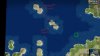
I felt offended looking at the current city namemaps in Estonia so I spent my weekend digging through maps and history of medieval Livonia. As a result I have worked out a namemap of the Livonian region that tries to be geographically accurate and also takes account the importance of various settlements in the medieval era. Now every sqare has it's own city name.
So I ask of you to provide me access to Norse, German, Polish, Lithuanian, Russian and Swedish namemaps so I can edit them all at the same time and keep them in sync.
Also I have a few suggestions of tweaking the location of rivers, marshes and province borders. Can I do it myself or do I have to draw a picture explaining my suggestions for you to implement?
So changing the terrain means downloading beta10, starting a regular game as Byzantium & saving the changes as a sepratate world builder file?
So changing the terrain means downloading beta10, starting a regular game as Byzantium & saving the changes as a sepratate world builder file?
I will keep it in mind, but I probably won't have time to edit the terrain anyway before weekend.Actually, you should talk to Ogi123 so the two of you can sync your changes