Altered maps

Status
Not open for further replies.
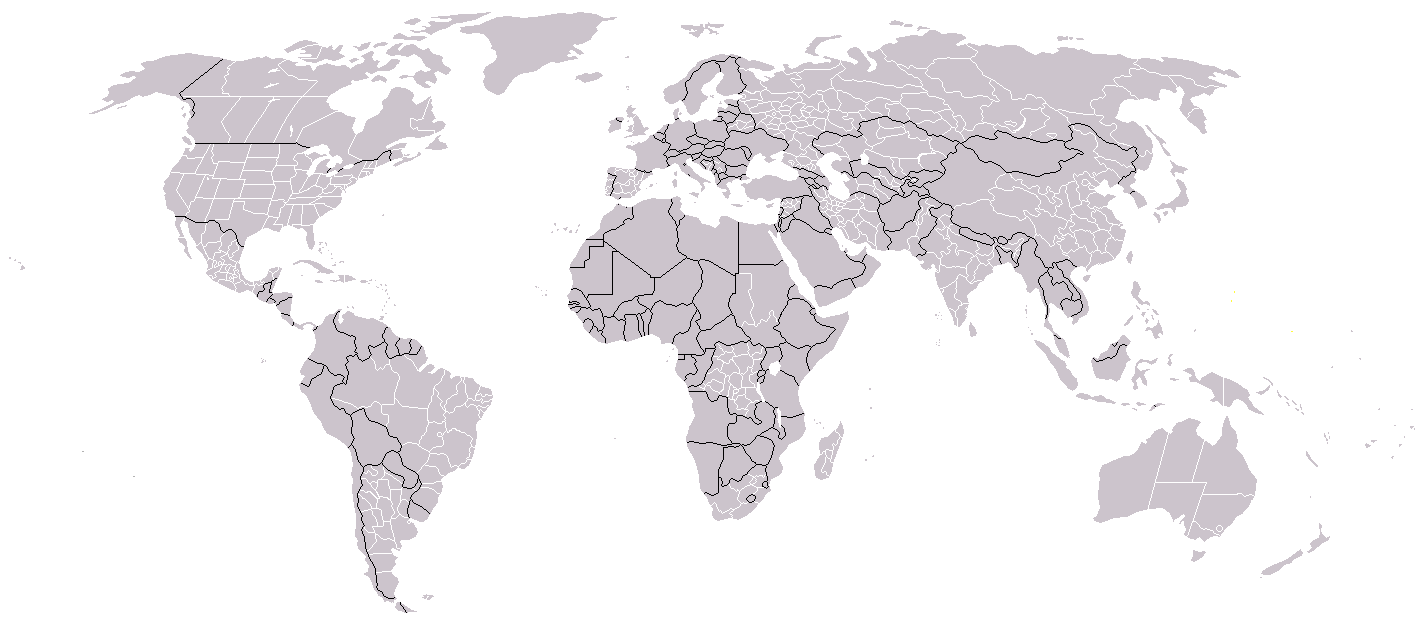
This is my favourite blank map:
Spoiler :
BlankMap-World-BlackBorders-WhiteSubdivisions.png


It has the subdivisions of most of the world's larger countries, and the national borders are in a different colour to prevent confusion...

Maybe "Bengal" started in the Northwest Frontier, and "Patagonia" started in the Gran Chaco? Food for thought.
Northwest Frontier is nowhere near the bay of Bengal, its in Pakistan. Bengal is on the Bangladesh side, and the country 'Bengal' has almost no territory in that area. I think the Bay of Bengal has been confused with the Arabian sea.
 
Northwest Frontier is nowhere near the bay of Bengal, its in Pakistan. Bengal is on the Bangladesh side, and the country 'Bengal' has almost no territory in that area. I think the Bay of Bengal has been confused with the Arabian sea.
I said, it started on the Bay of Bengal and originally expanded on the coastline, but Ganges revolted and Bengal had no choice but to expand westward.
 
Also, Germany does not have its landern. Weird, since Brazil and Spain have theirs...
They have rather strange ideas about which countries to show subdivisions in, apparently. Syria's subdivisions are shown, but much larger countries like Ukraine and Saudi Arabia are not split.

But it's still quite a good map, I like the fact that the Siberian Republics of Russia are shown, which lets you make maps about scenarios where Russia collapses.
 
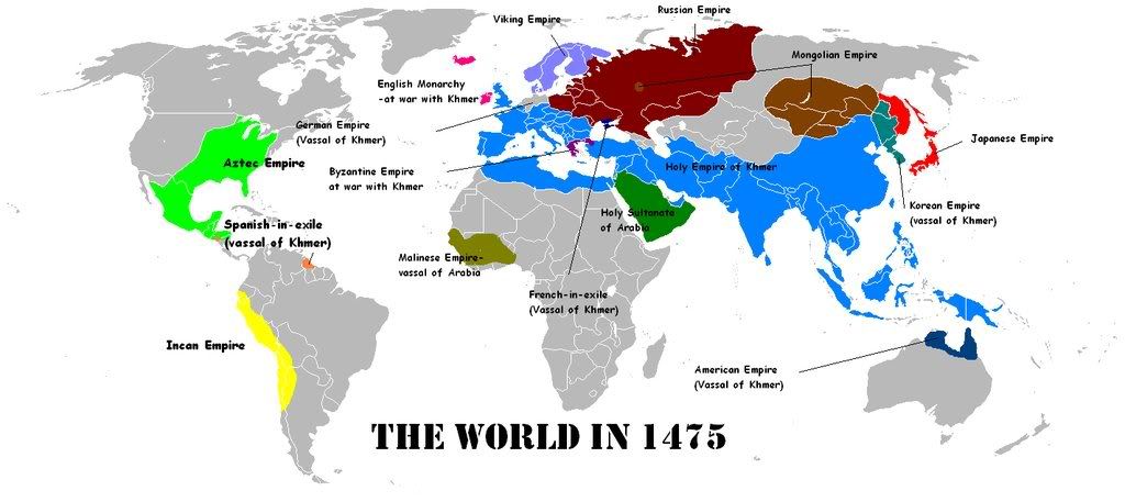
My own map of my Civ4 Earth:1000AD Game. I played as the Khmer. Initial first strike took China, followed by India, Arabia, and Europe (through Italy). Byzantium and England are falling fast. The Military Advisor says I have roughly 565 units in play currently. Indonesia and former China provide tons of beakers per turn, due to the many plantations, trade routes, sea tiles, and cottages there.

Spoiler for large map:
Spoiler :
theworldin1475.jpg


I'm aiming for a conquest victory. I just need to finish off England, send two expeditionary forces to the Americas (Aztec=Muskets, Inca=Maces), one north through Viking to Russia, finish off Byzantium, turn around, and kill Arabia.
 
Civilitas? What's Civilitas?

BTW, I love these altered maps! Keep 'em coming :goodjob: !

Civilitas = Country of CFC Model Parliament, where downtown was President!
 
Quebec Republic-2060

attachment.php


Huge map-but if it were smaller you wouldn't be able to see that tiny dot on Montreal called Westmount

dont forget about COTE ST LUC! they are 80% english speaking, and said in the 90s during referendum that they were CANADIAN not QUEBECOIS and would remain in canada.
 
Here is a great map for you to play around with. This is my World in 2010 rendition:

Spoiler :
Earth-2008-Northern.gif
 
Status
Not open for further replies.
Back
Top Bottom