[Development] Map Suggestions

Leoreth

Blue Period
Moderator
Joined
Aug 23, 2009
Messages
36,993
Location
東京藝術大学
The new map is still under development. It is not meant to be played on. The new map is meant to be first released in the main DoC mod, in the way I intend to. This is a community project that I invested a lot of time and effort into to aggregate, curate, and research. Do not create modmods using this map before it is official released as part of the mod's develop branch.


You can make suggestions for the map itself. To repeat, this includes the shape of landmasses, terrain/feature types, resource placement, river courses etc.

This is part of Phase I of developing the new map, see here for a general overview.

Please make your suggestions in the following way:
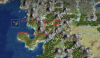
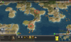
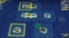
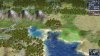
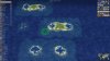
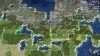
- include a screenshot of the affected area (you can zoom out as far as you can until the cloud cover appears)
- annotate all your changes (with a tool of your liking, you can use the ingame landmarks with text, or use an image editor, the important part is that it is comprehensive)
- if resources are affected, please also enable Ctrl + R
- use your judgment on what is comprehensible to someone who doesn't know what you did, it should also not be required for me to know exactly what the map looked like before your changes
- I encourage you to also include a text description of your changes and the reasoning behind it. The more you support your reasoning the higher the chances I will include your changes.

You can also make a pull request that includes your changes, but you still need to frame your suggestions as described above. That's because it is impossible for me to actually understand your changes just from the diff of the scenario file. If you do not make a pull request (which is in no way required) I will integrate the changes myself over time.
 
Last edited:
Spoiler :


As I mentioned in the alt map thread, I noticed the Bug river was not there. My reasoning was that Warsaw could become a more desirable spot while nearly surrounded by rivers. Oh, and I believe it just looks better this way.
 
Last edited:
Yeah, I decided against it.
 
I'm not super passionate about BC but a few minor changes I'm going to advocate. I added one tile NW of Vancouver Island to better reflect the shape/length of Vancouver Island. I'll admit it is a bit far West but before is not far enough, also it gives Vancouver a bit more productivity.

I moved the Haida Gwaii Islands 1 NW (opted against using a land tile because it looked bad). This is purely aesthetic but I think better reflects their position in relation to the Alaska panhandle archipelago.

I removed one mountain in the BC interior in favour of a wooded hill. This I think better reflects the topography of the BC interior. These changes also give Vancouver a bit more room to grow and breathe, especially if Prince George is founded to the North and Seattle/Portland to the South.
 

Attachments

  • BC map.png
    BC map.png
    1.1 MB · Views: 1,229
I think the Mediterranean would feel better modeled with more full islands. I know you removed the Baleares tile, and I understand the reasoning, but I think it'd be better to include it, especially since it's large enough. So that it's not a dead tile that nobody will care about, it could get the second Olive resource I was pushing for in Iberia.

In a similar vein, I think the Aegean islands would also be more interesting with a full land tile. I know there is no island there that is quite large enough, but there are enough islands with sufficiently large density to justify a tile that would enhance the tactical game in Greece (and have the possibility to be settled). It would be 2E1S of Athens. It would mostly represent Naxos, but it could also represent the small but important island of Santorini as well. It could get a resource from Greece to declutter it. For instance, the marble, to represent the famous marble from the island Paros.
 
Last edited:
In a similar vein, I think the Aegean islands would also be more interesting with a full land tile. I know there is no island there that is quite large enough, but there are enough islands with sufficiently large density to justify a tile that would enhance the tactical game in Greece (and have the possibility to be settled). It would be 2E1S of Athens. It would mostly represent Naxos, but it could also represent the small but important island of Santorini as well. It could get a resource from Greece to declutter it. For instance, the marble, to represent the famous marble from the island Paros.
Maybe they can be represented by a large islands tile that acts as both a land and sea tile at all times.

You know, because you can stand on large islands, and sail between them too.
 
This mostly looks very good, except for Western Europe which looks quite distorted. I especially like the West Coast of America, Central Europe, and Asia Minor. The Great Lakes look somewhat off, and I'm playing around with them in World Builder to see if I can make something more accurate.

My suggestions:
1. Use the Britain shape in the original proposal for this larger map: this new version just looks oddly stretched/squished.
2. Spain/Iberia looks like it has been vertically compressed. I'd recommend adding a row of tiles to the Northern coast. Moving Africa down, which I saw proposed in another thread, would be a mistake in my opinion, since it would throw off the entire Middle East, and making the Mediterranean larger would probably negatively impact gameplay, since the AI seems to be bad with navies, and the region has historically been very active and interconnected.
3. France also looks distorted, but I've played around with it for half an hour in World Builder, and haven't been able to come up with a better configuration.
4. Italy looks "lumpy", and I think that vertically connecting Corsica and Sardinia is a mistake. Just make them both one-tile islands, since you'll only ever have one city there anyway. Same thing with Sicily: the extra tile in the south is unnecessary, since it just looks distorted and you'll never have a city there.
5. Denmark should be connected by land to Sweden, both for gameplay reasons, and because the straits separating them are no larger than the strait separating Sicily from mainland Italy, or the strait that separates Vancouver Island from Canada proper.
6. I saw a really nice New Zealand proposal in another thread, I'll see if I can dig it up later.
 
If you mean Xyth's New Zealand proposal, I already included it.
 
Experiments in lagoonology:

I converted the Pacific islands that should be atolls into lagoons. Most of the Pacific islands are not actually atolls, but a few of them are, especially north of the Polynesian spawn area. Unforested lagoons look weird, but with a rainforest on top I think the effect is quite nice already:
Spoiler :
Civ4ScreenShot0048.JPG
Civ4ScreenShot0049.JPG

Note that Bora Bora (easternmost lagoon in the second picture) could be represented as either a lagoon or a regular land tile, since it's a hilly island surrounded by an atoll. Also, the lagoon next to a land tile in the first picture is meant to represent Pohnpei, which is a relatively large island in Micronesia, and where the Venice-style ancient city of Nan Madol was built. Here's what lagoon islands look like with cities (in the second picture, "Samoa" is Bora Bora):
Spoiler :

Civ4ScreenShot0050.JPG
Civ4ScreenShot0052.JPG

Lagoons look less nice with a city than with trees, but it's not so bad either I think. It would be nice with some sort of sand bar graphic.

I also experimented with using the lagoon to represent Lake Texcoco in Mexico. Here it is without and with a city:
Spoiler :
Civ4ScreenShot0047.JPG
Civ4ScreenShot0051.JPG

I think it's nice. It also fits the real fact that Lake Texcoco was shallow and brackish. The lagoon could be changed to dry terrain in the 1600s. A lagoon could also be a requirement for the Floating Gardens wonder (where else would you build floating gardens, if not on a lake/lagoon?).

Lastly, this has nothing to do with lagoons, but I noticed Hawaii has been shrunk to only two land tiles? I can think of reasons for that—Hawaii's not actually very big—but it feels like it's missing something. The shape of the archipelago, probably. Since nothing in the Pacific is really to scale due to the minimum size of a land tile, I think it should be enlarged back to what it was in the smaller map.
 
Last edited:
Experiments in lagoonology:

Lagoons look less nice with a city than with trees, but it's not so bad either I think. It would be nice with some sort of sand bar graphic.

I think it's nice. It also fits the real fact that Lake Texcoco is shallow and brackish. The lagoon could be changed to dry terrain in the 1600s. A lagoon could also be a requirement for the Floating Gardens wonder (where else would you build floating gardens, if not on a lake/lagoon?).

Lastly, this has nothing to do with lagoons, but I noticed Hawaii has been shrunk to only two land tiles? I can think of reasons for that—Hawaii's not actually very big—but it feels like it's missing something. The shape of the archipelago, probably. Since nothing in the Pacific is really to scale due to the minimum size of a land tile, I think it should be enlarged back to what it was in the smaller map.

Yeah, having a crescent-shaped island-like terrain for the Lagoon would be interesting. And Hawaii IS 2 tiles in the smaller map, I don't think it has changed in the new map.
 
Yeah, having a crescent-shaped island-like terrain for the Lagoon would be interesting. And Hawaii IS 2 tiles in the smaller map, I don't think it has changed in the new map.
Hawaii currently has 3 islands and 4 tiles, one of which is a peak.
Or perhaps only when a civ other than the Aztecs takes control of it?
Maybe whenever the civ controlling the city has the Hydraulics tech?
 
1. Use the Britain shape in the original proposal for this larger map: this new version just looks oddly stretched/squished.

The Southwest Peninsula on Britain is to the new map what the notch is to the iPhoneX. Distracting and unnecessary.

5. Denmark should be connected by land to Sweden, both for gameplay reasons, and because the straits separating them are no larger than the strait separating Sicily from mainland Italy, or the strait that separates Vancouver Island from Canada proper.

Except that it needs to be passable and Copenhagen is not the in the right position to make it passable.

Aside: Agreeing with the others, Hawaii is sad. Hawaii should not be sad.
 
Rainforest + lagoon looks surprisingly good. However, it seems you only edited the map once in WB. This usually leaves graphical artifacts of the editing process and does not represent how the map would actually look. Can you save and reload the map and show another set of screenshots?
 
I'd like to propose a switch between wine resource, currently in Apulia, and the olive one in Sicily. Apulia is Italian top producer of olive oil and I also think that giving the access to another luxury resource to a hypothetical Sicilian city would be more useful.
 

Attachments

  • Immagine.png
    Immagine.png
    1.6 MB · Views: 820
A test with some sandbanks. I used the vanilla coast texture, so it is a bit lighter than the coast used in DoC.

It does give an ugly border when you add a land tile next to it. It can be masked a bit by rainforests and cities.

Spoiler :


And the Venice Lagoon.

Spoiler :


The Tenochtitlan lagoon looks similar to stebs image.

EDIT:
This is with the DoC coast texture for reference.
Spoiler :
 

Attachments

  • Civ4ScreenShot0109.JPG
    Civ4ScreenShot0109.JPG
    420.7 KB · Views: 8,113
  • Civ4ScreenShot0108.JPG
    Civ4ScreenShot0108.JPG
    481.7 KB · Views: 8,129
  • Civ4ScreenShot0110.JPG
    Civ4ScreenShot0110.JPG
    442 KB · Views: 7,976
Last edited:
I wondered if that was possible, I think it looks great. However I prefer Venice without the sandbanks. Maybe we need only a new Atoll terrain that uses these graphics.

Also, your first screenshot is the HR water texture, correct? I'm considering just making that the official terrain art for the mod along with Blue Marble.
 
It uses the vanilla water texture. I don't know which one texture HR uses.
I think it is possible to have a single texture file which removes the sandbanks from Venice while still having them for the Atols. But I have to check that.


I changed my Canada suggestion, making the changes a bit more rigorous. I moved all great lakes 1 tile to the east. This has the following benefits.
1) The longitudes of the Great Lakes are better alligned with the ones of Hudson Bay.
- It alligns the west coast of Lake Superior with the west coast of Hudson Bay.
- Half of Lake Erie is now below James Bay. I think that is more accurate than having Lake Ontario be directly below it.
- The eastern tip of Lake Huron is east of the western coast of James Bay. Now they are on the same longitude, instead of the eastern tip of Lake Huron being 1 tile west of the western coast of James Bay.

2) Improved Ottawa and St. Lawrence setup.
- The new river setup improves the Montreal area, because it is now at the confluence of the Ottawa River and St. Lawrence River and also in the bend of the St. Lawrence river.
- It allows both Ottawa and Montreal without one being on a wrong tile.
- The shape of Ontario is less distorted compared to my previous suggestion.
- The Ottawa bends to the north 1 tile to the west, which is more accurate compared to James Bay.

The Mississippi should probably move east as a result of this. But I didn't focus on that.

Spoiler :
 

Attachments

  • Civ4ScreenShot0112.JPG
    Civ4ScreenShot0112.JPG
    485.5 KB · Views: 7,597
It uses the vanilla water texture. I don't know which one texture HR uses.
I think it is possible to have a single texture file which removes the sandbanks from Venice while still having them for the Atols. But I have to check that.


I changed my Canada suggestion, making the changes a bit more rigorous. I moved all great lakes 1 tile to the east. This has the following benefits.
1) The longitudes of the Great Lakes are better alligned with the ones of Hudson Bay.
- It alligns the west coast of Lake Superior with the west coast of Hudson Bay.
- Half of Lake Erie is now below James Bay. I think that is more accurate than having Lake Ontario be directly below it.
- The eastern tip of Lake Huron is east of the western coast of James Bay. Now they are on the same longitude, instead of the eastern tip of Lake Huron being 1 tile west of the western coast of James Bay.

2) Improved Ottawa and St. Lawrence setup.
- The new river setup improves the Montreal area, because it is now at the confluence of the Ottawa River and St. Lawrence River and also in the bend of the St. Lawrence river.
- It allows both Ottawa and Montreal without one being on a wrong tile.
- The shape of Ontario is less distorted compared to my previous suggestion.
- The Ottawa bends to the north 1 tile to the west, which is more accurate compared to James Bay.

The Mississippi should probably move east as a result of this. But I didn't focus on that.

Spoiler :
Though it's more compact I like this a bit better.
 
Top Bottom