Yes, I finally gave up and switched to another civ, and it seemed like half my starts had desert.Which is hilarious because I seem to have no problem finding deserts with other civs . . .

Yes, I finally gave up and switched to another civ, and it seemed like half my starts had desert.Which is hilarious because I seem to have no problem finding deserts with other civs . . .
Re watching the video, at about 01:06 when the Warak goes through the tunnel, it traverses the volcano to get there. That's a three tile move. I'm wondering if this means they have to coded to allow you to exit any portal that is on a contiguous mountain range- basically doing a BFS along mountain ranges and marking other tunnels as valid exit points- which would mean that on the map in the FL video you could teleport across inca land in like 3 Qhapac nans! (just building along the two end of a long snaky chain.)
Prepare for warp speed!
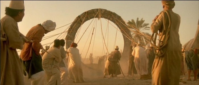
Whow! What a brilliant photo - quite convincing! Just one question: for this "Orbital Insertion" thingy - do you need a civic like 'advanced wizardry' or something from the tech tree to activate that gate to the nano wormhole?? Btw, cf. to Erich von Däniken with respect to 'Pyramids & Nazca Lines' ...I think it works like this:
As I already wrote, I still believe mountain tiles are impassable for the Warak'Aq on foot (and the Qhapaq Ñan invisible to other civs). But I'm not so sure, if he uses a magic carpet (1st class llamas wool etcI don't think so. As I understand it, units still can't be on mountain tiles. Moving onto a Qhapaq Ñan or a Mountain Tunnel teleports you to the other end at a cost of 2 movement points.
") ).
).There is already a pre-existing tunnel to the south which traverses a single mountain square

Yeah, I don't really restart because of "strong start" vs. "Weak Start." But if I'm playing with a civ that wants to use deserts for example, it might be that I--oh, I don't know--want to do stuff with the desert. Heh.Yes, I finally gave up and switched to another civ, and it seemed like half my starts had desert.
Yeah, I don't really restart because of "strong start" vs. "Weak Start." But if I'm playing with a civ that wants to use deserts for example, it might be that I--oh, I don't know--want to do stuff with the desert. Heh.
There is already a pre-existing tunnel to the south which traverses a single mountain square, this is the one he goes through.
if I'm playing with a civ that wants to use deserts for example, it might be that I--oh, I don't know--want to do stuff with the desert. Heh.
What about starting a game and then decide to play as whom?I've restarted a few times when I've played Peter and been nowhere near tundra.
Indeed.Of course, it's really hard to tell with this map
Teasing? The 2nd & 3rd Monday picture were also less explicit than possible ...why show so explicitly the builder creating the qhapaq nan
It looks like in this screenshot, the Qhapaq Ñan only costs 1 movement rather than 2.Can recon units cross rivers for 1MP? I thought they, like every other unit, could not. The only direct path is a river:
Of course, it's really hard to tell with this map because every tile has rivers everywhere and we don't know if the scout has the hills/woods promo. The rest of video has movement animations on, but in this shot the warak basically just teleports right to the barb camp instead of walking over the river first; hence I'm inclined to think he goes through that tunnel next to him.
I think just the option of actually working mountain tiles is a plus in my opinion. This makes it to where it can be a good production Civ without having to build lots of mines and use those for terrace farms instead.Work on mountains, those mountains only provide +2 prod, +1 food from each nearby Terrace, seems not a good yield to be worked on. But maybe I'm wrong.
How is his path, tile by tile, to the silver(?) tile - right from the lower portal?But Warakaq is not actually grossing a river. It seems in this case Warakaq goes inside the tunnel on his right side and then comes out from the tunnel below the cows. This is pretty clear when you look what other tiles he can move.
Based on the two Qapacs, I think graphically they put a stone arch/tunnel entrance facing every land hex a unit could enter/exit from that isn't across a river (or maybe they have a restriction so you don't get weird 6 arches depicted around mountain). The map icon shows the qapac symbol above the peaks of those two mountains- the qapac is probably attached to the whole tile itself. A one tile thick mountain range could probably be crossed by building just one tunnel/qapac. Its much easier to code that way.does a builder create an entry on all accessible sides of a mountain when he creates a Qhapaq Ñan or only at one side
I think when you "exit" it's kind of like flying to an aerodrome- it just drops you in the tile instead of computing crossing into it. I wonder if Qapac/tunnels also serve as road/rail hook up points.How is his path, tile by tile, to the silver(?) tile - right from the lower portal?
Yes, I suppose too, that 1 arch is displayed for this pair of tiles towards it stands inbetween. ("The new built Qhapaq Ñan to the right has no 3rd stone arc symbol towards the two volcanoes. I interpreted that as no valid direction. (not connected to the portal below)")Edit: I'm starting to think they have it set up to display 3 arches in a triangle, unless there's only mountains on that edge. The lower Qapac only shows three but it could show more, the upper qapac looks like it's showing the same arch layout.
The river crossing is ignored? Oh well.I think when you "exit" it's kind of like flying to an aerodrome- it just drops you in the tile instead of computing crossing into it. I wonder if Qapac/tunnels also serve as road/rail hook up points.

It's a little concerning that trade routes ignore the Qapacs (1:22 and 1:30) and go around the mountains - aren't they supposed to affect the "efficiency" of the TR and increase the yields?
Could be an oversight, could have been unfinished when they recorded the FL. Since railroads count for TR bonus but roads don't it wouldn't really bring you more gold. It's also possible when they included it, they felt it really hurt the incan ability to establish roads in their own empire if traders were just tunneling everywhere.I will be disappointed though if Trade Routes fail to utilize both in the release build.
I noticed that too. I think they said that about tunnels. It's not clear if that also applies to Qhapaq Nans. I will be disappointed though if Trade Routes fail to utilize both in the release build.
It's because the traders are still using camels and not llamas.It's a little concerning that trade routes ignore the Qapacs (1:22 and 1:30) and go around the mountains - aren't they supposed to affect the "efficiency" of the TR and increase the yields?
