[Map] Giant Earth Map

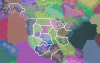
here is a preview version, I've made changes in the US based on your suggestions, split Congo, changed Quebec splitting axe to add Labrador, added a few strategic, and did a few other things, including small changes in elevation, which will make my other mod to fail to identify the map, so it's not for playing, just looking in the Editor.

let me know if there are some obvious changes that should be made before starting naming territories.

and landmarks, they seem to work now.

@SeelingCat @Evie @Tigranes @brick623
 

Attachments

and @Elhoim the Editor says we should not have a same continent for different landmasses for the AI, but do you know if we can split a big landmass (Europe/Africa/Asia on our maps) into multiple continents ?
 
and @Elhoim the Editor says we should not have a same continent for different landmasses for the AI, but do you know if we can split a big landmass (Europe/Africa/Asia on our maps) into multiple continents ?

This is what a dev told me:

- A territory needs to be configured to be either a ocean or a continent. Territory in the same continent should use the same continent number. For a earth map you should have only a few continents : eurasia+africa, america, australia. New zealand or small island can belong to ocean territories.
 
Thanks!

I think continent name is only used when you're the first to put foot on a new empty landmass, so noone will find out there is an "Eurasiafrica", only Australia, America and eventually Greenland would have to be named.
 
Yeah, and probably for civics events and such (your first city in another continent, etc).
 
For reference, the full territory maps

Spoiler Old World (North) :
Clipboard-12.jpg


Spoiler Old World (South) :
Clipboard-13.jpg


Spoiler New World (North) :
Clipboard-15.jpg


Spoiler New World (South) :
Clipboard-14.jpg
 
Took a stab at the United States regions - net neutral on territories overall. A quick summary (with some territory name ideas):

Alaska (pink): Just some smoother borders - Southern Alaska, Kenai?
Alaska (black): Smoother borders - Alaska
West Coast (black): Smoothed the borders a bit, grabbed an extra tile for San Diego area - West Coast
Southwest US (green): Expanded to encompass Arizona and part of New Mexico - Great Basin
Southwest US (purple): repurposed for Central America (see below)
North-Central US (olive): extended east to grab the rest of the Dakotas - Northern Great Plains
Central US (pink): extended east to get the drier parts of Nebraska/Kansas and half of Iowa - Central Great Plains
Texas (blue): gave it the full Rio Grande and half of New Mexico - Texas
Louisiana (lime green): shrunk down a bit - Louisiana, Mississippi
Florida (black): given West Florida to make it a bit bigger - Florida
Great Lakes (pink): shifted east to make it Great Lakes proper, basically Minnesota to Ohio - Great Lakes
Northeast US (grey): shifted border south touch just for aesthetics/practicality mostly - Northeast
Southeast US (black): loses Ohio country but gains southern Georgia - The South
Northwest Mexico (green): extends eastward to gain the rest of arid Northern Mexico - Northern Mexico
Central Mexico (blue): shifts south - should be less arid than the north - Central Mexico
Central America (black): split in two: the northern one would be Yucatan (Maya/Olmec zones); the southern one would be Central America
 

Attachments

  • NorthAmerica.png
    NorthAmerica.png
    3.5 MB · Views: 48
Many provinces are to small. (Greece, Netherlands, Latvia, Israel (this province is really ugly...no wood, no river or resources ) :rolleyes:
It feels like Civ 6 every three fields a City...:blush: I hate civ 6 for this.... no space for war or landscape...
 
Back again after looking at the southern part of the old world - this time I'm pretty sure I added quite a few net provinces (but at least I numbered them!):

Spoiler Africa :
1: Morocco - expanded borders a bit
2: Barbary Coast - slightly smaller
3: Mauritania - this is where the Ghanaian capital would be; extended out into the Sahara a bit
4: Western Sahara - shrunk significantly
5: Guinea - split this region in two since it was huge
6: Mali - this is like the core Mali territory: Niani, Jenne, Timbuktu, and Kangaba are all in this area
7: Niger - more Songhai focused area - Gao and Agadez are here
8: Benin - essentially Togo, Benin, and most of Nigeria; the exact western and northern borders are just kinda guidelines/ideas here
9: Libya - shrunk a bit
10: Chad - moved south a bit
11: Egypt - chopped in half to make room for:
12: Sudan - now theoretically Nubia and Egypt can exist at the same time
13: Central Africa - basically the Central African Republic and western South Sudan - could merge with Cameroon (16) but I thought that it looked a bit off
14: Abyssinia - Extended this one to the coast/Eritrea because Aksum's core was up there as opposed to the highlands - I know this may be undesirable for terrain aesthetics however
(Also I think Dallol should possibly move up a space or too but not super important)
15: Somalia - Loses Eritrea to Abyssinia (14)
16: Cameroon (or Equatorial Guinea) - Carved out of giant Central Africa (13) province
17: Congo - a BIG province; theoretically could cut in half east-west?
18: Swahili Coast - just gains the top of Lake Victoria
19: Angola - less dramatic shape - should not be desert
20: Zambia - not much to say here
21: Mozambique - as above
22: Namibia (or Kalahari) - extended a bit to the east to encompass the Botswanan desert regions
23: Zimbabwe - slightly larger than it should be but keeps the unique shape
24: South Africa - minor border tweak with the river, but those tiles could go to Zimbabwe instead if it needed to be bigger


Spoiler Middle East :
25: Hejaz - tweaked the border here to better reflect the border between Yemen and Oman in the south (and let it touch Socotra)
26: Eastern Arabia - as above
27: Persia - gave it some extra coastline but it loses a chunk of territory to Balochistan (28)


Spoiler South Asia :
28: Balochistan - carved out of Persia (27) and Indus/Sindh (29)
29: Indus/Sindh - loses western chunk to Balochistan (28) to focus mostly on the river
30: Maharashtra - central India; a tad dryer than the southern and eastern bits - Mumbai is located here
31: Ganges/Northern India - the Ganges river valley, both Delhi and Mauryan capital would be here; part of me wanted to split this east/west but couldn't find a good way to do so
32: Orissa - I guess you could shift the northern border here up to the Himalayas to split Ganges (31) but it looked weird to me when I tried it at first - advantage of that would be that you could have both Delhi and Pataliputra/Patna present; if you do that, this could be renamed to Bihar probably or even just Eastern India
33: Dravidia/Southern India - helps break up huge India provinces
34: Bengal - could push this western border one tile farther to the west to include more of West Bengal potentially


Spoiler Southeast Asia :
35: Burma - gave away its southernmost tile so that Siam could have a connected territory
36: Siam/Thailand - based on geography/linguistics decided to move Laos to this territory
37: Cambodia - gave it the Mekong delta, which historically Khmer territory
38: Vietnam - lost a good chunk of territory but gained a couple tiles in the north
39: Java - recommend merging the Lesser Sundas here
40: Makassar - move the Moluccas here; more cultural proximity than with Papua


Spoiler Australia :
41: Western Australia - just some border tweaks - recommend nixing the Lake Hillier territory and just put it on the mainland
42: Northern Australia - border tweaks
43: Queensland - border tweaks
44: South Australia - gave it its borders to the south of Adelaide
45: New South Wales/Southeastern Australia - border tweaks
 

Attachments

  • SouthernOldWorld.png
    SouthernOldWorld.png
    6.4 MB · Views: 54
One more map - northern Old World. Only got partway through before I had to stop (apologies in advance I didn't get to number these!):

Highlights:
  • Alternate split for Iberia into Portugal/Galicia, Castile, Aragon
  • Giving Denmark/Germany control of the Oresund due to Sound Tolls
  • Combination of northern Scandinavian Sápmmi provinces
  • Combined Baltic and Belarus territories ('Eastern Europe'?)
  • Split Iran in half (exact border is guesswork tbh)
  • Split Caucasus into Ciscaucasia and Transcaucasia
  • Marked alternative North Indian border from my last post
Unrelatedly, any idea what that lake in eastern Iran is supposed to represent?
 

Attachments

  • NorthernOldWorld.png
    NorthernOldWorld.png
    7.7 MB · Views: 46
Unrelatedly, any idea what that lake in eastern Iran is supposed to represent?
May have been a way to give fresh water to Persia spawn position in civ5...
Spoiler :
yagem_mo_8o3-jpg.435074


Or it has dried since and no-one had told me until now.
 
Many provinces are to small. (Greece, Netherlands, Latvia, Israel (this province is really ugly...no wood, no river or resources ) :rolleyes:
It feels like Civ 6 every three fields a City...:blush: I hate civ 6 for this.... no space for war or landscape...
Let's finish the version with territory naming for the True Culture Location mod, then we could have a version with larger territory more balanced for the unmodded game
 
Random thought, but Dyes could be a good resource to add to the Levant region potentially to make it a more appealing area and also represent the famous Tyrian purple dye
 
West Coast (black): Smoothed the borders a bit, grabbed an extra tile for San Diego area - West Coast
That area now has Silver, Gold, Oil and Coal.

Splitting would make 2 small region (Florida California, Oregon ?) in number of land tiles, but with 2 resources each, which I suppose would compensate.

thoughts ?
 
Last edited:
we have ~20 territory indexes left to use BTW (before starting to change the southern Old World)
 
I think either Temperate or Grassland looks best here - probably leaning towards Grassland with the examples.

That area now has Silver, Gold, Oil and Coal.

Splitting would make 2 small region (Florida, Oregon ?) in number of land tiles, but with 2 resources each, which I suppose would compensate.

thoughts ?

Could split the West Coast into Pacific Northwest (or Oregon) and California, I might recommend giving California the two or three lowest tiles of the Colorado River as compensation or maybe convert a mountain to hills.

Gold and Oil make sense for California, are the Coal and Silver in the Oregon section?
 
Grassland then.

Gold and Oil make sense for California, are the Coal and Silver in the Oregon section?
yep.

(edit: and I have no idea how I ended up writing Florida here :D)
 
Back
Top Bottom