You are using an out of date browser. It may not display this or other websites correctly.
You should upgrade or use an alternative browser.
You should upgrade or use an alternative browser.
Realistic Starting Nations Scenario v1.1
- Thread starter Paul Saunders
- Start date
Kal-el
Deity
Kal-el
Deity
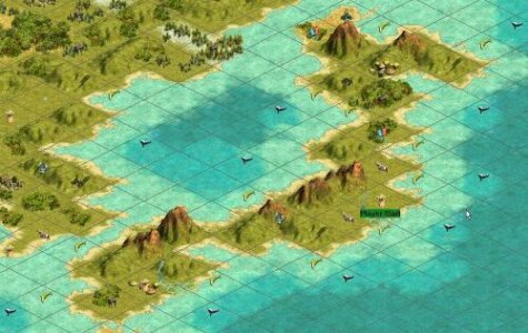
Here is the map. If you have already downloaded the latest version of Marla's Map with Vonotar's civ placement utility this map will work with it.
I think you have to rename this map to "Marla Singer's World Map 1.13" in order for the civ placement program to work.
After doing some editing I have moved the map to its own thread. There are more pics there.
http://forums.civfanatics.com/showthread.php?s=&threadid=12771
I think you have to rename this map to "Marla Singer's World Map 1.13" in order for the civ placement program to work.
After doing some editing I have moved the map to its own thread. There are more pics there.
http://forums.civfanatics.com/showthread.php?s=&threadid=12771
Marla_Singer
United in diversity
The civ placement doesn't require the map (.bic file) to be renamed.
You just need to load that custom version of the map and then save the game as FIX.SAV.
The placement will put each civ to their correct locations.
")
You just need to load that custom version of the map and then save the game as FIX.SAV.
The placement will put each civ to their correct locations.
Kal-el
Deity
Marla, thanks for the heads-up on that.
Paul Saunders
Warlord
Originally posted by Bamspeedy
I definitely like some of the adjustments you have made to Marla's map. The way it was set up before, it was way too easy for the european countries to make it to North America, way too early in the game (too much coast for the galleys to travel on). Because of the easy travel, that is probably why she said the AI settles everywhere!
However, although it seems logical to give the Celts and Japanese map making at the start, the problem I see is that it allows them to build the Great Lighthouse before any other nation had even discovered Map Making. The Great Lighthouse built before the Pyramids!?!? And any civ that did build the Great Lighthouse would be able to colonize the Americas well before any other nation.
After playing on this map for a while, I think I should add a thin strip of sea around the coasts, just to give early boats a bit more room to manoeuvre around one another and to help stay out of other nation's territory.
I agree with what you're saying about giving the Celts and Japanese mapmaking. It does give them an unnatural headstart. In my current game the Japanese did indeed build the Great Lighthouse before anyone else, yet seemed strangely reluctant to leave their islands, preferring to colonise crappy tundra islands before sailing to the mainland. No point giving them mapmaking in that case.
Paul
Paul Saunders
Warlord
Originally posted by Blakis Maximus
There must be some way to make tundra and desert behave like mountains. Also, it's important to keep in mind that catapults and such are unable to travel on mountains. I'm not sure if this would make sense for tundra and desert tiles.
Well we don't want to make tundra and desert act like mountains, we just want to prevent anyone settling there. There's probably a flag which controls this. I've been looking at the .bic file with a hex editor and I think I've found the part that controls it, unfortunately I don't know what the numbers mean. Maybe time for a bit of experimentation?
Anyone experienced with hex editing out there who could figure it out?
Paul
Paul Saunders
Warlord
Originally posted by redtom
Why don't you make desert and tundra not have any food? As it extremely difficult to take food out of the sahara (i should know i've been there.) This alter discourage ppl from settling on unfit land.
Well desert doesn't give any food anyway, so I doubt that reducing food to zero on tundra would help. I know tundra looks like ice in the game, but it's not frozen all year round.
The key problem is that whenever you settle a city, it automatically gets at least two food and one shield, no matter where you build it. This is why it's possible to settle on desert and tundra in the game.
This is wrong IMO. How can deciding to make a city in the middle of the Sahara suddenly make the land underneath magically fertile? This is just stupid. And I imagine this would be difficult if not impossible to change.
So the only way to stop it is to prevent settlers from building cities on desert and tundra in the first place.
Paul
Paul Saunders
Warlord
Originally posted by wilboman
I'm half Viking (Norwegian) and half Irish.
It just so happens that both a Viking explorer (Leif Erikson, look him up), and an Irish saint (Brendan the Navigator), made it to the Americas before 1000 AD. As did Breton fishermen. AND there have been made subsequent expeditions to prove it. They found Viking settlements on Nova Scotia and Newfoundland. So you're not all right there. The reason they disappeared was because they weren't interested in staying. The natives were too dangerous. But I do see your reasoning, however. It would be boring if the Americas were colonized too early. It's more fun this way.
Well I'm not saying they didn't get there, but they didn't built up a civilisation there. Maybe they could have, but they didn't, and that's what this scenario is trying to represent.
Paul
Paul Saunders
Warlord
Originally posted by Bamspeedy
there was a settlement in Greenland (perhaps a few grassland squares should be added to a tip of Greenland).
Yes, there should, Greenland is not all ice. Unfortunately the grassland in the game represents rich farmland, whereas the Greenland grass is just thin topsoil, just tundra really, I doubt it could support farming. The sea would be the main source of food.
I tried placing plains tiles there but the game wouldn't allow plains next to tundra, it insists on putting grassland in between, and I think grassland is just too good to put on Greenland. I don't think civs should be encouraged to settle there.
Paul
Paul Saunders
Warlord
Originally posted by wilboman
Eric successfully got himself exiled from Iceland for killing a man (never learn, do they?) and, foolishly, headed west (must have had a bad sense of direction...). He lucked out though, and landed on what was at that time a green land. It's not really very green anymore, due to climate changes, but whatever.
I don't think climate has changed that much in such a short time. I was taught at school that Greenland was purposely named in order to encourage settlers, to make people think they were heading to a "green" land.
So I completely agree with the reasoning as regards the whole uncrossable thing. I said so the other time as well. All I'm saying is that historically we're not entirely correct here...
True, but hey, it's just a game, and it's not particularly realistic anyway. I'm just trying to make it play in a reasonably "realistic" way.
Paul
Paul Saunders
Warlord
Originally posted by Kal-el
This is a beautiful idea. I love the idea of handicapping the Africans, Aztecs and Iroquois. Although I think that I will play with the Aztecs and the Iroquois in the game. There were tribes here when the Europeans got here after all.
Well that's your choice, but I don't really agree. By the way, I've just reached America first as the Germans (actually my settlers were mostly built in Britain and France so it's really the British and the French who are colonising America's east coast), and I'm having a hard time settling there.
After thousands of years the barbarians have built up into significant numbers and my early settlements are being hammered by wave after wave of barbarian horsemen. Washington has been sacked a number of times, my workers and explorers are afraid to leave the settlements and many of my settlers are still waiting on galleons anchored just off the coast while the remainder of my fleet is racing back for reinforcements. Britain and France are desperately churning out more galleons to get troops over there as quickly as possible.
It seems I underestimated the barbarian (Red Indians) threat. I should have taken an army over there first to clear some space before taking the settlers (I did take some troops with them but not enough).
I'm guessing that if I'd played with the Iroquois in the game, they'd have dealt with the barbs as and when they'd appeared and the whole area would now be covered with small cities and few, if any, barbs.
Attacking any of these cities would constitute war (not good for a republic, soon to be a democracy) and it would be a war against a whole civilisation rather than just scattered tribes. So far I think the barbarian idea is working very well. I shall have to see how it pans out.
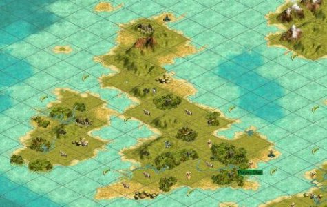
I am currently working on my own modification of the Singer map. I have concetrated on making certain areas of the map look more like their actual earth counterparts. To this end I have redone Italy, Sicily, and Corsica. I have modifed England in order give the Brits some more room to work with. I reworked Greenland, placing mostly mountains with a touch of grassland around the southern and southeastern edges. I have reworked the Great Lakes Region of the United States.
Great Lakes: very good, I like it, much better.
Italy: Mm.. maybe.
Britain: I think you've overdone it a bit, it may be a slightly better shape but I don't think the size of Britain should be overemphasised. There definitely shouldn't be any plains there, it's all rich green grassland. And if you're going to put oil there, it should be in Aberdeen (north-east coast) because that where it arrives from the North Sea Oil Rigs.
Spain: Sorry, but I don't like the shape of this at all, I think Marla's was much better. And what happened to the Pyrenees? There's a major mountain range separating Spain from France.
Japan: You haven't changed the shape of the land much, you mainly seem to have added more resources, especially whales. I like it.
I realize that in some places i have put plains when others might think that grassland would be more appropriate but I was really going more for asthetics. There isn't that much of a difference between the two in the game, but the appearance on the map is amazingly different.
I think there's a big diffence in the game. Grassland allows for fast growth and big cities, plains are better for mining resources, and are more difficult to get food from. Mined grassland is the same as irrigated plains, but irrigated grassland and mined plains are very different.
I'll be honest, I think Marla's map is pretty definitive in that it was copied square by square from an actual map. I think that altering the shape of things here and there in a localised way is a bit dubious, and doesn't necessarily fit well with the overall design philosophy.
It's impossible to design a truly realistic world map, so much depends upon the projection used and the way features are interpreted by the designer. I don't think anyone is really right or wrong about how an area should be represented, it's all down to personal intepretation, and we all have different ideas about that.
I personally think that much of Southern Europe (Mediterranean climate) should be represented by plains rather than grassland, since the soil is thinner and drier than northern Europe.
Paul
Bamspeedy
CheeseBob
Ok, now that I have played on this map for awhile, I have two comments. I played as America (I know I'm not supposed to, but I wanted to see how the AI developed Europe, Asia and Africa, with no interferance from me).
#1. For some reason whenever I tried to settle on the Aluetian Island (Alaska), that was farthest west, the game crashed. I looked at the editor rules, and the setting for Huge was 180X180, so I changed it to 255X204 (the size of the map), thinking this could be the problem, but then I had also changed the island one square over so it had a 0 coordinate, instead of 255, so I don't know if changing the rules actually solved it. But it worked after that.
#2. This is more my fault, because I didn't use the right program. I used the map with Paul's changes, but I used her program (the fixed.sav one) for the starting locations. Africa was limited to only one city (in South Africa it couldn't grow past a size of 2 to be able to build a settler!) No tiles produced more than one food.
Oh, yeah almost forgot, yeah, it is a good idea, to add perhaps one square of sea to separate between the coast and the ocean. This would allow coastal and island cities to be slightly more valuable by producing a little more commerce (working ocean tiles suck!)
Paul Saunders
Warlord
Well I've been playing the Germans and have been stuck in Northern Europe for most of the game, so I think I've seen a fairly realistic development, although the Romans and Russians might have been a bit more successful without me there, I've absorbed a number of Roman cities and captured a couple of Russian cities. (I'm not a warmonger type player.)
Currently my score shows me 6th out of 9, with the Egyptians in the lead, closely followed by China, Russia and India. Japan is 8th, only slightly ahead of Africa.
The score is very misleading though, it's calculated mainly on happy citizens and territory controlled. I've got the smallest land area of anyone except the Japanese, but I have the largest population, the most money and the highest production, and I'm only slightly behind in tech (I can catch up easily but I'm building up my treasury at the moment). I don't think the score is a valid representation of who's actually winning. My culture is way ahead of everyone else and I've colonised America first, so my future is secure.
Thanks for pointing out that map problem. I hadn't realised I should set the map size. I reverted to the default rules before modifying them and I forgot to change that.
As for Africa, yeah, you should have used the file I supplied because I changed the start location for the Africans. I started them on a grassland tile with a lake full of fish next to them. Nearby are another four grassland tiles and a couple of lakes with fish, an excellent location for a second city, and good for churning out settlers.
I've just checked and they currently have 24 cities, covering almost the entire southern half of Africa (the Egyptians have the north half, mainly in the desert). Most of the African cities are size 2 or 3, but they have one 4 and two 5's.
Yes, I will add an extra strip of sea next to the coasts.
As well as taking mapmaking away from the Celts and Japanese, do you think I should start the Celts in Europe instead? After all, they didn't originate in Britain, they moved there like everyone else. In fact, should they be in it at all?
How many European nations are you playing with? If a lot, are they all wiping one another out and letting the eastern empires get too powerful?
Paul
Paul Saunders
Warlord
Janneboy
Chieftain
Originally posted by Paul Saunders
I don't think climate has changed that much in such a short time. I was taught at school that Greenland was purposely named in order to encourage settlers, to make people think they were heading to a "green" land.
Actually it has... Greenland was more arable 1000 years ago.
British fishermen were travelling quite frequently between British Isles and New Foundland and even Nova Scotia coasts. The climate of those areas has changed as well - the climate change is described in the book mentioned later. Markku Henriksson estimated the frequency of those trips (IIRC, I'm not totally sure) to be 100 trips per year at the time when Columbus made his trips. The reason why outsiders knew very little of these trips is that fishermen want to keep their best places a secret
I don't know if Henriksson's book is translated into English or other languages, but for those who can read Finnish I recommend a book (I believe at least a Swedish version should be available):
Markku Henriksson: Toinen Aalto: Eurooppalaiset löytö- ja ryöstöretket Amerikoissa
The name could be freely translated as: The Second Wave: European exploration and raiding in America. The first chapters describe nicely pre-Columbus voyages to America. The rest is quite detailed description of different expeditions throughout the continent also giving some background to the expeditions. Mr. Henriksson has made some throughly exhaustive research on the matter. Fashinating reading
- Janne Keskinarkaus

Paul Saunders
Warlord
Well if that's true it's very interesting. Thanks for pointing it out.
Paul
Paul
Paul:
I have been playing your version 1.0 of this scenerio and it's been a lot of fun. Problem is, my computer is choking on the game. Each turn constitutes a coffee break.
I really love the concept of developing nations in europe and colonizing the americas later,- is there anyway you could scale the whole map down while keeping the spirit of the idea intact.
Someday when i get a faster computer i love the earth bit, but for now i would settle for a map that kept the spirit of mid-game colonization and the existence of a "third-world" like civ (your africa).
Thanks for creating this great scenerio, hopefully you'll make some more.
Originally posted by jpippert
Someday when i get a faster computer i love the earth bit, but for now i would settle for a map that kept the spirit of mid-game colonization and the existence of a "third-world" like civ (your africa).
Hey jpippert!
Just a suggestion for you. After you've chosen this as the scenario to make a new game out of, you've probably noticed you get the option for Civ3 to create a random map instead of the map in the scenario. You could even choose to have less Civs involved, changing the scenario completely to your liking. That way you can still have the special aspects and rules of this scenario, including the racial restrictions while still being able to play on a smaller map that won't slow the computer so much. Could be worth a try.
Ash
Paul Saunders
Warlord
Originally posted by jpippert
I have been playing your version 1.0 of this scenerio and it's been a lot of fun. Problem is, my computer is choking on the game. Each turn constitutes a coffee break.
Are you using the latest patch? You can switch off the graphics and animations for the other nations, it speeds up the turns a lot.
I really love the concept of developing nations in europe and colonizing the americas later,- is there anyway you could scale the whole map down while keeping the spirit of the idea intact.
That was the original idea, but I haven't got around to doing my own map yet, so I used Marla's for now. What size would you prefer? It's currently 256x204. I was thinking one of the two largest sizes would be best, either 180x180 or 140x140. What do you think?
Thanks for creating this great scenerio, hopefully you'll make some more.
Yeah, I plan to, but I have trouble finding the time at the moment.
Paul
Similar threads
- Replies
- 1
- Views
- 402
- Replies
- 5
- Views
- 774
- Replies
- 8
- Views
- 2K