tofof
Chieftain
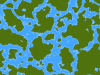
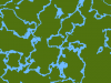
SpincruS said:1) There are too many desert tiles in too many weird locations. Even right next to a tundra. Yes, deserts aren't always necessarily hot, any open area without considerable plant growth is classified as a desert, but the graphics annoys me. I'd like to see more plains rather than deserts, and deserts focused on certain key areas. More like big spots where all desert tiles are concentrated, rather than small spots scattered throughout the map.
I'm the one who asked about deserts, Spin. Rather than changing the grain, as was suggested, when I went into CvMapGeneratorUtil.py I found that, to my surprise, deserts were set to 35% coverage while plains were only 20%. I too was annoyed at the desert/tundra thing. I think I see the problem the devs ran into - the northern borders of mongolia and khazakstan (both basically desert) are at the same latitude as the southern border of alaska. I guess what breaks immersion for me is that desert/tundra isn't so much defined by latitude as by geocentric region. Yes - in asia, there is desert that far north. In north america, that same latitude is tundra and the nearest desert is 1000 miles south.
So, my fix - It's crude, but I'll be refining it further. (This is around line 1000 in the mapgenerator python file, in the terraingenerator function).
def __init__(self, iDesertPercent=25, iPlainsPercent=30,
fSnowLatitude=0.7, fTundraLatitude=0.6,
fGrassLatitude=0.1, fDesertBottomLatitude=0.15,
fDesertTopLatitude=0.4, fracXExp=-1,
fracYExp=-1, grain_amount=4):
I moved the desert latitude further south (it was at .2-.5, now it's .15-.4), dropped the amount of desert by 10%, and raised the amount of plains by 10%. The desert has a slightly smaller region in latitudes, which keeps it from getting even more 'patchy' with the reduced coverage percentage.
Even if you're not a programmer, these numbers are easy to understand. Oh - latitude is 0.0 at the equator and 1.0 at the poles, so a latitude of .5 is the same as 45 degrees on a globe.
Hope this helps you.
")