(My first SG)For newbies

Pequenino said:
@gmaharriet: Stupid mistake on my part:mad: :mad: .........No wonder it was going slow:p

@Scoutsout: Thx for the suggestion..........BTW r the maps i made with CivAssit II alright??

lurker's comment: With respect, the biggest mistake you made was building on the Wheat. Even in despotism it would give 4 food once irrigated.
 
Pequino built on the wheat?? :eek: :eek:
 
Pequenino said:
BTW r the maps i made with CivAssit II alright??
CAII is great for locating all the sites possible on a ring, and you did a good job with it.

I think I know what Scout has in mind (I've seen his dot maps) and, once having figured out what sites are possible, his maps are easier to visualize what your empire will look like after choosing specific sites, and probably easier for another player to use when actually sending out a new settler.

It was always a chore to just do all the counting manually to determine which tiles were in which ring, thus the real help CAII gives with that. It's also why they changed the corruption model in Conquests to eliminate the need for RCP.
 
Yeah I already know Scoutsout is the expert here , and I will listen to his advices for sure :D
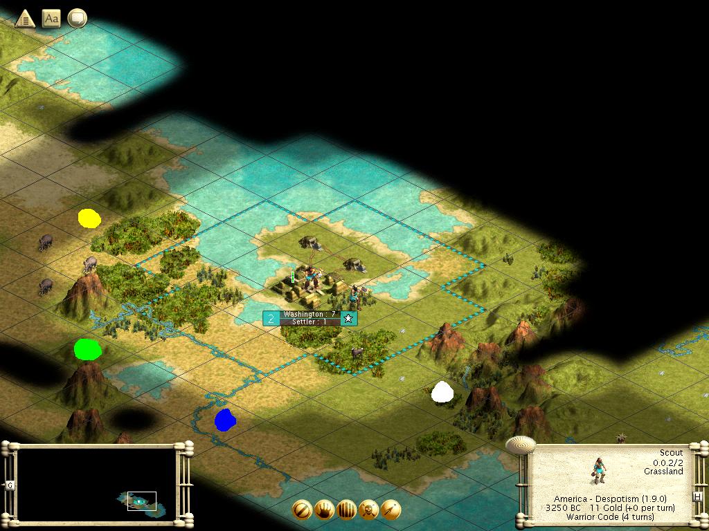
and Pequenino gmaharriet just told you about a mistake you've done with the settler , you can't build a settler if your city has no Citizens to sacrifice for him , when building a settler, the city prudces him drops in 2 . in our situation we don't have more than 2 citizens in our city which means our settler will be ready when the city will grow to 3 ( I guess I've to change the settler -> Granary . and the forest choping will make it faster )

Since I don't know how creating a dotmap I can only talk about it .
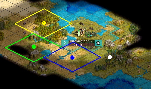
I saw in one of your screenies that we've a river but on plains. I think our 2nd city should be settled on the southern Ivory. 3rd city has 2 options for me , it can be settled on the Game that out of our borders , or 1tile WEST the Game that out of our borders .
4th city on the hills along the Coast and if we scout next maybe we can get something interesting .
I think 5th city should be settled on the Wheat NE along the Coast ( we'll still have another Wheat to work , it's good ) .
6th city should be settler SW to the cow in the east , we will have a cattle , river and 2 BG's in our non-expanded borders .

@Scoutsout what do you think ? ( maybe you should translate my bad english to have comments :D )

@ Bucephalus - hmm I hope it won't sound newbiee , but can we irrigate that Wheat ? the nearest river does'nt even located in our Capitol borders :|
 
goodsmell said:
and Pequenino gmaharriet just told you about a mistake you've done with the settler


Already acknowledged that.


Hadn´t even noticed the whole Wheat thing:crazyeye: .................guess it shows just how newbie i am, huh?:D :D :D

So i take my screenies with the CivAssit II dotmaps were helpful????....I agree with you on the city settling, all though there might be some changes as new terrain is explored and new resources come up.

BTW, I am really interested in learning how to make better dotmaps, so I´ll take your offer Scoutsout, if you are still offering to teach me

PS: goodsmell, you haven´t posted a "got it" yet, and its past the 24 hour limit. I´ll give you another 24, since were discussing some game strategies with experts. If you want us to skip you this turn just post so, and choxorn wil take it up
 
Hey guys, I will be away until Sunday evening. HOpefully I won't holdyou up....how long does each person have for their turns?
 
@Pequenino: The maps you made with CA2 looked good for thier intended purpose... which is mainly to show where the ring is at a given distance.

I'll post an example of one of my dotmaps later tonight. I'll probably use a different ring setting so you guys aren't tempted to just use my settlement pattern. ;)
 
Here's a dotmap for you. I prepared this using sites at distance 4... and when you look at this dotmap, you'll probably conclude that distance 3 is a little better for your first ring on this particular map.

When you start plotting the positions and looking at the tiles, it can help you spot positions that might be crowded, or opportuntities you didn't see at first. It also gives a clear reference for in-team discussion.

Pequenino_Dotmap.jpg


What I like to do is plot the sites I intend to settle, and then draw lines around the nine tiles that a city on that site would be able to work immediately. Others may prefer to sketch in the full 21 tiles you'd get with the first cultural expansion. Neither technique is really "better"; I just prefer to look at the first 9 tiles. Looking at the territory claimed will give you a better idea of what the empire would look like if you settle it that way.

Anyway, if we were having a hypothetical discussion on the dotmap I just posted, we could make the following points about this plan:
  • "Yellow Dot" claims Ivory
  • "Green Dot" and "Blue Dot" have a lot of riverside plains to work for commerce.
  • "White Dot" is on a game tile, but is the only site in that area at distance 4 because of the mountains, and it crowds "Blue Dot".
  • If we were to try looking at an inner ring at distance 3, we might be able to get a nice riverside/coastal site in our second ring at distance 6 or so, south of "Blue Dot".
 
I'm not sure if I understand what you meant . but Distance 3 is like CxC ?
and I like your dotmap , it's like neat
Yellow Dot will help us by capturing the Ivories , we will have Coastal city plus luxuries .
green dot has river and forest to chop to have early development .
Blue dot also has a lot of river . White dot is great by capturing the Game , and it's also has BG .

If our next ring will be on CxC . I afraid the cities won't have enough tiles for Citizen workers .
btw , is'nt it a good idea to settle first city on the Wheat with the river and coast ( 2 Wheat ) it may produce a Settler factory ? if so , we can manage the Settler Factory and build the Ring you show'ed .

and Pequenino I guess I will skip . I'm sorry I did'nt say it before .
 
goodsmell said:
I'm not sure if I understand what you meant . but Distance 3 is like CxC ?

and Pequenino I guess I will skip . I'm sorry I did'nt say it before .


CxC??? was that on the rule of thumb gma gave us?..............i though it was either CxxC or CxxxC:confused:


Alright, don´t worry about it. Choxorn, can u take it up? (@choxorn: you have 24 hours to post a "got it", since the time i posted this)
 
goodsmell said:
I'm not sure if I understand what you meant . but Distance 3 is like CxC ?
and I like your dotmap , it's like neat
Yellow Dot will help us by capturing the Ivories , we will have Coastal city plus luxuries .
green dot has river and forest to chop to have early development .
Blue dot also has a lot of river . White dot is great by capturing the Game , and it's also has BG .

If our next ring will be on CxC . I afraid the cities won't have enough tiles for Citizen workers .
btw , is'nt it a good idea to settle first city on the Wheat with the river and coast ( 2 Wheat ) it may produce a Settler factory ? if so , we can manage the Settler Factory and build the Ring you show'ed .
and Pequenino I guess I will skip . I'm sorry I did'nt say it before .
No, distance 3 is CxxC, 2 tiles and then the city.
 
Strange, scoutsout's cities are at CxxC and CxxxC. I think the Yellow dot should be 1 tile NW and the Blue Dot 1 tile SW to make all cities CxxxC. I'll do that on this turn. Got it.
 
hmm the problem is that he did one city CxxxC to settle on the Game and not on the BG to be able to work it , and if you change the Yellow dot 1NE , it won't capture the Ivory in it . and consider the idea of the blue dot choxorn , that will make a distance between green dot and blue dot of CxC ( I don't think we want it )

but we've to think what to do with the White dot . it does'nt dotted on a CxxC system , and it's CxC from the blue dot , I think it's too much overlaping . I can't think about any options :(
 
You seem to have misunderstood me, goodsmell. These are the city locations I meant:

Pequino_dotmap.JPG

Now do you understand? All the cities are at CxxxC with the capital, the Yellow dot still gets the ivory, and there is no ICSing.
 
Now I see what you mean mate , it looks nice ! but I would like to see our Ivory city has it ivory and Coast too . btw what is it ICSing ? I'm very sorry I don't know some meanings from "Civ dictionary"

I also want Scoutsout and Gmaharriet to say their opinion on your dotmap , okay ? I hope you've time to not to play now , try to play after their comment please .
 
Back
Top Bottom