You are using an out of date browser. It may not display this or other websites correctly.
You should upgrade or use an alternative browser.
You should upgrade or use an alternative browser.
Undersea Eruption in Tonga (awesome pictures)
- Thread starter Nordstream
- Start date

I think this is current, credited to Tonga Geological Services/via Reuters from here. Click for hi res.Does anyone have a ground-level view of the thing exploding?


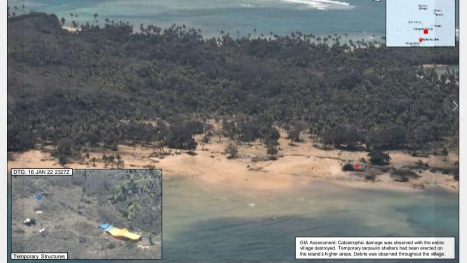

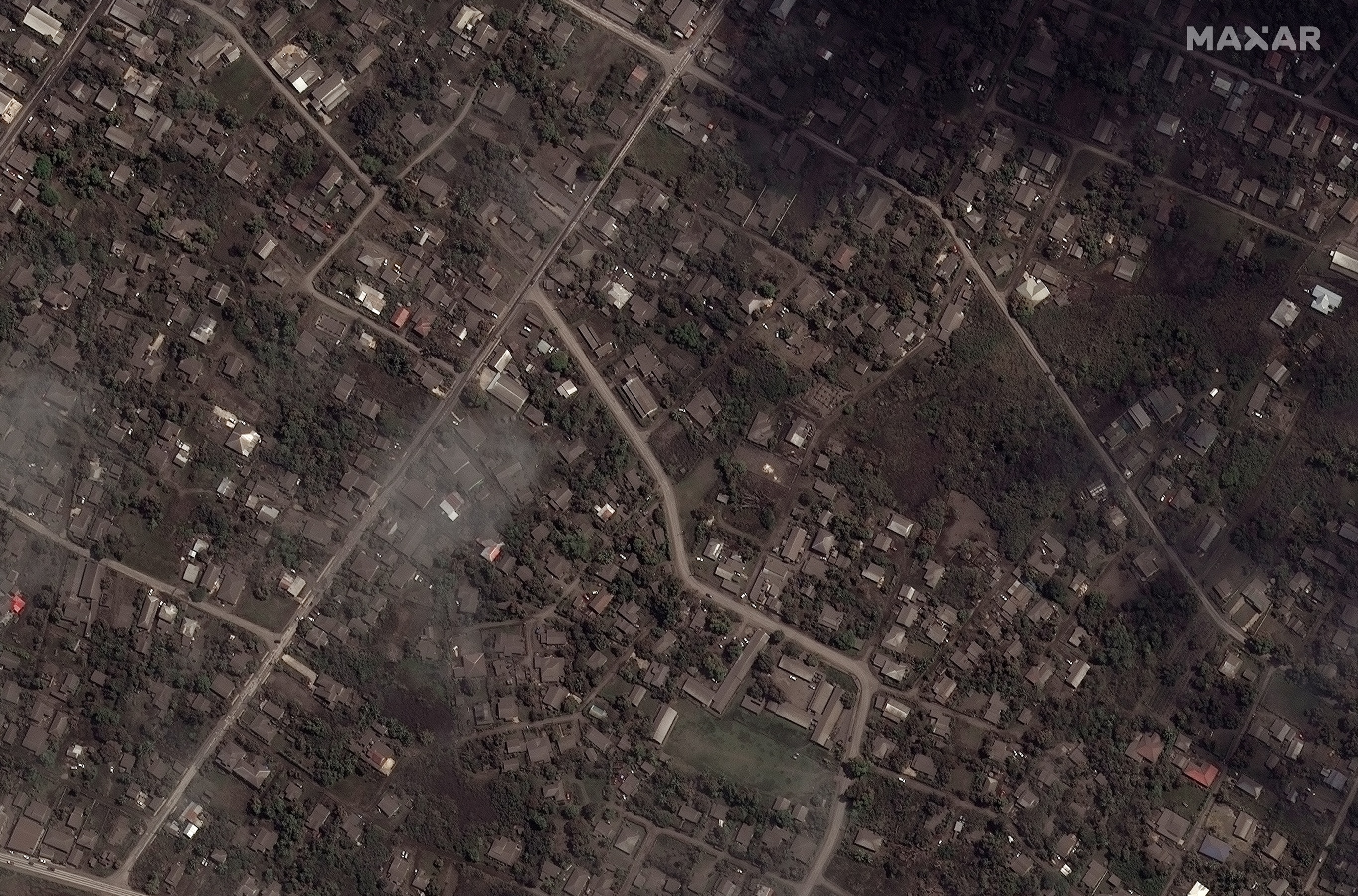


Couple more images:

Water vapour imagery shows how the #eruption causes a ripple effect across the atmosphere. Absolutely enormous energy.
The volcano is a bit larger than it may have appeared.
Water vapour imagery shows how the #eruption causes a ripple effect across the atmosphere. Absolutely enormous energy.
The volcano is a bit larger than it may have appeared.
Tonga volcano eruption created puzzling ripples in Earth’s atmosphere
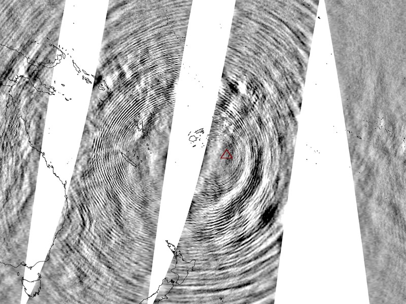
Images from the Atmospheric Infrared Sounder on NASA’s Aqua satellite show dozens of concentric circles, which are fast-moving atmospheric waves. Note the outline of Australia and New Zealand to get an idea of the scale of these waves.
Powerful waves ringing through the atmosphere after the eruption of Hunga Tonga–Hunga Haʻapai are unlike anything seen before.
Scientists are racing to understand a puzzling series of massive ripples in Earth’s atmosphere triggered by the eruption of the Tongan volcano at the weekend. Satellite data shows that the event provoked an unusual pattern of atmospheric gravity waves. Previous volcanic eruptions have not produced such a signal, leaving experts stumped.
The discovery was made in images collected by the Atmospheric Infrared Sounder (AIRS), mounted on Nasa’s Aqua satellite, in the hours after the eruption of the Hunga Tonga–Hunga Haʻapai volcano on 14 January.
They show dozens of concentric circles, each representing a fast-moving wave in the gases of the atmosphere, stretching for more than 16,000 kilometres. The waves reached from the ocean surface to the ionosphere, and researchers think that they probably passed around the globe several times.
“This instrument has been operating for something like 20 years now and we have never seen such nice concentric wave patterns,” Hoffmann adds.
He and his co-workers suspect that a “great big, messy pile of hot gases” in the upper atmosphere might be what kicks the waves off. The hot gas is “going up high into the stratosphere and knocking the air around”, he says.n
Osprey says that the eruption might have been unique in causing these waves because it happened very quickly relative to other eruptions. “This event seems to have been over in minutes, but it was explosive and it’s that impulse that is likely to kick off some strong gravity waves,” he says.
Images from the Atmospheric Infrared Sounder on NASA’s Aqua satellite show dozens of concentric circles, which are fast-moving atmospheric waves. Note the outline of Australia and New Zealand to get an idea of the scale of these waves.

Snowygerry
Deity
(...)
So they have clearly been driving it, without cleaning the ash over more than the windscreen wipers sweep ?
Not sure if you can conclude that from this picture - maybe someone just got in to see if it still started ?
Zardnaar
Deity
Lots ofTongans here. They've sent a couple Of frigates to help. That's half of the navy.
https://i.stuff.co.nz/world/south-p...i-tweeted-pictures-show-eruptions-devastation
Loading up the Hercules.
https://www.rnz.co.nz/news/national...ve-for-tonga-today-with-water-and-food-henare
https://i.stuff.co.nz/world/south-p...i-tweeted-pictures-show-eruptions-devastation
Loading up the Hercules.
https://www.rnz.co.nz/news/national...ve-for-tonga-today-with-water-and-food-henare
Last edited:
So they have clearly been driving it, without cleaning the ash over more than the windscreen wipers sweep?
Water is likely in short supply and cleaning the car is probably a low priority. Cleaning the side windows at the front might have been a good idea, though.
Zardnaar
Deity
Water is in short supply we're shipping it up to Tonga.
EnglishEdward
Deity
Tonga is an island, there is plenty of sea water.
But water may cause the ash to set, like cement.
But water may cause the ash to set, like cement.
Zardnaar
Deity
Tonga is an island, there is plenty of sea water.
But water may cause the ash to set, like cement.
It does. Tongas gonna need help as they might get crop failure as well.
That's gonna fall on Aussie and NZ.
Zardnaar
Deity
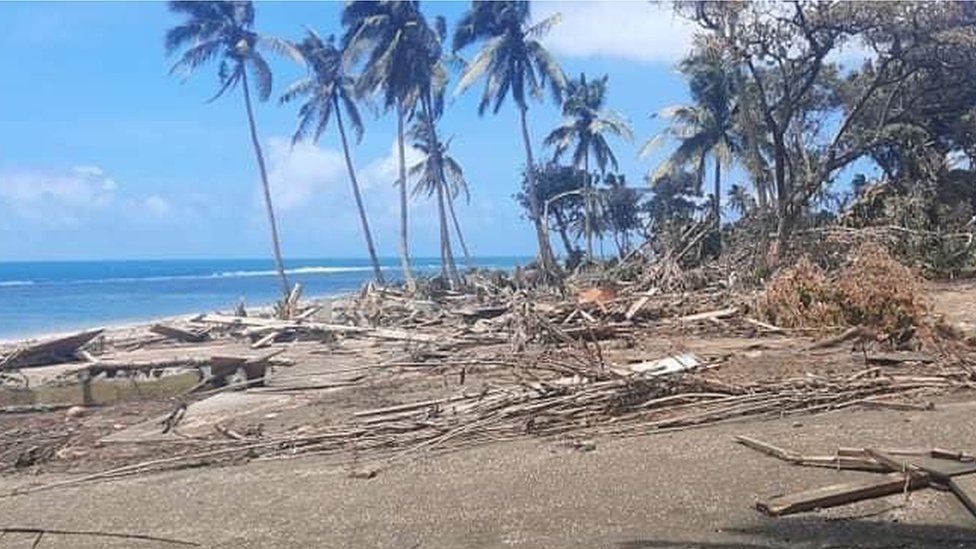
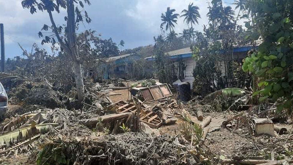
Earthquake strikes off Tonga’s coast

A magnitude 6.2 earthquake has been recorded off the coast of Tonga almost two weeks after the Pacific kingdom was devastated by a volcanic eruption and tsunami.
The epicentre was located 219km (136 miles) northwest of Pangai, a town on the remote island of Lifuka, at a depth of 14.5km (9 miles), according to United States Geological Survey (USGS) data.
There have been no immediate reports of damage but communication is limited after the earlier eruption severed the main underwater cable connecting Tonga to the world.
Similar threads
- Replies
- 40
- Views
- 3K
- Replies
- 2
- Views
- 705
- Replies
- 9
- Views
- 197
W