Akbarthegreat
Angel of Junil
PS: MORE REGIONS, PLEASE. The new map badly needs them.Would it be possible to allow editing of the region map through WB, though? I'm itching to add more regions already.

What are these regions used for?
PS: MORE REGIONS, PLEASE. The new map badly needs them.
Having only 1 tile between Salonica and Athens looks worse than the slight crowding of Belgrade. You can get an 8 pop city with only 5-6 workable tiles if the resources and planning are good, and Belgrade isn't a huge city, even today.Seven tiles seems like a choke to me, but it can be addressed with more resources. I still don't see how that is more geographically accurate, though.
Spoiler :
Edit: Both tiles would be somewhat geographically accurate, actually. But it's better to give breathing room to Austria+Hungary+Serbia; Athens has water tiles for growth, anyway.
Is it really necessary to set cities that cannot fully work their first ring onto this map? Especially when their corresponding civilizations haven't been implemented.
I assume all the cities there are only for context, no AI will ever found cities this way and I certainly won't do this placement in a scenario.
Here is my feedback
1. Asia Minor looks better when stretched from the eastern side (i.e. 1 extra column in the Trebizond area) than on the western side like you did, but this is minor and can be easily changed - here's my proposal for Asia Minor + Byzantine city placement
2. I really don't like the land connection between Denmark and Sweden, for three reasons, some more valid/important than others.
a. It turns the Baltic into a lake and makes Atlantic access for Baltic civs dependent on good relations with or control of Copenhagen
b. It's not really geographically accurate
c. It looks rather strange
3. The new Pomeranian coastline looks nice around Stettin, but I don't like the way it gives Berlin sea access. The two tiles removed from the Danzig area sort of looks like someone took a bite out of Poland, though.
4. The way you did the shift made the Vistula 1 tile wider, which shouldn't actually happen. Just put Warsaw on the East side and leave the Vistula the way it was - Warsaw (and Cracow) are on both sides of the Vistula, so either side is equally geographically accurate.
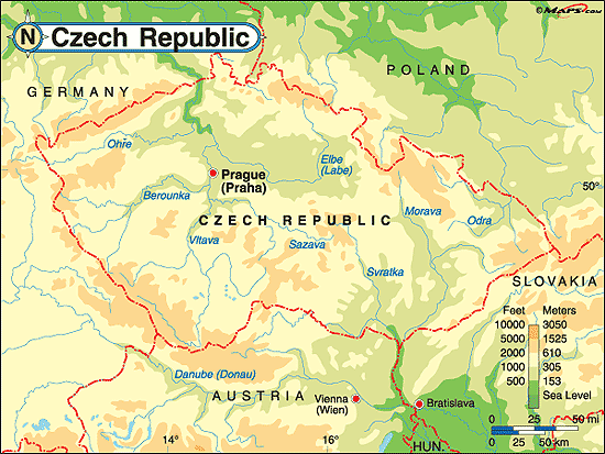
5. Prague should be 1S


2. a. The same situation is produced with Constantinople and the Black Sea, or the Suez. These were important, historical chokepoints, and I think that they do their job nicely. My biggest issue is that to pass the Oresund or the Bosphorus, a city or fort must exist. This could be fixed by allowing ships to pass diagonally through a narrow isthmus:
Spoiler :
I remember that this was a feature in Civ2, which allowed for navigable island chains and straits.
b. Enlarging Europe to the size that it is isn't geographically accurate. :^)
c. I think that the strangeness stems partially from how blocky it is. Here you can see that it's not terribly inaccurate:
Spoiler :
Open borders?
Thanks for your work in making the new map editor. But are you planning to fix this bug soon? It could be very helpful. Thanks again.The feature is still in the game. But a small bug (the word "not" missing somewhere) disabled the feature from working. Will upload a PR soon. Thanks for noticing it.
If they are in good terms with Vikings or Holy Rome(Hamburg as passage). If neither, then... well probably colony should not be their main concern.How about Poland? Will they be allowed to occasionally recreate Courland's colonies?
Thanks for your work in making the new map editor. But are you planning to fix this bug soon? It could be very helpful. Thanks again.
It's not any more crowded than Europe on the current mapI assume all the cities there are only for context, no AI will ever found cities this way and I certainly won't do this placement in a scenario.
All kind of things. Company values, Congresses, Colonies, Dynamic civ names, Religions and more.
And the reason for a larger map is that things are not so crowded anymore.It's not any more crowded than Europe on the current map
And the reason for a larger map is that things are not so crowded anymore.
I don't understand this post so apparently yes.I thought we had a policy against making sense?
Wrong, those calls will only crowd the map further if they end up being implemented, which they won't.I think that the larger map will increase the calls for more minor civilizations to be included (like the Papal States). Which in turn will crowd the map further.