YnAMP sub-project: True location corresponding city names

I have decided I was going to start out mapping the Civ Specific names for East Asia. Starting with Japan. One thing I noticed is that in this map I am using as reference, Sunchon and Kaechon need to be swapped. They are in the wrong places. Kaechon is north of Sunchon and Sunchon is along the river that Kaechon is currently placed on. So I would appreciate it if someone could go in and swap those two names. I know this map isn't 100% to date. But I am assuming all the cities are still used so I am renaming the cities to their Japanese Colonial equivalent.
01-japan-korea-and-china-png.465353
 
Using the top map as reference (with the little edit of switching Kaechon and Sunchon) this is a map of Japan and all its colonies names (Note I also included a rename for Dailan and added the names for Karafuto) https://i.imgur.com/sboBbMz.jpg

Edit: the picture is too low quality to read for some reason (Thanks Imgur)
So instead I will list all the changes city by city in reference to the previous map I posted

Korea
Jeju -> Saishu
Busan -> Fusan
Gwangju -> Koshu
Jeonju -> Zenshu
Seoul -> Keijo
Daegu -> Taikyu
Ulsan -> Urusan
Pohang -> Hoko
Daejon -> Taiden
Gangneung -> Koryo
Incheon -> Jinsen
Pyongyang -> Heijo
Sunchon -> Jungawa (Remember that Kaechon is North of Sunchon)
Kaechon -> Kaisen
Kanggye -> Kokai (It is spelled Kangye on the map but Kanggye is the correct Korean)
Hamhung -> Kanko
Chongjin -> Seishin

Taiwan
Taipei -> Taihoku
Kaohsiung -> Takao

Karafuto (Sakhalin)
Name both tiles Toyohara for Japan

China
Dalian -> Dairen

So these names should be added for the Japanese Civ on those locations please. (I don't know how to do it myself, but I found the names for you guys!)
 
Last edited:
Hello! I will be making my own addition to this project!

Australian Aboriginal Cities:

If you play Aztec, Indonesia, Khmer, Kongo or Nubia, instead of seeing the modern city names, you will have the cities in Australia named after the Aboriginal tribe that are the historical custodians of that land. In the case of Aztec, Kongo and Nubia, choosing them to use the Aboriginal tribe names was due to their own tribal qualities, and would have more likely respected the Aboriginal rights to the land if they had settled Australia first. Indonesia and Khmer were chosen due to their proximity to Australia, which in a standard random game would give a good chance for these alternate names to be used. The other races, historically, are less likely to keep the tribal identities of a land they colonize. I am using the AIATSIS map of Indigenous Australia as a reference.

Here is an example with Tasmania
 
To change the names for 1 civilization, here is the code format:

Original:
Code:
<Replace Area="0" CityLocaleName="LOC_CITY_NAME_NICOSIA" Y="19" X="77" MapName="PlayEuropeAgain"/>
Where LOC_CITY_NAME_NICOSIA represents the city of Nicosia, the XY values represent its tile, and PlayEuropeAgain is the map. 0 is the radius for which the area of the map is replaced with that city, so in this case it will only affect the 1 tile.

New:
Code:
<Replace Civilization="CIVILIZATION_GREECE" Area="0" CityLocaleName="LOC_CITY_NAME_SALAMIS" Y="19" X="77" MapName="PlayEuropeAgain"/>
Where Civilization_Greece represents the civ for affected by the change, 0 is radius of change, and Salamis is the name of the city that is changed.

You might also want to change adjacent tiles to Salamis, in which case you could continue:

Code:
<Replace Civilization="CIVILIZATION_GREECE" Area="0" CityLocaleName="LOC_CITY_NAME_SALAMIS" Y="19" X="78" MapName="PlayEuropeAgain"/>

<Replace Civilization="CIVILIZATION_GREECE" Area="0" CityLocaleName="LOC_CITY_NAME_SALAMIS" Y="20" X="79" MapName="PlayEuropeAgain"/>


After you're done, you'll need Game Text files for all the cities. This allows them to display differently depending on what language the player is using.
Code:
<Replace Language="en_US" Text="Salamis" Tag="LOC_CITY_NAME_SALAMIS"/>
where en_US is the language for which the tag is replaced with any city assigned LOC_CITY_NAME_SALAMIS is replaced with the name "Salamis".

Additionally, you can bypass the steps I mentioned above using this trick with gametext:
Code:
<Replace Language="en_US" Text="Barcelona" Tag="LOC_CITY_NAME_BARCELONA"/>
<Replace Language="en_US" Text="Baršalūnâ" Tag="LOC_CITY_NAME_BARCELONA_ARABIA"/>
where Barcelona will be founded as Barcelona for most civs, except for Arabia, which will found Barsaluna. This method is much faster but it is also means you are limited to the map constructed with the previous city names. It would be easier to stick with this, then make any extra edits to add in historic Japanese places/place names whose modern equivalent does not appear on the map you posted using the previous method.
 
I tried looking for a Github thing earlier but I didn't find anything, do I just handtype all of this in a message here then it gets merged?

Edit: I read the guide and I removed my other questions because it answered it, but this still seems a bit over my head.
Edit2: Opened up Notepad, I guess I am going to try this lol
 
Last edited:
Also, I created Civ Specific names for Manchuria for Korea, it is a bit more complicated because I don't use the Korean name of Chinese cities at all, I just use cities that were founded by Balhae (A Korean Kingdom) that were in the same area.(I also forgot to fix Kaechon and Sunchon, but you all already know it is an issue)
gn8y0sI.png
 
Aboriginal Australia: Victoria Complete

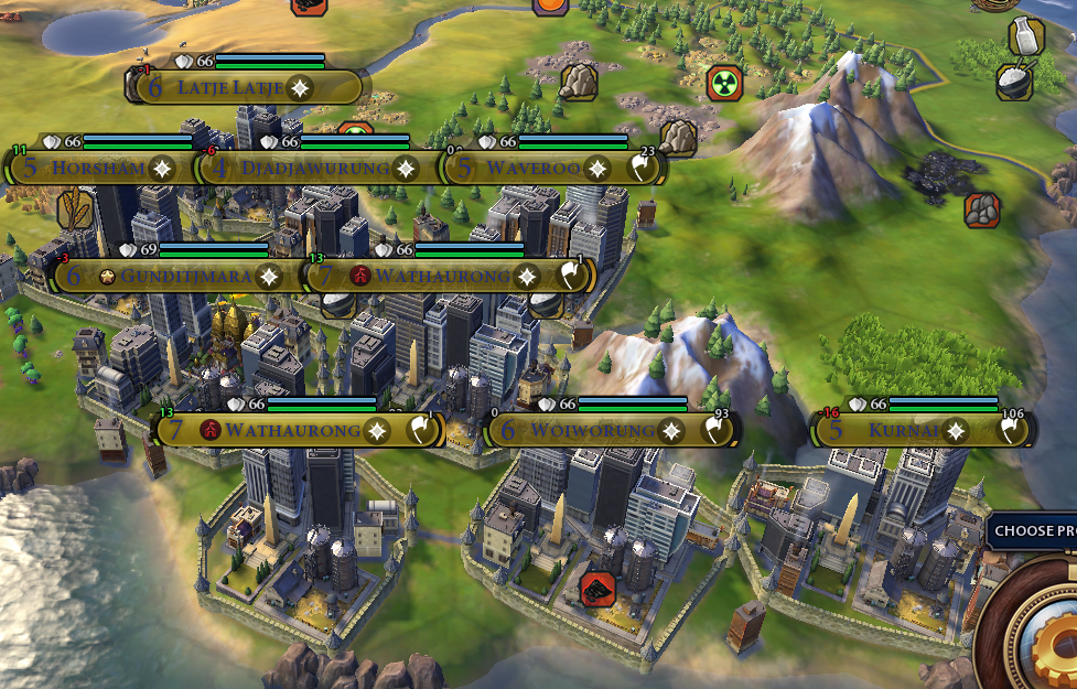
The mountain next to Wathaurong (which legitimately takes up two hexes) is Jaitmatang

 
While working on the Aboriginal Australian names for cities, I was finding that some cities in the system was not intuitively in a position I would expect. The people who have done the work so far have done an amazing job, but we know that there is some tweaking that can be done.

To assist in this, I have created a image overlay for google earth that will place a grid that corresponds to the Giant Earth gridding. The North/south gridding limitations were set by using Hammerfest, Norway to the north and Ushuaia, Argentina to the south, ensuring the reference point to edge of map matched in both the Giant Map and the Real World Map. This gives us a range of 75 degrees north to 57.3 degrees south, with the point 56.5 s, 22 w corresponding to point 0,0 on the giant earth map.

Due to inherit differences between the Giant Earth Map and the real world map, you will find discrepancies if you try to use it to relate cities on separate land masses. (look at New Zealand, for example, on the Giant Earth Map it is much lower south than on the real world relative to the edge of the map. This is most likely due to a squashing of south america on the Giant Earth Map, which I used as my southern reference point.

By using this grid, you can not only plot your cities, but figure out what potential neighboring tiles would be named and keep relative distances intact

Note: I will create a smaller one that keeps proportions intact to the larger one for those that want to have more control over the grid placement :)

Enjoy
upload_2017-12-21_10-42-31.png

upload_2017-12-21_10-41-9.png
 

Attachments

Last edited:
As promised, a more moveable 10 x 10 grid that complies with the grid layout of Giant Earth to be used with Google Earth. When you move it, click and drag it when having the properties open, dont change any of the numbers, and dont drag the corners!
 

Attachments

So I created this, but I have not figured out how to really use github or actually apply this to my game, could someone tell me if the code works or not and test it?
 

Attachments

Another small thing, to prepare for the Expansion and just because its an important city in General, I would trade out Pohang on the map of Korea for Gyeongju. Because it will be the capitol of Silla (And likely where they start) and Gyeongju is much more important than Pohang Historically (Seeing that it was the capitol of Silla, while Pohang is just a city that developed shortly after the occupation of Korea by the Japanese) I highly doubt even for a modern world map scenario that anyone will place a city over Pohang (More likely it will be Seoul and if they add another city, Ulsan/Busan)

Edit: I would also extend the river on Busan to reach Gyeongju/Pohang as well If you look at a geographical map then rivers do go all the way up to the Gyeongju area, even if Gyeongju itself is not directly by a river. I don't want most people to waste a turn settling in Ulsan though because they don't have a river for a Gyeongju start.

Edit2: added the text file with the Japan specific names for Korea if we change Pohang to Gyeongju (Use the Japanese name for Gyeongju instead of the Japanese name for Pohang, Gyeongju was more important than Pohang at the time as well)
 

Attachments

Last edited:
FYI I am currently working on the Russian Far Northeast (Kamchatka, Sakhalin, Chukotka, Kolyma) for Giant Earth (along with appropriate names for other Asian Civs)
 
Ex. Ozernovskiy is founded as Ozenofusuki as Japan
Ah alright! Can you use Toyohara for Sakhalin with Japan, and add in the code for Yeongju, Anju, and Jeongju for Korea near Vladivostok? You can reference my map above to see where they go
 
I've just pushed a pull request to add the final four sections to Africa on GEM. This means that all we have left now for GEM is the rest of Russia!
Spoiler :
africa_political_1.png

africa_political_2.png

africa_political_3.png

africa_political_4.png

Spoiler :
Red names are those which were already on Play Europe Again:
north_east_africa.png

west_africa.png
 
Last edited:
GiantEarthNERussiaPossible.png

Here's what I have for Northeast Russia on Giant Earth map at the moment.

Deciding which cities should appear on Sakhalin is problematic, due to the island's dramatic downsizing so that Hokkaido's size could be increased. Here's the information:
  • Yuzhno-Sakhalinsk was founded by Russia and is the largest city on the island by far. It has 180K inhabitants and is at the far Southern End. The name Yuzhno-Sakhalinsk means Southern Sakhalin and was given in the Soviet Era, after it was recovered from Japan. Before belonging to Japan the city was known as Vladimirovka.
  • Toyohara is the Japanese name for Yuzhno-Sakhalinsk. It served as the administrative capital of Karafuto Prefecture from 1905-1946.
  • Okha was also founded by Russia and has 20K inhabitants. It is on the far North of the island. In Japanese, it is known as Oha, but Northern Sakhalin was never really settled by Japan.
  • Otomari was settled by the Japanese in 1679 in Southern Sakhalin at the site of the modern town of Korsakov. It was Japan's main port on the island for many years and served as a base for trading with the local Ainu.
On the map I had South Sakhalinsk be Yuzhno-Sakhalinsk for Russia and Otomari for Japan/other Asian Civs. North Sakhalinsk was Toyohara for Japan (just to represent it, and it is further North than Otomari at least) and Okha for others. Any thoughts or opinions on what approach should be taken?
 
Well I initially suggested that both tiles be marked as Toyohara for Japan. But I think perhaps having the southern tile be Toyohara and the northern tile being Oha would be fine. Having the same city with different names on different tiles is kind of awkward. Oha still sounds decently Japanese and may even be what they would have used had they had taken that city.
 
Can I work on making Japanese localization for all the city names? And if I can, how should I go about it? Just go down the Maps/GiantEarth/CityMap.xml list and add a
<Replace Language="ja_JP" Text="サラミス" Tag="LOC_CITY_NAME_SALAMIS"/> for each city?
I am also willing to help translate YNAEMP to Japanese in general
 
Last edited:
Back
Top Bottom