Alternative Map for DOC

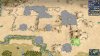
Would it be possible to lower the area between diagonally connected land tiles to sea level and use terrain features in order to apply different graphics to the area. Having land connections at sea level would probably not look that badly. And applying textures by terrain features might certainly be easier than changing the heightmap?

As a side note, I really love the ideas you came up with. When I designed the larger world map, I often contemplated how great it might be if diagonally connected sea tiles could be used to simulate straits.

The heightmap is responsible for that. So that has to be changed for it to work.

But this would allow a dummy tile with different textures I think, because the textures can be controlled by this.
 
Something else. I've done some experiments with making peaks a feature type so elevation levels are more feasible. I'm quite pleased with the result.

I used the vanilla icecaps art. I only modified the z-axis and recolored the texture (still a temporary texture of course). The great benefit of using icecaps is that it automatically allows mountain ranges, similar like you can create huge blocks of ice.

Spoiler :
civ4screenshot0052-jpg.494640


Some more reference, this is how Tibet could look like. The "flatlands" are the elevated hill tiles from Planetfall.

Spoiler :
civ4screenshot0056-jpg.494641


I was affraid that creating mountain ranges would create plateaus, like the elevation level. But the modified z-axis enlarges the minimal elevation of the ice plateaus, giving a nice rocky surface. I was positively surprised by this.

Spoiler :
civ4screenshot0055-jpg.494642
 

Attachments

  • Civ4ScreenShot0052.JPG
    Civ4ScreenShot0052.JPG
    371.4 KB · Views: 768
  • Civ4ScreenShot0056.JPG
    Civ4ScreenShot0056.JPG
    423.1 KB · Views: 803
  • Civ4ScreenShot0055.JPG
    Civ4ScreenShot0055.JPG
    390.3 KB · Views: 790
My only concern is the fact, that the mountains seem to cover the rivers. Can that be fixed?
 
Will you change the shadows? Elevation isn't clear, and the mountains are missing. Also, these caps are too rectangular and do not overlap some land, maybe use the old mountain graphic.
Some isthmuses should not be there like Indochina. And the general result seems somewhat off colour.
 
Will you change the shadows?

I haven't thought about that yet. I have never done shadows, so I have no idea what I can expect.

Elevation isn't clear, and the mountains are missing.

I agree that the elevation level in Tibet is not really clear, because the is no surrounding flatland for reference. But it is clearly a plateau, which is what the elevation levels should do. In the first picture it is really clear what flatlands, medium elevation and high elevation are.

Of course the mountains are missing. They are replaced by the "high elevation level". The new peak future is meant to replace the old peaks.

Also, these caps are too rectangular and do not overlap some land, maybe use the old mountain graphic.

I don't think it's a bad thing that some parts of the high elevation levels can be seen in the peaks. IMO it makes the peaks blend in with the surroundings.

I cannot use the old peak art. The art mechanics are compeletely different.

Some isthmuses should not be there like Indochina. And the general result seems somewhat off colour.

The colors are temporary colors to give general impression how it will look like. The final version will have much better texture.
Currently I'm just exploring what is possible and what not. Polishing the results come later.
 
Here are all area's of the bigger map that have diagonal water tiles and would be affected. The green circles are straits IRL, the red ones are not.
(There are some more near the North Pole, but I don't think those are really important.)

Spoiler :
civ4screenshot0038-jpg.494627


civ4screenshot0046-jpg.494630


civ4screenshot0045-jpg.494629


civ4screenshot0044-jpg.494628


civ4screenshot0047-jpg.494631


civ4screenshot0048-jpg.494632


civ4screenshot0049-jpg.494633


civ4screenshot0050-jpg.494634


civ4screenshot0051-jpg.494635

Nova Scotia is connected to the rest of Canada by land, there shouldn't be a strait between the two.
 
Last edited:
Nova Scotia is connected to the rest of Canada by land, there shouldn't be a strait between the two.

Hence why the top strait is in red and circled: that's the land connection between Nova Scotia and New Brunswick, and it shouldn't be a strait as a result. The bottom strait is a 'strait' and the resulting 1 tile of water would represented the Bay of Fundy, hence the green circle.
 
Man, how fun it has to be a mod developer. You get some dumb results that can be very fun to watch.... and then its a painful ride to fix it
 
Software development is 90% this.
 
I'm currently working on the British Isles a bit:
Spoiler :
Civ4ScreenShot0279.JPG

Not exactly happy but it does approximate the real shape and arrangement of the islands better in my opinion. Thoughts or alternative proposals?
 
The islands directly north of Ireland look a bit weird and too far from the Scottish mainland to really look like the Southern Isles; I would say move them 1N or 1E.

What are do the islands NW of Ireland represent? I don't recall any islands at all out there.

This is a significantly lesser consideration, but maybe also move the sheep so that Edinburgh won't be a terrible place to found a city?
 
I think Cornwall, or just the far western tile can be move 1S, should make it a bit closer to the actual shape.
 
The Isle of Wight is my personal Königsberg, here, I think out of any island features in the British Isles, it needs to be included the most.
 
Does anybody here remember watermills?

Pepperidge Farm remembers.
 
Back
Top Bottom