The biggest issues I see with the S. America changes revolves around Paraguay.
1) Check a map (any map) and you'll see that Paraguay's borders are bound by rivers -- the southeastern border by the Parana river, the western border by the Pilcomayo river. The same should be true of our map. To get the Parana shifted to the river, you'll need to move the Uruguay, but that river flows pretty close to the coast anyway, so it's easy enough to move its course a bit to the east as well.
Here's a
map of the Rio de la Plata river basin. The final map of this area should incorporate the Rio de la Plata itself, the Uruguay, the Parana, the Paraguay, and the Pilcomayo as discrete tributaries. (Presumably the Salado should be included as well, but that's Argentina, which I'm less familiar with).
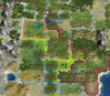
2) The
geography of Paraguay is pretty easy to remember, and it's hardly at all reflected in the above map. The country is cut roughly in half by the Paraguay river. The region east of that river is called 'Paraneña', and it is identifiable as
grassland hills terrain (and dotted with forests, not jungles). These hills descend as you move westward, toward the grassy floodplains of the Paraguay itself. Notably the hills of the Paranena are the same geological feature as the Brazilian Highlands that cover most of the southern coast of Brazil.
The region west of the Paraguay is called 'Chaco', and can be subdivided into two parts. '
Bajo Chaco' (Lower Chaco, or sometimes 'Humid Chaco') is furthest east (closest to the Paraguay) and is the only area that can be considered 'swamp' (at most a single tile; grasslands/floodplains is probably more accurate for the whole region). The rest is
Alto Chaco (Upper or 'Dry' Chaco), and it can be depicted with plains or grasslands with no hills.
The Chaco is known for a pastoral economy, so it might be good to add a few cattle there, with a few corn/wheat resources toward the west. Paraguay is the world's sixth largest exporter of corn, eighth largest exporter of beef, and tenth largest exporter of wheat, so agriculture should be a priority. There is a bit of iron production in the Paranena, as well as a significant uranium deposit, but I'm not sure either are big enough to really define that region.