New indigenous American civs? Suggestions and discussion

Thanks! Yeah, I'm professor but not exactly a history one, since my academic field is more focused on political science, sociology and strategic studies.
But I do love to read about history and these ancient civilizations. In part, you can blame this game series for this hobby of mine :lol:

Could I contact you on your profile page? I am trying to get advice for how to become a professor, congratulations on getting a job!
 
Continuing my Andean civs suggestions, I’d like to discuss my findings about Tiwanaku, one of the most famous and mysterious civilizations of Ancient Americas. Again, many of you may already be somewhat familiar with this civ, since its has been depicted in few mods, such as this one in Civ V, but more famously in our community in 1SDAN’s DoC Reborn. For the sake of reference (as he was the first one to port Tiwanaku for RFC mechanics), here is his general framework for the civ.

Civilization: Tiwanaku
Leader: Malku Huyustus
Birth: 110 AD at Tiwanaku - 1SW Lake Titicaca
UP: The Power of Hospitality - Extra Production in the Capital. +1 Priest Slot from Pagan Temples.
UU: Sisqeno - Replaces Spy. Available at Priesthood. +1 Prophet GPP per turn while stationed in a foreign city
UB: Kalasasaya - Replaces Civic Square. Available at Construction. 1 Priest Slot. Costs 33% less production.
UHV1: The Great Andine Theocracy - Build the Gate of Sun and settle a Great Prophet in your capital by 900 AD
UHV2: The Multi-Cultural Empire - Have two cities with refined culture by 1000 AD
UHV3: The Splendor of Tiwanaku - Experiece two golden ages by 1100 AD

Just like in we did in the other suggestions, first we have to define whose people and polities are included in this civ. While obviously it represent the famous Tiwanaku Empire from the Middle Horizon (600-1000 CE), I have to say that I’m somewhat conflicted in deciding if this civ should include other peoples/polities to become an “umbrella Altiplano/Southern Andean” civilization, since while we have many aspects of continuity, we also have radically distinct characteristics among them that would present several challenges in doing so. I’ll stick with a mostly-centered Tiwanaku civilization, but mention some other options.

So, to base our discussion, let us discuss about the Altiplano and Tiwanaku history, so hopefully we can understand them better to design the civ.

Spoiler :

In 1549, when the Spanish were marching in search of the Inca capital of Qullasuyu (the empire’s southern part), they found some mysterious ruins in the southern shores of Titicaca Lake, a place that was considered sacred for the Aymara (the people that lived in the Altiplano) and Inca. In fact, the Incas claimed that their founding fathers originally came from that area, and that ancient city was said to have settled by the old deity Wiracocha, the famous Staff God. During the colonial era, religious authorities were concerned by heathen practices made there while some of the large megalithic stones were taken to become the foundations for churches and other public buildings in La Paz. In the 19th century, the libertador Antonio José de Sucre, Bolivia’s first de facto president, ordered raise some of the ruins in honor to the new country. However, in the following decades, while the site attracted attention of several foreign visitors, it was in general viewed negatively by them and Bolivian elites, since it was a viewed as a symbol of the poor, decadent and inferior indigenous peoples that hindered the possibilities to establish a modern country in European standards. Only by the 20th century the area became object of modern archeological studies, particularly in the 1950s when a nationalistic government saw Tiwanaku as a symbol of national pride, the seat of an ancient empire that showed that Bolivia was destined to rise again in glory. By 1980s-1990s, new archeological approaches were developed, this time without the nationalistic tones or the racist views of the past, giving rise to the contemporaneous debate about the nature, organization, expansion and history of this still largely unknown and mysterious ancient civilization.

The Altiplano seems to be an unlikely place for the emergence of a complex and expansive civilization. Situated almost at 4000 mts above the sea level, the environment is quite harsh. Days are warm or even hot, but nights are freezing. During most of the year, the climate is semi-arid, except during few months in the summer when the rains and snowmelt in the surrounding mountains turn the small rivers in seasonal torrents, flooding most of areas around the Titicaca and other smaller lakes within the high plateau. Yet, permanent human inhabitation here can be identified at least from 4000 BCE on, and around 1600-1500 BCE we can find evidence of complex societies, permanent settlements, territoriality and the emergence of ceremonial centers.

Thus, the periodization of Pre-Colombian Altiplano is slightly distinct from the rest of the Andes, with the Formative Period starting roughly at that time and lasting almost two millennia until the next era, when Tiwanaku rose as hegemon. To survive and prosper, these first societies there developed clever economic and social strategies. The most fertile and productive lands were located around the Titicaca and agriculture faced two main challenges there: the altitude and the water management. Few crops could survive in that altitude and the drastic temperature changes during the days, so production was based in few cereals (like quinoa) and tubers (the most famous being potatoes, which may have been first domesticated in this region). To manage with droughts during most of the year and flooding in the summer, these societies developed an agricultural practice called raised fields (also known as camellones, suka kollus or waru waru), in which cultivation was made in elevations bounded by water-filled ditches to control watering. Likewise, specific knowledge about calendar and seasons was essential to predict longer droughts or more intensive flooding, that was combined with labor organization to ensure the farming in the right seasons and economic distribution/reciprocity. Nonetheless, this highland agriculture was unable to provide the requirements of large and complex societies. Thus, these first Altiplano societies looked for economic diversification, establishing links with the neighboring camelid pastoralism (mainly llamas and alpacas) areas in the puna, complemented with fishing, hunting, and foraging.

The first complex societies of the Formative period are still largely unknown, but archeologists point that they established a network of small and semi-autonomous villages that surrounded a ceremonial center; their religion seems to be based on fertility cults and depicted images of frogs, lizards and turtles. Around 1000-800 BCE, the first “true” cities appear, based on increased urbanization and the construction of the first public buildings, ceremonial sunken enclosures. While most of these constituted largely autonomous (although economic interdependent) chiefdoms, archeologists and historians identify them as the Chiripa culture, named after the most researched site from this period. It seems that the Titicaca basin was home of at least eight identified chiefdoms, each centered around a ceremonial center that was surrounded by a cluster of small villages and hamlets. The main city was the only place where we can find monumental architecture, usually a stepped elevated platform associated with a sunken enclosure, all built following the orientation of the largest and most visible mountains around the Altiplano. In the following centuries, the Chiripa culture was dominant power in the region, occupying the southern and west banks of Titicaca; in the far north side, another chiefdom grew in power and influence, developing some distinct cultural aspects identified as the Qaluyu culture, that may have been the responsible for the diffusion of the raised fields; further south in the Altiplano, near Desaguadero river, there was another slightly distinct culture, though still largely unknown, called Wankarani.

Early Titicaca sites.jpg

Formative archeological sites around Titicaca lake. From Silverman, I. & Isbell, W. Handbook of South American Archeology.

Around 600 BCE a new religious tradition appeared in the region, called Yaya-Mama or Pa’Ajano (respectively, “father-mother” in Quechua and Aymara), that became much influential, changing the religious iconography and ideological foundations of these societies in the Titicaca basin. The cult’s main characteristics were the temple-storage complexes, located in monumental man-made mounds that were combined with a central sunken court; some specific religious paraphernalia and iconography, use of hallucinogenic substances, ceramic trumpets and large monolith stelae that often portrayed a male figure with feline characteristics and associated with head trophies on one side and a female with an alpaca/llama on the other side. The Yaya-Mama cult became widely influential within few centuries, in a process followed by political changes in the Titicaca. Around 400-300 BCE, the Chiripa culture declined and a new northern polity, based in Pukura/Pucurá and associated with the cult, became the hegemonic power in the Altiplano.

The Pukura culture introduced many changes in Altiplano’s political and economic structure. The raised-fields technique was fully developed and became consolidated in all Titicaca basin, while at same time they developed new agricultural strategies based on verticality, colonizing nearby regions in lesser altitudes to be able to diversify their crops, particularly with maize (that could not grow in the upper heights), and thus, when combined with fishing and puna pastoralism, provided an economic surplus that allowed considerable and constant population growth in the Altiplano even during droughts. They also intensified old and established new trade networks with far away areas in the Andes, thus becoming the main commercial hub in the Altiplano and even trying to monopolize some strategic resources (mostly for religious reasons) such as obsidian. To the northwest, there were strong connections with the peoples in Cuzco valleys and possibly even with the Cupisnique culture (the antecessors of the Moche). To the south, there was solid links with the peoples in Arica region and particularly those that lived in the oases within Atacama Desert, who supplied many of the hallucinogenic substances used in religious rituals. But the main trade partners were the Paracas culture in the east, in the southern Peruvian coastal deserts in Nazca region. In fact, we can see their relationship almost as a dyad: two societies with comparable levels of social organization that were engaged in complementary trade and other forms of interaction, in a synergy that stimulated their own internal developments. Thus, they also shared many cultural features, including the introduction of the Staff God and the emphasis in head trophies.

Around 200-300 CE, the Pukara culture declined and lost much of its former influence, collapsing by 400 CE. Just like in the case of the earlier Chiripa, we are unsure about the specific reasons, tough archeologists often point to possible climate changes since. New and old chiefdoms divided again the Titicaca basin, particularly in its southern side, the most powerful and influential being Sillumocco, Santiago de Huatta, Khonko Wankani and Kala Uyuni. Another growing power was a city called Tiwanaku that eventually became the hegemon over the Altiplano.

The origins and foundation of Tiwanaku are a matter of discussion for archeologists since they first started to study the ruins. The oldest radiocarbon data suggest that the city was already inhabited sometime around 1600 BCE, but most specialists argue that such early date seems unlikely, and most probably Tiwanaku appeared as a modest village sometime between 800-200 BCE; few archeologists suggested that the town was originally two small hamlets that eventually merged. Either way, Tiwanaku was mostly insignificant until around 100 CE, when the first public buildings appeared, but was still seem as a minor town in the southern side of Titicaca, whose main urban center was Kala Uyuni, located 20km north in the Taraco peninsula.

Tiwanaku's original inhabitants are another issue hotly debated, since we simply don’t know who they were, how they called themselves or the city (the modern name comes from Aymara and means “stone center”) and even what language they spoke. Some linguists argue that the Titicaca basin was inhabited by a succession of distinct people, the first ones being the Uru-speaking peoples that still can be found near the lake; then, the Puqina (alternatively Puquina or Pukina) became dominant in a period that roughly corresponds to Pukara ascension, and supposedly were still the main ethnicity during Tiwanaku era; after the fall of the latter, Aymara was the leading language/ethnicity until the Inca (Quechua) conquest. Others point that, most likely, the Altiplano was ever a multiethnic area, and Uru, Puqina and Aymara speakers co-existed in relative harmony for many centuries, including during Tiwanaku’ era.

Either way, by the first centuries CE Tiwanaku became an expanding chiefdom. The Yaya-Mama tradition was much relevant for giving the religious and ideological foundations, although some aspects were distinct, particularly when considering the town’s oldest surviving building, the semi-subterranean (sunken) temple, which was unorthodoxly built on the plains instead on a specific mound. By 300 CE, Tiwanaku was the rising power in Titicaca basin, slowly surpassing its main competitors while the city was first rebuilt, modifying some of architectonic characteristics (and thus indicating some religious/ideological changes). New temples and other public buildings were erected (such as the Kalasasaya) over old habitation areas, all built according solar and astronomical orientations and surrounded by a circular moat that had defensive and symbolic roles, dividing the sacred core of the city from the outside world. The political landscape also becomes clearer, and the city establish itself as the center of the southern side of the lake, extending its influence over most of the villages and even larger cities such as Lukurmata. Combined with Pukara decline, the trade routes shifted to Tiwanaku, who became the Altiplano’s central llama caravan hub and established solid connections with the oases in southern and western deserts that provided the hallucinogenic substances required for religious rituals.

Temples.jpg

The Kalasasaya (up) and Sunken Temple (bellow) as reconstructed today. Taken from the internet.

By 600 CE, Tiwanaku was already the dominant power in the Altiplano. The city again passed through a dramatic reconstruction during this century, made during a short period of time, that established most of the existent urban plan. The old temples were rebuilt and expanded and new and mighty ones, such as the massive Akapana pyramid, were built. These architectonical features were representative of the new iconography and religious cult (often called as South Andean Iconographic Series, or SAIS) that rose around that time and eventually set an Andean pattern that marks the Middle Horizon. Tiwanaku turned itself in a pan-regional center, extending its power and influence well beyond the Altiplano.

Tiwanaku expansion is interesting because shed some light in how this empire was organized. In the initial phase, the expansionism seems to have been pushed by an economic strategy based on the verticality and diversification required to prosper during harsh droughts. In this sense, it did not represented a major change from the old Altiplano and Pukara strategies of colonizing new regions and establishing trade routes. The initial Tiwanaku enclaves outside the high plateau were in the neighboring area of Moquequa region, in the Omo site, established within a deliberate colonizing push in direction to lower and fertile lands near the Pacific. The colony supplied mostly maize and mimicked many Tiwanaku architectonical characteristics, but seems to have been largely autonomous. Similar enclaves were also established in the following centuries in Arequipa, Tacna and Arica, tough these sites were somewhat smaller and did not had many stone structures. While certainly we cannot dismiss some form of violence, Altiplano/Tiwanaku colonies seems to have lived in relative harmony with the original inhabitants of these lands, since most of them lived near the ocean and depended on fishing. Thus, none Tiwanaku sites in those areas had defensive structures, but established profitable trade and political links with the original communities. In the trade sphere, Tiwanaku expanded the caravan routes to the Nazca culture (the successors of the Paracas) and to southern oases in the Atacama, inhabited by the Kunza/Atacama people, mostly in search of hallucinogenic substances, hardwoods and incenses.

If the economic diversification/verticality was one side of Tiwanaku’s expansion, the religion was another. The SAIS was adopted quickly around 700 CE and represent, in many ways, an effort to syncretize old traditions from the Altiplano with the northern cults, however there is no consensus about the religion’s specific characteristics. We can identify three main characters portrayed: the Staff God, that was the main deity, the Rayed Head (possibly another face or attribute from the first) and several Profile Attendants, who may have represented the months in the solar calendar, which was calculated by observations made in Kalasasaya Temple. Tiwanaku religion also involved intimate rituals that combined ancestral veneration, fertility rites, shamanism practices (using hallucinogenic substances) and stories about mythological zoomorphic figures/priests. The city was the focal point of the cult and thus quickly became a pilgrimage center, attracting people from far away areas that brought their offerings in search of blessings, oracle and calendar services. Caravans, trade, colonies and Tiwanaku regional prestige were important to the SAIS diffusion. Wari was possibly one of the first foreign cities to adopt the religion and possibly was even involved in defining its canons and standard depictions of the gods, thus turning into the other main SAIS center and the northern counterpart of the cultural patterns that dominated the Middle Horizon.

Gate of the Sun.jpg

The Gate of the Sun, displaying the Staff God and other iconographic figures related to SAIS. From Wikipedia.

Thus, more than using coercive means and establishing a solid imperial system, Tiwanaku expansion was pushed mostly by “soft power” strategies. This does not mean that coercion, violence or warfare were not employed when needed – there are several stelae/monolith stones in the site that were actually carved much earlier in other Altiplano towns/cities and were taken possibly by war, tribute or persuasion; points for spears, darts and/or arrows were also found – but Tiwanaku ascension seems to have been relatively peaceful and pushed by economic complementarity and reciprocity, trade, religious influence and prestige. The city led a loosely organized sphere of influence that encompassed many cities within and outside the Altiplano, many of them completely or largely politically autonomous but with strong economic and religious ties.

Around 800 CE, Tiwanaku was in its peak. The city had an estimated between 10-20k inhabitants, most of them dedicated to the religious activities in temples and monuments, civil servants and artisans that produced jewels, textiles, tools and other crafts. Unlike in other urbanized areas in most of the world, most of the population was not concentrated in the larger cities, but in the surrounding countryside where there were many smaller towns, villages and hamlets dedicated to the agricultural work. Between these settlements and the capital, we also had a series of secondary cities, many of them that also included similar monumental stone buildings such as Lukurmata, Putuni, Khonko, Paqchiri and Wankani, all located within 75 km from the capital that shows a clear hierarchical urban structure on the heartland of Tiwanaku’s polity. The government system is largely unknown, but we are almost certain that the city didn’t have some form of monarchy, since we don’t have palaces, royal tombs or statues of rulers; most specialists suggest some form of theocracy (that possibly slowly became more secular as the time progressed) or some form of senate or council ruling the city.

Tiwanaku reconstrución.jpg

Reconstruction of Tiwanaku's civic-religious center with the main structures. Taken from the internet.

Tiwanaku’s sphere of influence extended over most of the southern-central Andes, though outside the southern Titicaca basin control, if any, was more limited. Tiwanaku was certainly the most powerful polity in the whole Altiplano basin, being able to enforce its power and influence over any other city or polity there, but couldn’t control directly all the high plateau. To the southeast, its influence extended to the Cochabamba valley, but direct control is unlikely; the area was a supplier of maize and its rulers adopted and copied Tiwanaku’s style, iconography and religion. To the south, influence extended to Atacama Desert and some areas in northwest Argentina, mostly result of the increased trade (based on the old caravan routes that existed long before) and international prestige associated with Tiwanaku.

To the west, in Moquegua, Arequipa and Tacna there were several Tiwanaku and other Altiplano colonies, but as said before, they seem to have been largely autonomous. The first two were actually a frontier zone with Wari polity and shows a puzzling relationship between these main superpowers from the Middle Horizon: Tiwanaku’s and Wari’s colonies in Moquegua were really close from each other, in some cases within 10 km and in plain sight, with the first generally occupying lower lands and the latter higher areas. Hostilities appears to have occurred mostly in the initial period (Tiwanaku’s colonists seems to have considered the Wari as “water thieves”, but nonetheless only Wari’s colonies had defensive structures), but afterwards they lived together on common grounds, trading and even intermarrying. An archeologist suggested a quite interestingly comparison that the Tiwanaku-Wari relations were like the contemporaneous Rome-Constantinople affairs in Europe: two highly influential centers, based roughly on the same religious canons, leading its own sphere of influence that occasionally cooperate or competed.

Middle Horizon.jpg

Middle Horizon spheres of influence with the main archeological sites. From Silverman, I. & Isbell, W. Handbook of South American Archeology.

Thus, as said before, Tiwanaku expansionism is baffling because it was not supported by a clear, coercive and extractive imperial system, something that poses some contrast with the other coin from Middle Horizon, Wari. That doesn’t mean that it wouldn’t involve some sort of imperialistic policies sometimes, but that Tiwanaku’s influence grew connected with the economic integration, religious and identity mechanisms: the city was truly a cauldron of cultures, identities and ethnicities, all united by a common rituals, economic interdependency, religion and social identity. Tiwanaku was cosmopolitan in its nature, the spiritual and commercial center of a loosely organized sphere of influence that recognized its authority.

After the turn of the millennium, things started to change in the Altiplano, and the following decades may have been some of the most dynamics in Titicaca’s history. While still a powerful polity, Tiwanaku was in a clear stagnation around 1000 CE, when the last monumental building complexes were built (possibly including one of the most recognizable structures, the famous Gate of Sun) and Moquegua colonies became largely independent. Recent studies confirmed that around that time the Altiplano faced an unprecedent drought that may have lasted for decades; Titicaca shores literally receded in many kilometers, leaving the raised fields and entire populations without an adequate water supply. This put a strong strain over the agricultural and, most importantly, the social systems that supported Tiwanaku empire: we must leave aside here monocausal explanations or environmental determinisms. The environmental pressure intensified the long existing social tensions, which in turn led to Tiwanku’s fall and consequent social fragmentation around 1150 CE.

Nonetheless, the last decades of Tiwanaku are still puzzling. There are no signs that Tiwanaku was abandoned abruptly, but gradually; as some neighborhoods were abandoned, other groups moved to these areas, often on a temporary basis. In few elite areas, some residences, temples and monuments were destroyed in short periods, suggesting intensified social unrest and insurrections against the old rulers and the establishment of a new social and ideological order – ultimately also unable to revert the city’s decline. The social change in the last moments of the empire are also reinforced by the findings that show the deliberated destruction of old religious icons and structures, when some monoliths and stelae were ceremoniously beheaded and mutilated, a symbolic act to show the changing order; we are not really sure if these acts occurred before or after Tiwanaku’s fall, but considering how the later peoples and polities considered the city as sacred, these most likely occurred during Tiwanku’s demise.

Another element to the social chaos in these decades was the emergence of large migratory movements. Linguists, in particular, suggest that during these decades the Altiplano was invaded by the Aymara tribes, who eventually established their own chiefdoms and kingdoms that dominated the area until the Inca conquest. According to this theory, the Aymara came from the north in Ayacucho region in Peru or the south in northern Chile/Argentina; it is debatable if they directly attacked the declining Tiwanaku empire or just occupied the power vacuum after its fall. While archeological evidence supports the idea of large migrations happening during this time, many specialists argue that most of them occurred within the Altiplano, with large populations leaving the southern areas (Tiwanaku’s core) to Titicaca’s northern shores and neighboring regions; many of them also argue that most of the Aymara may have already been living in the area for a long time.

Either way, by the end of the 12th century, the political and cultural landscape in the Altiplano was completely distinct. While Tiwanaku was never entirely abandoned, only a small fraction of its former population still lived within the old boundaries of the city, and the once great capital became a small hamlet and village, laying the foundations of the modern Tiahuanaco a little west from the archeological site; other secondary and larger cities were completely abandoned and forgotten. This transition era was quite chaotic and violent, the Altiplano population declined and became more nomad; cities and towns became much smaller, though their number multiplied, showing the political fragmentation and dispersion during this period.

During the next century, the conditions in the Titicaca basin were more stable and the Altiplano was politically divided under the Aymara hegemony. They established a series of chiefdoms and kingdoms that occasionally fought against each other; the most powerful and complex among them were the Qolla (Qulla or Colla) and the Lupaqa (Lupaka or Lupaca) kingdoms, both located in Titicaca’s northwest shores in modern-day Peru; their respective capitals were Hatun Colla (between modern cities of Juliaca and Puno) and Chucuito (few kilometers south from Puno). The former Tiwanaku heartlands were occupied by the Paka Jaqis (“eagle men” in Aymara, Hispanized as Pacajes), a people organized in a loosely defined chiefdom that didn’t had a strong sense of territoriality or hereditary succession but were regarded as brave and free men. Their capital was called Axawiri, a marka (village in Aymara) that became the modern city of Caquiaviri.

Aymara Kingdoms.jpg

Aymara Kingdoms before the Inca conquest. From Wikipedia.

These Aymara polities seems to have maintained an uneasy relationship, mixing agreements, political marriages and trade with occasional warfare. Qolla and Lupaqa, in particular, maintained a long political rivalry in the following centuries, which was explored by the growing Cuzco Kingdom. Viracocha (not the Staff God, but the Inca ruler in early 15th century) made the first Inca incursions against the Altiplano, when he established an alliance with Lupaqa. The Qolla mallku (Aymara title for ruler), worried about this coalition, quickly launched a military expedition to conquer the Lupaqa before Viracocha could send reinforcements, thus establishing a short-lived empire that dissuaded new Inca invasions. The enlarged Qolla kingdom, however, proved unstable and was soon dissolved under the old rivalries. Viracocha’s son, Pachacuti, was the next ruler that laid eyes over the Altiplano, however during most of his reign he was engaged in wars in the west against the Chanka. Around 1450, he prepared a full-scale invasion and the Qolla and Lupaqa, threatened by the growing Inca, put their rivalry aside and formed a coalition, however they were unable to defeat Pachacuti and the northern side of the Altiplano became part of the empire.

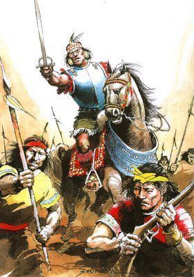
During the reign of the next Inca ruler, Topa Inca, both the Qolla and Lupaqa staged a rebellion, led by the son of the former Qolla mallku, when the emperor was engaged in a campaign against Amazon tribes the late 1470s. Topa Inca organized one of the largest armies assembled in Inca history and ruthlessly crushed the rebellion, slaughtering every Qolla rebellious noble in field or in sacrifices, making such strong impression that the Lupaqa and other allies immediately surrendered. Topa Inca, however, continued his campaign in the Altiplano, conquering every single Aymara chiefdom that wasn’t submitted to the Inca during the next decade. He would go further south, expanding the empire into modern Argentina and Chile, while leaving his son, the future emperor Huayana Capac, consolidating the newly organized Collasuyu (the southern part of the empire). While Tiwanaku was still largely in ruins and was a small marka during that time, Huayana Capac was aware of its symbolic value, ordering the restauration of some structures and even personally staying at the site for some time. After his ascension to emperorship, he still regularly visited at Tiwanaku and in one of these a son (possibly Manco Inca, the founder of the Neo-Inca state) or daughter was born there.


After all these historical considerations, let’s discuss the possible characteristics of this civ.


Spawn/Starting Tile:
As said before, we can have few options here depending in who the civ will represent. If they are an umbrella “Altiplano” civ and we want an earlier spawn, I’d say a reasonable option is around 500-400 BCE starting in Pukara. If we focus mostly in Tiwanaku (which is my preference here), I’d say that they can start in that tile and any date between 200 BCE to 100 CE.


Color/Flag:
There is not much info about some characteristic colors for Tiwanaku, but their ceramic was painted mostly in tones of red, orange and black. The modern indigenous peoples in the Altiplano, on the other hand, like to use very colorful clothes, so it may be reasonable to use anything we deem interesting. As with the other civs, we should choose these colors considering the neighboring civs.

About the flag/symbol, I think that the most iconic symbols are the Gate of the Sun or the Staff God (which is the main figure carved in the gate). If we include the Aymara (which I don’t think is interesting in this case), we have their flag, the Wiphala, that while was created much later, can still be used.

Leaders:
Just like the other pre-contact Andean civilizations, we actually don’t know the name of any ruler from Tiwanaku; in fact, we are even unsure about their form of the government. Nonetheless, the Aymara oral history tell us about a mythical mallku called Huyustus that was the ruler or a wiseman of Tiwanaku, so I’d say that this is the best option we have. His depiction could be based on the reconstructed images of the Tiwanaku’s high priests/nobles with their fancy headdresses. Obviously, we don’t have such LH here, so probably an Andean/Mesoamerican LH can be taken instead.

For favorite civics, Huyustus can have Redistribution (just like all the other Andean civs), Deification or Theocracy (tough they won’t fully enjoy the bonuses for the lack of a non-pagan religion and tech requirements may be too high).


UP:
Looking at Tiwanaku’s history, I think that we have two major characteristics that fit and represent them well that could be interesting UPs. The first is the idea that the city was the most important pilgrimage center in the Andes from that time and that was crucial for its power and influence. This is the idea taken in 1SDAN’s mod, tough I’d slightly change some of its effects. The second idea is to represent their economic system based on redistribution, complementarity, diversification and verticality, however I’m not sure about the name, so I’d go with a more generic.

  • The Power of Hospitality: extra :hammers: for each culture level in the capital and Pagan Temples provide + 1 Priest Slot.
  • The Power of the Altiplano or The Power of Titicaca: extra :food: to cities based on each distinct type of terrain worked or trade routes provide :food: and/or :culture:.

UUs:
As in the other Andean suggestions, we have some issues related to choosing UUs. I think that Tiwanaku’s gameplay should be focused more in “peaceful” activities rather than warfare, so I’s say that we should focus here in “civilian” UUs instead of military ones. The art assets may be an issue here, and I also tried to choose Puqina names (based on a word list available here; I’ll say more about the issues with languages below) when possible. The first one (which is also my favorite) is the same from 1SDAN’s mod, though with twists.

  • Sisqeno (Spy): available at Priesthood, + 1 GP generation when stationed in a foreign city at peace and cheaper and higher success chance for Spread Culture mission. Name means “wiseman”.
  • Qallasso (Worker): slightly expensive worker but build improvements a little faster and/or can build farms/hamlets in any tile regardless of its requirements. Name is literally “worker” in Puqina.
  • Puma Warrior (Light Swordsman): weaker (4 :strength:) but doesn’t require Copper; produces :culture: to the nearest city when defeat enemy units. The only military unit suggested here, it is based on the findings in Pumapunku, a monumental complex within Tiwanaku site. According to ceramics and other archeological remains, human sacrifices were made there, associated the practices of taking head trophies in which warriors/priests wore puma skulls as masks during these rituals, hence the proposed name. Alternative Puqina names are Sipeno, “kicker”, or Chojnasso, “brave”, which are the closest references to “warrior” that I could find.

UB:

Choosing UBs is a little simpler than UUs, since Tiwanaku developed a distinct and unique architectural style, but again we have some issues. Its architecture was marked by the sharp contrast between the civic-megalithic monumental complexes, all built with stones, and the common people habitations, characterized by a vernacular architecture of small adobe rooms, similar to the Aymara traditional rural houses that still can be seen today and only the largest and most important cities had monumental buildings (from all the colonies studied, the only ones with similar stone complexes were those in Moquegua). In those more impressive public and religious structures, the Tiwanaku style gave emphasis in the sunken courts and massive stepped mounds, megalithic gateways and stelae.

  • Sunken Court (Civic Square). Available with Construction, cheaper :hammers: cost and + 1 Priest Slot. The UB would represent the Sem-subterranean (Sunken) Temple, which was one of the oldest buildings in Tiwanaku and its basic characteristics were incorporated as basis for its architectural style. 1SDAN’s mod uses this same UB (called Kalasasaya, which is a distinct and newer complex, but that still have a sunken court like all the religious buildings) with the same proposed effects. The art is quite simple and the only issues here is that this UB probably would fit better as replacement for the Pagan Temple and may be much similar to one of Norte Chico/Caral’s proposed UBs.
  • Qocha (Aqueduct). Cheaper :hammers: cost and gives +1 :food: and +1 :commerce: to Pasture Improvement. As I said in the history section, the Altiplano’s peoples, including Tiwanaku, had to develop smart strategies for their water management. They built aqueducts, canals (some were even connected with the sewer systems in the largest cities) and qochas. This latter an artificial pound commonly found in southern areas in the Altiplano and also in puna regions, whose main function was supply water for the llamas/alpacas herds. If we find the bonuses too weak (there are only two accessible Llamas near Tiwanaku), maybe we can make the UB available with an earlier tech.
  • Megalithic Gateway (Monument). + 1 :culture: and + 1 :commerce:. Represents the well-known gates found in Tiwanaku, the most famous being the Gate of the Sun and Gate of the Moon, whose main role was to mark the symbolic passage from the outside world to the sacred religious core of the cities.
  • Qoro (Theater). + 1 :culture:, + 1 :commerce: and + 1 Priest Slot. Represents the massive mounds present even in smaller cities, but is particularly inspired by the Akapana pyramid in Tiwanaku. Such complexes had residential quarters, burial grounds and served as platforms for religious activities, particularly related to the shaman-turning-into-puma cults. The name is the Puqina word for “mound”.

As a bonus suggestion, I’m really found to make the Gate of the Sun as a wonder, since we have the art asset and would add an interesting flavorful wonder for these expanded Andean civs. I’m fully on bord with 1SDAN’s proposal:

New Wonder: The Gate of the Sun - Requires Corn, Cement. Costs 300 Production. Double production with Stone. +2 Prophet GPP. Great Person births require 50% less GPP.


UHVs:
Considering the historical background of Tiwanaku, whose empire was built by religious and commercial influence, all my suggestions here emphasize a gameplay style that favors a peaceful, trade and culture centered gameplay with a possible unique espionage and religious element, which would possibly offer a distinct experience. Thus, I think that 1SDAN’s version already presents a good framework for UHVs, but I also make some additional suggestions:

  • The Great Andine Theocracy - Build the Gate of the Sun (wonder) and settle a Great Prophet in your capital by 900 CE.
  • The Multi-Cultural Empire - Have two cities with refined culture in 1000 CE.
  • Splendor of Tiwanaku - Experience two golden ages by 1150 CE.
  • Llama Caravan Hub: Settle a Great Merchant in your capital and have active trade routes with all existent Andean civilizations by 600 CE.
  • Andean Cultural Hegemony: Obtain a city by culture flip by 1000 CE.

Expansion:
Tiwanaku was one of the most influential polities in Middle Horizon, roughly establishing an area of influence that encompassed much of the south-central Andes, extending in modern Peru, Bolivia, Chile and Argentina. Such large historical extent puts some challenges when defining the civ expansion, particularly in issues related to city names.

There is the lack of information, particularly outside the Altiplano. There is still few systematic archeological research in the area, so we know few sites, particularly in the peripheries of Tiwanaku’s sphere of influence. Besides, as I said before, we don’t know precisely what language was spoken in Tiwanaku or how they even called their cities, even though most specialists suggest Puqina, a language almost extinct today and thus, mostly inaccessible for us. Most of the modern names for Tiwanaku’s sites are in Aymara or Spanish, so I favored the first as a primary language for the cities. In some other areas, particularly in modern Peruvian and Chilean lands, I couldn’t find Aymara or Puqina names, so I searched Quechua or other indigenous names for cities. There is some tiles lacking names near Inca and Wari cores that should be historical areas; I’m making additional research in those and hopefully will include suggestions for the future Wari post.

So here goes my suggestions. Note that I’m using the larger map without my recent terrain proposals for the Peruvian Andes.
Spoiler :

Expansion Tiwanaku.jpg


Core:
1 – Tiwanaku, the starting tile,
2 – Pukara, the main pre-Tiwanku urban center in the Titicaca.
3 – Konchamarka. The southernmost fortress and large “true” Tiwanaku city ever found. Built around 500 CE and while I’m unsure if we can settle cities in salt flats, I’ve added as option.

Historical:
4 – Omo: the largest Tiwanaku colony ever found outside the Altiplano, established around 500 CE. Couldn’t find if the name is originally Aymara, Puqina or Spanish, but I think that the last is unlikely. The site is located near Moquegua, so it is possible to establish a nice transition to modern city; while it was founded during colonial times, the name has Aymara and Quechua roots, meaning “fertile or humid land” and the area was inhabited both by Aymara and the Inca. Alternatively, can be called Chen Chen, a site few kilometers north that became the main center in later Tiwanaku’s era (900-1000 CE).
5 – Jasapa: Tiwanaku established a series of small colonies in the region, the most important in the Azapa valley, located in modern Chile near the small city of San Miguel de Azapa. The current name comes from Aymara and means “soft land”.
6 – Sonqonata/Pillo: this was a frontier region with Wari and most of Tiwanaku’s sites were small towns/hamlets, almost all near or inside modern Arequipa, offering an excellent opportunity to establish a nice transition to later cities. Because we don’t know exactly which one was the main center, we have four main options, the first two seemingly more studied: Sonqonata, Pillo, Yumina or Kasapatac. All of them seems to be Aymara or Puqino names.
7 – Kanata: seems to be the oldest known name of Cochabamba, in Bolivia, which was the main center of a chiefdom that was under Tiwanaku’s orbit. After the Inca conquest, the city was called Kochaj-pampa or Q'ochapanpa, which gave the modern name.
8 – Tarapaka/Jach’a Uta: the Tarapacá valley (whose name comes from Aymara and means “bird of prey/eagle” or “bush inn”) was integrated with the Altiplano and thus its small settlements were under Tiwanaku influence. It was inhabited by the Aymaras at least since 12th century, when their main settlement was in a site called Caserones (Spanish for “mansions”); translating to Aymara I’ve found Jach’a Uta.
9 – Lickan: the capital of the Atacama/Kunza people, the modern San Pedro de Atacama. The name is how they called it during colonial times and means “village of excellence”. Alternatively, can be called Ckara-ama, the indigenous name for the area near modern Calama that was also inhabited by that time. I know that the tile is a salt flat (I’ve added an oasis to represent those that existed in the region) and possibly we can’t settle there; in that case, it can be the southern tile with Silver.
10 – Tastil: another city built by the Atacama/Kunza people. I don’t know the specific name that they gave for it (all that I’ve found is that they called the minor cities Leri). It seems that the city was already abandoned when the Inca arrived, who gave the proposed name based on the local indigenous population.
11 – Nawinkupio: more an easter egg if settled early, the city was the capital of the Warpa/Huarpa culture, the antecessors of the Wari, who should start on this tile.
12-14 – Those tiles are regions that were initially under Tiwanaku’s influence; however, they soon became part of the Wari Empire. I’m unsure about the specific city names because I’ve deliberately focused my research on southern lands that were part of Tiwanaku for much longer; the name suggestions will much probably be the same for Wari cities.

Possible historical or foreign:
15 – Cahuachi: spiritual capital of the Nazca.
16 – Warikayan: the Paracas necropolis and spiritual center.


By the 11-12th century CE, the Tiwanaku civ should have some troubles with stability in form of some possible negative modifiers and the spawn of Native or Barbarian units in its territory, representing the migrations in the period and particularly the ascension of the Aymara to ensure Tiwanaku’s fall in the appropriate time. I don’t think it is a good idea to use this civ to represent the Aymara kingdoms because their most important and powerful entities (Qolla and Lupaqa) can’t coexist with Cuzco, the Inca capital. The city of Tiwanaku, if not razed, maybe can change its name after such collapse to represent the emergence of newer and more powerful centers in the Altiplano, particularly La Paz (which was a relevant town from Inca times on and is some 70 km east from modern Tiahuanaco).

Pagan religion:
As said before, Tiwanaku’s religion was an essential element to understand the city’s development, expansion and even the whole Middle Horizon. Nonetheless, we know little about its specific characteristics and, as with the other Andeans civs, probably they can have the same shared Pagan religion from the Incas, since the Staff God was still a major deity in Inti religion.

To make Tiwanaku’s pagan religion more flavorful, maybe we can add a distinct Pagan Temple (the Sunken Temple, if not chosen as UB, is a nice fit here) and an unique set of URVs. Possible options include achieving Legendary Culture level, settling GPs and possibly directly controlling the entire Andean region.

Edit: corrected some external links.
 
Last edited:
How about the Muisca/Chibcha peoples? The Muisca Confedration was a pre-Columbian Native American civilization in modern-day Colombia that existed between 600 and 1600 CE. Based mainly in the Andes mountains, the confederation was loose, with anthropologists disagreeing on the extent to which the people were united, but despite different backgrounds and languages the people formed what the Spanish conquerors called one of the best-organized tribes in South America. They are best known in today as the culture that spawned the legend of "El Dorado".

I think the Muisca would be a great choice, and would nicely fill that gap between the Mayans and Incans. It would also make more sense for the Musica to respawn as Columbia instead of the Maya too.
 
Last edited:
The Muisca have been tried in 1SDAN's mod, based on some of my ideas:
Pre-Colombian Update Part 6

New Civ: Muisca
Leader: Saguamanchica
Birth: 800 AD at Bacata (Bogota)
UB: Goldsmith - Replaces Forge. +1 Gold per Gold Resource. Available at Smelting.
UU: Guecha Warrior. Replaces Skirmisher. +1 Strength. Available at Property.
UHV1: Tejuelo Gold Coins - Spend 2000 Gold in diplomacy by 1540
UHV2: The Altiplano Cundiboyacense - Have the largest average population in the new world at the time of Old World contact
UHV3: El Dorado: Ensure no Old World civilization controls a silver or gold resource in South or Central America in 1600 AD

Added Hyenas, Polar Bears, Jaguars, and Tigers
Fixed a massive amount of bugs
Unfortunately, I think they didn't turn out to be super interesting to play. You're an isolated, not very expansionist civ, somewhat primitive civ... There's only so much you can do, and the game is long before the Europeans reach you.
 
That's why early civs end up with designs that are often criticised for being "puzzles" ... there's not much you can do when the amount of things you can interact with is limited. It's a design challenge for all civs that mostly had internal accomplishments that were not based on interactions with other civs.
 
That's why early civs end up with designs that are often criticised for being "puzzles" ... there's not much you can do when the amount of things you can interact with is limited. It's a design challenge for all civs that mostly had internal accomplishments that were not based on interactions with other civs.
That's a fair point. Although if there are more Indigenous civs then there will be more to interact with. After all, very few, if any, of these civs were actually completely isolated. But the problem remains that any civ with mostly internal accomplishments will probably have UHVs that don't involve much interaction.
 
How many people who call them 'puzzles' are actually being critical? I would certainly consider Harappa and Polynesia to be 'puzzles', but I'm a huge fan of your design of both civs.
Puzzle civs are some of my favourites to design. There's so many different design spaces that Civ 4's gameplay allows for that you virtually never see in typical games.
 
Sometimes they are, but I agree that being a puzzle is not inherently a problem.
 
For my last Andean civ suggestion, I’d like to present and discuss my findings about Wari, the other coin of the Middle Horizon that is much less famous than Tiwanaku but likely was the imperial antecessor of the Inca Empire. As in the previous cases, many of you may already be somewhat familiar with this civ, given that was included in 1SDAN’s DoC Reborn. As always, his general framework for the civ is below.

Civilization: Wari
Leader: Wari Capac
Birth: 400 AD at Wari - 1W Cusco
UP: The Power of Terraces* - +1 Food on tiles adjacent to Mountains.
UU: Picta Aucac - Replaces Archer. 30% Withdrawal Chance. 25% City Attack.
UB: Colcas - Replaces Granary. +15% Production. +1 Land Unit XP
UHV1: Wari Arts - Acquire gold, dyes, cotton, and sheep and have at least 500 Culture by 900 AD
UHV2: The First Andine Empire - Build 3 barracks and colcas and connect your cities by road by 1000 AD
UHV3: The Great Centers - Have four cities with developing culture and 5 population by 1100 AD

*: The Incan UP has been renamed "The Power of the Andes".

So, before we dive in the central Andean Middle Horizon history, let ‘us first define who is included in this civ besides the Wari Empire since this civ, just like most of the previous suggestions, can also represent other related peoples including the predecessor Warpa/Huarpa culture and maybe, with some stretching, some of the later Chanka chiefdoms, giving a civ that should be mostly contemporaneous to Tiwanaku and Moche/Chimú, while providing a challenging enemy for Inca players during the immediate turns after their spawn (1150 CE).

Spoiler :

During the Spanish conquest, Tiwanaku was a renowned place within Inca Empire, whose legendary mythical status impressed the conquistadors and indigenous peoples alike. Nonetheless, all over the Andes there was a myriad of less famous even unknown sites lost in history. In 1548, after the colonial conquest, the Spanish chronist Pedro de Cieza de León was traveling near the city Huamanga (nowadays Ayacucho) when he noted some ruins on the side of the Inca road that certainly were much older than any other the Inca buildings, which he called Viñaque and interpreted as the remains of an old and lost civilization. Over time, the colonial authorities built a separate road and the ruins became forgotten. By the 1890s, when the first modern archeological studies in Peru started, the site was mentioned again in few newspapers, but no research was made in the following decades. At that time, Tiwanaku was regarded as the ancient great empire that ruled the Andes before the Inca, something evident by its iconographic influence in the ceramics found in all over. Nonetheless, these pioneer archeologists noted that there were some important distinctions between the ceramics from the Altiplano and those found in other areas, particularly in the coastal valleys, labeling them as a distinct style called “coastal Tiwanaku”. By the 1930s, new research revealed massive amounts of these in the ruins near Ayacucho, which soon revealed that the ruins were the remains of a huge city, called then as Wari (or Huari in the hispanized version), which means “ancient” and “honorable ancestor” in Quechua. In the 1950s, when more systematic studies were made, it was clear that this city was the capital of a large state responsible for the “coastal Tiwanaku” style, a contemporaneous but distinct entity from the Altiplano polity. Unfortunately, the next few decades were marked by political unrest in Peru and much of the Wari heartland was a conflict zone between guerrilla and government forces, thus most of the research was suspended; only by mid-to-late 1990s systematic studies were carried out again.

Thus, we know much less about Wari than the contemporaneous Tiwanaku, Moche and Nazca, and there are many controversies about its history and societal organization. For example, in the last decades there was a serious discussion among Andean historians and archeologists about the nature of Wari polity, with some arguing for an imperial model, others for a regional or minor state, others for a far-reaching federation of cities connected by trade bonds and others even for a province or vassal of Tiwanaku. I’m going to argue for the imperial polity here for two reasons: 1) almost all Wari specialists support such idea despite de lack of some typical structures common to classical imperial models and 2) if it was a minor or regional kingdom, it would be probably better represented as an Indy city.

Before Wari rose as a distinct culture, the Ayacucho region was originally inhabited by a people identified today as Warpa/Huarpa. They emerged around the 1st century CE and were organized in rural communities, whose small and circular buildings were made with wood and clay. Situated between 2600-3000 mts of altitude, the area was quite poor for farming since lacked proper irrigation; the Warpa developed a precarious and rudimentary agriculture based on small terraces that were enough for an unstable subsistence economy, requiring much workforce without providing adequate yields for a sustainable growth. The only compensation was the livestock production in the puna (highland steppes) areas, which provided meat and, more importantly, wool for the textile production. Combined with the dyes obtained from the dry bushes and clay deposits, these resources were transformed in rudimentary products traded for the vital resources required to sustain the Warpa communities.

Slowly over time, some of these villages grew larger, forming the first Warpa cities, the more important being Ñawinpukyo, which was likely the capital of the chiefdom. The society, likewise, became more complex, and new stone-built rectangular structures are evidence of the first public buildings and more pronounced social stratification, even though there were relatively little differences in social and spatial organization; they also may have been largely peaceful by then, since most of the sites lack defensive structures. Nonetheless, trade and cultural interactions with the peoples in the nearby Ica valleys may have played an important role in changing Warpa society since its ceramics and textiles became increasingly influenced by the Nazca culture by 400-600 CE. Some religious practices, such those related to trophy heads, were adopted. But unlike the Nazca society, which was dominated by the priest caste, we have evidence of a militarization of Warpa society, with the rise of warlords and possibly a dedicated warrior caste (like the güecha of the Muisca) involved on those practices. Around that time, when Warpa possibly became a state, new urban centers emerged, the most important ones being Qonchopata and Wari, both located within 30 km from each other and from the old capital.

The transition from the Warpa culture to the Wari state, which occurred around 600-700 CE, is still largely unknown, although most archeologists agree that the latter emerged from the former. During that time, Wari and Qonchopata (which likely were local rivals) became influenced by the Tiwanaku cult (also called South Andean Iconographic Series, or SAIS), adopting much of its iconography in a short period of time: stelae (carved in volcanic rocks) and some stone-built structures were constructed in similar fashion to those on the Altiplano, including a sunken temple that imitated the original. The reasons for those changes are basically unknown, however there are some interestingly information that may help us understand some aspects: at that time climate change affected the Andes and Warpa/Wari established some presence in the southern areas in modern Arequipa and Moquegua departments, both with fertile valleys that held Tiwanaku colonies. Some archeologists suggested that the rising Wari state may have clashed with Tiwanaku there, capturing workers and priests that eventually built the structures and spread the cult and associate iconography within the Warpa heartland. Others, mentioning the findings in Qonchopata of ceramics displaying Wari warriors on reed boats – which were virtually useless in the mostly dry lands in Ayacucho but were common in the Titicaca – suggested that it may represent a mission (be of conquest or peace) sent directly to Tiwanaku, where the new religious canons were defined. Either way, these interactions prompted major changes that resulted in the emergence of Wari as a distinct society.

Nonetheless, the Tiwanaku style didn’t last much in Wari and in the following century they establish their own distinct version of the SAIS that retained the most important iconographic religious canons and features but presented fundamental changes in art, architecture and even in religious practices. The most strikingly differences are in architecture. Unlike Tiwanaku, Wari did not build massive pyramidal structures and mounds, or other megalithic structures according to a pre-defined urban plan. The most basic feature for new buildings were large walled enclosures in the orthogonal cellular architecture. Thus, these compounds were surrounded by thick (commonly 2 to 4 mts) and high (up to 8 mts) walls, build with stones, mud and painted in white constructed in rectangular shapes divided between a central square patio surrounded by several other rectangular rooms erected up to three to four floors. This same pattern was consistently reproduced in all public and private buildings for all social classes, creating a somewhat chaotic urban plan with multipurpose buildings raised over older ones cut by labyrinthic paths, streets, canals, and aqueducts. The only exception to the rule were the temples, built in circular and, more commonly, D-shape. Surrounding the cities there were walls and other defensive structures, which ensure that most Wari towns were not much accessible to outsiders.

Qonchopata Plan.jpg

Urban plan of Qonchopata site. The circular structures were the temples. From Tung, T. Violence, ritual and the Wari Empire.

Pikillaqta reconstruction.jpg

Reconstruction of a neighborhood in Pikillaqta around 700 CE with the orthogonal buildings. From McEwan, G. Pikillacta: the Wari Empire in Cuzco.

Pikillaqta Ruins.jpg

Wari ruins in Pikillaqta. Taken from the internet.

All these architectural features were clearly visible in the capital, which also contained palatial complexes for the Wari elite, oracles, and impressive defensive structures that included large walls and fortified gates. The city was larger and more populous than Tiwanaku and may have housed up to 40k people in its peak. Just like that town, Wari also attracted its own pilgrims, who visited the panoramic views in the neighboring hills and mountains and visited the city proper and its temples with help of specialized guides that knew the paths and shortcuts within the urban maze. We are unsure about why Wari developed such architectonical style, but there are suggestions that it was the result of interactions and conquests of northern and coastal peoples.

The art was dominated by the religious iconography, whose main figure was the Staff God just like in Tiwanaku. Even so, there were significant differences in the form: while the Altiplano peoples often displayed the deity on impressive megalithic structures, Wari chose more moveable mediums, particularly in ceramics, many related to the special rituals with chicha (corn) beer. Another interesting difference was in the use of hallucinogenic substances, which was uncommon in Wari. While textiles habitually displayed similar figures and patterns within the SAIS framework, the textile production and garments, such the four-corned hats, were also quite distinct between the two Middle Horizon centers.

But one of the huge distinctive aspects was that Wari art also commonly displayed non-religious human figures in statues and ceramics, which are identified as the secular rulers and elite of the empire. Considering that Wari society was relatively open to foreign influences, as evident by the adoption of innovations, religious practices, and artistic styles during its existence, we can argue that its elite deliberately pursued a progressive syncretism within the peoples and polities that Wari conquered or interacted according to how that supported its political designs. That means that Wari lacked a powerful orthodox or fundamentalist priest class (which most likely dominated Tiwanaku’s government) averse to change, even though religion was an important issue for the ruling elite and its ideology. Such approach, as some archeologists and historians point, is quite like what the Inca did centuries later.

Wari people.jpg

Representation of a Wari cerimony with Chicha beer. From McEwan, G. Pikillacta: the Wari Empire in Cuzco.

These societal changes occurred more or less simultaneously with the first waves of Wari expansion. Like in many other aspects, the strategies and means employed to grow its influence with the SAIS cult were quite distinct from Tiwanaku. If the latter built impressive and prestigious religious shrines, oracles, and a wide-range commercial hub to attract other peoples to its capital and orbit, Wari took a more direct approach to bring its power and influence over other peoples – ceramics with SAIS figures were obviously symbols of Wari power and prestige that were deliberately spread all over the Andes. While most specialists agree with these points, we enter here the issue of the nature and reasons that led this polity deliberately take such expansive strategy. On one side, we have those who argue that Wari was a minor state or chiefdom, and its influence were the result of changes in trade routes and action of proselytizing missionaries that brought prestige to it in more or less the same way (albeit more directly than) of Tiwanaku and the older Chavín culture. On the other side, we have the proponents that Wari was an empire, pursuing imperialist strategies for its expansion with religious, economic, and military means.

But how and why a small kingdom in a peripheral and poor area in the Andes would successfully seek imperialist expansion and eventually become a hegemon over the central and northern Andes? Archeologists and historians are mostly unsure, but they pointed possibilities that may give some answers. The traditional explanation links the emergence of SAIS cult with the rising of a militant state; thus, the expansion would be result of Wari zealots spreading their religion and influence. While this suggestion has many merits, the fact that new archeological findings suggested that Wari had a secular elite who was not only open, but willing to adopt foreign influences to grow its power point that their view to religion was far from a fundamentalist one. A distinct suggestion links Wari expansion with the regional conflicts and rivalries, making parallels with the rise of the later Inca Empire. In the latter case, the traditional histories account that the Chankas were a constant menace to the rising Kingdom of Cuzco, making frequent raids and pillaging lands, essentially being seen as an existential threat. The continuing rivalry would end only when the Inca, under the powerful leadership of Pachacuti, were able to finally conquer Chanka lands. But doing so, the rising kingdom now had to face former Chanka allies who know felt threatened by Inca; the same pattern, which invoke the security dilemma theory in international relations, would repeat itself until the Inca became a far-reaching empire. In this case, proponents argue that Wari expansion followed more or less the same process. There are yet other explanations that point to climate and demographic pressures dictating the imperial expansion.

Another view stress economic factors. As we saw above, the Ayacucho area was poor for farming and early Wari economy was precariously structured, depending on pastoralism and manufactures (ceramics and textiles) to obtain the resources needed for its survival. Nonetheless, Wari products couldn’t compete in quality with the more complex and refined contemporaneous Nazca and Moche ones, particularly in the more profitable luxurious products. Thus, they had to find an alternative strategy, which was the establishment of mass production – using new technologies such the hand wheel and prefabricated molds – of domestic goods. But doing so, the Wari society required a more complex societal organization to manage the workshops and artisans, and more raw materials that also required support of state institutions (military and ideological) to ensure a constant flux of those. However, the only way to ensure the reliable flow of manufactures, food, and raw materials was the establishment of a distributive model that dictated the relationships between Wari and other peoples, which was essentially one of political domination: if those other societies had too much autonomy to change their production or trade partners, the system would lose its stability. Yet, this economic system was essentially unstable, since the increased focus on manufacture and political structures also meant an unprecedent urbanization process in Wari heartland and less manpower available to the already precarious Ayacucho agriculture, putting more stress on it and required continuous expansion backed by an imperial and centralized structure supported by a military and religious sector. Thus, Wari was essentially committed for a continuous expansion.

Certainly, all these factors were relevant to explain Wari imperialism, but without historical records we cannot be sure about the human motivations and justifications for it. Likewise, we are uncertain about the waves and routes of expansion and conquests since they mostly occurred in a relatively (in archeological scale) short time between 700 to 850 CE. Wari emerged as a distinct polity around 600 CE and consolidated its control over older Warpa heartland (Ayacucho region) in the following decades, occasionally making successful incursions in nearby valleys, particularly those to the north, since Wari architecture seems to have been influenced by these northern styles. Then, it seems that Wari focused its expansion on southern lands: Cuzco valley became part of its sphere of influence around 650 CE and, far to southwest, the empire made its first intrusions in modern Moquegua and Arequipa regions, where there was some Tiwanaku colonies. As said before, we are unsure about the Wari-Tiwanaku relationship, but after some initial clashes the Ayacucho power establish their own colonies in these areas. Cerro Baúl, the main colony and administrative center in Moquegua, was located a couple dozen km from Omo (main Altiplano colony) and strategically established on the top of a hill, giving not only an excellent defensive position (that included fortified walls) but also a relative control of the water flux, essentially ensuring Wari dominated much of the valley; some of the local population slowly became “Warified” over time, although Tiwanaku colonies remained apart and untouched by colonial Wari efforts.

To the west, Wari expanded its influence over all Nazca territories from 700 CE on in a period that coincides with their collapse. Again, we are mostly uncertain about the specific dynamics of these cultures, since Nazca had intense interactions and influence over the older Warpa and early Wari. Nonetheless, archeologists usually argue that imperial Wari wasn’t the responsible for Nazca collapse; more likely, it occupied the power vacuum after their decline. More or less at the same time, Wari moved north, bringing much of the Lima culture lands under its influence. There, they possibly rebuilt much of Pachacamaq, near modern Lima, which became one of the most important oracles and religious center in all Andes, tough other cities felt less direct Wari influence.

More inland, Wari also moved north in the highlands and mountain valleys, possibly going by the same routes that Inca armies would run centuries later. In contrast to the coastal valleys, this region did not saw the emergence of many urban centers since the fall of Chavín (the Cajamarca was an exception), so Wari was implemented an impressive urbanization effort in that led to the establishment of many new cities and towns. Afterwards, they moved to the wealthy Moche lands; as said in a previous post, the Moche valley states were also in decline or collapsing when these conquerors arrived.

Middle Horizon.jpg

Estimated Wari area of influence at their peak in Middle Horizon. From Silverman, I. & Isbell, W. Handbook of South American Archeology.

Around that time (850 CE), Wari was at its peak, politically – for the first time in history – and culturally uniting much of the Andean world as the northern side of the Middle Horizon period. However, it is important to note that not all areas within their sphere of influence, particularly the northern coastal valleys, were under direct Wari administration; the empire employed what is called model of “mosaic of control” strategies: some lands were more autonomous vassals while others were tightly controlled by Wari governors. Nonetheless, the emergence of this first pan-Andean empire had a profound impact on the political, cultural, and social landscapes of the region. The Ayacucho region became one of the most populous abd urbanized areas in Ancient Peru, and its precarious agriculture was intensively developed (thus reducing some of its structural handicaps) with the establishment of larger agricultural colonies fueled by mit’a workers – a mandatory work service that was essentially a form of tribute required by Wari over the conquered peoples that would also be common in the later Inca empire. New canals and aqueducts were built and the terraced agriculture, called later by the Spanish as andenes (itself the origin of the name of the mountain range), was developed in larger scale for the first time to ensure an increased food output for the growing empire.

Significant changes also occurred in other places. For example, the Cuzco valley – the later heartland of the Inca – was essentially an underdeveloped area sparsely inhabited by semi-nomad pastoralists and few small hamlets, being one of the backward peripheries of Andean civilization. Under Wari administration, the area flourished as an intensive agricultural colony focused on corn production with a booming population, serving as one of the main “granaries of the Andes”. New cities were founded, such as Pikillaqta, giving rising for the first urbanization process in the area.

In fact, the urbanization process in the Andes was unprecedent during the Wari Empire. While the coastal valleys were already occupied by larger and older cities, Wari was the responsible for the establishment of many new urban centers inland. Like the Inca did centuries later, Wari commonly settled new cities that served as administrative centers in newly conquered areas, reorganizing the peoples that lived there. These towns also acted as trade centers, ensuring the flow of products to Wari core and receiving in turn Wari manufactures; they also housed the imperial military forces. As such, this urban effort was also completely distinct from the predecessor urbanization process, since it was less centered on temples and ritualistic spaces and more in palaces, workshops, residences, and defensive structures. Likewise, these cities were connected by a road system to ensure communication with the rest of the empire; many of these were later absorbed by the Inca road system. They also were one the main responsible for the development of the first unambiguously and widely used quipus/khipus, a proto-writing recording device common to the Andes; Wari quipus used different colors (instead of knots) to record information.

An empire of that size also required ideological and military systems to ensure its cohesion. For the first, SAIS cult provided the religious and ideological foundations, but as said before Wari adopted a syncretic strategy as expanded and incorporated (with its artistic reflexes) any religious icons, ideas, and practices that could contribute to their power. In this sense, some archeologists stress the figure of the Staff God: more than his core-concept, what really mattered was his widely known image and symbolism that became a reflection of Wari power. Likewise, the trophy head practices played important religious and ideological roles, representing the militarism and prowess of Wari elite. While this practice goes back to Warpa and Nazca cultures, Wari gave new meanings for it. Instead of being a sacrificial act to please the gods by taking victims among their own society, Wari sought foreigners as preferential victims as bioarcheological evidence point: they demanded hostages as tribute and captured others in battle and raids against enemies and/or rebellious nobles and peoples, which were ceremonially beheaded (in field or temples) to make trophy heads that symbolized Wari power.

The more specific characteristics of their government and society, however, are mostly unknown since we lack sociological evidence. Thus, some specialists made few assumptions based archeological remains and interpretative models based on later Andean societies that give some suggestions. We are unsure about how Wari government functioned or rulers were chosen, but their militarism and religious syncretism suggest a military elite that ruled over the common people with support of a limited and subservient priest class, in a similar way to the Inca. Others suggested that the military class was not the ruling one but was closely associated and prestigious in which warlords supported the elite and civil leadership; later this relationship may have become more conflictive and that would explain, in part, the Wari’s decline. The empire employed the mentioned so-called “mosaic of control” strategies to ensure its empire, with foreign vassals combined with Wari governors in the provinces. Their rulers were probably kings or emperors given the human figures found in their artistic representations, but they may have had a diarchic system since Andean culture values highly the dualism. The ethnolinguistic affiliations are basically unknown, since they disappeared much long before the earliest historical records, so we don’t know how they called themselves or their cities. Some linguists suggested that they likely spoke some form of Aymara based on the model that see Ayacucho as the original homeland of that people before they moved to the Altiplano.

Soon after its peak, the Wari empire entered in decline around 900 CE and many provinces (particularly those in the northern coastal valleys) became independent again. The polity would continue to exist and control much of their heartland and some southern lands until their final demise around 1100 CE. The reasons for the decline and final collapse are mysterious and many suggestions have been made. Some archeologists point to the climate changes that affected Tiwanaku as catalysts for Wari fall, but this interpretation is dubious: the empire was already declining before the severe drought that affected the Altiplano around 1000 CE; likewise, we must avoid simple environmental determinism, since the empire seems to have been able to cope with other previous climate crisis. Another suggestion focused on the economic system that supported Wari imperialism in the first place: the pax Wari redirected and intensified the Andean trade, eventually favoring the older and wealthier cities in coastal valleys to the point that they may have become strong enough to successfully rebel against Wari rule; without these rich areas, the economic system required to fed and enrich the Wari heartland became increasingly unstable and the central government was unable to impose their rule over other regions and even to their own population.

Either way, the empire’s ideological foundations and military institutions couldn’t work properly anymore, and the Wari suffered with many rebellions and civil unrest. As said before, the context and reasons surrounding Wari fall are mostly unknown, but we have archeological evidence that suggest a chaotic demise. The capital became gradually depopulated after 1000 CE; in some neighborhoods (particularly those identified with elite areas) we can see signs of deliberate destruction, but in other areas there are buildings that were carefully closed before being abandoned, indicating that the inhabitants may have hoped to return. The nearby city of Qonchopata, in other hand, was suddenly abandoned and it was found that many ceremonial objects displaying gods and other human figures were deliberately destroyed, which suggest a violent and sudden change – maybe by conquest, maybe by civil war – in the social order. Wari burials from this time show increased signs of non-lethal and lethal violence, indicating widespread warfare or riots. Ayacucho suffered major depopulation after Wari’s fall and almost all the cities and larger agricultural projects were abandoned.

Other areas fared better, like in the coastal valleys. The former Moche lands saw the rise of new powerful and wealthy polities, such as the Chimú Kingdom. While they returned to some of their pre-Wari patterns, some influence from the Ayacucho empire could be seen in their architectural style and art. More to south, the Lima culture returned to its previous urban organization (more focused on temples and religious structures suggesting a theocratic form) and divided into new chiefdoms, but the legacy of Wari was visible in Pachacamaq, which continued to be one of the most important oracles in the Andes until the Spanish conquest. In the Cuzco valley, the fall of the empire coincides with the emergence of the pre-Inca culture called Killke. The former Wari cities were abandoned in favor of minor towns within an urban-agrarian foundation that seems to have existed in a fairly peaceful cooperation. In the highlands and mountains, and as well in most southern lands, the empire collapse led to the abandonment of cities and return to more communal forms based on pastoralism and precarious subsistence agriculture.

Ayacucho, the Wari heartland, was depopulated and suffered widespread violence, and its population reverted to even pre-Warpa social and economic organization until the rise of the Chanka culture in the 12th centurry. Some archeologists and ethnohistorians suggest some links between them and the Wari, citing the apparent similarity between their militarism, but we lack robust evidence. Oral traditions tell us that the Chanka came from neighboring Huancavelica region and conquered the former Wari core, dividing the region between their tribes that built their own chiefdoms there, slowly absorbing the native populations in their fold. Either way, the Chanka, who spoke a distinct dialect of Quechua, lacked the urban and political organization from Wari, although certain traditions may have common roots. They became renowned and feared as skilled, courageous, vicious and literally bloodthirsty warriors – they were nicknamed “vampires of the Andes” – and the first archenemies of the Inca, which portrayed them as cruel barbarians. In fact, emperor Pachacuti, who was a key character in turning the old Cuzco Chiefdom into the Inca Empire, gained prominence exactly by repelling a Chanka attack and later conquering them; these accomplishments allowed him to challenge the throne succession and proclaim himself as legitime ruler. Some archeologists also suggested that some imperial institutions established by the Inca may be linked with older Wari traditions and legacies, which offered a institutional framework for the rising empire. The Inca never admitted that – they claimed, as many empires around the world, to be the civilization force in a largely barbarian world and only recognized Tiwanaku, which had already a semi-mythical status, as their ancestors – but, as mentioned above, we have many parallels and similar institutions; their architecture and road system almost certainly have some Wari influence, even so because the Inca actually rebuilt many Wari structures and roads.

Nonetheless, in the Ayacucho region the Chankas became rebellious subjects of the Inca Empire, revolting in various occasions; during the Spanish conquest, they requested an alliance with the conquistadors to fight the Incas. Pizarro was warned by his indigenous allies about the fearsome and negative Chanka reputation, but he eventually allowed them to join forces, allowing them to retain some privileges during the colonial rule.


After these historical considerations, let’s discuss the possible characteristics of this civ. I also like to point to this thread in an Age of Empires II discussion about the Wari that I’ve found recently when was looking for some illustrations; while they point to many common points to my discussion and suggestions here, they also have some excellent images and some different approaches to think Wari and its civilization that can contribute to our discussion.


Spawn/Starting tile:
Considering the contemporaneous Andean civs suggested and the proposal to also look to the Wari to represent other peoples, I think that some spawn date between 200-400 CE is appropriate, as they would appear after Tiwanaku (200 BCE to 100 CE) and Moche/Chimú (0-100 CE). The starting tile would be the civ namesake, 1W from Cuzco.

Color/Flag:
Wari were quite colorful in their art, although like many Andean civs they often used tones of red, yellow, white and black. Considering that their cities and buildings were mostly painted in white, I do think that is a good option. They also were prolific in their artistic skills, thus we have many options here. The Staff God probably was the more identified symbol of the Wari, but I really like 1SDAN’s work, who based on this condor image (condors, as the largest prey birds in the Andes, had an important symbolic value and were depicted by Wari art).

Leaders:
While we have representations in art and found royal/noble burials (such that in Huarmey), we have an issue here because we don’t have any recorded name of a Wari leader, not even a semi-legendary one. Basing in these burials and Wari mummies found, I’d suggest two options: the so-called Wari Lord of Vilcabamba and the Lady of the Mask found in Huaca Pukllana (modern Lima).

Evidently, we must avoid using these English translations of the original Spanish names. As we discussed in the history section, we actually don’t know what Wari spoke, though some linguists suggested an Aymara-related language. The issue with using Aymara here is that most of the Wari sites are in Quechua-speaking lands and all were named in that language; if we want to make the link between Wari and the Chanka, the latter also spoke its own dialect of Quechua. So, for these reasons and the fact that Quechua dictionaries/vocabularies seem to be more accessible, I’ve decided using it for the Wari.

Turning to the Wari leaders, the translations that I’ve came up were respectively Wari Apu (“Wari governor/lord”) and, my personal favorite, Saynatasqa Ñust’a (“masked lady/dame/queen”). Obviously, we don’t have art assets for them, so any reasonable generic Andean LH may be good enough, although it would be interesting to represent somehow Wari typical clothes. A last option is using the name of one of the mythical founders of the Chanka, called in their oral traditions as Uscovilca and Ancovilca.

Favorite civics can be Conquest (representing Wari militarism), Distribution (a common option for all Andean civs) or Tributaries (representing the “mosaic of control” imperial strategies).


UP:
There are few interesting and distinctive Wari characteristics that may be interesting UPs, however there are some overlaps with the Inca because both were famous for building pan-Andean empire. Thus, I’m trying to make them feel and play a little different and the bellow suggestions were made taking that in mind.

  • The Power of Orthogonal Architecture: regular (non-wonder) buildings cost –15%:hammers: in Ancient and Classical Age. Refers to the typical Wari architecture, based on multipurpose buildings, and their urbanization efforts.
  • The Power of Terraces: + 1:food: in tiles adjacent to Mountains. Identical to 1SDAN’s version, this UP refers to their extensive use of terraces in agriculture. If chosen, we must change the Inca UP name as 1SDAN also did in his mod.
  • The Power of the Trophy Heads: start the game with Conquest, Tributaries, and the ability to make Vassal States enabled. Another reference for Wari militarism and its ideological foundations.


UUs:
While we do know about Wari militarism and its role in their empire-building, the specific characteristics of their military forces and warfare are less clear. The mentioned discussion in AoE2 thread about Wari includes much interesting ideas for the Wari UU, so it’s a good read for those interested. In general, based on archeological remains, we found that Wari nobles (who possibly were the responsible for levying and arming warriors for the state following the old Warpa warlord traditions) wore bronze armor and garments, and their preferred weapons were axes and star-shaped maces; we also found small bronze figures showing spearmen and javelineers and cranial analysis in warrior burials revealed wounds (lethal and non-lethal) mostly provoked by sling projectiles, clubs, and maces. Such info gives us a picture more or less within the same patterns and traditions of Andean warfare, so roughly we could say that they weren’t that much distinct than later Inca soldiers, though Wari could be the origin of many characteristics of the later Inca and more broadly Andean warfare.

In Qonchopata, however, besides some weapons (clubs and maces), ceramics were found displaying several warriors and military themes, many of them showing a somewhat more unique vision of the Wari army and society, such as their tattoos and face paints. The iconography shows three clear distinct images: the warriors on reed boats that were already mentioned, which may represent some military campaign (be historical or mythical); other groups of warriors without boats, probably representing the more regular or other specialist Wari soldiers in their day-to-day roles; finally, some warriors dressed or associated with some specific animals, the most evident ones being a “jaguar” and a “eagle” warriors. Focusing in these last, we actually don’t know much about them, but some links with the Aztec version of these were made. They probably had specific ritualistic roles and the jaguar, in particular, was probably related to dismembering and mutilation rituals, much likely the trophy heads practices. They possibly composed a specialist corps within the Wari army, maybe some kind of warrior-priest, but any more definitive answers are unknown.

Spoiler Wari Warriors :

Wari warriors on boat.jpg

Warriors on reed boats found in ceramics in Qonchopata. From Silverman, H. & Isbell, W. Andean Archeology II: art, landscape and society.

Wari Warrior.jpeg

Reconstruction of a Wari noble warrior. Taken from the AoE2 discussion thread mentioned above.

Eagle and Jaguar Warriors.jpg

Eagle (left) and Jaguar (right) warriors found in ceramics in Qonchopata. From Tung, T. Violence, ritual and the Wari Empire.


Summing up all this info, we can reasonably propose the following UUs (although art assets may be an issue, however we could look in other mods like History Rewritten and Realism Invictus):

  • Wari Maceman (Light Swordsman): does not required Copper or Iron, free City Raider I promotion. This unit would represent the Wari heavy infantry and gives the required attributes to allow them successfully expand in the game. Obviously, such name is lacking and is more or less a template before choosing a proper one. Using Quechua names we can have these options: Champi Kamayuq (literally “mace specialist”); Wallawisa (war chief or warlord).
  • Wari Archer (Archer): identical to 1SDAN’s version, representing those archers – which were interestingly were really uncommon by Inca time – found in Qonchopata. Name probably should be Wachina Kamayuq (“bow specialist”).
  • Jaguar or Eagle Warrior (Light Swordsman): identical stats like the first unit here, but they would represent the specialist warriors found in Qonchopata. The issue here is that they may overlap too much with the Aztec versions, so I don’t know if they are ideal. Nonetheless, in Quechua their names are Uturunku Awqaq (“jaguar” + “who fights/soldier”) or Anka Awqaq (eagle warrior).


UB:
As said before, Wari buildings were mostly multipurpose and based on the orthogonal architecture, but there were some few distinct larger structures with specialized functions. The names here are also an issue and in many cases archeologists applied the same names that the Inca gave to similar buildings.

  • Chicha Brewery (Distillery): much cheaper and available earlier (Ceremony), + 1:commerce: and + 1 Hapiness with Corn. Chicha (Corn) beer was important to SAIS religious ceremonies and Wari built the largest breweries that existed in the Andes before the Inca.
  • Qullqa (Granary): New land units receive +2 Exp. Refers to the large storehouses built by the empire in its administrative centers, which stored products and food for trade redistribution and to fed and equip Wari armies. Name comes from similar later Inca structures.
  • Orthogonal Workshop (Weaver): slightly cheaper and available earlier (Construction), + 10%:hammers: production. A generic version of the most common Wari building found in their cities.
  • Kallanka (Barracks): + 20%:hammers: to unit production. Some larger orthogonal complexes were located alongside the main Wari roads to house and store supplies for their armies. The name is the Inca version of a similar later building.


UHVs:
The proposed UHVs try to represent the main characteristics of Wari, such as the fact that they established the first empire in the Andes, culturally and politically united much of the Andes and promoted urbanization in an unprecedent scale. Note that some of these objectives may have some parallels with the Inca, but I’ve tried to make them more distinct. Also note that some of them are like 1SDAN’s version:

  • The First Andean Empire: the same as 1SDAN’s or ensure that no independent city (so vassals are allowed) exists in the Andes by 900 CE.
  • Urban Expansion: have at least three cities with at least 5 population and with the UB, Barracks, Granary, Weaver, Monument and Pagan Temple in 850 CE.
  • Industrious Artisans: be the most productive (sum of :hammers: per turn) civilization in the Americas for 15? consecutive turns.
  • The Great Centers: control the most :hammers:, :commerce: and :culture: productive cities in the Americas by 1000 CE.
  • Staff God Zealots: settle a Great General and a Great Prophet in your capital by 700 CE.
  • The Northern Middle Horizon: Acquire gold, dyes, cotton, and sheep (llama) and have at least 500 :culture: or amass more :culture: than any other Andean civilization in 900 CE.


Expansion:
Just like Tiwanaku, Wari should have a large historical expansion area that encompasses much of the central-north Andes, roughly the same extent of their empire’s peak. As said before, we have the issue with their language (as some argue that they spoke some form of Aymara and others Quechua), which is particularly important to define when we need to approach the Wari archeological sites that are named in Spanish. Another issue is that many Wari cities were only inhabited during their empire, so we may have some problems with continuity and names changes. Also, note that I’m basing in the new map suggestions that I’ve made a while ago in northern Peru; I'm not sure if they will be included in the new map, but I've got a pretty positive feeling about it.

Spoiler :

Expansion.jpg


Core:
1 – Wari: starting tile. If somehow survive the Wari collapse and Inca spawn, can have a nice transition to nearby towns of Waman Qaqa (Inca) that became San Juan de Huamanga (Spanish colonial rule) and Ayacucho (post-Independence name).
2 – Wilkapampa: known as Vilcabamba (hispanized spelling) or Espíritu Pampa, this city was the capital of the Neo-Inca state after the Spanish conquest. However, recently was found that the city had Wari origins that revealed an impressive noble burial, the so-called Wari Lord of Vilcabamba.

Expansion:
3 – Pikillaqta: the most famous Wari city in Cuzco valley, the name means “flea market” in Quechua. It is obviously and consciously dislocated to the east, given map distortions and an effort to make this city coexisting with Wari.
4 – Waro: the non-hispanized version of Huaro, another town in the southern border of Cuzco valley. Recently it was discovered that it was one of the largest Wari cities in the region, and possibly was the regional administrative center. It is now a village and a district in Cuzco department.
5 – Hatun Wayllay: the Quechua name of Huayllay Grande, an archeological site that has many Wari monoliths but probably wasn’t a major city during that time. Alternatively, we can use Ayapata, a large Wari fortress located only 30 km west from the capital, even though it would be technically in the incorrect tile.
6 – Chuqi Urqu: another Quechua translation from the archeological site known as Cerro de Oro (“gold hill/mountain”), located near the modern city of San Luis de Cañete.
7 – Pataraya: the most important Wari administrative center built in Nazca lands. Name seems be probably of Aymara or Puqina origin, so I’ve left as it is.
8 – Qulluta: the less-hispanized version of Collota, was a small town that had many Wari ceramics but probably was not directly controlled by the empire since it does not have their typical architecture. It is located very close to Cotahuasi (Qutawasi), a modern city in Arequipa department originally settled since the Inca.
9 – Sonay: the main Wari city and archeological site in Majes valley, unorthodoxly built in the littoral. The name is also of Aymara or Puqina origin, so I’ve maintained them.
10 - Qhapachuray Urqu: the Quechua translation to the archeological site known as Cerro Baúl (“trunk hill/mountain”). It is the most importante southern Wari administrative center, sharing the area with Tiwanaku colonies in the Moquegua department.
11 – Pachacamaq: the important city and oracle located few kilometers south of modern Lima, chosen here to allow a nice transition to the later city. Please note that I’ve found several distinct spellings for the city/oracle, so it would be wise to stick to just one (I think that I’ve spelled differently on several occasions!)
12 – Warmey: original Quechua name of Huarmey, a city that have a large Wari fortress/tomb, the Castillo de Huarmey. Additionally, this city also has a possible translation to a Mochica name, Guaxme (fisherman). Alternatively, can be any of the Lima culture cities mentioned in the Moche/Chimú post: Cajamarquilla or Wallamarka or Pukllana; the last contains the Damme of the Mask tomb.
13 – Wari Willka: the less-hispanized version of Huarihuilca, which is another Wari administrative center. Later on, it was one of the main cities of the Huanca/Wanka culture and it is located near the modern city of Huancayo.
14 – Honqupampa: another Wari administrative center, this time in the Ancash department. It lies near a village with the same name (Honco Pampa).
15 – Wiracochapampa: one of the largest and northern Wari administrative centers, also noted for not being completed before its abandonment. Located few km north of modern Huamachuco.
16 – Moche/Chan Chan: while I’m mentioning these two Moche cities, I’m honestly unsure about the better city name for this tile. Historically, Wari presence was stronger in the site San José de Moro, one of the Moche cities in the area, but the empire does not seem to have built administrative centers to directly control these lands. Obviously, we cannot translate the name of that archeological site, so I’d chose Moche or Chan Chan.
17 – Patapu Urqu: recently it was discovered a large Wari administrative center in the Lambayeque valley, which possibly oversaw the former northern Moche lands. The archeological site is commonly called “Northern Wari Ruins” or “Cerro Pátapo ruins”, so I chose the latter name in as it is known in modern Quechua. It is located quite near the modern city of Chiclayo and the ancient cities of Pampa Grande and Sipán.


Ideally, around 1000 CE Wari should start to face troubles with stability, possibly receiving negative modifiers until the Inca spawn (1150 CE), which spawns in Cuzco tile and, thus, forces Wari to auto raze. I feel that these negative modifiers and losing the core city should led to collapse, but anyway they could survive a little longer to serve as additional foes against the Inca, maybe representing some of the Chanka chiefdoms – tough their capital certainly couldn’t coexist with Cuzco, as it would be located in the Wari tile.


Pagan Religion:
Wari religion was essentially the same from Tiwanaku, so much of the characteristics applied to them should also be taken here; in fact, my suggestion for a URV involves controlling the entire Andean region would fit well what we know about Wari. If we want it a little distinct than the Altiplano one, we can give them an unique D-shaped pagan temple.

Anyway, those were my findings. What you guys think? I'd love to hear your thoughts and ideas!
 
Last edited:
I remember reading that the two states were thought to have a Cold War with each other.
What are the evidences that the two nations had espionage on each other. Do you think there is a way to put that kinda competition into the game?
 
The truth is that we actually are mostly unsure about Wari-Tiwanaku relationship and evidence about it is pretty much inexistent. In Moquegua, where Tiwanaku and Wari colonies were really close from each other and thus is an excellent place to search evidence, we have few signs of a limited conflict about the time Wari established their colonies: they were likely considered water thieves by Tiwanaku colonists, but we cannot find obvious signs of warfare such as defensive structures built by the latter. Afterwards their relationship seems to be largely peaceful, which is interestingly because Wari certainly looked to bring the local non-Tiwanaku population to its dominion (given that they became more “Warified” over time) while Tiwanaku settlers remained apart and largely autonomous. So, at least from what we could gather until today, we cannot identify any serious conflict, enmity, and escalating rivalry between them; they seem to have simply coexisted without many issues between them.

That evidently put a large question mark on this interpretation about them being two superpowers locked in a Cold War-style conflict. In fact, among the material that I’ve read to make the post, I got the feeling that this interpretation is mostly dropped today. To become an ancient superpower, we need first a powerful empire: Wari certainly was, although much of its area of influence were vassals and tributaries and its relative short-lived peak suggested that they were not that powerful or stable as the Inca were later. Tiwanaku, on the other hand, mostly likely wasn’t even an empire, but more properly a regional center that controlled most (but not all) cities around Titicaca Lake and had an extensive sphere of influence loosely linked by commercial routes, religion, and international prestige. So certainly Tiwanaku wouldn’t be able to successfully face a long-term open conflict against Wari and it is puzzling why Wari, given its expansionism and militarism, did not tried to bring Tiwanaku under its empire.

Personally, I like the idea that Wari and Tiwanaku relationship (I’ve mentioned in the latter suggestion post) may have been similar to the contemporaneous Constantinople-Rome affairs in Europe: two highly influential centers, based roughly on the same religion canons, led their own sphere of influences that occasionally competed and collaborated with each other.

That certainly makes sense. These nations had entirely different strategies from one another, but did not see any upside from removing the other from the playing field. Perhaps the Tiwanaku's independence remained because they did not act the same as Wari, and filled a niche that Wari did not.
 
Thi
What do you think of having a second Incan Unique Unit, based on the Neo Incas which had muskets and horses?
...That is amazing. I was about to comment that this mod doesn't feature any alt-history units or concepts, but then I looked it up at the Neo-Inca State was actually historical. It only lasted for about 40 years, but that is pretty awesome, and that UU would be an amazing reward for an Inca player who manages to survive the conquistadors.
 
I really like the idea of a second Inca UU. And while I do find fascinating that they were able to adapt their forces to include gunpower, steel weapons/armor and horses during the Neo-Inca period, I see some issues in giving an UU of that kind.

As Publicola remembered, the Neo-Inca State was short-lived and far less powerful when compared with its predecessors. We also would have to find a good name for this unit, something that is not that big deal but is another factor to consider. We also must think about the survivability factor and the technological requirements, as would be seen as a waste have such nice unit if the Inca could not even build it in most games because lacks required techs or resources (horses and iron only appear by the 1600s, if I'm not wrong, and there isn't any near the Inca core). Then, there is also the question of usefulness: while certainly it would be nice having it as a reward for surviving conquistadors, I think that the Inca would benefit much more from a second UU that could help them establish their empire in the first place, particularly considering that possible new Andean civs would pose a much more powerful foe than the current Indy/Native cities that spawn.

Pondering about these issues, while I'm not necessarily against such UU, I think that using a distinct and unique art for these Renaissance-era units, which AFAIK DoC (or, more properly, Varietas Delectat) may already have, is a better option. The second UU, IMO, could be another unit to represent how they built the most impressive military system in pre-Columbian Americas. Could be a slinger (giving how this weapon was crucial for Andean warfare), a bolas warrior (which is an unique South American weapon that proved to be surprisingly efficient against mounted conquistadors and was later widely adopted) or even some elite Inca warriors armed with their typical halberds/pikes (which also were symbols of power and prestige, reserved only for the troops from Cuzco region or important military leaders).
 
Top Bottom