Mirc
Not mIRC!!!
Primative? actually its newer than the Latin one, and with a shorter alphabet to boot.
Huh? Russian has 33 characters, English has 26. Anyway, I don't see how that matters.
Agreed, to hell with those northern bastards and their alphabet stealing!Agree. I think that germanic languages should use their own alphabet and not ours. Latinitas per semper!!

And since we're talking about Latin and Germanic peoples, here's a map of the invasions that the Romans suffered until the fall of the Western part of the Empire:
Spoiler :
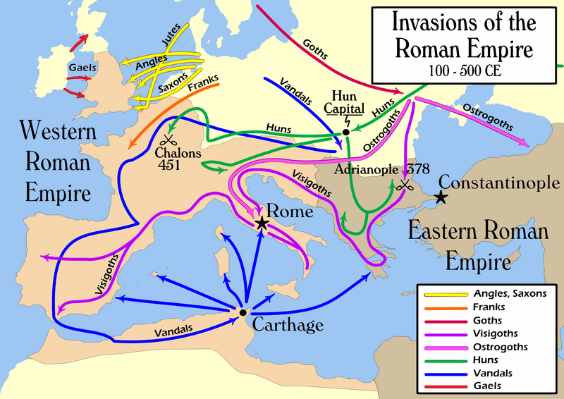
I find the Vandals particularly funny. It occurred to me as I was reading about them, that they went back and forth and often ended up in a place where they've already been before. This map seems to confirm it, although I'm not sure just how accurate it is.
")
")

 )
)