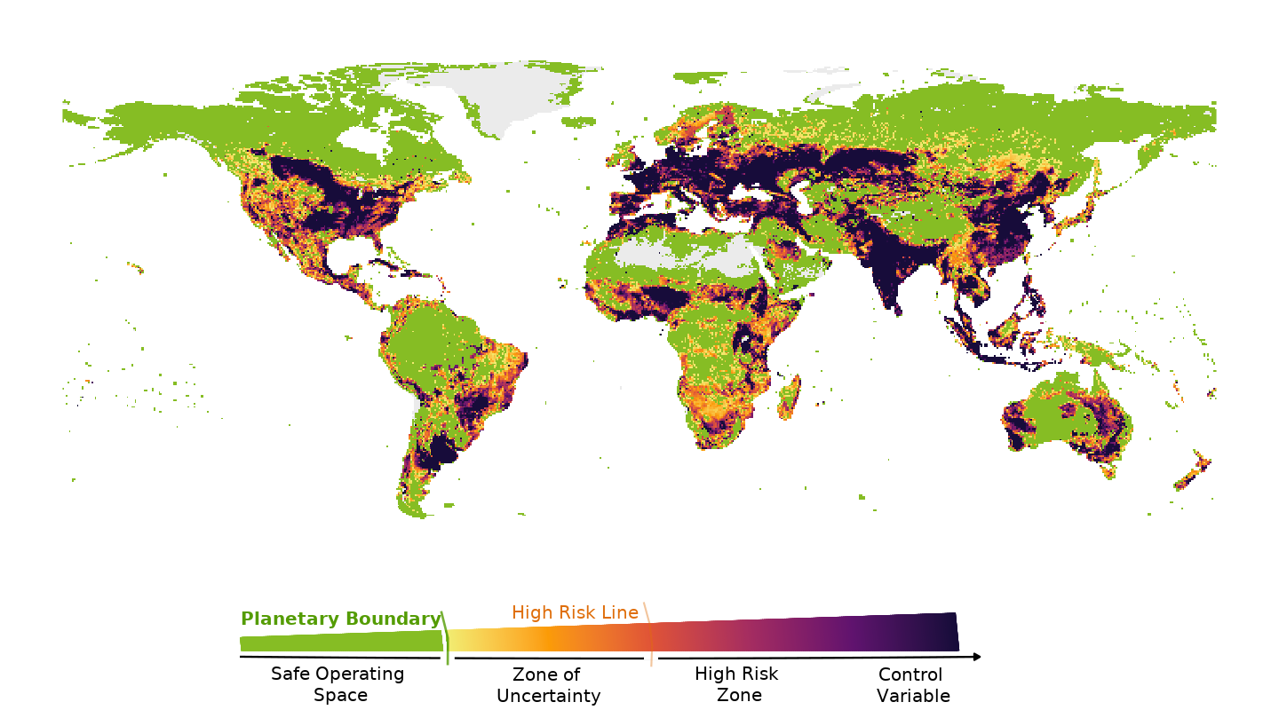
60 percent of the world’s land area is in a precarious state
This map displays global functional biosphere integrity maps and timelines from
1600 to 2014, including risk for biosphere destabilization (
EcoRisk), human appropriation of net primary production (
HANPP), and derived planetary boundary metrics developed in
Stenzel et al. 2025: Breaching planetary boundaries. The metrics are based on simulations with the vegetation model LPJmL. The thresholds determining the risk-level for the planetary boundary are (safe/intermediate; intermediate/high risk): HANPPHol (0.05; 0.23), EcoRisk (0.35; 0.55).
There is an interactive version here